Far Gate Farm Station Road North Kelsey Moor Market Rasen LN7
- Land size
- 4.5 acres
- Bedrooms
- 5
- Bathrooms
- 1
Description
This prominent detached country residence represents a rare opportunity to acquire a substantial home full of character, charm, and untapped potential. Well-maintained by its owners, the property features generously proportioned rooms throughout. While entirely liveable today, it offers an exciting blank canvas for buyers looking to modernise, personalise, or potentially extend (subject to planning permissions) to create a spectacular forever home.
A standout feature is the extensive outside space. The property boasts a large formal garden, a versatile range of traditional brick outbuildings, and an adjoining paddocks. The entire plot stands in approximately 4.5 acres, making it absolutely ideal for equestrian use, smallholding enthusiasts, or those simply seeking a private, expansive rural lifestyle.Epc rating
Property additional info
Entrance hall:
With a four panel Victorian front door with a fan light over, geometric tiled floor, radiator, under stairs storage cupboard, telephone point and cupboard housing electric meter and consumer unit.
Lounge: 4.48m x 3.93m (14' 8" x 12' 11")
With Minster style fireplace housing solid fuel stove, deep skirting boards, pine four panel door, large brass rim lock, multi pane sash window having secondary glazing and radiator. Measurements into chimney recess.
Dining Room: 4.23m x 4.67m (13' 11" x 15' 4")
With grey marble fire surround having tiled in set and hearth, deep skirting boards, four panel pine door with large brass rim lock, radiator and multi pane sash window having secondary glazing. Measurements into chimney recess.
Study: 3.00m x 5.26m (9' 10" x 17' 3")
With built-in pine cupboard, bay window, radiator and pine four panel door. Maximum width and depth measurements.
Cloakroom: 1.71m x 1.46m (5' 7" x 4' 9")
With close coupled toilet, wash basin, heated towel rail, part tiled walls, tiled floor, wall mounted blow heater, window having secondary glazing, fitted shelf and coat hook rail.
Breakfast Kitchen: 4.26m x 4.59m (14' x 15' 1")
With fitted wall and base cupboards, stainless steel sink and drainer board, roll top works surfaces, tiled splashbacks, widow having secondary glazing, built-in alcove pine cupboards, chimney recess housing Rayburn oil fired range cooker which also provides the central heating, tiled flooring, plumbing for washing machine, space for cooker and walk in pantry (8'8" x 5' 9" (2.69m x 1.80m)) with fitted shelving. Maximum width measurements.
Rear Entrance Porch & Coal Store:
With mahogany rear access door, part tiled wall, tiled floor, coat hooks and door providing access to adjoining coal store.
Stairs To First Floor Landing:
With original staircase having mahogany rail and pine spindles and newel posts, radiator, double glazed window, and access to roof space
Bedroom 1: 4.21m x 4.69m (13' 10" x 15' 5")
With multi pane sash window and secondary glazing, radiator, pine four panel door. Maximum width measurement.
Bedroom 2: 3.30m x 4.12m (10' 10" x 13' 6")
With radiator, access to roof space, window having secondary glazing, deep skirting boards, and built-in wardrobe with cupboard over. Minimum width and depth measurement.
Bedroom 3: 3.59m x 3.13m (11' 9" x 10' 3")
With radiator, pine four panel door, multi pane sash window having secondary glazing . Maximum width measurement.
Bedroom 4: 3.00m x 4.65m (9' 10" x 15' 3")
With electric panel heater, pine four panel door. Maximum width measurements.
Bedroom 5: 3.00m x 2.59m (9' 10" x 8' 6")
With multi pane sash window having secondary glazing and pine four panel door.
Shower room: 1.72m x 2.69m (5' 8" x 8' 10")
With large shower having mains fed shower and mermaid style splash boarding, close coupled toilet, modern vanity wash basin, radiator, tiled walls, wall mounted heated blow heater, double glazed window, radiator and built-in airing cupboard housing hot water cylinder.
Gardens:
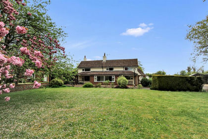
The formal gardens to the house include a small front garden area with flower and shrub beds, small lawn areas, footpath having metal pedestrian gate and brick pillars all enclosed with low-level hedging. A gated entrance with brick pillars and walls provide access to the driveway leading to a large corrugated detached garage which has lighting and power. The spacious rear gardens include lawns, flower and shrub beds , semi mature trees, timber summer house and an orchard with apple and plum trees. Please note there is a small area of the garden on the north west corner of the house side of the house which we understand is in the ownership of the National Rail Network.
Outbuildings:
The former coach house comprises of two separate stables and adjoining former tack room, storeroom and former coach house as well as a lean to garage which are all in need of significant repair but provide a great opportunity for redevelopment, subject to any necessary consents.
Stables & Crew Yard:
Adjoining the former Coach House are five separate brick stables opening out to a former crew yard.
Land:
Immediately adjacent to the property are two grass paddocks with a total area of approximately 4 acres. A further 6 acres (approximate) of land may be available subject to separate negotiation.
Services:
The property is understood to have mains water, electricity and non mains drainage. Oil fired central heating via Rayburn range. Electric car charging point.
Tenure:
The property is understood to be freehold.
Council Tax Band:
According to the governments online portal, the property is currently in Council Tax Band D.
Mobile:
We understand from the Ofcom website there is 69% coverage from Vodafone, 68% from O2, 67% from EE and 66% from Three.
Broadband:
We understand from the Ofcom website that standard broadband is available at this property with a standard download speed of 9 Mbps and an upload speed of 1 Mbps. Ultra fast broadband is also available with a download speed of 1800 Mbps and an upload speed of 220 Mbps. Openreach is the available network.
Mandatory Buyer Anti-Money Laundering Check:
Should a purchaser(s) have an offer accepted on a property marketed by John Taylors, they will need to undertake an identification check and asked to provide information on the source and proof of funds. This is done to meet our obligation under Anti Money Laundering Regulations (AML) and is a legal requirement. We use a specialist third party service together to verify your information. The cost of these checks is £45 inc VAT per person, which is paid in advance, when an offer is agreed and prior to a sales memorandum being issued. This charge is non-refundable under any circumstances.
Map Location
Property details
- Tenure
- Freehold
- Council Tax Band
- D
- Date Posted
- 2026-10-05
Market Value Analysis
Compared with 716 Homes with Land listings in East Midlands (1+ acres).
Energy Performance Certificate
Energy Efficiency Rating
Based on UK Energy Performance Certificate standards (EU Directive 2002/91/EC)
Running costs are one side. Planning activity, flood history and ground risks for this location are in the full report.
Utilities & Restrictions
Utilities
- Electricity
- Ask Agent
- Water
- Ask Agent
- Heating
- Ask Agent
- Broadband
- Ask Agent
- Sewerage
- Ask Agent
Rights & Restrictions
- Public Rights of Way
- Ask Agent
- Private Rights of Way
- Ask Agent
- Listed Property
- Ask Agent
- Restrictions
- Ask Agent
Listed status, conservation areas and planning constraints for this location are in the full report.
Property Features
- Accessibility
- Ask Agent
- Parking
- Parking Available
- Garden
- Garden
Beyond the particulars: planning activity, flood history, heritage and ground risks, checked for this exact spot.
Connectivity
Broadband
Fastest speed available at this postcode
1.8 Gbps
Gigabit full fibre
Suitable for
- 4K streaming on every screen
- Full-time home working
- Online gaming & big downloads
Fixed wireless access may also be an option here.
Mobile signal
Predicted 4G and 5G signal; indoor signal depends on building materials.
Ofcom Connected Nations postcode-level predictions. Speeds and signal are modelled, not measured, and vary between addresses and providers.
Signal is the easy part. Planning activity, flood history and protected designations here are in the full report.
Nearest Schools
Primary
- Kelsey Primary School1.7 milesNo Ofsted rating
- Ages
- 3 to 11
- Pupils
- 100
- Type
- Community school
- Grasby All Saints Church of England Primary School2.3 milesNo Ofsted rating
- Ages
- 3 to 11
- Pupils
- 89
- Type
- Voluntary controlled school
- Faith
- Church of England
- Nettleton Community Primary School2.5 milesNo Ofsted rating
- Ages
- 4 to 11
- Pupils
- 65
- Type
- Community school
- Caistor CofE and Methodist Primary School3 milesNo Ofsted rating
- Ages
- 3 to 11
- Pupils
- 189
- Type
- Voluntary controlled school
- Faith
- Church of England/Methodist
- St Barnabas CofE Primary School, Barnetby5 milesOfsted report card · Feb 2026
- Ages
- 5 to 11
- Pupils
- 127
- Type
- Voluntary controlled school
- Faith
- Church of England
Secondary
- Caistor Grammar School2.8 milesOfsted: Good
- Ages
- 11 to 18
- Pupils
- 690
- Type
- Academy converter
- Caistor Yarborough Academy3.2 milesOfsted report card · Dec 2025
- Ages
- 11 to 16
- Pupils
- 680
- Type
- Academy converter
- Sir John Nelthorpe School5.5 milesNo Ofsted rating
- Ages
- 11 to 19
- Pupils
- 878
- Type
- Voluntary controlled school
- The Vale Academy5.8 milesNo Ofsted rating
- Ages
- 11 to 18
- Pupils
- 627
- Type
- Academy converter
- Kirton Academy8.2 milesOfsted: Inadequate
- Ages
- 11 to 16
- Pupils
- 406
- Type
- Academy converter
Distances are straight-line from the advertised location. Source: the national school registers (DfE, Welsh Government, Scottish Government) and Ofsted.
Schools are just the start: sold prices nearby, planning activity and any flood history are in the full report.
Amenities
Supermarket
GP surgery
Pharmacy
Hospital
Straight-line distances from the advertised location. Sources: NHS records, Geolytix supermarket locations, OS Open Greenspace and the national trails registers.
The area stacks up? Now check the location itself: planning nearby, protected designations and past flooding.
Getting Around
Nearest station
Nearest bus stop
Typical drive times
Straight-line distances from the advertised location; drive times are typical free-flow times over OpenStreetMap road data, so allow more at peak. Public transport locations from DfT NaPTAN.
Easy to reach matters. So do planning activity, flood history and ground risks: all in the full report.
Flood Risk
Environment Agency open data, checked around the advertised map pin for the listed acreage. Long-term risk counts flood defences; the planning map's flood zones do not. Provided by LandSale, not the listing agent, and not part of the agent's particulars. Risk varies across a holding, so verify before committing.
Rivers and the sea
Not at the pin: mapped about 10 metres away.
Planning map: Flood Zone 3, about 10 metres away.
Surface water
Not at the pin: mapped about 10 metres away.
These bandings are the summary. Where this location sits on the flood maps, plus planning activity, heritage and ground risks, is in the full report.
Important notice: Information, maps and tags on this page are drawn from the advertising agent's marketing materials or generated automatically. LandSale has not verified them. Relying on these details is at your own risk, always carry out independent checks before committing to a purchase.
LandSale full disclaimer
Marketing information only - not formal particulars. The details on this website are provided for general guidance and do not constitute an offer or contract. Neither LandSale nor the advertising estate/land agent accepts responsibility for any inaccuracy.
1. Source of information
- Listing content: Core description, asking price, tenure, measurements, photographs and planning history originate from the marketing materials of the advertising estate or land agent. LandSale does not author this content and cannot guarantee its accuracy.
- Automated tags & categorisation: Property type, land-use class, acreage bands and similar labels may be applied by machine-learning models. They are intended as a helpful guide only and may not reflect the property's legal status or permitted use.
- Third-party & enriched data layers: Maps, boundary outlines, planning designations, soil reports, broadband coverage and other environmental or location-based insights are licensed from external suppliers. Such data are supplied “as is", may be incomplete or out of date and are subject to change without notice.
2. Verification required
Prospective purchasers must verify critical matters, including but not limited to planning permission, title boundaries, public rights of way, environmental constraints, acreage, services, access and VAT status, through their own inspections, specialist surveys, legal advisers and the selling agent before relying on the information or entering into any contract.
3. No warranty or liability
LandSale gives no warranty, express or implied, as to the accuracy, completeness or fitness for any particular purpose of the information displayed. LandSale shall not be liable for any loss, damage, cost or expense arising directly or indirectly from any use of or reliance on such information, save where liability may not be excluded by law.
4. Updates & feedback
If you believe any detail on this listing is inaccurate, please let us know. We will investigate and, where appropriate, update the listing or notify the agent.
© LandSale | Version 1.3 - August 2026
Listing agent
John Taylors, Louth
The Mart, 127 Eastgate, Louth, Lincolnshire, LN11 9QE
Similar properties for sale
- Price
- £525,000
- Size
- 2.04 acres
Bridge View Lane, West Rasen, West Rasen, Lincolnshire LN8 England
Added on 29/01/2026Cottage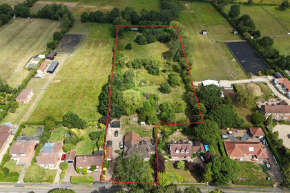
- Price
- £685,000
- Size
- 2.3 acres
Added on 09/09/2026House with Land
- Price
- Guide Price£600,000
- Size
- 2.3 acres
Added on 18/09/2026Smallholding
- Price
- £735,000
- Size
- 2.4 acres
Larkrise, Meadow Lane, Benniworth, Benniworth, Lincolnshire LN8 England
Added on 23/07/2026House with Land
- Price
- Guide Price£695,000
- Size
- 3.4 acres
Montana, Ings Lane, Fotherby, LN11, Louth, Lincolnshire LN11 England
Added on 02/05/2026House with Land
- Price
- £750,000
- Size
- 10.5 acres
Added on 14/08/2026House with Land
- Price
- Guide Price£795,000
- Size
- 4.14 acres
Added on 18/09/2026House with Land
- Price
- £650,000
- Size
- 5.74 acres
High Street, Marton, Gainsborough, Lincolnshire, DN21, Marton, Lincolnshire DN21 England
Added on 31/05/2026Equestrian property
- Price
- Offers in Region of£790,000
- Size
- 3 acres
Added on 14/08/2026House with Land
- Price
- Guide Price£495,000
- Size
- 3.9 acres
Palmer Nook, Connisholme Road, Grainthorpe, Louth, LN11, Louth, Lincolnshire LN11 England
Added on 04/06/2026House with Land