St.Michaels, Leuchars, St Andrews, Fife, KY16
- Land size
- 12 acres
- Bedrooms
- 4
- Bathrooms
- 2
Key Features
- Charming Former Farmhouse
- Set in Approx. 12 acres or thereby
- Derelict Outbuildings
- Spacious & Versatile Accommodation
- Lounge with Log Burning Stove
- Farmhouse Style Kitchen. Walk-in Pantry
- Utility Room with WC
- Shower Room plus a Former Bathroom
- Four Bedrooms
- Former Farm Office. Separate Store Room
Description
Charming B listed former farmhouse set in approx.12 acres or thereby with mature gardens, woodlands/Arboretum style, two ponds, outbuildings and abundance of parking. Located within a rural location on the outskirts of the small Hamlet of St. Michaels, approx. one mile from Leuchars and approx. 8.5 miles from St. Andrews. This property offers versatile spacious accommodation, with views over garden towards farmland.
Entry is gained into a spacious hallway offering access to lounge, master bedroom, shower room, inner hall leading to pantry, dining kitchen and a former bathroom. Understairs cupboard. Door to stairs leading to attic space. Staircase to upper landing.
Well-proportioned lounge with feature log burning stove and hearth. Triple window aspect with operable shutters, offering an abundance of natural light, along with views over the garden. Creating a relaxing room.
Substantial sized farm style kitchen with space for an eight-seater dining table and chairs, ideal for hosting larger gatherings, in the heart of the home. Attractive floor mounted units and complementary worktop surfaces offering generous area for meal prep. Wood panel splashbacks. Five ring Lpg cooker and electric oven. Double ceramic sink. Feature stone alcove. Window with deep sill. Door to office.
Walk-in pantry is fitted with stone slabbed shelving. Space for an American style fridge freezer. Window. Within the inner hall is a cupboard, skylight window and side door to garden.
The office is spacious and adaptable area for office furniture, or can be utilised as multiple other purposes, depending on your needs. Dual window formation with deep sills. Access to the utility.
The utility/boot room/WC offers an ideal laundry area with sink/drainer, space and plumbing for washing machine and dryer. Door to WC. Boiler in situ. Ample space for storage of coats and outdoor footwear. Door to parking area. Access to a storage area with potential to create a further room. Power, light, insulation to roof and wall framing in place.
Master bedroom with feature fire surround, open fire and cast-iron log holder. Plentiful space for a super king size bed and freestanding furniture. Dual window formation with operable shutters offering view to garden.
Shower room comprises a wc, wash hand basin, walk in double shower enclosure with a fitted screen and wet-wall panelling. Window with secondary glazing.
Potential bathroom with plumbing only in situ. Would require a bath, wc and wash hand basin to be purchased /installed by purchaser, however, versatile room can be utilised for multiple other purposes. Window with deep sill.
Staircase with window offering farmland view and natural light to upper landing. Doors open to three bedrooms.
Exceptionally spacious second bedroom, which is presently accommodating two double beds and free-standing furniture. Dual window formation with operable shutters overlooking garden.
Bedroom three is another exceptionally spacious bedroom offering plentiful space for king-size bed and free-standing furniture. Window with operable shutters overlooking garden and towards farmland. Two large walk-in wardrobes.
Bedroom four is a generous sized single bedroom, however, is presently accommodating a double bed. Window with operable shutters overlooking the garden towards nearby farmland.
Oil Fired Heating. Predominantly single glazed except for two double glazed windows.
Externally you will find a mature garden with lawn, greenhouse, herbaceous plants and trees, parking area, woodlands/Arboretum style leading down to a summerhouse and large pond. A second pond. Derelict outbuildings with land to side potential for development subject to local planning consent.
Shared access road with the neighbour.
EPC E
Council Tax F
Viewings Strictly by appointment, caution should be exercised at all times viewing the outbuildings.
360 Video walk through & Home Report available on request.
Location
Local amenities can be found at nearby Leuchars, which offers, eateries, shops and pharmacy. A wider range of amenities can be found in Cupar (approx. 8.3 miles), the historic Town of St.Andrews (approx. 8.5 miles) and the City of Dundee (approx. 7 miles).
School catchment area is Balmullo Primary School and Bell Baxter Secondary School in Cupar. Denominational Schools St Columba's Roman Catholic Primary School and St Andrew's Roman Catholic High School.
Tentsmuir Beach (approx.6.2 miles) offer forestry and beach walks. Golf courses can be found at St.Andrews and Drumoig.
Leuchars train station offers access to Edinburgh, Dundee, Aberdeen, London and beyond. as Dundee Airport approx. 7.8 miles
Lounge (at widest)
Dining Kitchen (at widest)
Walk-in Pantry (at widest)
Office (at widest)
Utility/Boot Room/WC (at widest)
Store Area (at widest)
Master Bedroom (at widest)
Shower Room (at widest)
Former Bathroom (at widest)
Bedroom Two (at widest)
Bedroom Three (at widest)
Bedroom Four (at widest)
Map Location
Property details
- Tenure
- Freehold
- Council Tax Band
- F
- Date Posted
- 2026-10-01
Market Value Analysis
Compared with 71 Homes with Land listings in Scotland (10+ acres).
Energy Performance Certificate
Energy Efficiency Rating
Based on UK Energy Performance Certificate standards (EU Directive 2002/91/EC)
Running costs are one side. Planning activity, flood history and ground risks for this location are in the full report.
Utilities & Restrictions
Utilities
- Electricity
- Ask Agent
- Water
- Ask Agent
- Heating
- Ask Agent
- Broadband
- Ask Agent
- Sewerage
- Ask Agent
Rights & Restrictions
- Public Rights of Way
- Ask Agent
- Private Rights of Way
- Ask Agent
- Listed Property
- Ask Agent
- Restrictions
- Ask Agent
Listed status, conservation areas and planning constraints for this location are in the full report.
Property Features
- Accessibility
- Ask Agent
- Parking
- Parking Available
- Garden
- Garden
Beyond the particulars: planning activity, flood history, heritage and ground risks, checked for this exact spot.
Connectivity
Broadband
Fastest speed available at this postcode
6 Mbps
Under 10 Mbps here
Suitable for
- Basic browsing & email
Mobile signal
Predicted 4G and 5G signal; indoor signal depends on building materials.
Ofcom Connected Nations postcode-level predictions. Speeds and signal are modelled, not measured, and vary between addresses and providers.
Signal is the easy part. Planning activity, flood history and protected designations here are in the full report.
Nearest Schools
Primary
- Balmullo Primary School1.5 miles
- Pupils
- 116
- Type
- Non-denominational
- Leuchars Primary School2.1 miles
- Pupils
- 199
- Type
- Non-denominational
- Newport Primary School2.3 miles
- Pupils
- 199
- Type
- Non-denominational
- Wormit Primary School2.5 miles
- Pupils
- 192
- Type
- Non-denominational
- Guardbridge Primary School2.7 miles
- Pupils
- 74
- Type
- Non-denominational
Secondary
- Harris Academy5 miles
- Pupils
- 1,338
- Type
- Non-denominational
- Craigie High School5 miles
- Pupils
- 725
- Type
- Non-denominational
- Grove Academy5.2 miles
- Pupils
- 1,346
- Type
- Non-denominational
- Morgan Academy5.3 miles
- Pupils
- 942
- Type
- Non-denominational
- St John's RC High School5.9 miles
- Pupils
- 1,279
- Type
- Roman Catholic
Distances are straight-line from the advertised location. Source: the national school registers (DfE, Welsh Government, Scottish Government) and Ofsted.
Schools are just the start: planning activity, heritage and any flood history here are in the full report.
Amenities
Supermarket
GP surgery
Pharmacy
Walking trail
Straight-line distances from the advertised location. Sources: NHS records, Geolytix supermarket locations, OS Open Greenspace and the national trails registers.
The area stacks up? Now check the location itself: planning nearby, protected designations and past flooding.
Getting Around
Nearest station
Nearest bus stop
Typical drive times
Straight-line distances from the advertised location; drive times are typical free-flow times over OpenStreetMap road data, so allow more at peak. Public transport locations from DfT NaPTAN.
Easy to reach matters. So do planning activity, flood history and ground risks: all in the full report.
Flood Risk
SEPA open data, checked around the advertised map pin for the listed acreage. Provided by LandSale, not the listing agent, and not part of the agent's particulars. Risk varies across a holding, so verify before committing.
Rivers and the sea
Not at the pin: mapped about 120 metres away.
Surface water
Not at the pin: mapped about 110 metres away.
These bandings are the summary. Where this location sits on the flood maps, plus planning activity, heritage and ground risks, is in the full report.
Important notice: Information, maps and tags on this page are drawn from the advertising agent's marketing materials or generated automatically. LandSale has not verified them. Relying on these details is at your own risk, always carry out independent checks before committing to a purchase.
LandSale full disclaimer
Marketing information only - not formal particulars. The details on this website are provided for general guidance and do not constitute an offer or contract. Neither LandSale nor the advertising estate/land agent accepts responsibility for any inaccuracy.
1. Source of information
- Listing content: Core description, asking price, tenure, measurements, photographs and planning history originate from the marketing materials of the advertising estate or land agent. LandSale does not author this content and cannot guarantee its accuracy.
- Automated tags & categorisation: Property type, land-use class, acreage bands and similar labels may be applied by machine-learning models. They are intended as a helpful guide only and may not reflect the property's legal status or permitted use.
- Third-party & enriched data layers: Maps, boundary outlines, planning designations, soil reports, broadband coverage and other environmental or location-based insights are licensed from external suppliers. Such data are supplied “as is", may be incomplete or out of date and are subject to change without notice.
2. Verification required
Prospective purchasers must verify critical matters, including but not limited to planning permission, title boundaries, public rights of way, environmental constraints, acreage, services, access and VAT status, through their own inspections, specialist surveys, legal advisers and the selling agent before relying on the information or entering into any contract.
3. No warranty or liability
LandSale gives no warranty, express or implied, as to the accuracy, completeness or fitness for any particular purpose of the information displayed. LandSale shall not be liable for any loss, damage, cost or expense arising directly or indirectly from any use of or reliance on such information, save where liability may not be excluded by law.
4. Updates & feedback
If you believe any detail on this listing is inaccurate, please let us know. We will investigate and, where appropriate, update the listing or notify the agent.
© LandSale | Version 1.3 - August 2026
Listing agent
Harley Estate Agents, Covering Scotland
84 Monkland Avenue, Lenzie, Glasgow, G66 3BP
Contact Harley Estate Agents, Covering Scotland
84 Monkland Avenue, Lenzie, Glasgow, G66 3BP
View agent profileSimilar properties for sale
- Price
- Offers Over£425,000
Perth Road, Dundee, Dundee, DD2, Dundee Central, Dundee City DD1 Scotland
Added on 16/07/2026Development Land
- Price
- Offers Over£449,000
- Size
- 2 acres
Emmock Farm Steading House, Tealing, Dundee, DD3, Angus and Perthshire Glens, Angus DD3 Scotland
Added on 14/08/2026House with Land
- Price
- Offers Over£650,000
- Size
- 1 acres
Teasses Mill, Ceres, Cupar, Fife, North East Fife, Fife KY15 Scotland
Added on 09/09/2026House with Land
- Price
- Offers Over£550,000
- Size
- 1 acres
Orchard House, Old Mill Road, Craigrothie, Cupar, North East Fife, Fife KY15 Scotland
Added on 22/05/2026House with Land
- Price
- Offers Over£675,000
- Size
- 6.6 acres
Stenton House, Invergowrie, Dundee, Angus, Angus and Perthshire Glens, Angus DD2 Scotland
Added on 11/09/2026Farmhouse
- Price
- Offers Over£675,000
- Size
- 1.1 acres
Added on 13/10/2026House with Land
- Price
- Offers Over£598,000
- Size
- 10 acres
Kirkbuddo, Forfar, DD8, Arbroath and Broughty Ferry, Angus DD8 Scotland
Added on 29/01/2026Redevelopment Land
- Price
- Offers Over£695,000
- Size
- 2 acres
Newburn, Upper Largo, Leven, Fife, North East Fife, Fife KY8 Scotland
Added on 10/09/2026House with Land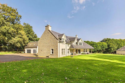
- Price
- Offers Over£750,000
- Size
- 1.3 acres
Meigle, Blairgowrie, PH12, Angus and Perthshire Glens, Perth and Kinross PH12 Scotland
Added on 29/09/2026House with Land
- Price
- Offers Over£495,000
- Size
- 3 acres
Losset Farm, Losset Road, Alyth, PH11, Angus and Perthshire Glens, Perth and Kinross PH11 Scotland
Added on 29/01/2026Redevelopment Land