Blackblair Wood Olgrinmore, Scotscalder, Caithness, near Thurso, KW12
- Land size
- 37 acres
Key Features
- Ideally suited as legacy to leave for future generations from both a financial and environmental perspective.
- Located close to the Forsinard Flows National Nature Reserve.
- UK Forestry Standard (UKFS) compliant Woodland Management Plan in the Forestry Commission format.
- ‘Turn-key solution’ to help demonstrate commercial management, with guidance provided on local foresters and land agents to assist, if required.
- Trees include predominantly conifer planting, but also some mature sycamore and oak, with a large area of moss on deep peat.
- Woodland in the area has seen consistent appreciation, underpinned by a limited supply and an increasing demand.
Description
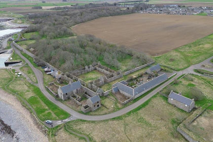
Blackblair woodland bears the unmistakable imprint of its former life as a working croft. The weathered ruins of the original buildings remain as a tangible link to that past, offering both a sense of continuity and the potential framework for renewal with a commercial focus. The woodland itself is predominantly a Sitka spruce plantation with a narrow band of sycamore and oak along the front. Growth has been good and this will provide a substantial crop of timber in due course as part of a commercial management strategy.
On the open ground adjoining the woodland there remains a generous area of grassland and an area of blanket bog that forms part of the internationally significant Flow Country. This deep peat landscape, punctuated by pools and subtle variations in vegetation, is of exceptional ecological importance. Further, there may a carbon capture angle which would enhance the commercial management of the land.
The lightly populated local area has allowed wildlife at Blackblair woodland to flourish. The most common deer are Roe and Fallow, whom are a lot smaller than Red deer. With a lack of natural predators, deer populations in this part of Scotland have greatly increased in recent times.
Blackblair woodland is in no immediate need of any intervention in the short term unless this fits with a new owner’s commercial aims, whereby some timber value could be realised as part of a broader strategy based on professional advice and the objectives of a well-considered woodland management plan or indeed planning consents could be sought in relation to the substantial existing buildings.
Boundaries
The boundaries are clearly defined and easy to identify on the ground, with a combination of Caithness stone fencing, stock net and individual posts.
Tenure
The freehold is available including any sporting rights that pass with the land. There is no VAT chargeable on the purchase price.
Ownership
The benefits of woodland ownership have recently become more widely acknowledged. There is a good deal of flexibility when acquiring woodland to do so in such a way that can assist with inheritance tax planning for future generations. In addition, during the period of ownership there is currently no income tax payable on sales of timber. There are also capital gains tax benefits relating to the increase in value of trees as standing timber and there are no business rates or annual taxes on woodland.
Planning for the best financial outcome from woodland ownership starts with a well-conceived Woodland Management Plan. This is a site-specific document that sets out the long term aims for the woodland with the focus of commercial management in mind. At Legacy Forestry, we provide buyers with a bespoke Woodland Management Plan drafted by a professional forestry consultant who will not only be able to advise on your personal aims for managing the woodland but also have the local contacts to contract any forestry operations necessary to carry out specific objectives.
There is also a further consideration that comes with the opportunity to own woodland. Apart from HMRC’s favourable tax treatment of commercial forestry investments, woodland ownership also brings with it the enormous additional benefit of stewardship of the countryside and a chance to conserve, manage and enjoy a precious and important environment.
Access
There is a metal gate at the entrance off the public road. There is a grassy track that goes round the entirety of the plantation with one internal ride and a wayleave through part of the wood. The wood includes plenty of space for timber handling.
Location
The woods at Olgrinmore sit in a remote part of the country nestled between Westerdale and Scotscalder. Caithness has a low population with only a handful of towns, including Thurso and Wick.
The low population has encouraged wildlife to flourish both at sea and on the rivers, with otters and seals inhabiting small islands on the nearby River Thurso. This area was a Pictish stronghold until the Norwegian Norsemen arrived from the 10th century onwards establishing settlements all along the coast.
Viewing and Directions
Please contact Dan Sharp on 07780 900 192 to arrange a visit. You are welcome to visit this wood by yourself, but as many woodlands do not have mobile phone reception or internet access, please try and make sure you have a copy of these sales details with you. Please be aware of potential hazards within the woodland when viewing.
Map Location
Property details
- Tenure
- Freehold
- Council Tax Band
- Ask Agent
- Date Posted
- 2026-09-10
Market Value Analysis
Compared with 33 Woodland listings in Scotland (25+ acres).
Property Brochure
Seen the details? The full report adds the independent checks: planning activity, flood history, heritage and ground.
Utilities & Restrictions
Utilities
- Electricity
- Ask Agent
- Water
- Ask Agent
- Heating
- Ask Agent
- Broadband
- Ask Agent
- Sewerage
- Ask Agent
Rights & Restrictions
- Public Rights of Way
- Ask Agent
- Private Rights of Way
- Ask Agent
- Listed Property
- Ask Agent
- Restrictions
- Ask Agent
Listed status, conservation areas and planning constraints for this location are in the full report.
Property Features
- Accessibility
- Ask Agent
- Parking
- Ask Agent
- Garden
- Ask Agent
Beyond the particulars: planning activity, flood history, heritage and ground risks, checked for this exact spot.
Connectivity
Broadband
Fastest speed available at this postcode
7 Mbps
Under 10 Mbps here
Suitable for
- Basic browsing & email
Mobile signal
Outdoor predictions; indoor signal depends on building materials.
Ofcom Connected Nations postcode-level predictions. Speeds and signal are modelled, not measured, and vary between addresses and providers.
Signal is the easy part. Planning activity, flood history and protected designations here are in the full report.
Nearest Schools
Primary
- Halkirk Primary School3.7 miles
- Pupils
- 83
- Type
- Non-denominational
- Miller Academy Primary School7.9 miles
- Pupils
- 267
- Type
- Non-denominational
- Pennyland Primary School8.1 miles
- Pupils
- 180
- Type
- Non-denominational
- Mount Pleasant Primary School8.2 miles
- Pupils
- 185
- Type
- Non-denominational
- Watten Primary School9.3 miles
- Pupils
- 37
- Type
- Non-denominational
Secondary
- Thurso High School7.6 miles
- Pupils
- 753
- Type
- Non-denominational
- Wick High School17 miles
- Pupils
- 735
- Type
- Non-denominational
- Farr High School24 miles
- Pupils
- 68
- Type
- Non-denominational
- Stromness Academy35 miles
- Pupils
- 338
- Type
- Non-denominational
- Golspie High School38 miles
- Pupils
- 264
- Type
- Non-denominational
Distances are straight-line from the advertised location. Source: the national school registers (DfE, Welsh Government, Scottish Government) and Ofsted.
Schools are just the start: planning activity, heritage and any flood history here are in the full report.
Amenities
Supermarket
GP surgery
Pharmacy
Walking trail
Straight-line distances from the advertised location. Sources: NHS records, Geolytix supermarket locations, OS Open Greenspace and the national trails registers.
The area stacks up? Now check the location itself: planning nearby, protected designations and past flooding.
Getting Around
Nearest station
Nearest bus stop
Typical drive times
Straight-line distances from the advertised location; drive times are typical free-flow times over OpenStreetMap road data, so allow more at peak. Public transport locations from DfT NaPTAN.
Easy to reach matters. So do planning activity, flood history and ground risks: all in the full report.
Flood Risk
From SEPA flood map open data, checked around the advertised map pin and allowing for the listed acreage where known. This summary comes from LandSale, the advertising platform, not from the listing agent, and is not part of the agent's particulars. Risk can vary across a single holding, so verify anything critical through your own searches before committing.
Rivers and the sea
Surface water
Mapped within the area searched, not at the advertised map pin itself.
The detail behind these bandings
The full report pinpoints where this location sits on the flood maps, and runs the deeper checks that usually only surface after an offer.
- Exact flood zones & annual chances (included in the full report)
- Any recorded past flooding (included in the full report)
- Planning activity nearby (included in the full report)
- Heritage & conservation (included in the full report)
- Protected nature designations (included in the full report)
- Ground risks (included in the full report)
£14.99 · one-off purchase
By LandSale, the platform. Not provided by the listing agent. Ready in about a minute.
Important notice: Information, maps and tags on this page are drawn from the advertising agent's marketing materials or generated automatically. LandSale has not verified them. Relying on these details is at your own risk, always carry out independent checks before committing to a purchase.
LandSale full disclaimer
Marketing information only - not formal particulars. The details on this website are provided for general guidance and do not constitute an offer or contract. Neither LandSale nor the advertising estate/land agent accepts responsibility for any inaccuracy.
1. Source of information
- Listing content: Core description, asking price, tenure, measurements, photographs and planning history originate from the marketing materials of the advertising estate or land agent. LandSale does not author this content and cannot guarantee its accuracy.
- Automated tags & categorisation: Property type, land-use class, acreage bands and similar labels may be applied by machine-learning models. They are intended as a helpful guide only and may not reflect the property's legal status or permitted use.
- Third-party & enriched data layers: Maps, boundary outlines, planning designations, soil reports, broadband coverage and other environmental or location-based insights are licensed from external suppliers. Such data are supplied “as is", may be incomplete or out of date and are subject to change without notice.
2. Verification required
Prospective purchasers must verify critical matters, including but not limited to planning permission, title boundaries, public rights of way, environmental constraints, acreage, services, access and VAT status, through their own inspections, specialist surveys, legal advisers and the selling agent before relying on the information or entering into any contract.
3. No warranty or liability
LandSale gives no warranty, express or implied, as to the accuracy, completeness or fitness for any particular purpose of the information displayed. LandSale shall not be liable for any loss, damage, cost or expense arising directly or indirectly from any use of or reliance on such information, save where liability may not be excluded by law.
4. Updates & feedback
If you believe any detail on this listing is inaccurate, please let us know. We will investigate and, where appropriate, update the listing or notify the agent.
© LandSale | Version 1.3 - August 2026

Listing agent
Legacy Forestry
19 Half Moon Lane, London, SE24 9JU
Similar properties for sale
- Price
- Offers in Excess of£250,000
- Size
- 6.67 acres
Added on 30/04/2026Development Land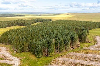
- Price
- Offers in Excess of£295,000
- Size
- 391.01 acres
Fasach Forest, Forsinard, Highland, Caithness, Sutherland and Easter Ross, Highland KW12 Scotland
Added on 08/08/2026Timberland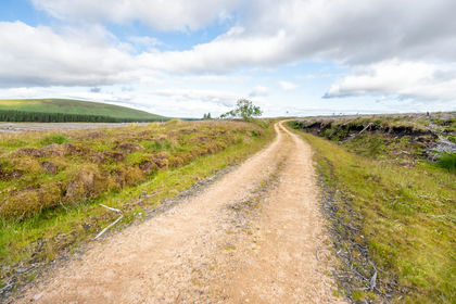
- Price
- Offers Over£295,000
- Size
- 390.43 acres
Fasach Forest, Caithness, Sutherland and Easter Ross, Highland KW136yt Scotland
Added on 07/08/2026Timberland
- Price
- Offers Over£250,000
- Size
- 44.29 acres
Land at Linksfield, Banff, AB45, Aberdeenshire North and Moray East, Aberdeenshire AB45 Scotland
Added on 11/09/2026Agricultural Land
- Price
- Offers Over£160,000
- Size
- 27.88 acres
Added on 11/09/2026Agricultural Land
- Price
- Offers Over£250,000
- Size
- 26 acres
Greenhill, Killearnan, Muir Of Ord, Caithness, Sutherland and Easter Ross, Highland IV6 Scotland
Added on 20/05/2026Agricultural Land
- Price
- Offers Over£140,000
- Size
- 41.31 acres
Added on 29/01/2026Grazing Land
- Price
- Offers Over£150,000
- Size
- 4.03 acres
Added on 29/01/2026Commercial Land