Blackblair Wood, Scotscalder, Caithness
- Land size
- 37 acres
Key Features
- About 37 acres comprising an historic croft, productive forestry, open land and blanket bog, in a striking rural setting close to Thurso.
- Ruins of substantial former croft buildings, offering an unusual restoration or development opportunity, subject to the necessary planning permissions.
- Predominantly Sitka spruce plantation with good growth, together with a band of established sycamore and oak and the potential for a substantial future timber crop.
- Open land adjoining the old croft, potentially suitable for grazing animals or small-scale growing.
- Part of the Flow Country landscape, with extensive blanket bog, deep peat and bog pools providing an important and diverse wildlife habitat.
- Direct access from the public road, with a track leading to the old croft and existing wayleaves across the plantation.
- Potential for a range of future uses, including restoration as a small holding, nature conservation or management for future timber income.
- Sporting rights included.
Description
It is not often that a viable development with extensive forestry included becomes available: it could be the perfect opportunity for someone wanting a development project with forestry, in the north of Scotland, arguably in one of the most stunning locations. This was a working croft that fell into neglect some time ago. The ruins of the old farm buildings show a rare glimpse into a time now past and could perhaps be the template of something new and exciting. The presence of a substantial existing building is usually a good sign that planning permission would be forthcoming. The old maps show a quarry that sits outside the title, that would have been a source for the stone used in the construction of the croft. There is a conveniently sized area of open land on this side of the woodland that would be perfect for grazing animals or for small scale growing.
The woodland itself has shown good growth and will provide good income down the line, though it might be advisable to think along the lines of managing it through continuous tree cover, rather than the more common and controversial, clear-fell policy. Long term this is better for the soil, wildlife and the environment generally.
This would be a very exciting project to take on if one wanted it to be brought back to life as a working croft. Alternatively these woods could be the perfect investment for those companies looking to invest in carbon capture.
The landscapes are large in this part of the world, in what is a strikingly beautiful part of Scotland and early viewing is recommended.
The purchasers of the meadow will be asked to enter into a covenant to ensure the quiet and peaceful enjoyment of adjoining woodlands and meadows.
Trees
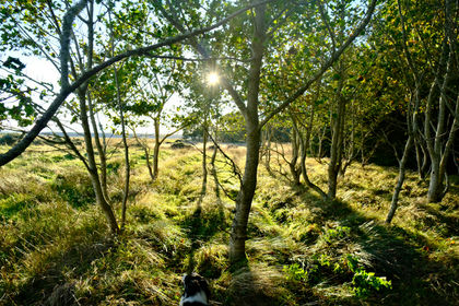
The land is planted predominantly as a Sitka spruce plantation with a narrow band of sycamore and oak along the front. Growth has been good and will provide a substantial crop of timber in due course.
Wildlife
Very few people come into these woods allowing wildlife to flourish, especially the deer population and bird population. The most common deer are Roe and Fallow and are a lot smaller than Red deer. With a lack of natural predators deer populations have greatly increased in recent times.
Features
One of the main features of this woodland is the area of blanket bog that stretches out beyond the plantation. This is part of what is known as the Flow Country and is the largest blanket bog in Europe. It is an area of deep peat, dotted with bog pools and a very important habitat for wildlife, as well as climate change mitigation. Peat is largely made up of the remains of plants, which are themselves made up of carbon; it locks up large stores of carbon for thousands of years. This carbon would otherwise be released to the atmosphere and contribute to global warming. The Flow Country is currently being considered as a potential World Heritage Site on account of its unparalleled blanket bog habitat. Closer examination shows a real diversity with a richness of insect life providing the perfect habitat for many rare bird species, including greenshank, dunlin, merlin and golden plover.
Access, tracks and footpaths
There is direct access off the public road with a track leading up to the old croft and there are wayleaves crossing the plantation. However the plantation itself is fairly dense through good growth but trails could be established fairly easily, perhaps as part of a harvesting or thinning program.
Rights and covenants
All sporting rights are sold with the woodland.
The purchasers of the meadow will be asked to enter into a covenant to ensure the quiet and peaceful enjoyment of adjoining woodlands and meadows.
Activities
This is a very diverse habitat with the potential timber income stream that would allow the area to be transformed, whether as a small holding or nature area.
Local area and history
The woods at Olgrinmore sit in a fairly remote part of the country on the edge of the Flow Country nestled between Westerdale and Scotscalder. The railway station at Scotscalder boasts the reputation as the least used station in the UK! Caithness has a low population with only two towns, Thurso and Wick but many very small settlements. The low population has encouraged wildlife to flourish both at sea and on the rivers with otters and seals inhabiting small islands on the nearby River Thurso. This area was a Pictish stronghold until the Norwegian Norsemen arrived from the 10th century onwards establishing settlements all along the coast.
How to find this meadow
You are welcome to visit this meadow by yourself, but please ensure that you have a copy of these sales details with you - many of our meadows do not have mobile phone reception or internet access so we recommend either printing the details or downloading them to your phone/tablet/laptop.
Do remember to also check that it is still available for sale. If you have seen the meadow and wish to be accompanied on a second more detailed visit please contact our local manager.
Directions
Heading north on the A9
At Mybster take the B870 towards Westerdale and then on in the direction of Scotscalder
The woods are on the left-hand side about a mile before Scotscalder railway station.
From Thurso:
Head out on the B874
Turn left on to the B870
The woods are on the right about 1 mile past Scotscalder railway station.
Our regional managers are often out working in our woodlands, so if you email an offer and want to be sure it has been received, please phone our manager on his or her mobile phone. The first offer at the stated price which is accepted, whether by phone or email, has priority.
Please take care when viewing as the great outdoors can contain unexpected hazards and woodlands are no exception. You should exercise common sense and caution, such as wearing appropriate footwear and avoiding visiting during high winds.
All woodlands are sold at a fixed price, and include free membership of the Small Woodland Owners Group and the Royal Forestry Society, as well as £300 towards paying for a course (or courses) to help with managing and enjoying your woodland.
These particulars are for guidance only and, though believed to be correct, do not form part of any contract. Woodland Investment Management Ltd hereby give notice under section 21 of the Estate Agents Act 1979 of their interest in the land being sold.
Map Location
Property details
- Tenure
- Freehold
- Council Tax Band
- Ask Agent
- Date Posted
- 2026-10-01
Market Value Analysis
Compared with 35 Woodland listings in Scotland (25+ acres).
Property Brochure
Seen the details? The full report adds the independent checks: planning activity, flood history, heritage and ground.
Utilities & Restrictions
Utilities
- Electricity
- Ask Agent
- Water
- Ask Agent
- Heating
- Ask Agent
- Broadband
- Ask Agent
- Sewerage
- Ask Agent
Rights & Restrictions
- Public Rights of Way
- Ask Agent
- Private Rights of Way
- Ask Agent
- Listed Property
- Ask Agent
- Restrictions
- Ask Agent
Listed status, conservation areas and planning constraints for this location are in the full report.
Property Features
- Accessibility
- Ask Agent
- Parking
- Ask Agent
- Garden
- Ask Agent
Beyond the particulars: planning activity, flood history, heritage and ground risks, checked for this exact spot.
Connectivity
Broadband
Fastest speed available at this postcode
7 Mbps
Under 10 Mbps here
Suitable for
- Basic browsing & email
Mobile signal
Predicted 4G and 5G signal; indoor signal depends on building materials.
Ofcom Connected Nations postcode-level predictions. Speeds and signal are modelled, not measured, and vary between addresses and providers.
Signal is the easy part. Planning activity, flood history and protected designations here are in the full report.
Nearest Schools
Primary
- Halkirk Primary School3.7 miles
- Pupils
- 83
- Type
- Non-denominational
- Miller Academy Primary School8.3 miles
- Pupils
- 267
- Type
- Non-denominational
- Pennyland Primary School8.5 miles
- Pupils
- 180
- Type
- Non-denominational
- Mount Pleasant Primary School8.6 miles
- Pupils
- 185
- Type
- Non-denominational
- Watten Primary School8.8 miles
- Pupils
- 37
- Type
- Non-denominational
Secondary
- Thurso High School8 miles
- Pupils
- 753
- Type
- Non-denominational
- Wick High School16 miles
- Pupils
- 735
- Type
- Non-denominational
- Farr High School25 miles
- Pupils
- 68
- Type
- Non-denominational
- Stromness Academy36 miles
- Pupils
- 338
- Type
- Non-denominational
- Golspie High School38 miles
- Pupils
- 264
- Type
- Non-denominational
Distances are straight-line from the advertised location. Source: the national school registers (DfE, Welsh Government, Scottish Government) and Ofsted.
Schools are just the start: planning activity, heritage and any flood history here are in the full report.
Amenities
Supermarket
GP surgery
Pharmacy
Straight-line distances from the advertised location. Sources: NHS records, Geolytix supermarket locations, OS Open Greenspace and the national trails registers.
The area stacks up? Now check the location itself: planning nearby, protected designations and past flooding.
Getting Around
Nearest station
Nearest bus stop
Typical drive times
Straight-line distances from the advertised location; drive times are typical free-flow times over OpenStreetMap road data, so allow more at peak. Public transport locations from DfT NaPTAN.
Easy to reach matters. So do planning activity, flood history and ground risks: all in the full report.
Flood Risk
SEPA open data, checked around the advertised map pin for the listed acreage. Provided by LandSale, not the listing agent, and not part of the agent's particulars. Risk varies across a holding, so verify before committing.
Rivers and the sea
Surface water
Not at the pin: mapped about 40 metres away.
These bandings are the summary. Where this location sits on the flood maps, plus planning activity, heritage and ground risks, is in the full report.
Important notice: Information, maps and tags on this page are drawn from the advertising agent's marketing materials or generated automatically. LandSale has not verified them. Relying on these details is at your own risk, always carry out independent checks before committing to a purchase.
LandSale full disclaimer
Marketing information only - not formal particulars. The details on this website are provided for general guidance and do not constitute an offer or contract. Neither LandSale nor the advertising estate/land agent accepts responsibility for any inaccuracy.
1. Source of information
- Listing content: Core description, asking price, tenure, measurements, photographs and planning history originate from the marketing materials of the advertising estate or land agent. LandSale does not author this content and cannot guarantee its accuracy.
- Automated tags & categorisation: Property type, land-use class, acreage bands and similar labels may be applied by machine-learning models. They are intended as a helpful guide only and may not reflect the property's legal status or permitted use.
- Third-party & enriched data layers: Maps, boundary outlines, planning designations, soil reports, broadband coverage and other environmental or location-based insights are licensed from external suppliers. Such data are supplied “as is", may be incomplete or out of date and are subject to change without notice.
2. Verification required
Prospective purchasers must verify critical matters, including but not limited to planning permission, title boundaries, public rights of way, environmental constraints, acreage, services, access and VAT status, through their own inspections, specialist surveys, legal advisers and the selling agent before relying on the information or entering into any contract.
3. No warranty or liability
LandSale gives no warranty, express or implied, as to the accuracy, completeness or fitness for any particular purpose of the information displayed. LandSale shall not be liable for any loss, damage, cost or expense arising directly or indirectly from any use of or reliance on such information, save where liability may not be excluded by law.
4. Updates & feedback
If you believe any detail on this listing is inaccurate, please let us know. We will investigate and, where appropriate, update the listing or notify the agent.
© LandSale | Version 1.3 - August 2026
Contact Woodlands.co.uk

19 Half Moon Lane, London, SE24 9JU
Call agent
07803 903 203Similar properties for sale
- Price
- Fixed Price£215,000
- Size
- 36 acres
Balgair Wood, Scotscalder, Caithness, , Highland KW12 Scotland
Added on 08/10/2026Peatland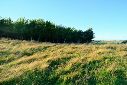
- Price
- Fixed Price£215,000
- Size
- 37 acres
Added on 10/09/2026Woodland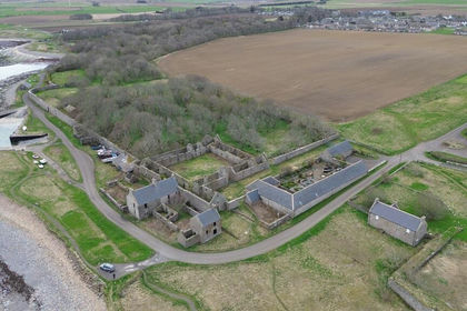
- Price
- Offers in Excess of£250,000
- Size
- 6.67 acres
Added on 30/04/2026Development Land
- Price
- Offers Over£182,000
- Size
- 52 acres
52 acres of Land at Appiehouse Harray, KW17, Orkney and Shetland, Orkney Islands KW17 Scotland
Added on 13/10/2026Agricultural Land
- Price
- Offers Over£250,000
- Size
- 44.29 acres
Land at Linksfield, Banff, AB45, Aberdeenshire North and Moray East, Aberdeenshire AB45 Scotland
Added on 11/09/2026Agricultural Land
- Price
- Offers Over£160,000
- Size
- 27.88 acres
Added on 11/09/2026Agricultural Land
- Price
- Offers Over£250,000
- Size
- 26 acres
Greenhill, Killearnan, Muir Of Ord, Caithness, Sutherland and Easter Ross, Highland IV6 Scotland
Added on 20/05/2026Agricultural Land
- Price
- Offers Over£140,000
- Size
- 41.31 acres
Added on 29/01/2026Grazing Land
- Price
- Offers Over£150,000
- Size
- 4.03 acres
Added on 29/01/2026Commercial Land
- Price
- Offers Over£190,000
- Size
- 4.86 acres
Added on 02/10/2026Development LandLeasehold