Tregele, Cemaes Bay, Anglesey, LL67
- Land size
- 7.5 acres
- Bedrooms
- 3
- Bathrooms
- 1
Key Features
- 3 Bed link-detached home, all with en-suites
- Approx. 7.5 acres of versatile land
- Established caravan site with income potential
- Further commercial development potential
- EPC: E / Council Tax Band: D
Description
This impressive linked detached country property extends to approximately 7.5 acres and provides versatile accommodation, commercial potential and extensive ancillary facilities. The main house offers three double bedrooms, each benefiting from its own ensuite, together with well-proportioned living accommodation suited to either private occupation or hospitality use. Accessibility has been thoughtfully considered, with wide doorways, ramped access and routes leading to accessible garden relaxation areas. The property is already operated with a small number of caravans on site, supported by a purpose-built shower block and workshop, creating an established income stream and a foundation for further commercial growth. There is considerable potential, subject to the necessary consents, to expand the caravan provision and explore additional development or diversified uses. The land is divided into five separate parcels and includes a substantial steel-frame agricultural building with roller door, offering useful storage, workshop or agricultural capacity. Solar panels and a battery storage system are also installed, helping to offset running costs and improve the property’s energy efficiency.
Situated in an attractive rural location on Anglesey, the property is approximately one mile from the proposed Gwyndod SMR Power Station. The popular coastal destination of Cemaes is nearby, offering a range of local shops, cafés, pubs, takeaways and eateries, together with beaches, coastal walks, harbour views and areas of outstanding natural beauty. Cemaes Bay is recognised for its independent businesses, attractive coastline and relaxed village atmosphere, making it a desirable base for visitors exploring the northern coastline of Anglesey.
Ground Floor
Entrance Vestibule
Window to front. Storage cupboard. Radiator. Door to:
Entrance Hall
Two windows to side. Stairs to first floor. Door to WC with wash hand basin under stairs.
Bedroom 1
Window to front and skylight. Built in sliding door wardrobe. Door to:
En-suite Bathroom 1
Three piece suite comprising bath with shower over and glass screen, wash hand basin and WC. Window to rear.
En-suite Bathroom 2
Three piece suite with comprising, bath with separate shower over, wash hand basin and WC. Tiled surround. Heated towel rail.
Lounge
Two windows to front. Three radiators. Double door to:
Sun Room
Windows to front, rear and side. Radiator.
Kitchen
Fitted with a contemporary range of base and eye level units with worktop space over and sink unit. Space for range style cooker, built in dishwasher. Two windows to rear. Door to:
Utility
Space for fridge, freezer and washing machine. Window to rear. External door to patio.
Garage
Window to rear. Remote-controlled electric up and over door. Housing solar panel inverter and battery storage.
Shower Room
Externally accessed with shower, wash hand basin and WC.
First Floor Landing
Window to rear. Door to:
Bedroom 2
Window to rear. Radiator. Door to:
Bedroom 3
Window to front. Radiator. Door to:
En-suite Shower Room
Three piece suite with comprising of shower, wash hand basin and WC. Tiled surround. Heated towel rail.
Outside
Sitting in some 7.45 acres total of predominantly grazing land with extensive gardens with hard landscaping, established planting and also benefitting from a detached garden room and polytunnel. The property also benefits from a workshop with attached shower and toilet block serving the caravans and an additional static caravan for additional accommodation. There is also a steel frame agricultural building with roller door.
Map Location
Property details
- Tenure
- Ask Agent
- Council Tax Band
- D
- Date Posted
- 2026-08-27
Market Value Analysis
Compared with 365 Homes with Land listings in Wales (5+ acres).
Energy Performance Certificate
Energy Efficiency Rating
Based on UK Energy Performance Certificate standards (EU Directive 2002/91/EC)
Running costs are one side. Planning activity, flood history and ground risks for this location are in the full report.
Utilities & Restrictions
Utilities
- Electricity
- Ask Agent
- Water
- Ask Agent
- Heating
- Ask Agent
- Broadband
- Ask Agent
- Sewerage
- Ask Agent
Rights & Restrictions
- Public Rights of Way
- Ask Agent
- Private Rights of Way
- Ask Agent
- Listed Property
- Ask Agent
- Restrictions
- Ask Agent
Listed status, conservation areas and planning constraints for this location are in the full report.
Property Features
- Accessibility
- Ask Agent
- Parking
- Parking Available
- Garden
- Garden
Beyond the particulars: planning activity, flood history, heritage and ground risks, checked for this exact spot.
Connectivity
Broadband
Fastest speed available at this postcode
1.8 Gbps
Gigabit full fibre
Suitable for
- 4K streaming on every screen
- Full-time home working
- Online gaming & big downloads
Mobile signal
Predicted 4G and 5G signal; indoor signal depends on building materials.
Ofcom Connected Nations postcode-level predictions. Speeds and signal are modelled, not measured, and vary between addresses and providers.
Signal is the easy part. Planning activity, flood history and protected designations here are in the full report.
Nearest Schools
Primary
- Ysgol Cemaes0.7 miles
- Pupils
- 63
- Type
- Nursery, Infants & Juniors
- Language
- Welsh medium school / provision (including transitional)
- Ysgol Gymuned Llanfechell1 mile
- Pupils
- 81
- Type
- Nursery, Infants & Juniors
- Language
- Welsh medium school / provision (including transitional)
- Rhyd y Llan4.3 miles
- Pupils
- 118
- Type
- Nursery, Infants & Juniors
- Language
- Welsh medium school / provision (including transitional)
- Ysgol Gynradd Rhosybol4.9 miles
- Pupils
- 75
- Type
- Infants & Juniors
- Language
- Welsh medium school / provision (including transitional)
- Ysgol Gynradd Amlwch5.2 miles
- Pupils
- 258
- Type
- Nursery, Infants & Juniors
- Language
- Welsh medium school / provision (including transitional)
Secondary
- Ysgol Syr Thomas Jones4.9 miles
- Pupils
- 537
- Type
- Secondary (ages 11-19)
- Language
- Welsh medium school / provision (including transitional)
- Ysgol Uwchradd Bodedern7.9 miles
- Pupils
- 810
- Type
- Secondary (ages 11-19)
- Language
- Welsh medium school / provision (including transitional)
- Ysgol Uwchradd Caergybi9.4 miles
- Pupils
- 818
- Type
- Secondary (ages 11-19)
- Language
- Welsh medium school / provision (including transitional)
- Ysgol Gyfun Llangefni12 miles
- Pupils
- 761
- Type
- Secondary (ages 11-19)
- Language
- Welsh medium school / provision (including transitional)
- Ysgol David Hughes17 miles
- Pupils
- 1,123
- Type
- Secondary (ages 11-19)
- Language
- Welsh medium school / provision (including transitional)
Distances are straight-line from the advertised location. Source: the national school registers (DfE, Welsh Government, Scottish Government) and Ofsted.
Schools are just the start: sold prices nearby, planning activity and any flood history are in the full report.
Amenities
Supermarket
GP surgery
Pharmacy
Green space
Straight-line distances from the advertised location. Sources: NHS records, Geolytix supermarket locations, OS Open Greenspace and the national trails registers.
The area stacks up? Now check the location itself: planning nearby, protected designations and past flooding.
Getting Around
Nearest station
Nearest bus stop
Typical drive times
Straight-line distances from the advertised location; drive times are typical free-flow times over OpenStreetMap road data, so allow more at peak. Public transport locations from DfT NaPTAN.
Easy to reach matters. So do planning activity, flood history and ground risks: all in the full report.
Flood Risk
Natural Resources Wales open data, checked around the advertised map pin for the listed acreage. Long-term risk counts flood defences; the planning map's flood zones do not. Provided by LandSale, not the listing agent, and not part of the agent's particulars. Risk varies across a holding, so verify before committing.
Rivers and the sea
Planning map: Flood Zone 1.
Surface water
Not at the pin: mapped about 70 metres away.
These bandings are the summary. Where this location sits on the flood maps, plus planning activity, heritage and ground risks, is in the full report.
Important notice: Information, maps and tags on this page are drawn from the advertising agent's marketing materials or generated automatically. LandSale has not verified them. Relying on these details is at your own risk, always carry out independent checks before committing to a purchase.
LandSale full disclaimer
Marketing information only - not formal particulars. The details on this website are provided for general guidance and do not constitute an offer or contract. Neither LandSale nor the advertising estate/land agent accepts responsibility for any inaccuracy.
1. Source of information
- Listing content: Core description, asking price, tenure, measurements, photographs and planning history originate from the marketing materials of the advertising estate or land agent. LandSale does not author this content and cannot guarantee its accuracy.
- Automated tags & categorisation: Property type, land-use class, acreage bands and similar labels may be applied by machine-learning models. They are intended as a helpful guide only and may not reflect the property's legal status or permitted use.
- Third-party & enriched data layers: Maps, boundary outlines, planning designations, soil reports, broadband coverage and other environmental or location-based insights are licensed from external suppliers. Such data are supplied “as is", may be incomplete or out of date and are subject to change without notice.
2. Verification required
Prospective purchasers must verify critical matters, including but not limited to planning permission, title boundaries, public rights of way, environmental constraints, acreage, services, access and VAT status, through their own inspections, specialist surveys, legal advisers and the selling agent before relying on the information or entering into any contract.
3. No warranty or liability
LandSale gives no warranty, express or implied, as to the accuracy, completeness or fitness for any particular purpose of the information displayed. LandSale shall not be liable for any loss, damage, cost or expense arising directly or indirectly from any use of or reliance on such information, save where liability may not be excluded by law.
4. Updates & feedback
If you believe any detail on this listing is inaccurate, please let us know. We will investigate and, where appropriate, update the listing or notify the agent.
© LandSale | Version 1.3 - August 2026
Listing agent
Williams & Goodwin The Property People, Llangefni
21 & 23 Church Street, Llangefni, LL77 7DU
Contact Williams & Goodwin The Property People, Llangefni
21 & 23 Church Street, Llangefni, LL77 7DU
View agent profileSimilar properties for sale
- Price
- Guide Price£455,000
- Size
- 24 acres
Llanfairynghornwy, Llanfairynghornwy, Anglesey, LL65, Cylch-y-Garn, Isle of Anglesey LL65 Wales
Added on 15/09/2026House with Land
- Price
- £525,000
- Size
- 6 acres
Elim, Llanddeusant, Anglesey, LL65, Tref Alaw, Isle of Anglesey LL65 Wales
Added on 26/03/2026Equestrian property
- Price
- £495,000
- Size
- 6 acres
Pentrefelin, Amlwch, Anglesey, LL68, Amlwch, Isle of Anglesey LL68 Wales
Added on 29/01/2026Smallholding
- Price
- Offers in Region of£550,000
- Size
- 3 acres
Off the B5111, Llannerch-y-medd, Anglesey, LL71, Llannerch-y-medd, Isle of Anglesey LL71 Wales
Added on 11/08/2026House with Land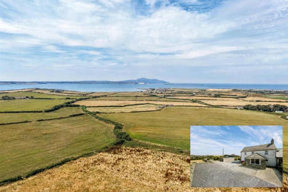
- Price
- £597,950
- Size
- 6.82 acres
Shadowfax, Llanfwrog, Holyhead, Anglesey LL65, Llanfaethlu, Isle of Anglesey LL65 Wales
Added on 17/09/2026House with Land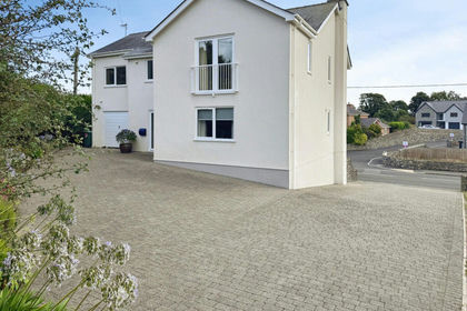
- Price
- £550,000
- Size
- 3 acres
Holyhead Road, Gwalchmai, Anglesey, LL65, Trewalchmai, Isle of Anglesey LL65 Wales
Added on 22/06/2026House with Land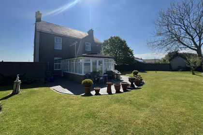
- Price
- £399,950
- Size
- 3.8 acres
Bodffordd, Llangefni, Anglesey, LL77, Bodffordd, Isle of Anglesey LL77 Wales
Added on 26/08/2026House with Land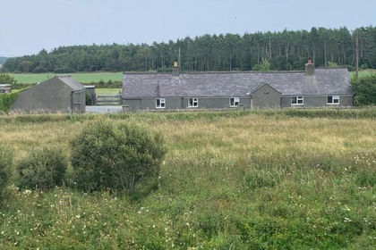
- Price
- Offers in Region of£420,000
- Size
- 3.97 acres
Pen Cob, Malltraeth, Anglesey, LL62, Bodorgan, Isle of Anglesey LL62 Wales
Added on 08/08/2026House with Land
- Price
- £595,950
- Size
- 7 acres
off the B4419, Dwyran, Anglesey, LL61, Rhosyr, Isle of Anglesey LL61 Wales
Added on 22/07/2026House with Land
- Price
- £535,000
- Size
- 3.59 acres
Newborough, Llanfairpwll, Sir Ynys Mon, LL61, Rhosyr, Isle of Anglesey LL61 Wales
Added on 29/01/2026House with Land