Upper Clay Pitts Farm, Clay Pitts Lane, Ripponden, Sowerby Bridge, Yorkshire, HX6
- Land size
- 9.72 acres
- Bedrooms
- 6
- Bathrooms
- 4
Key Features
- Substantial country home in a rural setting above Ripponden
- Approximately 9.72 acres of land
- Flexible accommodation arranged across South and East wings
- Character features including stone mullions, exposed beams, and flagstone floors
- Impressive principal suite with vaulted ceiling and luxurious ensuite
- Multiple reception spaces offering considerable versatility
- Panoramic countryside views from the house and grounds
- 9kW solar PV system with 22 panels, 11kWh battery storage, and air source heat pump – all very recently installed
- Very large detached two-storey timber barn
- Gardens with terrace, pergola, pond, and dome sunroom
Description
A SUBSTANTIAL COUNTRY HOME WITH OVER 9.7 ACRES, PANORAMIC VIEWS, AND CHARACTERFUL, HIGHLY VERSATILE ACCOMMODATION ARRANGED ACROSS TWO DISTINCT WINGS
Upper Clay Pitts Farm is an impressive country property occupying a private rural setting on the hills above Ripponden, with over 9.7 acres of land and far-reaching views across the surrounding countryside.
The accommodation is particularly versatile, combining the character of the original farmhouse with an extensive East Wing to create a home well suited to family life, multi-generational living, or those requiring generous space to work and entertain at home. At its heart is a characterful dining kitchen, from which the house naturally divides into its South and East wings.
Flagstone floors, exposed beams, stone mullioned windows, and log-burning stoves retain a strong sense of the property's heritage, while large picture windows, skylights, and bifold doors introduce light and make the most of its rural outlook. Modern additions include a recently-fitted air source heat pump serving the underfloor heating and hot water, alongside a recently installed 9kW solar PV system with 22 panels and 11kWh of battery storage.
A large driveway extends around three elevations, while the immediate garden includes a flagged terrace and pergola, meadow-style lawn, pond, and dome sunroom. Beyond lie over 9.7 acres of land and a very large detached two-storey timber barn, together creating an appealing proposition for buyers seeking space, privacy, and a genuine countryside lifestyle.
GROUND FLOOR
ENTRANCE PORCH
The property is entered through a practical porch with a traditional flagged floor and dual-aspect outlook. There is ample space for outdoor footwear and hanging coats before continuing into the main accommodation.
DINING KITCHEN
Forming the heart of Upper Clay Pitts Farm, the dining kitchen is a characterful and sociable space from which the accommodation divides into the South and East wings.
The dining area enjoys a dual-aspect outlook through two sets of stone mullioned windows, complemented by fitted cupboards and a flagstone floor.
Within the kitchen, four skylights introduce generous natural light, while exposed timber beams reinforce the property's character. Cream wall units are paired with blue drawer and base units, contrasting black worksurfaces and a central island with a wooden worktop.
Appliances include an AGA and Bosch dishwasher, while a door provides direct access outside.
---
SOUTH WING
SITTING ROOM
A comfortable reception room with a flagstone floor and log-burning stove set within a traditional surround. French doors open directly onto the terrace, while the dual-aspect arrangement brings in plenty of natural light and connects the room with its countryside setting.
WC/UTILITY
Combining two practical functions, this room includes a WC, bowl-style sink set upon a unit, fitted cupboards, and space and plumbing for laundry appliances.
SNUG
A characterful additional reception room with exposed wooden beams and a dual-aspect outlook. Its proportions also allow it to serve as a single bedroom if required, adding further flexibility to the ground-floor accommodation.
---
SOUTH WING – FIRST FLOOR
PRINCIPAL SUITE
The principal bedroom is a particularly impressive space, combining generous proportions with some of the farmhouse's strongest architectural features.
A vaulted ceiling and exposed wooden beams create a sense of height, while stone mullioned windows frame the countryside beyond. A log-burning stove set within a stone surround provides an atmospheric focal point.
PRINCIPAL ENSUITE
A stone archway leads directly from the bedroom into a substantial wet room-style ensuite, where stone mullioned windows and a skylight bring natural light into the space.
The bathroom includes a freestanding roll-top bath, shower, WC, bidet, sink set upon a unit, and heated towel rail. Exposed beams continue overhead, while a walk-in hanging closet provides useful dedicated clothes storage.
DOUBLE BEDROOM
A characterful double bedroom with exposed wooden beams and stone mullioned windows overlooking the surrounding fields.
ENSUITE
Fitted with a WC, sink, and shower.
---
EAST WING
From the dining kitchen, the East Wing opens into a light-filled hallway distinguished by a large arched barn window – an impressive architectural feature which floods the space with natural light.
The split-level arrangement provides access both upstairs and down, creating a distinct area of the house with considerable flexibility for family members, guests, home working, or children's spaces.
SINGLE BEDROOM
A single bedroom with a window featuring deep stone sills and an exposed wooden beam above.
A staircase rises from here to an attic room with reduced head height, exposed beams, and a skylight. This provides useful additional space for children's play or storage.
BATHROOM
Fitted with a bath with rainfall shower over and manoeuvrable pencil attachment, WC, and sink set upon a drawer unit. Two wall-mounted cabinets, including a mirrored cabinet, provide storage, while there is also a heated towel rail and skylight.
---
EAST WING – LOWER LEVEL
LOUNGE
A bright additional living space making the most of the rural setting. Bifold doors provide a direct connection with the outdoors, while a large picture window frames the surrounding countryside. A storage cupboard is also provided.
PLAYROOM / POTENTIAL BEDROOM
Currently arranged as a children's playroom with monkey bars and a fireman's pole, this generously proportioned room offers considerable flexibility and could alternatively serve as an additional bedroom.
There is a storage cupboard alongside a larger cupboard housing the property's air source heat pump, which serves the underfloor heating and hot water.
STUDY
A dedicated study provides valuable space for home working, positioned away from the property's principal living areas.
---
EAST WING – FIRST FLOOR
DOUBLE BEDROOM
A bright double bedroom with two skylights, exposed wooden beams, and a large picture window positioned to capture the exceptional countryside views.
ENSUITE
Fitted with a WC, sink and rainfall shower with manoeuvrable pencil attachment. Exposed wooden beams and a skylight add character and natural light.
---
GARDENS AND GROUNDS
Upper Clay Pitts Farm stands within over 9.7 acres of land, providing an increasingly rare degree of space around the home and allowing its panoramic countryside setting to be fully appreciated.
A large driveway extends around three elevations of the property, providing extensive off-road parking. There is also an EV charger, outdoor tap, and gated access into the immediate garden.
Adjoining the house is a flagged terrace with a pergola, bordered by established flower beds and providing a natural setting for outdoor dining and entertaining. Steps rise from the terrace to a grassy, meadow-style lawn incorporating a pond and dome sunroom – a peaceful place from which to enjoy the open views.
A very large detached two-storey timber barn provides substantial additional space and adds considerably to the versatility of the property and its grounds.
Beyond the immediate gardens, the land extends to approximately 9.716 acres in total, with panoramic views reinforcing the property's sense of privacy and rurality.
---
LOCATION
Upper Clay Pitts Farm occupies an enviable countryside position on Clay Pitts Lane, within the wider Ripponden area. The setting offers the space and seclusion associated with rural living while retaining access to one of Calderdale's most sought-after villages.
Ripponden provides a useful range of everyday amenities, places to eat and drink, and village services, while the surrounding Ryburn Valley is particularly well regarded for its attractive countryside and network of walking routes.
The location is also well placed for those travelling across West Yorkshire and into Greater Manchester, with access towards the M62 providing connections to the wider motorway network. Halifax, Huddersfield, and surrounding commercial centres are all within reach, making Upper Clay Pitts Farm an appealing option for buyers who want a substantial rural home without becoming disconnected from everyday amenities and commuter routes.
---
KEY INFORMATION
- Fixtures and fittings: Only fixtures and fittings mentioned in the sales particulars are included in the sale.
- Wayleaves, easements and rights of way: The sale is subject to all of these rights whether public or private, whether mentioned in these particulars or not. There is an obligation in the deeds to allow the bus stop to be situated on the corner of the land. There is also an agreement to allow the energy services to prune/maintain trees around the overhead cables across the land.
- Local authority: Calderdale
- Council tax band: B
- Tenure: Freehold
- Property type: Detached
- Property construction: Coursed stonework
- EPC rating: C. The vendors have since upgraded the property's former ground source heat pump to a more efficient air source heat pump and very recently installed solar panels with hybrid battery storage. A new EPC may therefore be commissioned.
- Electricity supply: Connected (Octopus Energy), solar PV system comprising 22 solar panels amounting to 9kW, and storage batteries (located to the rear of property, non-roadside) of 11kWh, air source heat pump.
- Gas supply: Not connected
- Water supply: Business Stream
- Sewerage: Septic tank
- Heating: Air source heat pump (underfloor heating and water), electric AGA (kitchen heating), and air-con/heating units to some bedrooms
- Broadband: Connected (Sky). Currently Fibre at 18 Mbps but will soon be Fibre to door at 1,000 Mbps
- Mobile signal/coverage: Good outdoor, variable in-home on some networks (Ofcom Mobile Coverage Checker)
- Parking: Very large private tarmacadam area outside the property with space for many cars, plus one EV charger
---
Viewing is essential to fully appreciate the unique nature of this property.
Get in touch to arrange your private tour today.
Map Location
Property details
- Tenure
- Freehold
- Council Tax Band
- B
- Date Posted
- 2026-08-21
Market Value Analysis
Compared with 193 Homes with Land listings in Yorkshire and The Humber (5+ acres).
Energy Performance Certificate
Energy Efficiency Rating
Based on UK Energy Performance Certificate standards (EU Directive 2002/91/EC)
Running costs are one side. Planning activity, flood history and ground risks for this location are in the full report.
Utilities & Restrictions
Utilities
- Electricity
- Mains, Solar Panels
- Water
- Mains
- Heating
- Air Source Heat Pump
- Broadband
- Ask Agent
- Sewerage
- Septic Tank / Private
Rights & Restrictions
- Public Rights of Way
- Ask Agent
- Private Rights of Way
- Ask Agent
- Listed Property
- Ask Agent
- Restrictions
- Ask Agent
Listed status, conservation areas and planning constraints for this location are in the full report.
Property Features
- Accessibility
- Ask Agent
- Parking
- Driveway
- Garden
- Garden
Beyond the particulars: planning activity, flood history, heritage and ground risks, checked for this exact spot.
Connectivity
Broadband
Fastest speed available at this postcode
46 Mbps
Superfast
Suitable for
- HD streaming
- Video calls
- Web & social
Fixed wireless access may also be an option here.
Mobile signal
Predicted 4G and 5G signal; indoor signal depends on building materials.
Ofcom Connected Nations postcode-level predictions. Speeds and signal are modelled, not measured, and vary between addresses and providers.
Signal is the easy part. Planning activity, flood history and protected designations here are in the full report.
Nearest Schools
Primary
- St Mary's CofE (VC) J and I School768 metresOfsted: Good
- Ages
- 4 to 11
- Pupils
- 61
- Type
- Voluntary controlled school
- Faith
- Church of England
- Triangle CofE VC Primary School1.1 milesOfsted: Good
- Ages
- 4 to 11
- Pupils
- 173
- Type
- Voluntary controlled school
- Faith
- Church of England
- Ripponden Junior and Infant School1.3 milesNo Ofsted rating
- Ages
- 4 to 11
- Pupils
- 171
- Type
- Community school
- Trinity Academy St Peter's1.4 milesOfsted: Good
- Ages
- 4 to 11
- Pupils
- 94
- Type
- Academy sponsor led
- Faith
- Church of England
- Barkisland CofE VA Primary School1.8 milesOfsted: Good
- Ages
- 4 to 11
- Pupils
- 197
- Type
- Voluntary aided school
- Faith
- Church of England
Secondary
- Ryburn Valley High School1.5 milesNo Ofsted rating
- Ages
- 11 to 18
- Pupils
- 1,589
- Type
- Academy converter
- Trinity Academy Grammar2.7 milesOfsted: Good
- Ages
- 11 to 16
- Pupils
- 968
- Type
- Academy sponsor led
- The Calder Learning Trust3.1 milesOfsted: Good
- Ages
- 4 to 16
- Pupils
- 1,250
- Type
- Academy converter
- The Halifax Academy3.7 milesOfsted: Good
- Ages
- 4 to 16
- Pupils
- 1,461
- Type
- Academy converter
- The Crossley Heath School3.7 milesOfsted: Good
- Ages
- 11 to 18
- Pupils
- 1,179
- Type
- Academy converter
Distances are straight-line from the advertised location. Source: the national school registers (DfE, Welsh Government, Scottish Government) and Ofsted.
Schools are just the start: sold prices nearby, planning activity and any flood history are in the full report.
Amenities
Supermarket
GP surgery
Pharmacy
Hospital
Straight-line distances from the advertised location. Sources: NHS records, Geolytix supermarket locations, OS Open Greenspace and the national trails registers.
The area stacks up? Now check the location itself: planning nearby, protected designations and past flooding.
Getting Around
Nearest station
Nearest bus stop
Typical drive times
Straight-line distances from the advertised location; drive times are typical free-flow times over OpenStreetMap road data, so allow more at peak. Public transport locations from DfT NaPTAN.
Easy to reach matters. So do planning activity, flood history and ground risks: all in the full report.
Flood Risk
Environment Agency open data, checked around the advertised map pin for the listed acreage. Long-term risk counts flood defences; the planning map's flood zones do not. Provided by LandSale, not the listing agent, and not part of the agent's particulars. Risk varies across a holding, so verify before committing.
Rivers and the sea
Planning map: Flood Zone 1.
Surface water
Not at the pin: mapped about 10 metres away.
These bandings are the summary. Where this location sits on the flood maps, plus planning activity, heritage and ground risks, is in the full report.
Important notice: Information, maps and tags on this page are drawn from the advertising agent's marketing materials or generated automatically. LandSale has not verified them. Relying on these details is at your own risk, always carry out independent checks before committing to a purchase.
LandSale full disclaimer
Marketing information only - not formal particulars. The details on this website are provided for general guidance and do not constitute an offer or contract. Neither LandSale nor the advertising estate/land agent accepts responsibility for any inaccuracy.
1. Source of information
- Listing content: Core description, asking price, tenure, measurements, photographs and planning history originate from the marketing materials of the advertising estate or land agent. LandSale does not author this content and cannot guarantee its accuracy.
- Automated tags & categorisation: Property type, land-use class, acreage bands and similar labels may be applied by machine-learning models. They are intended as a helpful guide only and may not reflect the property's legal status or permitted use.
- Third-party & enriched data layers: Maps, boundary outlines, planning designations, soil reports, broadband coverage and other environmental or location-based insights are licensed from external suppliers. Such data are supplied “as is", may be incomplete or out of date and are subject to change without notice.
2. Verification required
Prospective purchasers must verify critical matters, including but not limited to planning permission, title boundaries, public rights of way, environmental constraints, acreage, services, access and VAT status, through their own inspections, specialist surveys, legal advisers and the selling agent before relying on the information or entering into any contract.
3. No warranty or liability
LandSale gives no warranty, express or implied, as to the accuracy, completeness or fitness for any particular purpose of the information displayed. LandSale shall not be liable for any loss, damage, cost or expense arising directly or indirectly from any use of or reliance on such information, save where liability may not be excluded by law.
4. Updates & feedback
If you believe any detail on this listing is inaccurate, please let us know. We will investigate and, where appropriate, update the listing or notify the agent.
© LandSale | Version 1.3 - August 2026
Listing agent
Charnock Bates, Covering West Yorkshire
Property House, Lister Lane, Halifax, HX1 5AS
View agent profileSimilar properties for sale
- Price
- £1,500,000
- Size
- 9 acres
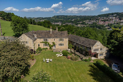
Lower Wat Ing, London Road, Norland HX6, Calder Valley, Calderdale HX6 England
Added on 04/06/2026Country Home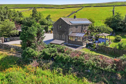
- Price
- Offers in Region of£1,100,000
- Size
- 6 acres
Claytons Farm, Wadsworth, Hebden Bridge, Wadsworth, Calderdale HX7 England
Added on 28/07/2026Farmhouse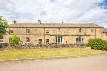
- Price
- Offers in Region of£1,000,000
- Size
- 4.5 acres
Holt Head Road, Slaithwaite, Huddersfield, HD7, Colne Valley, Kirklees HD7 England
Added on 24/06/2026House with Land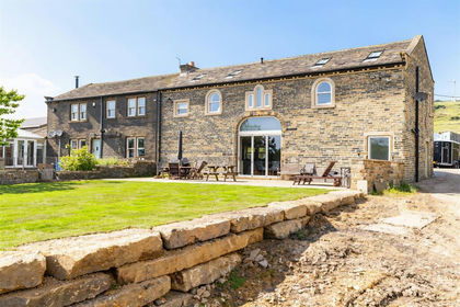
- Price
- Offers Over£1,350,000
- Size
- 22 acres
Added on 22/06/2026Equestrian property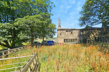
- Price
- Offers Over£1,000,000
- Size
- 22 acres
Higher Castleshaw Farm, Delph, Saddleworth, Saddleworth, Oldham OL3 England
Added on 29/01/2026Farmhouse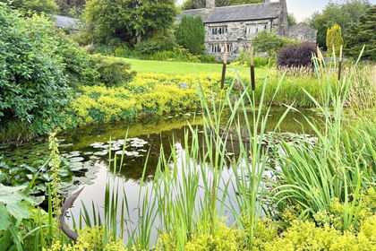
- Price
- £950,000
- Size
- 6 acres
Hartley Royd, Bluebell Lane, Todmorden, OL14, Todmorden, Calderdale OL14 England
Added on 14/08/2026House with Land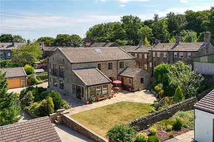
- Price
- £950,000
- Size
- 12.5 acres
Calder Bank Farm, Calder Banks, Queensbury, Bradford, BD13, Bradford South, Bradford BD13 England
Added on 22/08/2026House with Land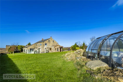
- Price
- £1,500,000
- Size
- 8 acres
Broad Lane, Delph, Saddleworth, OL3, Saddleworth, Oldham OL3 England
Added on 29/01/2026House with Land
- Price
- Offers in Excess of£950,000
- Size
- 11.8 acres
Oldham Road, Denshaw, Saddleworth, OL3, Saddleworth, Oldham OL3 England
Added on 29/01/2026House with Land
- Price
- £1,100,000
- Size
- 5 acres
Ringlows Lane, Syke, Rochdale, Greater Manchester, OL12, Rochdale, Rochdale OL12 England
Added on 29/01/2026House with Land