Bugley, Gillingham
- Land size
- 17.28 acres
- Bedrooms
- 2
- Bathrooms
- 2
Key Features
- Detached 2 bedroom bungalow (ag-tied) with stunning oak garden room
- Detached converted 1 bedroom former workshop
- New holiday cabin - The Hideaway
- Agricultural buildings extending to over 4,300 sq.ft
- 13 acres of productive pastureland
- Consent for 4 lakeside camping pods
- Situated in a pleasant rural yet accessible location
- Lot 2 - 3 lakes with established carp fishery set in 3.66 acres
- In total 17.28 acres (6.99 ha)
Description
An interesting and diversified smallholding comprising two dwellings, farm buildings, a new camping pod, pasture land, four lakes and an established carp fishery
Lot 1 - 13.62 Acres (5.51 Ha) -
Main Dwelling - A traditional farm bungalow which has been sympathetically improved and extended over time, most notably with the addition of an oak framed Dining Room with Varde log burner in 2015. Originally built in 1981 of Bradstone elevations under a tiled roof, the accommodation is arranged in a practical layout centred around a spacious Kitchen/Family Room with Rangemaster double oven and hob, a large dual-aspect Sitting Room with EFEL oil-fired double burner. There are two double Bedrooms, a family bathroom upgraded in 2026 and a useful utility room with separate WC. Outside is a large lawned garden to the rear and gravelled patio area to the front.
The Old Workshop - Converted in 2020, the old workshop has an attractive contemporary appearance with vertical timber cladding and aluminium double-glazed windows and doors. Inside the main room provides a modern open-plan living space with Varde log burner and flue and a kitchen fitted with shaker-style cabinetry and integrated appliances. There is a fully tiled wet room. Outside it has its own southwest facing garden with impressive flower and shrub beds.
Agricultural Buildings - Two sizable steel portal frame agricultural buildings and a lean-to make Walnut Tree Farm very adaptable. They are currently divided into a general storage barn, livestock barn, a workshop and a potential farm shop and have concrete block and Yorkshire board elevations with large sheeted gates. Access from the front is over a large concrete apron. The barns cover in total over 400 sq.m (4,300 sq.ft).
The Land - Stretching beyond the farmstead are paddocks of level and gently sloping productive permanent pasture divided by electric fencing and enclosed within mature hedgerow boundaries. The soil is a relatively free draining loam and clay over Cucklington Oolite which is part of the Coraillian limestone group and is classified grade 3 on the ALC.
In the southwestern corner of the land is a lake, toilet facilities and an area of hard-standing which services the adjoining Bugley Pools Fishery (Lot 2) and the approved permission for four holiday units. See planning section below.
The Hideaway - A high spec timber frame holiday cabin was installed by the vendors in 2024 and is currently let through Sykes & Airbnb. Outside is a landscaped garden area for enjoying the south facing sun, seclusion and lovely views. It is approached via its own drive past the lake.
Planning - The occupation of the bungalow shall be limited to a person solely or mainly employed or last employed, in the locality in agriculture as defined in s.290(1) of
the Town and Country Planning Act 1971 or in forestry.
In the south corner of Lot 1 is full permission, ref: P/FUL/2021/02288 for an amenity lake, use of the land for 4 camping pods, toilet and wet room facilities. The lake has been dug, clay lined and service infrastructure has been installed in readiness for the 4 pods.
The Old Workshop, planning ref: 2/2020/1104/FUL states the use as solely annex/ancillary purposes incidental to the enjoyment of the existing bungalow.
Lot 2 - 3.66 Acres (1.48 Ha) -
Bugley Pools Fishery - Directly adjoining Lot 1 but benefitting from its own access, Bugley Pools Fishery is an established and well-regarded coarse fishery occupying an attractive and secluded position. Originally created in 1972, the lakes were extensively restored and improved in 2019, including dredging and reinforcement works using bentonite, with a comprehensive restocking program and the installation of an otter-proof perimeter fence completed in 2020. The fishery has been carefully developed to provide a peaceful and well-managed venue and now operates as both a day-ticket and exclusive lake hire fishery, attracting anglers from across the region.
The lakes hold an impressive stock of specimen fish, including common and mirror carp in excess of 30lb, together with Tench, crucian carp, rudd and roach. The fishery benefits from established infrastructure, including purpose-built swims, charging facilities and ancillary amenities. The fishery offers significant scope for future income generation, whether through the continuation of the existing business model or by transitioning to a private syndicate operation with capacity for approximately 20–30 members. The fish stock is not included in the sale but may be available by separate negotiation.
Location - Walnut Tree Farm occupies a peaceful and private position in North Dorset close to the Somerset border and enjoys attractive views across its land and the surrounding rolling farmland beyond. The property lies within the small rural hamlet of Bugley, approximately 2 miles southwest of Gillingham and 6 miles northwest of the historic hilltop town of Shaftesbury, both of which provide an excellent range of shopping, educational, recreational and cultural amenities. Gillingham also benefits from a mainline railway station with direct services to London Waterloo.
Material Information - Mains electricity - Two main meters and sub-metering to the fishery and The Hideaway.
Oil fired central heating and woodburners.
Mains water supply serving the dwellings, buildings and field troughs.
Shared septic tank serving the dwellings.
Separate treatment plant serving the approved camping lodges and fishery facilities.
The property is not listed.
Dorset Council Tax Band D.
EPC ratings: The Bungalow – Band E, The Old Workshop – Band C
What3words - ///spellings.caveman.prepare
Viewing - Strictly by prior appointment with Symonds and Sampson LLP. .
Agents Notes - With reference to the sale plan, the successful purchaser will erect a stockproof fence between points A & B.
In the event Lot 2 is sold separately, the buyer will erect a stock proof fence between points C & D in addition to A & B.
Map Location
Property details
- Tenure
- Freehold
- Council Tax Band
- D
- Date Posted
- 2026-08-14
Price history
| Date | Change | Price |
|---|---|---|
| 25 Sep 2026 | Reduced 3.5% (−£50,000) | £1,375,000 |
| 14 Aug 2026 | Listed | £1,425,000 |
Utilities & Restrictions
Utilities
- Electricity
- Mains
- Water
- Mains
- Heating
- Ask Agent
- Broadband
- Ask Agent
- Sewerage
- Septic Tank / Private
Rights & Restrictions
- Public Rights of Way
- Ask Agent
- Private Rights of Way
- Ask Agent
- Listed Property
- Ask Agent
- Restrictions
- Ask Agent
Listed status, conservation areas and planning constraints for this location are in the full report.
Property Features
- Accessibility
- Ask Agent
- Parking
- Parking Available
- Garden
- Garden
Beyond the particulars: planning activity, flood history, heritage and ground risks, checked for this exact spot.
Connectivity
Broadband
Fastest speed available at this postcode
1 Gbps
Gigabit full fibre
Suitable for
- 4K streaming on every screen
- Full-time home working
- Online gaming & big downloads
Fixed wireless access may also be an option here.
Mobile signal
Predicted 4G and 5G signal; indoor signal depends on building materials.
Ofcom Connected Nations postcode-level predictions. Speeds and signal are modelled, not measured, and vary between addresses and providers.
Signal is the easy part. Planning activity, flood history and protected designations here are in the full report.
Nearest Schools
Primary
- Wyke Primary School0.9 milesOfsted: Requires improvement
- Ages
- 4 to 11
- Pupils
- 161
- Type
- Academy sponsor led
- Gillingham Primary School1.4 milesOfsted report card · Jan 2026
- Ages
- 4 to 11
- Pupils
- 233
- Type
- Academy converter
- St Mary the Virgin Church of England Primary School1.7 milesNo Ofsted rating
- Ages
- 2 to 11
- Pupils
- 242
- Type
- Academy converter
- Faith
- Church of England
- Milton-on-Stour Church of England Primary School2.3 milesOfsted: Good
- Ages
- 4 to 11
- Pupils
- 119
- Type
- Academy converter
- Faith
- Church of England
- Stower Provost Community School2.3 milesOfsted: Good *
- Ages
- 4 to 11
- Pupils
- 92
- Type
- Community school
Secondary
- Gillingham School1.5 milesOfsted: Good
- Ages
- 11 to 18
- Pupils
- 1,684
- Type
- Voluntary controlled school
- Shaftesbury School5 milesOfsted: Good
- Ages
- 11 to 18
- Pupils
- 782
- Type
- Academy converter
- Faith
- Church of England
- King Arthur's School5.9 milesOfsted: Requires improvement *
- Ages
- 11 to 16
- Pupils
- 450
- Type
- Academy sponsor led
- Sturminster Newton High School6.3 milesOfsted report card · Apr 2026
- Ages
- 11 to 18
- Pupils
- 605
- Type
- Academy converter
- Sexey's School9.1 milesOfsted: Good
- Ages
- 11 to 18
- Pupils
- 633
- Type
- Academy converter
- Faith
- Church of England
* Latest graded judgement covers quality of education only; no overall grade was issued under the 2024-25 inspection framework.
Distances are straight-line from the advertised location. Source: the national school registers (DfE, Welsh Government, Scottish Government) and Ofsted.
Schools are just the start: sold prices nearby, planning activity and any flood history are in the full report.
Amenities
Supermarket
GP surgery
Pharmacy
Hospital
Green space
Straight-line distances from the advertised location. Sources: NHS records, Geolytix supermarket locations, OS Open Greenspace and the national trails registers.
The area stacks up? Now check the location itself: planning nearby, protected designations and past flooding.
Getting Around
Nearest station
Nearest bus stop
Typical drive times
Straight-line distances from the advertised location; drive times are typical free-flow times over OpenStreetMap road data, so allow more at peak. Public transport locations from DfT NaPTAN.
Easy to reach matters. So do planning activity, flood history and ground risks: all in the full report.
Flood Risk
Environment Agency open data, checked around the advertised map pin for the listed acreage. Long-term risk counts flood defences; the planning map's flood zones do not. Provided by LandSale, not the listing agent, and not part of the agent's particulars. Risk varies across a holding, so verify before committing.
Rivers and the sea
Not at the pin: mapped about 20 metres away.
Planning map: Flood Zone 3, about 10 metres away.
Surface water
Not at the pin: mapped about 10 metres away.
These bandings are the summary. Where this location sits on the flood maps, plus planning activity, heritage and ground risks, is in the full report.
Important notice: Information, maps and tags on this page are drawn from the advertising agent's marketing materials or generated automatically. LandSale has not verified them. Relying on these details is at your own risk, always carry out independent checks before committing to a purchase.
LandSale full disclaimer
Marketing information only - not formal particulars. The details on this website are provided for general guidance and do not constitute an offer or contract. Neither LandSale nor the advertising estate/land agent accepts responsibility for any inaccuracy.
1. Source of information
- Listing content: Core description, asking price, tenure, measurements, photographs and planning history originate from the marketing materials of the advertising estate or land agent. LandSale does not author this content and cannot guarantee its accuracy.
- Automated tags & categorisation: Property type, land-use class, acreage bands and similar labels may be applied by machine-learning models. They are intended as a helpful guide only and may not reflect the property's legal status or permitted use.
- Third-party & enriched data layers: Maps, boundary outlines, planning designations, soil reports, broadband coverage and other environmental or location-based insights are licensed from external suppliers. Such data are supplied “as is", may be incomplete or out of date and are subject to change without notice.
2. Verification required
Prospective purchasers must verify critical matters, including but not limited to planning permission, title boundaries, public rights of way, environmental constraints, acreage, services, access and VAT status, through their own inspections, specialist surveys, legal advisers and the selling agent before relying on the information or entering into any contract.
3. No warranty or liability
LandSale gives no warranty, express or implied, as to the accuracy, completeness or fitness for any particular purpose of the information displayed. LandSale shall not be liable for any loss, damage, cost or expense arising directly or indirectly from any use of or reliance on such information, save where liability may not be excluded by law.
4. Updates & feedback
If you believe any detail on this listing is inaccurate, please let us know. We will investigate and, where appropriate, update the listing or notify the agent.
© LandSale | Version 1.3 - August 2026
Listing agent
Symonds & Sampson, Sturminster Newton
Agriculture House, Market Place, Sturminster Newton, DT10 1AR
Contact Symonds & Sampson, Sturminster Newton
Agriculture House, Market Place, Sturminster Newton, DT10 1AR
View agent profileSimilar properties for sale
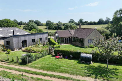
- Price
- Guide Price£1,100,000
- Size
- 13.62 acres
Added on 10/09/2026Smallholding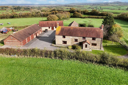
- Price
- Guide Price£1,425,000
- Size
- 13.13 acres
Kington Magna, Gillingham, Kington Magna, Dorset SP8 England
Added on 29/04/2026Smallholding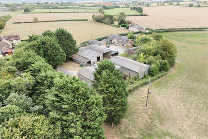
- Price
- Guide Price£1,335,000
- Size
- 67.15 acres
Gannetts, Todber, Sturminster Newton, Marnhull, Dorset DT10 England
Added on 30/09/2026Farm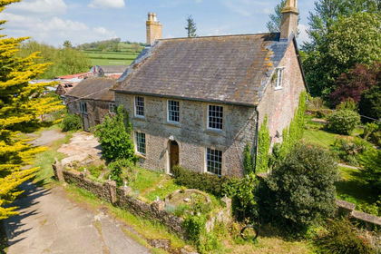
- Price
- Guide Price£1,450,000
- Size
- 43 acres
Farm-43 acres, Horwood, Wincanton, BA9, Wincanton, Somerset BA9 England
Added on 29/01/2026Farm
- Price
- Guide Price£1,500,000
- Size
- 8.6 acres
Bratton Seymour, Wincanton, BA9, Wincanton, Somerset BA9 England
Added on 09/07/2026House with Land
- Price
- Guide Price£1,500,000
- Size
- 10 acres
Gardeners Farm, Lower Whatley, Frome, Whatley, Somerset BA11 England
Added on 09/09/2026Smallholding
- Price
- Guide Price£1,110,000
- Size
- 16.91 acres
Melbury Bubb, Dorchester, DT2, Dorchester, Dorset DT2 England
Added on 16/06/2026Smallholding
- Price
- Guide Price£1,595,000
- Size
- 9.78 acres
Butcombe, Bristol, BS40, Bristol, North Somerset BS40 England
Added on 02/05/2026Smallholding
- Price
- Guide Price£1,395,000
- Size
- 11.75 acres
Added on 11/09/2026House with Land
- Price
- Offers in Excess of£1,600,000
- Size
- 14.03 acres
Added on 27/06/2026Smallholding