Near Landrake
- Land size
- 1.5 acres
- Bedrooms
- 3
- Bathrooms
- 3
Description
CHARACTER BARN CONVERSION IN PEACEFUL RURAL SETTING.
A detached barn conversion of immense character in a peaceful rural setting on the edge of the Lynher Valley and set within about 1.5 acres of gardens and grounds. About 1503 sq ft, Sitting/Dining Room, Kitchen, Snug, Cloaks/WC, 3 Double Bedrooms (2 Ensuite), Family Bathroom, Established Gardens, Private Driveway Parking, Large Garage/Workshop (360 sq ft), Outdoor Kitchen, PP for further Double Garage.
LANDRAKE 1 MILE, SALTASH 5 MILES, PLYMOUTH 10 MILES, TAVISTOCK 15 MILES, FOWEY 30 MILES, EXETER 54 MILES
Location - No Such Place lies in a remarkably unspoilt part of South East Cornwall close to the western edge of the Lynher Valley Area of Great Landscape Value, an area which is deeply rural and yet highly accessible. Landrake offers a primary school (rated "outstanding by Ofsted), public house, village store/post office and a church. There is a Montessori Nursery at Tideford together with a renowned butchers and popular public house.
Nearby Treluggan Boatyard (3 miles) provides facilities for the yachting fraternity as does the Quay Sailing Club at St Germans (3 miles) and deep water moorings are available on the Rivers Tamar and Lynher. A bus route runs through Landrake linking it with Saltash and Plymouth.
Saltash has a wide range of shops (including a Waitrose on the northern outskirts), schools, a main line railway station (Plymouth to London Paddington 3 hours) and various other facilities including a sports and leisure centre and fascinating long water frontage to the tidal River Tamar.
The surrounding countryside of rolling farmland includes the unspoilt St Erney peninsula to the south, fronting onto the River Lynher, and the beaches of the South Cornish coast at Whitsand Bay are a short drive away. Fine golf courses in the area include the China Fleet Country Club set in 180 acres of exquisite countryside which is one of the South West’s leading country clubs, the spectacular cliff top course at Portwrinkle and of course St Mellion International Golf Resort with its additional leisure facilities.
Plymouth has a long and historic waterfront with notable restaurants and boutiques and a cross channel ferry port with regular services to France and Northern Spain. In addition there are various marinas providing opportunities for the yachtsmen to explore the sheltered waters of the Rivers Tamar and Lynher together with Plymouth Sound and beyond.
Description - No Such Place comprises a detached barn conversion, carefully converted and incorporating various handbuilt, bespoke and reclaimed features to create a truly unique country residence which perfectly balances character and modern fittings to provide a comfortable family home. The property benefits from full double glazing and oil fired central heating.
There is the potential for the provision of further accommodation as a certificate of lawfulness was granted on 23rd February 2022 for the siting of a caravan (Berts Box) for ancillary residential use in the former sand school under application number - PA21/12688. In addition extant permission exists for the construction of a double garage under application number - PA15/05836 These permissions can be viewed online by visiting the Cornwall Council Planning Portal and quoting the application numbers provided.
The accommodation extends to about 1503 sq ft - GROUND FLOOR - Reception Lobby - 29' Sitting/Dining Room with wood burner and French doors to garden - Kitchen with French doors to garden - 17' Snug with fireplace and French doors to garden - Cloakroom/WC - FIRST FLOOR - 17' Principal Bedroom (1) with Juliet Balcony and Ensuite Shower/WC - Double Bedroom (2) with vaulted ceiling, Ensuite Shower/WC and French doors to feature bridge access to garden - Further Double Bedroom (3) - Family Bathroom with feature claw and ball foot bath.
Outside - Gated entrance to walled courtyard area, gravelled and providing ample parking for many cars including space for motorhome/caravan etc. There is a large garage/workshop of about 360 sq ft with mezzanine storage, in addition permission exists for the construction of a further double garage. From here a tarmac drive leads down to the former sand school which has permission for an ancillary residential caravan.
The gardens are a particular feature with a small paddock area and formal gardens adjacent to the house with sweeping lawns, paved patio and colourful flower and shrub beds. An outdoor kitchen provides shelter and shade and is perfect for barbecues and entertaining. A superb bridge feature connects the house with the higher part of the garden and there is also a fascinating spring fed water feature.
Epc Rating - C, Council Tax Band - D - SERVICES - Mains water, electricity and private drainage. There is also a borehole water supply (currently not filtered).
The neighbour at Higher Penquite has their drainage in the roadside paddock with the necessary easements for maintenance access, Higher Penquite also has a sub-metered water supply from No Such Place.
Directions - Using Sat Nav - Postcode PL12 5AH - the property will be found on the left hand side.
Map Location
Property details
- Tenure
- Freehold
- Council Tax Band
- Ask Agent
- Date Posted
- 2026-08-10
Market Value Analysis
Compared with 1,633 Homes with Land listings in South West England (1+ acres).
Utilities & Restrictions
Utilities
- Electricity
- Ask Agent
- Water
- Ask Agent
- Heating
- Ask Agent
- Broadband
- Ask Agent
- Sewerage
- Ask Agent
Rights & Restrictions
- Public Rights of Way
- Ask Agent
- Private Rights of Way
- Ask Agent
- Listed Property
- Ask Agent
- Restrictions
- Ask Agent
Listed status, conservation areas and planning constraints for this location are in the full report.
Property Features
- Accessibility
- Ask Agent
- Parking
- Parking Available
- Garden
- Garden
Beyond the particulars: planning activity, flood history, heritage and ground risks, checked for this exact spot.
Connectivity
Broadband
Fastest speed available at this postcode
1.8 Gbps
Gigabit full fibre · available to 75% of premises
Suitable for
- 4K streaming on every screen
- Full-time home working
- Online gaming & big downloads
Fixed wireless access may also be an option here.
Mobile signal
Predicted 4G and 5G signal; indoor signal depends on building materials.
Ofcom Connected Nations postcode-level predictions. Speeds and signal are modelled, not measured, and vary between addresses and providers.
Signal is the easy part. Planning activity, flood history and protected designations here are in the full report.
Nearest Schools
Primary
- Sir Robert Geffery's Voluntary Aided Church of England Primary School1 mileOfsted: Good
- Ages
- 4 to 11
- Pupils
- 202
- Type
- Academy converter
- Faith
- Church of England
- St Mellion Church of England Primary School2.7 milesNo Ofsted rating
- Ages
- 3 to 11
- Pupils
- 33
- Type
- Academy converter
- Faith
- Church of England
- St Germans Primary School2.9 milesOfsted report card · Apr 2026
- Ages
- 3 to 11
- Pupils
- 41
- Type
- Academy sponsor led
- Burraton Community Primary School3.2 milesNo Ofsted rating
- Ages
- 4 to 11
- Pupils
- 343
- Type
- Community school
- Landulph School3.7 milesOfsted: Good
- Ages
- 4 to 11
- Pupils
- 58
- Type
- Academy converter
Secondary
- Saltash Community School4.2 milesOfsted: Good *
- Ages
- 11 to 18
- Pupils
- 1,139
- Type
- Academy converter
- Callington Community College5.1 milesOfsted: Good
- Ages
- 11 to 18
- Pupils
- 887
- Type
- Academy converter
- Torpoint Community College5.8 milesNo Ofsted rating
- Ages
- 11 to 18
- Pupils
- 668
- Type
- Foundation school
- Marine Academy Plymouth5.9 milesOfsted: Good
- Ages
- 11 to 18
- Pupils
- 989
- Type
- Academy sponsor led
- All Saints Church of England Academy6.7 milesOfsted: Good
- Ages
- 11 to 16
- Pupils
- 668
- Type
- Academy sponsor led
- Faith
- Church of England
* Latest graded judgement covers quality of education only; no overall grade was issued under the 2024-25 inspection framework.
Distances are straight-line from the advertised location. Source: the national school registers (DfE, Welsh Government, Scottish Government) and Ofsted.
Schools are just the start: sold prices nearby, planning activity and any flood history are in the full report.
Amenities
Supermarket
GP surgery
Pharmacy
Hospital
Green space
Straight-line distances from the advertised location. Sources: NHS records, Geolytix supermarket locations, OS Open Greenspace and the national trails registers.
The area stacks up? Now check the location itself: planning nearby, protected designations and past flooding.
Getting Around
Nearest station
Nearest bus stop
Typical drive times
Straight-line distances from the advertised location; drive times are typical free-flow times over OpenStreetMap road data, so allow more at peak. Public transport locations from DfT NaPTAN.
Easy to reach matters. So do planning activity, flood history and ground risks: all in the full report.
Flood Risk
Environment Agency open data, checked around the advertised map pin for the listed acreage. Long-term risk counts flood defences; the planning map's flood zones do not. The map pin for this listing marks the postcode area rather than the exact location, so these readings describe the surrounding area. Provided by LandSale, not the listing agent, and not part of the agent's particulars. Risk varies across a holding, so verify before committing.
Rivers and the sea
Planning map: Flood Zone 1.
Surface water
These bandings are the summary. Where this location sits on the flood maps, plus planning activity, heritage and ground risks, is in the full report.
Important notice: Information, maps and tags on this page are drawn from the advertising agent's marketing materials or generated automatically. LandSale has not verified them. Relying on these details is at your own risk, always carry out independent checks before committing to a purchase.
LandSale full disclaimer
Marketing information only - not formal particulars. The details on this website are provided for general guidance and do not constitute an offer or contract. Neither LandSale nor the advertising estate/land agent accepts responsibility for any inaccuracy.
1. Source of information
- Listing content: Core description, asking price, tenure, measurements, photographs and planning history originate from the marketing materials of the advertising estate or land agent. LandSale does not author this content and cannot guarantee its accuracy.
- Automated tags & categorisation: Property type, land-use class, acreage bands and similar labels may be applied by machine-learning models. They are intended as a helpful guide only and may not reflect the property's legal status or permitted use.
- Third-party & enriched data layers: Maps, boundary outlines, planning designations, soil reports, broadband coverage and other environmental or location-based insights are licensed from external suppliers. Such data are supplied “as is", may be incomplete or out of date and are subject to change without notice.
2. Verification required
Prospective purchasers must verify critical matters, including but not limited to planning permission, title boundaries, public rights of way, environmental constraints, acreage, services, access and VAT status, through their own inspections, specialist surveys, legal advisers and the selling agent before relying on the information or entering into any contract.
3. No warranty or liability
LandSale gives no warranty, express or implied, as to the accuracy, completeness or fitness for any particular purpose of the information displayed. LandSale shall not be liable for any loss, damage, cost or expense arising directly or indirectly from any use of or reliance on such information, save where liability may not be excluded by law.
4. Updates & feedback
If you believe any detail on this listing is inaccurate, please let us know. We will investigate and, where appropriate, update the listing or notify the agent.
© LandSale | Version 1.3 - August 2026
Listing agent
Scott Parry Associates, Cornwall
TAMAR VIEW NURSERIES Carkeel, Saltash, PL12 6PH
Contact Scott Parry Associates, Cornwall
TAMAR VIEW NURSERIES Carkeel, Saltash, PL12 6PH
View agent profileSimilar properties for sale
- Price
- Guide Price£600,000
- Size
- 3 acres
Added on 29/01/2026Cottage
- Price
- Guide Price£900,000
- Size
- 3.95 acres
Trevollard Farm, Trematon, Saltash, Saltash, Cornwall PL12 England
Added on 07/03/2026Barn Conversion
- Price
- Guide Price£725,000
Added on 16/08/2026Barn Conversion
- Price
- Guide Price£775,000
- Size
- 0.35 acres
Added on 28/08/2026Barn Conversion
- Price
- £600,000
- Size
- 4.5 acres
Halton Quay, St. Dominick - Cornwall, St. Dominick, Cornwall PL12 England
Added on 01/10/2026House with Land
- Price
- Offers Over£750,000
- Size
- 1.2 acres
Added on 15/05/2026Barn Conversion
- Price
- Guide Price£660,000
- Size
- 15.97 acres
Horningtops, Liskeard, Cornwall, PL14, Morval, Cornwall PL14 England
Added on 12/08/2026House with Land
- Price
- Guide Price£850,000
- Size
- 1.7 acres
Weir Quay, Yelverton, Devon, Bere Ferrers, Devon PL20 England
Added on 05/10/2026Farmhouse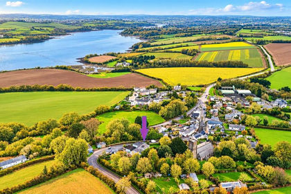
- Price
- £895,000
- Size
- 1 acres
Antony, Torpoint, Cornwall, PL11, Antony, Cornwall PL11 England
Added on 27/03/2026House with Land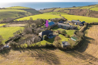 Added on 29/01/2026Barn Conversion