Temsend, Ivegill, Westmorland And Furness
- Land size
- 54.94 acres
- Bedrooms
- 5
Key Features
- 54.94 acres (22.23 hectares) or thereabouts in two lots or as a whole
- Grazing and mowing land
- Range of traditional and semi-modern buildings including a stable block
- Five bedroom farmhouse
- Desirable rural location
- Ideal for agricultural, equestrian or other use subject to obtaining necessary consents.
Description
An exciting opportunity to acquire a stock farm extending to approximately 54.94 acres (22.23 hectares) comprising a five-bedroom farmhouse, a range of agricultural buildings and productive mowing and grazing land, situated in a rural location near the village of Ivegill. Offered for sale in two lots or as a whole
Lot 1: Farmhouse, steading and land extending to approximately 33.24 acres (13.45 hectares). Guide price: £800,000
Lot 2: Land extending to approximately 21.70 acres (8.78 hectares). Guide Price: £260,000.
The whole – Guide price: £1,060,000
Link to Video:
Description
Temsend comprises a five-bedroom farmhouse, a range of buildings, and agricultural land extending in total to approximately 54.94 acres.
The farmhouse offers spacious accommodation over two floors. The property is of stone construction with a rendered finish under a slate roof. To the front of the property is a lawned garden. The property benefits from mains water and mains electricity. Drainage is to a septic tank and heating is provided by an oil-fired boiler.
The accommodation briefly comprises:
Ground Floor
Rear entrance hallway.
WC. 2.23m x 1.20m.
Dining Room/Snug. 3.23m x 4.06m.
Hall/Office. 4.75m x 3.19m. Stairs to first floor and built-in storage cupboard.
Kitchen. 5.51m x 4.28m. Base and wall units, electric hob, sink, cooker, space and plumbing for a washing machine and dryer, store cupboard/pantry (1.48m x 1.57m).
Porch
Lounge. 4.25m x 7.95m. Open fire set in a brick surround, sliding door to large front garden, exposed beams.
First Floor
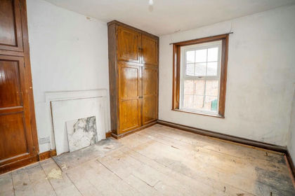
Double bedroom. 4.75m x 5.27m. Built-in storage.
Double bedroom. 3.69m x 3.26m.
Double bedroom. 4.25m x 4.28m. Built-in storage.
Single bedroom. 3.20m x 2.60m.
Single bedroom. 4.25m x 2.69m.
3.20m x 2.60m. Sink, WC, Bath, shower cubicle.
To the exterior of the house is an adjoining garage/outhouse (4.58m x 3.75m).
Buildings
Stable Block. 16.56m x 3.66m. Consists of 4 stables. Three stables are 3.66m x 3.73m and one larger stable extending to 5.04m x 3.66m. Block walls with Yorkshire boarding above.
Loose housing. 18.44m x 6.98m. Four bay, loose housing, steel portal frame, block walls with Yorkshire boarding above. Open front feed passage under cantilever.
Traditional Stone Barn. 4.44m x 5.7m. Part slate roof, concrete floor.
Traditional stone barn. 5.51m x 10.45m. Tile and concrete floor, partially lofted, part slate roof and part tin roof. Additional store adjoining (5.51m x 4.86m).
Storage Shed. Adjoining house, storage for boiler, block walls with tin roof.
Traditional Byre. 4.03m x 20.2m. Slate and tile roof. Traditional 18 stall byre.
Workshop. 11.45m x 6.38m. Stone and brick built.
Slurry tower.
Storage shed. 15.56m x 12.17m. Six bay steel portal frame, part block and sleeper walls, part concrete panel walls.
Outdoor silage pit and midden.
Cubicle shed. 13.49m x 16.84m. Cubicles for 50 cattle with scraping passages. Concrete and steel frame, block and sleeper walls.
Dutch Barn. 6.0m x 13.9m. Curved tin Dutch barn, block walls with tin above and tin roof.
Former collecting yard. 11.27m x 5.46m.
Former parlour. 7.13m x 4.73m. Rendered block walls and pit.
Former dairy. 4.19m x 4.91m.
There are also additional areas of outdoor yard space with sheep/cattle handling facilities.
Please note, the property is sold as seen, subject to all materials and buildings in situ.
The Land
The land extends to approximately 52.34 acres (21.20 Hectares). The land comprises productive mowing and grazing ground situated within a ring-fenced block surrounding the steading.
Lot 1 comprises the steading, and five parcels of agricultural ground extending to approximately 30.64 acres, totalling 33.24 acres. This land is mowing and grazing ground. Access is granted via a driveway leading to the farm steading.
Lot 2 comprises three fields of mowing and grazing ground extending to 21.70 acres. This land has roadside access to two points.
Services
The property benefits from mains water and mains single phase electricity supply. Drainage is to a septic tank. The windows are a mixture of single and double glazing, heating is provided by an oil-fired boiler. Please note, no formal investigation has been carried out on the septic tank. This may not meet the General Binding Rules 2020 and the property is being sold on this basis and no further allowance is to be made.
Viewing
Viewing of the property is available strictly by prior appointment with Hopes Auction Company. Tel: .
Method of Sale
The property is offered for sale by private treaty as a whole or in two lots. Offers should be submitted to Hopes Auction Company, Syke Road, Wigton, Cumbria, CA7 9NS.
The vendors reserve the right to conclude a sale at any time without setting a closing date. Prospective purchasers are therefore advised to register their interest with the selling agents.
Tenure and Vacant possession
We understand the property is held freehold. Vacant possession of the farmhouse and buildings will be available upon completion. The land is let until 30th September 2026.
Sporting and Mineral Rights
The sporting and mineral rights are included in the sale insofar as they are owned.
Matters of Title
The property is sold subject to and with the benefit of all rights of way, whether public or private, and whether constituted in the title deeds or not. The purchaser(s) will be held to have satisfied themselves as to the nature of such burdens and are advised to contact the vendor’s solicitor on any matters arising.
Ingoings
There are to be no ingoings affecting the property.
Environmental Schemes
The property is currently entered into an SFI scheme. This will be terminated upon sale of the property.
Energy Performance Certificate
The Farmhouse has an Energy Performance Rating of an E.
Council Tax
Temsend is Band E with Westmorland and Furness Council.
Money Laundering Regulations
As a requirement of the Money Laundering Regulations (Money Laundering Terrorist Financing and Transfer of Funds (Information on the Payer) Regulations 2017) relating to property transactions, the successful purchaser(s) will have to provide the selling agents with proof of identity prior to an offer being made.
IMPORTANT NOTICE
These particulars have been prepared in all good faith without responsibility on the part of the agents or their clients to give a general guide only as to the property. Nothing contained herein must be relied upon as a statement or representation of fact. These particulars do not form any part of an offer or contract and neither the agent nor their employees have any authority to make or give any representations or warranties whatever in relation to this property. We have not tested any services, appliances or installations nor carried out a survey. Areas, measurements or distances are given as a guide only and are not precise. Only specific items referred to are included. Intending purchasers must satisfy themselves by inspection or otherwise as to the correctness of these particulars and no responsibility can be accepted for any loss or expense incurred in viewing. If any points are particularly relevant to your interest please ask for further information. The Vendor Reserves the right to sell the property without notice.
Map Location
Property details
- Tenure
- Freehold
- Council Tax Band
- E
- Date Posted
- 2026-08-08
Market Value Analysis
Compared with 36 Farms & Smallholdings listings in North West England (50+ acres).
Utilities & Restrictions
Utilities
- Electricity
- Mains
- Water
- Mains
- Heating
- Ask Agent
- Broadband
- Ask Agent
- Sewerage
- Septic Tank / Private
Rights & Restrictions
- Public Rights of Way
- Ask Agent
- Private Rights of Way
- Ask Agent
- Listed Property
- Ask Agent
- Restrictions
- Ask Agent
Listed status, conservation areas and planning constraints for this location are in the full report.
Property Features
- Accessibility
- Ask Agent
- Parking
- Parking Available
- Garden
- Garden
Beyond the particulars: planning activity, flood history, heritage and ground risks, checked for this exact spot.
Connectivity
Broadband
Fastest speed available at this postcode
10 Gbps
Gigabit full fibre · available to 14% of premises
Suitable for
- 4K streaming on every screen
- Full-time home working
- Online gaming & big downloads
Fixed wireless access may also be an option here.
Mobile signal
Predicted 4G and 5G signal; indoor signal depends on building materials.
Ofcom Connected Nations postcode-level predictions. Speeds and signal are modelled, not measured, and vary between addresses and providers.
Signal is the easy part. Planning activity, flood history and protected designations here are in the full report.
Nearest Schools
Primary
- Ivegill CofE School1.3 milesOfsted: Good
- Ages
- 4 to 11
- Pupils
- 75
- Type
- Voluntary aided school
- Faith
- Church of England
- Raughton Head CofE School & Nursery2.8 milesNo Ofsted rating
- Ages
- 3 to 11
- Pupils
- 74
- Type
- Voluntary controlled school
- Faith
- Church of England
- Calthwaite CofE School3.8 milesNo Ofsted rating
- Ages
- 4 to 11
- Pupils
- 69
- Type
- Voluntary aided school
- Faith
- Church of England
- Skelton School4.4 milesOfsted: Good
- Ages
- 3 to 11
- Pupils
- 87
- Type
- Community school
- High Hesket CofE School4.4 milesOfsted: Good *
- Ages
- 3 to 11
- Pupils
- 136
- Type
- Voluntary controlled school
- Faith
- Church of England
Secondary
- Caldew School5.8 milesOfsted: Good
- Ages
- 11 to 18
- Pupils
- 990
- Type
- Academy converter
- St John Henry Newman Catholic School7.9 milesOfsted: Good
- Ages
- 11 to 18
- Pupils
- 703
- Type
- Voluntary aided school
- Faith
- Roman Catholic
- Richard Rose Morton Academy8 milesOfsted: Good *
- Ages
- 11 to 18
- Pupils
- 905
- Type
- Academy sponsor led
- Richard Rose Central Academy8.7 milesOfsted: Good *
- Ages
- 11 to 18
- Pupils
- 1,035
- Type
- Academy sponsor led
- Trinity School8.8 milesOfsted: Good *
- Ages
- 11 to 18
- Pupils
- 1,711
- Type
- Academy converter
- Faith
- Church of England
* Latest graded judgement covers quality of education only; no overall grade was issued under the 2024-25 inspection framework.
Distances are straight-line from the advertised location. Source: the national school registers (DfE, Welsh Government, Scottish Government) and Ofsted.
Schools are just the start: sold prices nearby, planning activity and any flood history are in the full report.
Amenities
Supermarket
GP surgery
Pharmacy
Hospital
Straight-line distances from the advertised location. Sources: NHS records, Geolytix supermarket locations, OS Open Greenspace and the national trails registers.
The area stacks up? Now check the location itself: planning nearby, protected designations and past flooding.
Getting Around
Nearest station
Nearest bus stop
Typical drive times
Straight-line distances from the advertised location; drive times are typical free-flow times over OpenStreetMap road data, so allow more at peak. Public transport locations from DfT NaPTAN.
Easy to reach matters. So do planning activity, flood history and ground risks: all in the full report.
Flood Risk
Environment Agency open data, checked around the advertised map pin for the listed acreage. Long-term risk counts flood defences; the planning map's flood zones do not. Provided by LandSale, not the listing agent, and not part of the agent's particulars. Risk varies across a holding, so verify before committing.
Rivers and the sea
Planning map: Flood Zone 1.
Surface water
Not at the pin: mapped about 70 metres away.
These bandings are the summary. Where this location sits on the flood maps, plus planning activity, heritage and ground risks, is in the full report.
Important notice: Information, maps and tags on this page are drawn from the advertising agent's marketing materials or generated automatically. LandSale has not verified them. Relying on these details is at your own risk, always carry out independent checks before committing to a purchase.
LandSale full disclaimer
Marketing information only - not formal particulars. The details on this website are provided for general guidance and do not constitute an offer or contract. Neither LandSale nor the advertising estate/land agent accepts responsibility for any inaccuracy.
1. Source of information
- Listing content: Core description, asking price, tenure, measurements, photographs and planning history originate from the marketing materials of the advertising estate or land agent. LandSale does not author this content and cannot guarantee its accuracy.
- Automated tags & categorisation: Property type, land-use class, acreage bands and similar labels may be applied by machine-learning models. They are intended as a helpful guide only and may not reflect the property's legal status or permitted use.
- Third-party & enriched data layers: Maps, boundary outlines, planning designations, soil reports, broadband coverage and other environmental or location-based insights are licensed from external suppliers. Such data are supplied “as is", may be incomplete or out of date and are subject to change without notice.
2. Verification required
Prospective purchasers must verify critical matters, including but not limited to planning permission, title boundaries, public rights of way, environmental constraints, acreage, services, access and VAT status, through their own inspections, specialist surveys, legal advisers and the selling agent before relying on the information or entering into any contract.
3. No warranty or liability
LandSale gives no warranty, express or implied, as to the accuracy, completeness or fitness for any particular purpose of the information displayed. LandSale shall not be liable for any loss, damage, cost or expense arising directly or indirectly from any use of or reliance on such information, save where liability may not be excluded by law.
4. Updates & feedback
If you believe any detail on this listing is inaccurate, please let us know. We will investigate and, where appropriate, update the listing or notify the agent.
© LandSale | Version 1.3 - August 2026
Listing agent
Hopes Auction Company, Cumbria
Hopes Auction Company Syke Road, Wigton, CA7 9NS
View agent profileSimilar properties for sale
- Price
- Guide Price£925,000
- Size
- 37.86 acres
Beechcroft Farm, Ivegill, CA4, Skelton, Westmorland and Furness CA4 England
Added on 02/05/2026Small Farm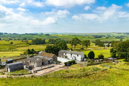
- Price
- £925,000
- Size
- 50 acres
Hilltop Farm Nether Row, Wigton, CA7, Caldbeck, Cumberland CA7 England
Added on 19/08/2026Farmhouse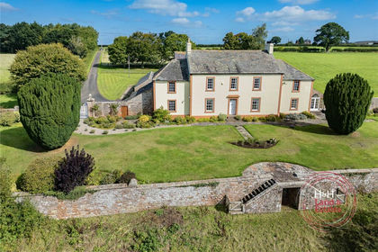
- Price
- Guide Price£1,250,000
- Size
- 31.5 acres
Carleton House, Carleton, Carlisle, Cumbria, St Cuthbert Without, Cumberland CA4 England
Added on 22/09/2026Country Estate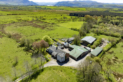
- Price
- Offers in Excess of£1,200,000
- Size
- 29.21 acres
Low Moor Farm, Bothel, Cumbria CA7, Bothel and Threapland, Cumberland CA7 England
Added on 22/08/2026Smallholding
- Price
- Offers Over£1,200,000
- Size
- 29.21 acres
Low Moor Farm, Bothel, Bothel and Threapland, Cumberland CA7 England
Added on 30/06/2026Smallholding
- Price
- Guide Price£1,300,000
- Size
- 45.48 acres
Solway View, Newton Arlosh, Wigton, Cumbria, Holme East Waver, Cumberland CA7 England
Added on 10/09/2026Agricultural Land
- Price
- £1,060,000
- Size
- 59.87 acres
Cleugh Head Farm & Cottages - Lot 1, Low Row, Brampton, Nether Denton, Cumberland CA8 England
Added on 29/01/2026Equestrian property- Price
- Guide Price£1,250,000
- Size
- 59.87 acres
Cleugh Head Farm & Cottages - Whole, Low Row, Brampton, Nether Denton, Cumberland CA8 England
Added on 29/01/2026Equestrian property
- Price
- Offers Over£985,000
- Size
- 110.74 acres
Slealands Farm, Longtown, Carlisle, Cumbria, CA6, Arthuret, Cumberland CA6 England
Added on 20/08/2026Farm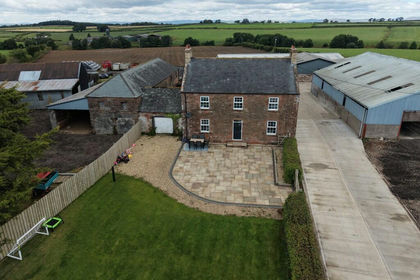
- Price
- Offers Over£1,165,000
- Size
- 64.66 acres
Slealands Farm, Longtown, Carlisle, Cumbria, CA6, Arthuret, Cumberland CA6 England
Added on 20/08/2026Farm