Llanio Road, Tregaron, SY25
- Land size
- 2.44 acres
- Bedrooms
- 4
- Bathrooms
- 2
Key Features
- LLANIO ROAD, TREGARON
- A 2.436 acre smallholding
- 5 bed, 2 rec roomed detached property
- Range of outbuildings
- Healthy productive level pasture
- 18 miles from Aberystwyth
- 8 miles from Lampeter
- 2.5 miles from Tregaron
- E.P.C. Rating - E
- Further land of approx. 6.812 available by negotiation
Description
*** A beautifully positioned residential holding of 2.436 acres or thereabouts *** 5 bedrooms, 2 reception rooms, Family bathroom and ground floor shower/w.c.
*** Good range of outbuildings - Including stable, kennels, workshop and garaging *** Healthy productive level pasture
*** Further land available of approximately 6.812 acres located opposite the house and available by further negotiation.
*** Within easy and close proximity to local amenities of the area *** Aberystwyth lies 18 miles to the North, Lampeter lies 8 miles to the South and the Market Town of Tregaron is some 2.5 miles distant *** Contact us today to view
We are informed by the current Vendors that the property benefits from mains water, mains electricity, mains drainage, oil fired central heating, UPVC double glazing throughout, telephone subject to B.T. transfer regulations, Broadband available.
LOCATION
The University Town Coastal Resort and Administrative Centre of Aberystwyth lies 18 miles to the North, the University Town of Lampeter is 8 miles to the South and the Market Town of Tregaron is some 2.5 miles distant. The property is within easy and close proximity to local amenities of the area.
GENERAL DESCRIPTION
A beautifully positioned residential holding of 2.436 acres or thereabouts. The property offers a very comfortable 4/5 bedroomed country dwelling house together with a good range of outbuildings, including stable, kennels, workshop, garaging and healthy productive level pasture and is set off the A485 Lampeter to Tregaron road and being within easy and close proximity to local amenities of the area.
The residence is detached and well appointed having an oak kitchen, 2 bathrooms and up to 5 bedrooms with spacious Family proportioned accommodation and benefits from double glazing and oil fired central heating.
A significant country property which extends in total to 2.436 acres or thereabouts comprising of a beautifully situated country holding close to the Teifi Valley and within the foothills of the Cambrian Mountains. The property is within easy access of the Villages of Llangeitho, Llanddewi Brefi and Llangybi, with the larger Market Town of Tregaron withi...
THE ACCOMMODATION
The accommodation at present offers more particularly the following.
RECEPTION HALL
Accessed via Oak entrance door. Oak flooring.
KITCHEN/DINER
23' 6" x 13' 6" (7.16m x 4.11m) overall in open plan. With fully tiled floor. Hotpoint appliances including 4 ring hob, electric fan oven, microwave and grill. 1.5 bowl sink unit. Dishwasher space.
GROUND FLOOR BEDROOM 5
13' 3" x 6' 9" (4.04m x 2.06m) with radiator.
STUDY
8' 9" x 8' 3" (2.67m x 2.51m)
CLOAKROOM
With shower cubicle and electric shower unit. W.C. Oil fired central heating boiler running domestic systems.
LIVING ROOM
13' 3" x 23' 3" (4.04m x 7.09m) into bay with fireplace.
SITTING ROOM
13' 9" x 13' 9" (4.19m x 4.19m) with feature fireplace.
REAR HALLWAY
With rear entry door to courtyard.
LANDING
Approached via internal timber staircase.
BEDROOM 1
012' 9" x 11' 3" (3.89m x 3.43m) with cast iron feature fireplace. Double panelled radiator.
BEDROOM 2
13' 7" x 9' 9" (4.14m x 2.97m)
BATHROOM
With panelled bath, low level flush w.c., pedestal wash hand basin. Double panelled radiator. Shaver light.
BEDROOM 3
15' 8" x 9' 8" (4.78m x 2.95m) with double panelled radiator.
BEDROOM 4
11' 3" x 13' 2" (3.43m x 4.01m) with radiator.
PARKING AND DRIVEWAY
The property has its own wrought iron gated driveway with matching railings, front patio and flower beds. To the side various paths serve the rear courtyard which has parking and availability for a number of vehicles.
DETACHED GARAGE
30' 0" x 18' 0" (9.14m x 5.49m) with electric and up and over door.
FURTHER GARAGE
18' 3" x 8' 6" (5.56m x 2.59m)
REAR WORKSHOP AND STABLE
17' 0" x 16' 7" (5.18m x 5.05m)
RANGE OF KENNELS
YARD
Clean tarmacadamed yard.
GARDENS
Gardens easily maintained.
THE LAND
The land is a particular feature of the property and in total extends to approximately 2.436 acres and could be further developed for alternative uses. This all combines to provide an attractive property as made available for the discerning buyer to create a very desirable country home.
The house sits centrally within the land with one large paddock. It is useful pasture land with roadside frontage, all laid to grazing, securely fenced and with good access from the home paddock to the homestead for stables and animal management.
The land would be ideally used for a number of purposes and located in a sought after agricultural locality.
PLEASE NOTE
There is further land available of approximately 6.812 acres located opposite the house and available by further negotiation.
FRONT OF PROPERTY
REAR OF PROPERTY
AGENTS COMMENTS
The property can be described as well appointed, set within a commodious plot yet with easily managed gardens and attractive gated drive with railings. The courtyard lies to the rear of the property with a Bell Tower and useful range of outbuildings that are adaptable to a multitude of alternative uses, including workshops, storage, or smallholding/animal keeping or equestrian purposes.
TENURE AND POSSESSION
We are informed the property is of Freehold Tenure and will be vacant on completion. No onward chain.
COUNCIL TAX
The property is listed under the Local Authority of Ceredigion County Council. Council Tax Band for the property - 'E'.
LAND TRANSACTION TAX
The purchase of this property may be subject to Land Transaction Tax (LTT). The amount payable will depend upon the purchase price and the purchaser’s individual circumstances. Buyers are advised to use the Welsh Revenue Authority Land Transaction Tax calculator and/or seek advice from their solicitor or financial adviser.
MONEY LAUNDERING REGULATIONS
To comply with Government anti-money laundering legislation, we are legally required to carry out identity and verification checks on all buyers and sellers.
We work with our trusted and industry-recognised partner, Coadjute, who will send you a secure link to complete these biometric checks electronically once your offer has been accepted (subject to contract).
A non-refundable fee of £45 + VAT per person is payable directly to Coadjute for this service. These checks must be completed before we can issue the memorandum of sale to the solicitors and progress the transaction.
If you have any questions or need any assistance, please don’t hesitate to contact the office – we’re always happy to help.
Map Location
Property details
- Tenure
- Freehold
- Council Tax Band
- E
- Date Posted
- 2026-07-31
Market Value Analysis
Compared with 1,211 Homes with Land listings in Wales (1+ acres).
Energy Performance Certificate
Energy Efficiency Rating
Based on UK Energy Performance Certificate standards (EU Directive 2002/91/EC)
Running costs are one side. Planning activity, flood history and ground risks for this location are in the full report.
Utilities & Restrictions
Utilities
- Electricity
- Mains
- Water
- Mains
- Heating
- Double Glazing, Oil Heating
- Broadband
- Full Fibre (FTTP)
- Sewerage
- Septic Tank / Private
Rights & Restrictions
- Public Rights of Way
- Ask Agent
- Private Rights of Way
- Ask Agent
- Listed Property
- Ask Agent
- Restrictions
- Ask Agent
Listed status, conservation areas and planning constraints for this location are in the full report.
Property Features
- Accessibility
- Level Access
- Parking
- Garage, Driveway, Gated Parking, Private Parking
- Garden
- Garden
Beyond the particulars: planning activity, flood history, heritage and ground risks, checked for this exact spot.
Connectivity
Broadband
Fastest speed available at this postcode
4 Mbps
Under 10 Mbps here
Suitable for
- Basic browsing & email
Mobile signal
Outdoor predictions; indoor signal depends on building materials.
Ofcom Connected Nations postcode-level predictions. Speeds and signal are modelled, not measured, and vary between addresses and providers.
Signal is the easy part. Planning activity, flood history and protected designations here are in the full report.
Nearest Schools
Primary
- Ysgol Rhos Helyg2.4 miles
- Pupils
- 55
- Type
- Infants & Juniors
- Language
- Welsh medium school / provision (including transitional)
- Ysgol Henry Richard2.9 miles
- Pupils
- 387
- Type
- Middle (ages 3-16)
- Language
- Welsh medium school / provision (including transitional)
- Ysgol Gymunedol Y Dderi3.1 miles
- Pupils
- 99
- Type
- Nursery, Infants & Juniors
- Language
- Welsh medium school / provision (including transitional)
- Ysgol Bro Pedr6.8 miles
- Pupils
- 967
- Type
- Middle (ages 3-19)
- Language
- Dual language school / provision (Welsh and English) (including transitional)
- Ysgol Dyffryn Aeron7 miles
- Pupils
- 180
- Type
- Nursery, Infants & Juniors
- Language
- Welsh medium school / provision (including transitional)
Secondary
- Ysgol Henry Richard2.9 miles
- Pupils
- 387
- Type
- Middle (ages 3-16)
- Language
- Welsh medium school / provision (including transitional)
- Ysgol Bro Pedr6.8 miles
- Pupils
- 967
- Type
- Middle (ages 3-19)
- Language
- Dual language school / provision (Welsh and English) (including transitional)
- Gyfun Aberaeron Comprehensive12 miles
- Pupils
- 573
- Type
- Secondary (ages 11-19)
- Language
- Welsh medium school / provision (including transitional)
- Ysgol Gyfun Penweddig16 miles
- Pupils
- 587
- Type
- Secondary (ages 11-19)
- Language
- Welsh medium school / provision (including transitional)
- Penglais School16 miles
- Pupils
- 1,120
- Type
- Secondary (ages 11-19)
- Language
- English medium school / provision
Distances are straight-line from the advertised location. Source: the national school registers (DfE, Welsh Government, Scottish Government) and Ofsted.
Schools are just the start: sold prices nearby, planning activity and any flood history are in the full report.
Amenities
Supermarket
GP surgery
Pharmacy
Straight-line distances from the advertised location. Sources: NHS records, Geolytix supermarket locations, OS Open Greenspace and the national trails registers.
The area stacks up? Now check the location itself: planning nearby, protected designations and past flooding.
Getting Around
Nearest station
Nearest bus stop
Typical drive times
Straight-line distances from the advertised location; drive times are typical free-flow times over OpenStreetMap road data, so allow more at peak. Public transport locations from DfT NaPTAN.
Easy to reach matters. So do planning activity, flood history and ground risks: all in the full report.
Flood Risk
From Natural Resources Wales flood map open data, checked around the advertised map pin and allowing for the listed acreage where known. This summary comes from LandSale, the advertising platform, not from the listing agent, and is not part of the agent's particulars. Risk can vary across a single holding, so verify anything critical through your own searches before committing.
Rivers and the sea
Surface water
These bandings are the summary. Where this location sits on the flood maps, plus planning activity, heritage and ground risks, is in the full report.
Important notice: Information, maps and tags on this page are drawn from the advertising agent's marketing materials or generated automatically. LandSale has not verified them. Relying on these details is at your own risk, always carry out independent checks before committing to a purchase.
LandSale full disclaimer
Marketing information only - not formal particulars. The details on this website are provided for general guidance and do not constitute an offer or contract. Neither LandSale nor the advertising estate/land agent accepts responsibility for any inaccuracy.
1. Source of information
- Listing content: Core description, asking price, tenure, measurements, photographs and planning history originate from the marketing materials of the advertising estate or land agent. LandSale does not author this content and cannot guarantee its accuracy.
- Automated tags & categorisation: Property type, land-use class, acreage bands and similar labels may be applied by machine-learning models. They are intended as a helpful guide only and may not reflect the property's legal status or permitted use.
- Third-party & enriched data layers: Maps, boundary outlines, planning designations, soil reports, broadband coverage and other environmental or location-based insights are licensed from external suppliers. Such data are supplied “as is", may be incomplete or out of date and are subject to change without notice.
2. Verification required
Prospective purchasers must verify critical matters, including but not limited to planning permission, title boundaries, public rights of way, environmental constraints, acreage, services, access and VAT status, through their own inspections, specialist surveys, legal advisers and the selling agent before relying on the information or entering into any contract.
3. No warranty or liability
LandSale gives no warranty, express or implied, as to the accuracy, completeness or fitness for any particular purpose of the information displayed. LandSale shall not be liable for any loss, damage, cost or expense arising directly or indirectly from any use of or reliance on such information, save where liability may not be excluded by law.
4. Updates & feedback
If you believe any detail on this listing is inaccurate, please let us know. We will investigate and, where appropriate, update the listing or notify the agent.
© LandSale | Version 1.3 - August 2026
Listing agent
Morgan & Davies, Lampeter
12 Harford Square, Lampeter, SA48 7DT
Similar properties for sale
- Price
- £425,000
- Size
- 6 acres
Llanddewi Brefi, Tregaron, SY25, Llanddewi Brefi, Ceredigion SY25 Wales
Added on 15/09/2026Smallholding
- Price
- Guide Price£650,000
- Size
- 5 acres
Cwmcarfan, Llanddewi Road, Llanddewi Brefi, Ceredigion SY25 Wales
Added on 29/01/2026Equestrian property
- Price
- Guide Price£600,000
- Size
- 2 acres
Llwynygroes, Tregaron, SY25, Tregaron, Ceredigion SY25 Wales
Added on 02/07/2026Country Home
- Price
- £499,950
- Size
- 4.5 acres
Added on 12/05/2026Smallholding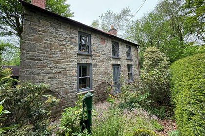
- Price
- £625,000
- Size
- 20 acres
Llangeitho, Tregaron, SY25, Llangeitho, Ceredigion SY25 Wales
Added on 29/01/2026Smallholding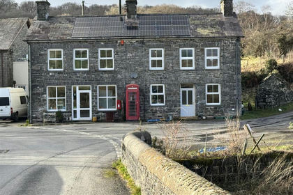
- Price
- £475,000
- Size
- 1.5 acres
Llanfair Clydogau, Lampeter, Llanfair Clydogau, Ceredigion SA48 Wales
Added on 29/01/2026House with Land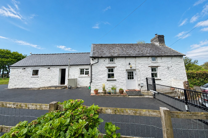
- Price
- £520,000
- Size
- 4.8 acres
Bwlchllan, Lampeter, SA48, Nantcwnlle, Ceredigion SA48 Wales
Added on 12/05/2026Smallholding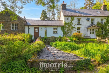
- Price
- £649,950
- Size
- 2.64 acres
Bwlchllan, Lampeter, SA48, Nantcwnlle, Ceredigion SA48 Wales
Added on 01/06/2026Farmhouse
- Price
- £469,950
- Size
- 4.68 acres
Cellan, Lampeter, SA48, Llanfair Clydogau, Ceredigion SA48 Wales
Added on 20/08/2026Smallholding
- Price
- £550,000
- Size
- 5 acres
Added on 29/01/2026House with Land