The Oaks, Brayford
- Land size
- 6.87 acres
- Bedrooms
- 4
- Bathrooms
- 2
Key Features
- 360 Virtual Tour Available
- 4 Bedrooms
- Agricultural/Equestrian Interests
- Available as a whole or with less land
- Detached House
- In all, about 7 Acres
Description
ABOUT THE PROPERTY
The Oaks represents a superb smallholding comprising an attractive four bedroomed detached modern country style home extending to almost 7 acres in all, with pasture paddocks and gardens, enjoying delightful village and rural views. The current vendors have adapted the property as an ideal equestrian set up with a range of stabling and outbuildings, nestled on the edge of this popular rural village just 7 miles from the market town of South Molton.
The Oaks offers a wonderful balance of peaceful countryside living with convenient access to local amenities and transport links, making it an ideal home for families, equestrian/agricultural appeal or those seeking a tranquil village lifestyle. The property is available as a whole, or with less land at a lower guide price, if required.
The spacious accommodation which enjoys lots of natural light, briefly comprises, a veranda, large open-plan kitchen/dining room, boot room/utility and cloakroom together with a large living room on the ground floor. On the first floor are four bedrooms, master with en-suite shower room and a family bathroom. Benefitting from double glazing and oil fired central heating with underfloor heating to the ground floor and radiators to the first.
The property is offered with no onward chain.
The property is available with 5.38 Acres as shown shaded blue on the enclosed identification land plan. Or as a whole, with the additional 1.49 Acres shaded yellow. In all, The Oaks extends to about 6.87 Acres
Please refer to the enclosed Floorplan. Virtual Tour available.
THE GARDENS & LAND
The Oaks is initially approached via a shared driveway, which leads to a private gated sweeping entrance wrapping around the property providing ample off road parking with a large car port to the rear. A further gated spur from the entrance drive leads to the stable block, outbuilding and pastureland divided into multiple enclosures. A real feature of the gardens are the two mature oak trees. Adjoining the rear garden and patio area is an enclosed lawned garden. A further gated entrance from the country lane to the north provides access to the separately enclosed 1.49 Acre paddock. The current vendors investigated the opportunity under an exemption for up to 5 mobile units for holiday use. We understand mains water crosses the land. Further details are available upon request.
In all, the property extends to 6.87 Acres and is available with less land, if required.
THE AREA
Brayford has a thriving local community, including a highly regarded pre and primary school, village hall, methodist chapel and the nearby High Bray Church. The village is located close to the western edge of Exmoor National Park and the beautiful North Devon countryside and coastline are also within easy driving distance. Renowned West Buckland School is just 4 miles distant with the market town of South Molton just 7 miles.
The market town of South Molton, offers an excellent range of everyday services including shops, schools, restaurants, together with a Sainsbury's supermarket, health centre, recreational facilities and cottage hospital. The town also enjoys a traditional country pannier market twice weekly.
SERVICES & OUTGOINGS
We understand that the property is connected to mains water and electricity. Oil fired boiler providing the central heating system. Drainage is to a private system.
North Devon Council - Band E (approx. £3,073 per annum)
EPC - F 52/80
Tenure - Freehold
Internet & Mobile - OFCOM
We understand that high speed fibre is available.
DIRECTIONS
Travelling on the A361 at North Aller Roundabout near South Molton, take the A399 turning signed Brayford/Blackmoor Gate and stay on this road for 5 miles turning right into the village of Brayford. Take the next left turning onto Little Bray Lane and the entrance to The Oaks is the last property on the left hand side before you leave the village.
What 3 Words Location - ///smoker.conductor.monument
DIGITAL MEDIA LINKS
VIRTUAL TOUR AVAILABLE
IMPORTANT NOTICE
These sale particulars have been prepared as a general guide. They must not be relied upon as statements of fact. We have not carried out a detailed survey, nor tested the services, heating systems, appliances and specific fittings. Room sizes should not be relied upon for carpets and furnishings. If there are points which are of particular importance to you, please make contact prior to viewing the property. To the best of our ability we try to represent the property accurately and honestly. A purchaser must make sure they are satisfied with the property before agreeing to proceed.
A Property Information Questionnaire & Title Register are available to prospective purchasers before committing to proceed with a purchase. We are not legal experts, and you must seek and be guided by your own legal advice. Talk to us if there are any questions or concerns relating to the property.
COPYRIGHT © 2026 MICHAEL ADEY PROPERTY
Council Tax Band: E (North Devon Council)
Tenure: Freehold
Electricity supply: Mains
Heating: Oil
Water supply: Mains
Sewerage: Septic Tank
Broadband: FTTP
Map Location
Property details
- Tenure
- Freehold
- Council Tax Band
- E
- Date Posted
- 2026-07-27
Market Value Analysis
Compared with 507 Homes with Land listings in South West England (5+ acres).
Energy Performance Certificate
EPC Rating: F
Running costs are one side. Planning activity, flood history and ground risks for this location are in the full report.
Property Brochure
Seen the details? The full report adds the independent checks: planning activity, flood history, heritage and ground.
Utilities & Restrictions
Utilities
- Electricity
- Ask Agent
- Water
- Ask Agent
- Heating
- Ask Agent
- Broadband
- Ask Agent
- Sewerage
- Ask Agent
Rights & Restrictions
- Public Rights of Way
- Ask Agent
- Private Rights of Way
- Ask Agent
- Listed Property
- Ask Agent
- Restrictions
- Ask Agent
Listed status, conservation areas and planning constraints for this location are in the full report.
Property Features
- Accessibility
- Ask Agent
- Parking
- Ask Agent
- Garden
- Ask Agent
Beyond the particulars: planning activity, flood history, heritage and ground risks, checked for this exact spot.
Connectivity
Broadband
Fastest speed available at this postcode
1.8 Gbps
Gigabit full fibre
Suitable for
- 4K streaming on every screen
- Full-time home working
- Online gaming & big downloads
Mobile signal
Outdoor predictions; indoor signal depends on building materials.
Ofcom Connected Nations postcode-level predictions. Speeds and signal are modelled, not measured, and vary between addresses and providers.
Signal is the easy part. Planning activity, flood history and protected designations here are in the full report.
Nearest Schools
Primary
- Brayford Academy394 metresOfsted: Good
- Ages
- 2 to 11
- Pupils
- 32
- Type
- Academy converter
- Bratton Fleming Community Primary School3.3 milesOfsted: Good
- Ages
- 4 to 11
- Pupils
- 70
- Type
- Academy converter
- North Molton Primary School4.4 milesNo Ofsted rating
- Ages
- 2 to 11
- Pupils
- 124
- Type
- Academy converter
- Filleigh Community Primary School4.4 milesOfsted: Good *
- Ages
- 3 to 11
- Pupils
- 61
- Type
- Foundation school
- Swimbridge Church of England Primary School5.2 milesOfsted: Good
- Ages
- 4 to 11
- Pupils
- 79
- Type
- Voluntary aided school
- Faith
- Church of England
Secondary
- South Molton Community College6.2 milesOfsted: Good *
- Ages
- 11 to 16
- Pupils
- 656
- Type
- Foundation school
- The Park Community School7.8 milesOfsted: Good *
- Ages
- 11 to 16
- Pupils
- 1,408
- Type
- Academy converter
- Pilton Community College8.4 milesOfsted: Good
- Ages
- 11 to 16
- Pupils
- 1,165
- Type
- Academy converter
- Braunton Academy12 milesNo Ofsted rating
- Ages
- 11 to 16
- Pupils
- 828
- Type
- Academy converter
- Chulmleigh Community College13 milesNo Ofsted rating
- Ages
- 11 to 16
- Pupils
- 735
- Type
- Academy converter
* Latest graded judgement covers quality of education only; no overall grade was issued under the 2024-25 inspection framework.
Distances are straight-line from the advertised location. Source: the national school registers (DfE, Welsh Government, Scottish Government) and Ofsted.
Schools are just the start: sold prices nearby, planning activity and any flood history are in the full report.
Amenities
Supermarket
GP surgery
Pharmacy
Hospital
Straight-line distances from the advertised location. Sources: NHS records, Geolytix supermarket locations, OS Open Greenspace and the national trails registers.
The area stacks up? Now check the location itself: planning nearby, protected designations and past flooding.
Getting Around
Nearest station
Nearest bus stop
Typical drive times
Straight-line distances from the advertised location; drive times are typical free-flow times over OpenStreetMap road data, so allow more at peak. Public transport locations from DfT NaPTAN.
Easy to reach matters. So do planning activity, flood history and ground risks: all in the full report.
Flood Risk
From Environment Agency flood map open data, checked around the advertised map pin and allowing for the listed acreage where known. This summary comes from LandSale, the advertising platform, not from the listing agent, and is not part of the agent's particulars. Risk can vary across a single holding, so verify anything critical through your own searches before committing.
Rivers and the sea
Mapped within the area searched, not at the advertised map pin itself.
Surface water
Mapped within the area searched, not at the advertised map pin itself.
These bandings are the summary. Where this location sits on the flood maps, plus planning activity, heritage and ground risks, is in the full report.
Important notice: Information, maps and tags on this page are drawn from the advertising agent's marketing materials or generated automatically. LandSale has not verified them. Relying on these details is at your own risk, always carry out independent checks before committing to a purchase.
LandSale full disclaimer
Marketing information only - not formal particulars. The details on this website are provided for general guidance and do not constitute an offer or contract. Neither LandSale nor the advertising estate/land agent accepts responsibility for any inaccuracy.
1. Source of information
- Listing content: Core description, asking price, tenure, measurements, photographs and planning history originate from the marketing materials of the advertising estate or land agent. LandSale does not author this content and cannot guarantee its accuracy.
- Automated tags & categorisation: Property type, land-use class, acreage bands and similar labels may be applied by machine-learning models. They are intended as a helpful guide only and may not reflect the property's legal status or permitted use.
- Third-party & enriched data layers: Maps, boundary outlines, planning designations, soil reports, broadband coverage and other environmental or location-based insights are licensed from external suppliers. Such data are supplied “as is", may be incomplete or out of date and are subject to change without notice.
2. Verification required
Prospective purchasers must verify critical matters, including but not limited to planning permission, title boundaries, public rights of way, environmental constraints, acreage, services, access and VAT status, through their own inspections, specialist surveys, legal advisers and the selling agent before relying on the information or entering into any contract.
3. No warranty or liability
LandSale gives no warranty, express or implied, as to the accuracy, completeness or fitness for any particular purpose of the information displayed. LandSale shall not be liable for any loss, damage, cost or expense arising directly or indirectly from any use of or reliance on such information, save where liability may not be excluded by law.
4. Updates & feedback
If you believe any detail on this listing is inaccurate, please let us know. We will investigate and, where appropriate, update the listing or notify the agent.
© LandSale | Version 1.3 - August 2026
Listing agent
Michael Adey Property, South Molton
106 East Street, South Molton, EX36 3DB
View agent profileSimilar properties for sale
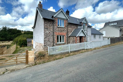
- Price
- Guide Price£835,000
- Size
- 8.34 acres
Brayford, Barnstaple, Devon, EX32, Brayford, Devon EX32 England
Added on 08/08/2026House with Land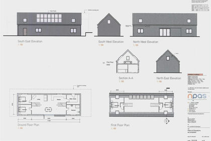
- Price
- Offers in Region of£675,000
- Size
- 13.6 acres
Added on 09/07/2026Building Plot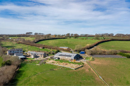
- Price
- Guide Price£795,000
- Size
- 11 acres
Added on 24/06/2026House with Land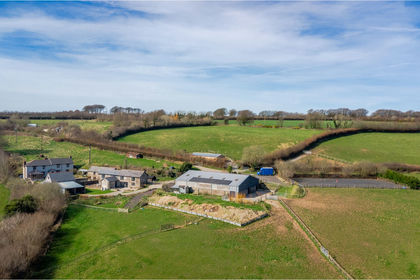
- Price
- Guide Price£795,000
- Size
- 11 acres
Added on 27/07/2026House with Land
- Price
- Guide Price£599,950
- Size
- 4.69 acres
Added on 26/03/2026House with Land
- Price
- Guide Price£800,000
- Size
- 10 acres
Knowstone, South Molton, Devon, EX36, Knowstone, Devon EX36 England
Added on 16/08/2026Smallholding
- Price
- Guide Price£695,000
- Size
- 7.2 acres
Roborough, Winkleigh, Devon, EX19, Roborough, Devon EX19 England
Added on 13/08/2026Smallholding
- Price
- Guide Price£800,000
- Size
- 13 acres
Added on 28/01/2026Golf Course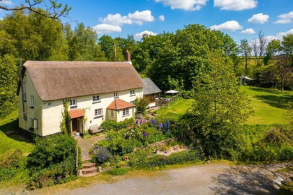
- Price
- Guide Price£675,000
- Size
- 4.4 acres
Added on 01/05/2026Cottage
- Price
- Offers in Region of£680,000
- Size
- 3.15 acres
Added on 20/07/2026Smallholding