Silver Hill, High Bickington
- Land size
- 5.13 acres
- Bedrooms
- 4
- Bathrooms
- 1
Key Features
- 360 Virtual Tour Available
- 4 Bed Detached Bungalow
- Stunning Position with Panoramic Views
- Picturesque Taw Valley
- Tremendous Potential
- 2026 Planning For Large Extension
- Land in all, about 5.13 acres
- 1.2 Miles From The Village
Description
ABOUT THE PROPERTY
Silver Hill occupies a truly outstanding elevated position enjoying dramatic panoramic views across the picturesque Taw Valley. Located half a mile from the A377 and just over a mile from the popular village of High Bickington, this rural property package represents a unique opportunity to acquire a superb detached bungalow which undoubtedly provides tremendous potential. The current vendors have remodelled and refurbished the accommodation together with obtaining planning consent for a large extension to the rear taking full advantage of the surrounding countryside.
The property is approached from the country lane via a private gated entrance which leads to a large driveway, garage and store. A spur from the initial drive leads to a separate parking area and to a superb timber cabin which may cater for a variety of uses, currently a salon. Adjoining the property are six pasture paddock enclosures and in all, Silver Hill extends to about 5.13 acres.
Enjoying lots of natural light with views over the gardens, land and countryside beyond, the accommodation, comprises; a welcoming entrance hallway, a spacious living room, large open-large kitchen/dining room, opening into a conservatory, four good sized bedrooms, family bathroom, inner hall and cloakroom. Contained within the western paddock is a useful field shelter.
Planning consent was granted in July 2026 for a large extension to the rear elevation for a vast open plan kitchen/living space, separate utility/boot room and to include remodelling the existing accommodation ro provide a master bedroom with dressing and en-suite and home office. Details and floorplans are contained within these particulars.
Torridge Planning Link: Full Planning Info. For layout and approximate room measurements please see the enclosed floorplan and refer to the Virtual Tour.
THE GARDENS & LAND
A long private driveway leads to large turning point with ample parking space and provides access to the detached block built single garage. Adjoining the entrance driveway is an enclosed paddock extending to about 0.4 of an acre, the current vendors have constructed a useful cabin, ideal for a home business with a separate entrance and parking.
To the south side of Silver Hill is a large garden laid mainly to lawn and a large decking area enjoying those wonderful views. The larger pasture paddock adjoins the south and west side of the property extending to about 4.2 acres and contains a useful field shelter and store, currently divided into six enclosures.
In all, Silver Hill extends to about 5.13 acres.
THE AREA
The property is located in an extremely accessible position just 0.5 of a mile from the A377 Exeter to Barnstaple road.
The popular village of High Bickington is just over 1 mile distant and boasts an excellent and well stocked village shop, a post office, doctors' surgery, two public houses, pre/primary school, a historic church, chapel, community centre & woodland together with a playing field offering cricket and football clubs. Whilst rurally situated, High Bickington provides thriving community with easy access.
South Molton, Great Torrington & Barnstaple provide a wide range of everyday facilities, services, shops and public houses together with primary and secondary schooling.
SERVICES & OUTGOINGS
We understand that the property is connected to mains water and electricity. Drainage to a private system. Oil fired boiler providing the domestic hot water and central heating.
North Devon Council - Band E (approx. £3,180 per annum)
EPC - E
Torridge District Council - Planning Application and details
Tenure - Freehold
Internet & Mobile - Visit OFCOM
DIRECTIONS
From Umberleigh on the A377 continue in the direction of Exeter and follow the road for approximately 1.8 miles and at Weirmarsh Cross turn right (unsigned lane). Continue along this lane towards High Bickington for 0.6 of a mile and the white gated entrance to Silver Hill will be seen on the left hand side.
What 3 Words Location - ///baseballs.cackling.swatting
DIGITAL MEDIA LINKS
VIRTUAL TOUR AVAILABLE
IMPORTANT NOTICE
These sale particulars have been prepared as a general guide. They must not be relied upon as statements of fact. We have not carried out a detailed survey, nor tested the services, heating systems, appliances and specific fittings. Room sizes should not be relied upon for carpets and furnishings. If there are points which are of particular importance to you, please make contact prior to viewing the property. To the best of our ability we try to represent the property accurately and honestly. A purchaser must make sure they are satisfied with the property before agreeing to proceed.
A Property Information Questionnaire & Title Register are available to prospective purchasers before committing to proceed with a purchase. We are not legal experts, and you must seek and be guided by your own legal advice. Talk to us if there are any questions or concerns relating to the property.
COPYRIGHT © 2026 MICHAEL ADEY PROPERTY
Council Tax Band: E (North Devon Council)
Tenure: Freehold
Parking options: Garage, Off Street
Garden details: Private Garden
Electricity supply: Mains
Heating: Oil
Water supply: Mains
Sewerage: Septic Tank
Map Location
Property details
- Tenure
- Freehold
- Council Tax Band
- E
- Date Posted
- 2026-10-03
Market Value Analysis
Compared with 472 Homes with Land listings in South West England (5+ acres).
Energy Performance Certificate
EPC Rating: E
Running costs are one side. Planning activity, flood history and ground risks for this location are in the full report.
Property Brochure
Seen the details? The full report adds the independent checks: planning activity, flood history, heritage and ground.
Utilities & Restrictions
Utilities
- Electricity
- Ask Agent
- Water
- Ask Agent
- Heating
- Ask Agent
- Broadband
- Ask Agent
- Sewerage
- Ask Agent
Rights & Restrictions
- Public Rights of Way
- Ask Agent
- Private Rights of Way
- Ask Agent
- Listed Property
- Ask Agent
- Restrictions
- Ask Agent
Listed status, conservation areas and planning constraints for this location are in the full report.
Property Features
- Accessibility
- Ask Agent
- Parking
- Ask Agent
- Garden
- Ask Agent
Beyond the particulars: planning activity, flood history, heritage and ground risks, checked for this exact spot.
Connectivity
Broadband
Fastest speed available at this postcode
17 Mbps
Standard (10-30 Mbps)
Suitable for
- Web & social
- Music streaming
- Standard video calls
Fixed wireless access may also be an option here.
Mobile signal
Predicted 4G and 5G signal; indoor signal depends on building materials.
Ofcom Connected Nations postcode-level predictions. Speeds and signal are modelled, not measured, and vary between addresses and providers.
Signal is the easy part. Planning activity, flood history and protected designations here are in the full report.
Nearest Schools
Primary
- High Bickington Church of England Primary Academy1.3 milesOfsted report card · Mar 2026
- Ages
- 2 to 11
- Pupils
- 84
- Type
- Academy converter
- Faith
- Church of England
- Umberleigh Primary Academy2 milesNo Ofsted rating
- Ages
- 2 to 11
- Pupils
- 94
- Type
- Academy converter
- Kings Nympton Community Primary School4 milesNo Ofsted rating
- Ages
- 4 to 11
- Pupils
- 17
- Type
- Foundation school
- Filleigh Community Primary School5.3 milesOfsted: Good *
- Ages
- 3 to 11
- Pupils
- 61
- Type
- Foundation school
- Beaford Community Primary & Nursery School5.5 milesOfsted: Good *
- Ages
- 2 to 11
- Pupils
- 118
- Type
- Academy converter
Secondary
- Chulmleigh Community College5.6 milesNo Ofsted rating
- Ages
- 11 to 16
- Pupils
- 735
- Type
- Academy converter
- South Molton Community College6.4 milesOfsted: Good *
- Ages
- 11 to 16
- Pupils
- 656
- Type
- Foundation school
- Great Torrington School7.4 milesNo Ofsted rating
- Ages
- 11 to 16
- Pupils
- 863
- Type
- Academy converter
- The Park Community School7.8 milesOfsted: Good *
- Ages
- 11 to 16
- Pupils
- 1,408
- Type
- Academy converter
- Pilton Community College9.3 milesOfsted: Good
- Ages
- 11 to 16
- Pupils
- 1,165
- Type
- Academy converter
* Latest graded judgement covers quality of education only; no overall grade was issued under the 2024-25 inspection framework.
Distances are straight-line from the advertised location. Source: the national school registers (DfE, Welsh Government, Scottish Government) and Ofsted.
Schools are just the start: sold prices nearby, planning activity and any flood history are in the full report.
Amenities
Supermarket
GP surgery
Pharmacy
Hospital
Straight-line distances from the advertised location. Sources: NHS records, Geolytix supermarket locations, OS Open Greenspace and the national trails registers.
The area stacks up? Now check the location itself: planning nearby, protected designations and past flooding.
Getting Around
Nearest station
Nearest bus stop
Typical drive times
Straight-line distances from the advertised location; drive times are typical free-flow times over OpenStreetMap road data, so allow more at peak. Public transport locations from DfT NaPTAN.
Easy to reach matters. So do planning activity, flood history and ground risks: all in the full report.
Flood Risk
Environment Agency open data, checked around the advertised map pin for the listed acreage. Long-term risk counts flood defences; the planning map's flood zones do not. Provided by LandSale, not the listing agent, and not part of the agent's particulars. Risk varies across a holding, so verify before committing.
Rivers and the sea
Planning map: Flood Zone 1.
Surface water
These bandings are the summary. Where this location sits on the flood maps, plus planning activity, heritage and ground risks, is in the full report.
Important notice: Information, maps and tags on this page are drawn from the advertising agent's marketing materials or generated automatically. LandSale has not verified them. Relying on these details is at your own risk, always carry out independent checks before committing to a purchase.
LandSale full disclaimer
Marketing information only - not formal particulars. The details on this website are provided for general guidance and do not constitute an offer or contract. Neither LandSale nor the advertising estate/land agent accepts responsibility for any inaccuracy.
1. Source of information
- Listing content: Core description, asking price, tenure, measurements, photographs and planning history originate from the marketing materials of the advertising estate or land agent. LandSale does not author this content and cannot guarantee its accuracy.
- Automated tags & categorisation: Property type, land-use class, acreage bands and similar labels may be applied by machine-learning models. They are intended as a helpful guide only and may not reflect the property's legal status or permitted use.
- Third-party & enriched data layers: Maps, boundary outlines, planning designations, soil reports, broadband coverage and other environmental or location-based insights are licensed from external suppliers. Such data are supplied “as is", may be incomplete or out of date and are subject to change without notice.
2. Verification required
Prospective purchasers must verify critical matters, including but not limited to planning permission, title boundaries, public rights of way, environmental constraints, acreage, services, access and VAT status, through their own inspections, specialist surveys, legal advisers and the selling agent before relying on the information or entering into any contract.
3. No warranty or liability
LandSale gives no warranty, express or implied, as to the accuracy, completeness or fitness for any particular purpose of the information displayed. LandSale shall not be liable for any loss, damage, cost or expense arising directly or indirectly from any use of or reliance on such information, save where liability may not be excluded by law.
4. Updates & feedback
If you believe any detail on this listing is inaccurate, please let us know. We will investigate and, where appropriate, update the listing or notify the agent.
© LandSale | Version 1.3 - August 2026
Listing agent
Michael Adey Property, South Molton
106 East Street, South Molton, EX36 3DB
Contact Michael Adey Property, South Molton
106 East Street, South Molton, EX36 3DB
View agent profileSimilar properties for sale
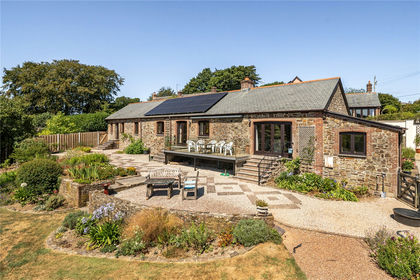
- Price
- Guide Price£695,000
- Size
- 7.2 acres
Added on 13/08/2026Smallholding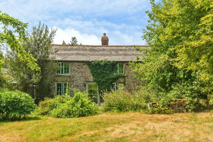
- Price
- Guide Price£800,000
- Size
- 4 acres
Added on 02/10/2026Smallholding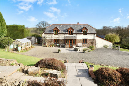
- Price
- Offers in Excess of£800,000
- Size
- 3.7 acres
Yarnscombe, Barnstaple, EX31, Barnstaple, Devon EX31 England
Added on 05/06/2026Barn Conversion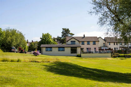
- Price
- Guide Price£800,000
- Size
- 13 acres
Added on 28/01/2026Golf Course
- Price
- Guide Price£675,000
- Size
- 4.4 acres
Added on 01/05/2026Cottage
- Price
- Guide Price£575,000
- Size
- 2.4 acres
Smemington Farm & Cottage, Tawstock, Barnstaple, Devon EX31 England
Added on 14/09/2026House with Land
- Price
- Guide Price£845,000
- Size
- 2.92 acres
Romansleigh, South Molton, EX36, South Molton, Devon EX36 England
Added on 22/05/2026House with Land
- Price
- Guide Price£900,000
- Size
- 24 acres
Added on 29/01/2026House with Land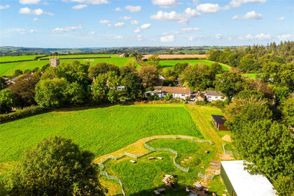
- Price
- Guide Price£625,000
- Size
- 2 acres
Added on 13/08/2026House with Land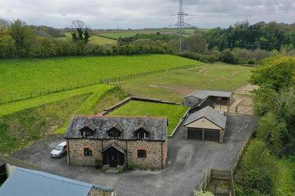
- Price
- Guide Price£650,000
- Size
- 2.21 acres
Added on 06/06/2026Barn Conversion