Lynton, Exmoor
- Land size
- 4.69 acres
- Dwelling size
- 1033 sqft
- Bedrooms
- 2
- Bathrooms
- 1
Key Features
- Stunning countryside and valley views
- Charming 2/3-bedroom cottage with traditional character
- Approximately 4.69 acres of woodland and meadows
- Stone outbuildings, studio, and detached garage/workshop
- Living room with log burner and kitchen/dining with Rayburn
- Ample parking for multiple vehicles
Description
ABOUT THE PROPERTY
Charming 2/3-Bedroom Cottage with Stunning Exmoor Views Nestled in the heart of Exmoor National Park and enjoying far reaching views across the surrounding countryside, this delightful 2/3 bedroom cottage has been sympathetically modernised by the current owners to create a welcoming home with country-style living.
The property sits within approximately 4.69 acres of mixed mature woodland and meadows, former trout ponds, bordered by a stream. There are a variety of stone outbuildings, currently used for workshop and storage, which may offer potential for conversion into additional accommodation (subject to planning permission), along with a studio with log burner, a detached garage/workshop, and ample parking for multiple vehicles via the driveway.
Inside, the accommodation retains the warmth and character of a traditional cottage. On the ground floor, there is an entrance porch, living room with log burner, study/third bedroom, kitchen/dining room with solid fuel Rayburn, utility room, cloakroom WC, and rear porch. Upstairs, there are two generously proportioned bedrooms (formerly three) and a bathroom with a roll-top bath.
Key Features
Beautiful Exmoor cottage with traditional charm
2/3 bedrooms, flexible accommodation
Approximately 4.69 acres of mixed woodland and meadow
Stunning countryside and valley views
Mature gardens and outdoor areas ideal for relaxing or entertaining
Stone outbuildings, studio, garage/workshop
Ample parking for multiple vehicles
For layout and approximate room measurement, please see the enclosed floor plan and link to Virtual Tour.
THE AREA
This is more than just a home - it's a gateway to Exmoor's unique way of life. Set in a peaceful rural location, the property offers a rare opportunity to enjoy the very best of country living while remaining conveniently connected, combining tranquillity with accessibility. Perched high on the dramatic North Devon coastline, Lynton is a charming Victorian town renowned for its breathtaking scenery, coastal walks, and relaxed lifestyle. Often referred to as the "Little Switzerland of England," the town enjoys spectacular views across the
Bristol Channel and the rugged cliffs of Exmoor National Park. The town offers a welcoming community atmosphere with a range of independent shops, cafés, traditional pubs, and everyday amenities. The property is conveniently located within easy walking distance of a wide selection of facilities including restaurants, bars, cafés, local shops, a gym, hairdressers, small supermarkets, a library, a primary school, cinema, tennis and bowls clubs, and a well-attended youth club, as well as places of worship. A regular bus service also provides
connections to surrounding towns and villages.
Lynton is famously linked to its picturesque twin village, Lynmouth, by the historic Lynton and Lynmouth Cliff Railway, the world's highest and steepest fully water-powered railway. From here, residents can easily access Lynmouth's harbour, riverside walks, and coastal charm. Surrounded by the dramatic landscapes of Exmoor, the area is a haven for walkers, cyclists, and nature lovers. Nearby, the iconic Valley of Rocks offers spectacular coastal views, striking rock formations, and its famous herd of wild goats. Combining stunning coastal scenery, historic character, and a strong sense of community, Lynton is a highly desirable location for those seeking a peaceful North Devon lifestyle while remaining within easy reach of the regional centre of Barnstaple and the wider North Devon coastline. Lynton is twinned with the coastal village of Lynmouth, set on the banks of the River Lyn overlooking the sea and reached by a cliffside railway. The South West Coast Path passes directly through Lynton & Lynmouth and is England's longest waymarked long-distance footpath
and a National Trail. It stretches for 630 miles (1,014 km), running from Minehead in Somerset, along the coasts of Devon and Cornwall, to Poole Harbour in Dorset. More extensive shopping facilities and
amenities are available at the larger town of Ilfracombe (about half an hour) and the regional centre of Barnstaple (about 45 minutes). The world-renowned surfing beaches at Woolacombe, Putsborough, Saunton (also with Championship golf course) and Croyde are also about 45 minutes by car.
SERVICES & OUTGOINGS
Services & Heating
The property is served by a private water supply (borehole) and private drainage (septic tank). A solid fuel Rayburn provides hot water and central heating, with an immersion heater on the hot water tank. Mains
electricity is also connected.
Connectivity
For further information regarding mobile phone signal coverage and internet connections, please see the Ofcom website.
Council Tax & EPC
North Devon Council - Band F
(2026/27: approx. £3,932.55 per annum)
EPC Rating - F
Tenure
Freehold
Note: The neighbouring property owns the private lane, with a formal right of way in place allowing Lower Ranscombe Farm access to the property and its land.
DIRECTIONS
From our office in Lynton proceed down Castle Hill and continue straight onto Lynbridge Road and stay on this road until you reach Barbrook. From our office in Lynton, proceed down Castle Hill and continue straight onto Lynbridge Road. Stay on this road until you reach Barbrook. Turn right at the junction onto the A39 and continue for approximately 2.5 km, passing the signs for New Mill Farm Holiday Cottages and Caffyns. The entrance to the property is on the left-hand side, marked by two red brick pillars. Proceed down the private access lane, and the property can be found on the left-hand side with a nameplate.
What 3 Words Location - ///jazzy.shields.wand
Property Reference #RSE0580
IMPORTANT NOTICE
These sale particulars have been prepared as a general guide.
They must not be relied upon as statements of fact. We have not
carried out a detailed survey, nor tested the services, heating
systems, appliances and specific fittings. Room sizes should not be
relied upon for carpets and furnishings. If there are points which
are of particular importance to you, please make contact prior to
viewing the property. To the best of our ability we try to
represent the property accurately and honestly. A purchaser
must make sure they are satisfied with the property before
agreeing to proceed.
A Property Information Questionnaire & Title Register are
available to prospective purchasers before committing to proceed
with a purchase. We are not legal experts, and you must seek
and be guided by your own legal advice. Talk to us if there are
any questions or concerns relating to the property.
COPYRIGHT © 2025 EXMOOR PROPERTY
Council Tax Band: F (North Devon Council)
Tenure: Freehold
Parking options: Driveway, Garage, Off Street
Electricity supply: Mains
Heating: Woodburner
Water supply: Private Borehole
Sewerage: Septic Tank, Private Drainage
Map Location
Property details
- Tenure
- Freehold
- Council Tax Band
- F
- Date Posted
- 2026-03-26
Market Value Analysis
Compared with 1,628 Homes with Land listings in South West England (1+ acres).
Energy Performance Certificate
EPC Rating: F
Running costs are one side. Planning activity, flood history and ground risks for this location are in the full report.
Property Brochure
Seen the details? The full report adds the independent checks: planning activity, flood history, heritage and ground.
Utilities & Restrictions
Utilities
- Electricity
- Mains
- Water
- Private Supply
- Heating
- Wood Burner
- Broadband
- Ask Agent
- Sewerage
- Septic Tank / Private
Rights & Restrictions
- Public Rights of Way
- Ask Agent
- Private Rights of Way
- Ask Agent
- Listed Property
- Ask Agent
- Restrictions
- Ask Agent
Listed status, conservation areas and planning constraints for this location are in the full report.
Property Features
- Accessibility
- Ask Agent
- Parking
- Garage, Driveway, Off-Street Parking
- Garden
- Garden
Beyond the particulars: planning activity, flood history, heritage and ground risks, checked for this exact spot.
Connectivity
Broadband
Fastest speed available at this postcode
1.8 Gbps
Gigabit full fibre
Suitable for
- 4K streaming on every screen
- Full-time home working
- Online gaming & big downloads
Mobile signal
Predicted 4G and 5G signal; indoor signal depends on building materials.
Ofcom Connected Nations postcode-level predictions. Speeds and signal are modelled, not measured, and vary between addresses and providers.
Signal is the easy part. Planning activity, flood history and protected designations here are in the full report.
Nearest Schools
Primary
- Parracombe Church of England Primary School1.9 milesNo Ofsted rating
- Ages
- 4 to 11
- Pupils
- 37
- Type
- Voluntary controlled school
- Faith
- Church of England
- Lynton Church of England Primary School2.2 milesNo Ofsted rating
- Ages
- 4 to 11
- Pupils
- 61
- Type
- Voluntary aided school
- Faith
- Church of England
- Kentisbury Primary School5.1 milesNo Ofsted rating
- Ages
- 4 to 11
- Pupils
- 51
- Type
- Community school
- Bratton Fleming Community Primary School6.5 milesOfsted: Good
- Ages
- 4 to 11
- Pupils
- 70
- Type
- Academy converter
- Combe Martin Primary School7.2 milesOfsted: Requires improvement *
- Ages
- 2 to 11
- Pupils
- 137
- Type
- Academy converter
Secondary
- The Ilfracombe Church of England Academy11 milesOfsted report card · Jan 2026
- Ages
- 11 to 18
- Pupils
- 1,016
- Type
- Academy sponsor led
- Faith
- Church of England
- Pilton Community College12 milesOfsted: Good
- Ages
- 11 to 16
- Pupils
- 1,165
- Type
- Academy converter
- The Park Community School12 milesOfsted: Good *
- Ages
- 11 to 16
- Pupils
- 1,408
- Type
- Academy converter
- South Molton Community College13 milesOfsted: Good *
- Ages
- 11 to 16
- Pupils
- 656
- Type
- Foundation school
- Braunton Academy14 milesNo Ofsted rating
- Ages
- 11 to 16
- Pupils
- 828
- Type
- Academy converter
* Latest graded judgement covers quality of education only; no overall grade was issued under the 2024-25 inspection framework.
Distances are straight-line from the advertised location. Source: the national school registers (DfE, Welsh Government, Scottish Government) and Ofsted.
Schools are just the start: sold prices nearby, planning activity and any flood history are in the full report.
Amenities
Supermarket
GP surgery
Pharmacy
Hospital
Straight-line distances from the advertised location. Sources: NHS records, Geolytix supermarket locations, OS Open Greenspace and the national trails registers.
The area stacks up? Now check the location itself: planning nearby, protected designations and past flooding.
Getting Around
Nearest station
Nearest bus stop
Typical drive times
Straight-line distances from the advertised location; drive times are typical free-flow times over OpenStreetMap road data, so allow more at peak. Public transport locations from DfT NaPTAN.
Easy to reach matters. So do planning activity, flood history and ground risks: all in the full report.
Flood Risk
Environment Agency open data, checked around the advertised map pin for the listed acreage. Long-term risk counts flood defences; the planning map's flood zones do not. Provided by LandSale, not the listing agent, and not part of the agent's particulars. Risk varies across a holding, so verify before committing.
Rivers and the sea
Not at the pin: mapped about 70 metres away.
Planning map: Flood Zone 3, about 80 metres away.
Surface water
Not at the pin: mapped about 30 metres away.
These bandings are the summary. Where this location sits on the flood maps, plus planning activity, heritage and ground risks, is in the full report.
Important notice: Information, maps and tags on this page are drawn from the advertising agent's marketing materials or generated automatically. LandSale has not verified them. Relying on these details is at your own risk, always carry out independent checks before committing to a purchase.
LandSale full disclaimer
Marketing information only - not formal particulars. The details on this website are provided for general guidance and do not constitute an offer or contract. Neither LandSale nor the advertising estate/land agent accepts responsibility for any inaccuracy.
1. Source of information
- Listing content: Core description, asking price, tenure, measurements, photographs and planning history originate from the marketing materials of the advertising estate or land agent. LandSale does not author this content and cannot guarantee its accuracy.
- Automated tags & categorisation: Property type, land-use class, acreage bands and similar labels may be applied by machine-learning models. They are intended as a helpful guide only and may not reflect the property's legal status or permitted use.
- Third-party & enriched data layers: Maps, boundary outlines, planning designations, soil reports, broadband coverage and other environmental or location-based insights are licensed from external suppliers. Such data are supplied “as is", may be incomplete or out of date and are subject to change without notice.
2. Verification required
Prospective purchasers must verify critical matters, including but not limited to planning permission, title boundaries, public rights of way, environmental constraints, acreage, services, access and VAT status, through their own inspections, specialist surveys, legal advisers and the selling agent before relying on the information or entering into any contract.
3. No warranty or liability
LandSale gives no warranty, express or implied, as to the accuracy, completeness or fitness for any particular purpose of the information displayed. LandSale shall not be liable for any loss, damage, cost or expense arising directly or indirectly from any use of or reliance on such information, save where liability may not be excluded by law.
4. Updates & feedback
If you believe any detail on this listing is inaccurate, please let us know. We will investigate and, where appropriate, update the listing or notify the agent.
© LandSale | Version 1.3 - August 2026
Listing agent
Exmoor Property, South Molton
106 East Street, South Molton, EX36 3DB
Similar properties for sale
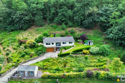
- Price
- £650,000
- Size
- 2.5 acres
Brendon, Lynton, Brendon and Countisbury, Devon EX35 England
Added on 07/07/2026House with Land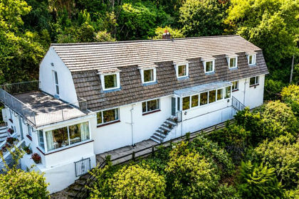
- Price
- £595,000
- Size
- 2.25 acres
St. Brannocks Road, Ilfracombe, Devon, EX34, Ilfracombe, Devon EX34 England
Added on 27/08/2026Development Land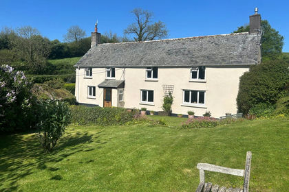
- Price
- Guide Price£675,000
- Size
- 2.5 acres
Middle Marwood, Barnstaple, EX31, Barnstaple, Devon EX31 England
Added on 29/05/2026Smallholding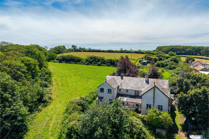
- Price
- Guide Price£575,000
- Size
- 2.4 acres
Smemington Farm & Cottage, Tawstock, Barnstaple, Devon EX31 England
Added on 14/09/2026House with Land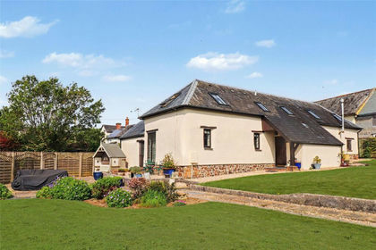
- Price
- £675,000
- Size
- 2 acres
Bishops Nympton, South Molton, Devon, EX36, Bishop's Nympton, Devon EX36 England
Added on 17/08/2026Barn Conversion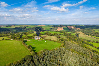
- Price
- Guide Price£725,000
- Size
- 5.13 acres
Silver Hill, High Bickington, Umberleigh, Devon EX37 England
Added on 03/10/2026House with Land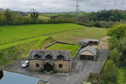
- Price
- Guide Price£650,000
- Size
- 2.21 acres
Added on 06/06/2026Barn Conversion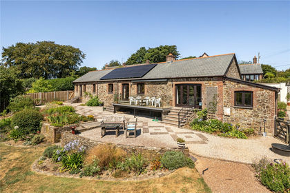
- Price
- Guide Price£695,000
- Size
- 7.2 acres
Added on 13/08/2026Smallholding
- Price
- Guide Price£500,000
- Size
- 48.58 acres
Added on 17/09/2026Building Plot
- Price
- Offers in Excess of£600,000
- Size
- 2 acres
Chichester Way, Westward Ho, Bideford, Devon, EX39, Northam, Devon EX39 England
Added on 17/06/2026Coastal property