Llawhaden, Narberth, SA67
- Land size
- 5 acres
- Bedrooms
- 4
- Bathrooms
- 2
Key Features
- Fabulous Period House Set Within 5 Acres Of Private Mature Grounds
- Gated Entrance With Sweeping In & Out Driveway
- Detached Double Garage/Workshop
- Spacious & Well Presented 4 Bedroom Accommodation
- Breathtaking Far-Reaching Countryside Views
- Extensive Lawns with Mature Specimen Trees, Large Patio with Gazebo, Woodland and Stream.
- Will Make A Simply Wonderful Family Home
Description
A magnificent country house, set privately within approximately 5 acres of mature grounds, boasting well presented and spacious accommodation with 4 bedrooms and 3 reception rooms, being situated in a leafy green and secluded countryside position, not far from the popular market town of Narberth and stunning Pembrokeshire coast. The property boasts an impressive gated driveway with ample parking, double garage/workshop, large patio and gardens.
EPC Rating: D
Situation
Situated in a peaceful and idyllic location on the periphery of the village of Llawhaden, yet within close driving proximity to the A40 with its transport links to the larger towns of the area, being both Narberth with its bespoke shops and restaurants and Haverfordwest being the County Town. Also within driving distance are the many coastal areas of south Pembrokeshire such as both Tenby and Saundersfoot.
Porch
Tiled floor, window to side, original decorative front door opens to:
Hallway
Stairs rise to the first floor, radiator, door to sitting room and door to:
Dining Room
French doors with outstanding views open out to the large patio, built in storage cupboard, radiator, glazed double doors to sitting room, glazed door to kitchen and glazed door to:
Living Room
Fantastic brick fireplace with wooden mantel housing a wood burning stove, bay and single windows to the front, external glazed doors to the rear opening onto patio, radiators.
Sitting Room
Bay window enjoying superb views, radiator.
Kitchen/Diner
Tiled flooring, fitted wall and base storage cupboards, worktops, one and a half bowl ceramic sink with drainer, range cooker, canopy extractor hood above, tiled splash backs, integrated fridge/freezer, space for dishwasher, windows to rear and side enjoying marvellous views, space for table and chairs, vertical radiator, door to:
Utility
Tiled floor, external door to patio, space and plumbing for washing machine/dish washer, radiator, door to:
Cloak Room
W.C, wash hand basin, window, radiator, tiled floor.
First Floor Landing
Spindle balustrade, window to front, radiator, doors to:
Bedroom 1
Windows to front and rear enjoying excellent views, fitted wardrobes, radiator, door to:
En-Suite
Comprising a large shower, W.C, wash hand basin, fitted vanity storage cupboards and worktops, tiled walls and floor, radiator, window to side.
Bedroom 2
Window to front, radiator, built in airing cupboard with hot water cylinder.
Bedroom 3
Windows to rear and side enjoying superb views, radiator.
Bedroom 4
Bay window enjoying superb views, radiator.
Bathroom
Comprising a bath with mixer shower, W.C, shower cubical, wash hand basin set in vanity storage unit, towel radiator, tiled floor and walls, window to rear enjoying lovely views.
Externally
The property boasts an impressive private entrance with gated stone walling, with a sweeping gravelled driveway leading to the front of the house, where there is ample parking and turning space. There is a detached double garage/workshop with twin electric doors and connected laundry room with plumbing for washing machine, fitted storage cupboards, worktop, sink and window. Other amenities include Starlink satellite and an EV charger. The grounds to the rear and side are mainly laid to lawn with tall majestic trees bordering. There is a large patio wrapped around the house with outstanding far reaching views. The driveway continues on past the side of the house and leads to a second gated walled entrance/exit. There is a wooden summer house, green house, area with pond and an array of mature specimen trees. Altogether there is approximately 5 acres of private grounds, ideal for any buyer seeking excellent outdoor space for gardening, nature and a place for children to play safely.
Directions
From Narberth travel along the A40 towards Haverfordwest and after the Canaston Bridge roundabout take the right turning signposted Toch Lane. Travel for roughly half a mile and the entrance to the property is on the left hand side, identified by our for sale sign.
Services
We are advised mains electric is connected. Private drainage and water. Oil fired central heating.
Broadband
Starlink satellite is installed and provides high internet speeds.
According to the Ofcom website, this property has standard broadband available. Please note this data was obtained from an online search conducted on ofcom.org.uk and was correct at the time of production.
Some rural areas are yet to have the infrastructure upgraded and there are alternative options which include satellite and mobile broadband available. Prospective buyers should make their own enquiries into the availability of services with their chosen provider.
Mobile
The Ofcom website states that the property has the following indoor mobile coverage
EE Voice & Data - 73%
Three Voice & Data - 62%
O2 Voice & Data - 74%
Vodafone Voice & Data - 65%
Anti Money Laundering
Please note when making an offer we will require information to enable us to confirm all parties identities as required by Anti Money Laundering (AML) Regulations. We may also conduct a digital search to confirm your identity.
We will also require full proof of funds such as a mortgage agreement in principle, proof of cash deposit or if no mortgage is required, we will require sight of a bank statement. Should the purchase be funded through the sale of another property, we will require confirmation the sale is sufficient enough to cover the purchase.
Map Location
Property details
- Tenure
- Freehold
- Council Tax Band
- G
- Date Posted
- 2026-06-18
Market Value Analysis
Compared with 365 Homes with Land listings in Wales (5+ acres).
Energy Performance Certificate
Energy Efficiency Rating
Based on UK Energy Performance Certificate standards (EU Directive 2002/91/EC)
Running costs are one side. Planning activity, flood history and ground risks for this location are in the full report.
Utilities & Restrictions
Utilities
- Electricity
- Mains
- Water
- Private Supply
- Heating
- Oil Heating, Wood Burner
- Broadband
- Ask Agent
- Sewerage
- Septic Tank / Private
Rights & Restrictions
- Public Rights of Way
- Ask Agent
- Private Rights of Way
- Ask Agent
- Listed Property
- Ask Agent
- Restrictions
- Ask Agent
Listed status, conservation areas and planning constraints for this location are in the full report.
Property Features
- Accessibility
- Ask Agent
- Parking
- Parking Available
- Garden
- Garden
Beyond the particulars: planning activity, flood history, heritage and ground risks, checked for this exact spot.
Connectivity
Broadband
Fastest speed available at this postcode
1.8 Gbps
Gigabit full fibre · available to 17% of premises
Suitable for
- 4K streaming on every screen
- Full-time home working
- Online gaming & big downloads
Mobile signal
Predicted 4G and 5G signal; indoor signal depends on building materials.
Ofcom Connected Nations postcode-level predictions. Speeds and signal are modelled, not measured, and vary between addresses and providers.
Signal is the easy part. Planning activity, flood history and protected designations here are in the full report.
Nearest Schools
Primary
- St Aidans Church in Wales VA School2.3 miles
- Pupils
- 75
- Type
- Nursery, Infants & Juniors
- Language
- English medium school / provision
- Narberth Community Primary School4.2 miles
- Pupils
- 281
- Type
- Nursery, Infants & Juniors
- Language
- Dual language school / provision (Welsh and English) (including transitional)
- Templeton Community Primary School4.6 miles
- Pupils
- 126
- Type
- Nursery, Infants & Juniors
- Language
- English medium school / provision
- Hook CP School5.3 miles
- Pupils
- 71
- Type
- Nursery, Infants & Juniors
- Language
- English medium school / provision
- Cleddau Reach VC School5.3 miles
- Pupils
- 231
- Type
- Nursery, Infants & Juniors
- Language
- English medium school / provision
Secondary
- Ysgol Caer Elen5.6 miles
- Pupils
- 907
- Type
- Middle (ages 3-16)
- Language
- Welsh medium school / provision (including transitional)
- Haverfordwest High VC School6.5 miles
- Pupils
- 1,699
- Type
- Secondary (ages 11-19)
- Language
- English medium school / provision
- Dyffryn Taf9.2 miles
- Pupils
- 890
- Type
- Secondary (ages 11-19)
- Language
- Dual language school / provision (Welsh and English) (including transitional)
- Ysgol Harri Tudur / Henry Tudor School9.3 miles
- Pupils
- 1,152
- Type
- Secondary (ages 11-19)
- Language
- English medium school / provision
- Milford Haven School10 miles
- Pupils
- 1,045
- Type
- Secondary (ages 11-16)
- Language
- English medium school / provision
Distances are straight-line from the advertised location. Source: the national school registers (DfE, Welsh Government, Scottish Government) and Ofsted.
Schools are just the start: sold prices nearby, planning activity and any flood history are in the full report.
Amenities
Supermarket
GP surgery
Pharmacy
Straight-line distances from the advertised location. Sources: NHS records, Geolytix supermarket locations, OS Open Greenspace and the national trails registers.
The area stacks up? Now check the location itself: planning nearby, protected designations and past flooding.
Getting Around
Nearest station
Nearest bus stop
Typical drive times
Straight-line distances from the advertised location; drive times are typical free-flow times over OpenStreetMap road data, so allow more at peak. Public transport locations from DfT NaPTAN.
Easy to reach matters. So do planning activity, flood history and ground risks: all in the full report.
Flood Risk
Natural Resources Wales open data, checked around the advertised map pin for the listed acreage. Long-term risk counts flood defences; the planning map's flood zones do not. Provided by LandSale, not the listing agent, and not part of the agent's particulars. Risk varies across a holding, so verify before committing.
Rivers and the sea
Planning map: Flood Zone 1.
Surface water
Not at the pin: mapped about 50 metres away.
These bandings are the summary. Where this location sits on the flood maps, plus planning activity, heritage and ground risks, is in the full report.
Important notice: Information, maps and tags on this page are drawn from the advertising agent's marketing materials or generated automatically. LandSale has not verified them. Relying on these details is at your own risk, always carry out independent checks before committing to a purchase.
LandSale full disclaimer
Marketing information only - not formal particulars. The details on this website are provided for general guidance and do not constitute an offer or contract. Neither LandSale nor the advertising estate/land agent accepts responsibility for any inaccuracy.
1. Source of information
- Listing content: Core description, asking price, tenure, measurements, photographs and planning history originate from the marketing materials of the advertising estate or land agent. LandSale does not author this content and cannot guarantee its accuracy.
- Automated tags & categorisation: Property type, land-use class, acreage bands and similar labels may be applied by machine-learning models. They are intended as a helpful guide only and may not reflect the property's legal status or permitted use.
- Third-party & enriched data layers: Maps, boundary outlines, planning designations, soil reports, broadband coverage and other environmental or location-based insights are licensed from external suppliers. Such data are supplied “as is", may be incomplete or out of date and are subject to change without notice.
2. Verification required
Prospective purchasers must verify critical matters, including but not limited to planning permission, title boundaries, public rights of way, environmental constraints, acreage, services, access and VAT status, through their own inspections, specialist surveys, legal advisers and the selling agent before relying on the information or entering into any contract.
3. No warranty or liability
LandSale gives no warranty, express or implied, as to the accuracy, completeness or fitness for any particular purpose of the information displayed. LandSale shall not be liable for any loss, damage, cost or expense arising directly or indirectly from any use of or reliance on such information, save where liability may not be excluded by law.
4. Updates & feedback
If you believe any detail on this listing is inaccurate, please let us know. We will investigate and, where appropriate, update the listing or notify the agent.
© LandSale | Version 1.3 - August 2026
Similar properties for sale
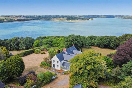
- Price
- Offers in Region of£750,000
- Size
- 5.73 acres
Woodhouse, Landshipping, Near Narberth, Narberth, Martletwy, Pembrokeshire SA67 Wales
Added on 12/08/2026House with Land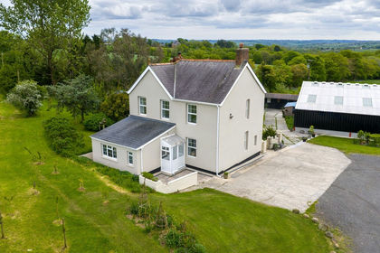
- Price
- Offers in Region of£795,000
- Size
- 20 acres
Llandissilio, Clynderwen, SA66, Clynderwen, Pembrokeshire SA66 Wales
Added on 20/05/2026Smallholding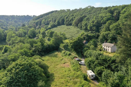
- Price
- £645,000
- Size
- 8 acres
Added on 26/07/2026House with Land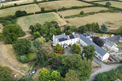
- Price
- £745,000
- Size
- 3.5 acres
Leonardston Road, Llanstadwell, SA73, Milford Haven, Pembrokeshire SA73 Wales
Added on 30/08/2026House with Land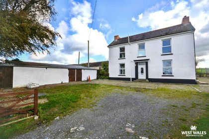
- Price
- Offers in Region of£550,000
- Size
- 5 acres
Added on 14/10/2026Smallholding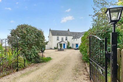
- Price
- £800,000
- Size
- 6 acres
Llanwnda, Goodwick, SA64, Goodwick, Pembrokeshire SA64 Wales
Added on 08/10/2026House with Land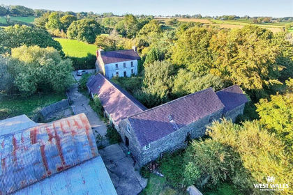
- Price
- Offers in Region of£800,000
- Size
- 72 acres
Added on 14/10/2026Agricultural Land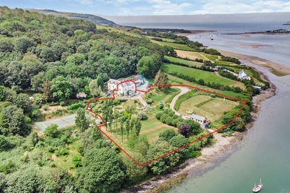
- Price
- Offers in Region of£725,000
- Size
- 2.16 acres
St. Dogmaels, Cardigan, St. Dogmaels, Pembrokeshire SA43 Wales
Added on 03/07/2026House with Land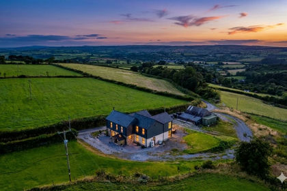
- Price
- £675,000
- Size
- 8 acres
Efail Y Banc, Rhydargaeau Road, Carmarthen, SA32, Carmarthen, Carmarthenshire SA32 Wales
Added on 10/04/2026Country Home