Boncath
- Land size
- 72 acres
- Bedrooms
- 4
- Bathrooms
- 1
Key Features
- Approx 72 Acre Farm
- 4 Bed 18C Character Main Farmhouse
- Grade II Listed
- Variety of Stone & Modern Outbuildings
- Secluded Setting / Down Long Track
- Pasture & Semi-Ancient Woodland
- Former Campsite & Nature Trail
- Edge of Preseli Hills - Easy Reach of Coast
- Oil Central Heating
- EPC Rating: Exempt
Description
Situated down a secluded track in North Pembrokeshire, south of Boncath and on the edge of the Preseli Hills and Pembrokeshire Coast National Park, this historic former farm extends to approximately 72 acres, combining good grazing pasture with around a third of semi-ancient woodland, through which a stream meanders.
Once a working farm supporting sheep, cattle and ponies, the property was also previously established with a caravan and camping site and nature trail, demonstrating the versatility of this substantial rural holding.
At its heart is a Grade II listed farmhouse with traditional stone outbuildings including former Coach House, dating back to around the 1800's and believed to be once part of the extensive historic Ffynone Estate. Grand in its proportions and rich in original character, the four-bedroom, three-reception farmhouse, together with its outbuildings, now requires improvement and investment, offering an exciting and rare opportunity for the next custodians to restore and reimagine this special property to create a truly individual country home and holding.
The farmhouse is entered via a porch into the hallway from the parking area, with a galley kitchen and smaller reception or breakfast room positioned to the rear. To the front, a second entrance is approached from the courtyard garden and leads to the principal reception rooms, comprising a dining room and characterful living room with a log burner set beneath an impressive inglenook fireplace. Upstairs, a split-level landing leads to four bedrooms, three of which are doubles, together with a family bathroom. Whilst the farmhouse requires refurbishment and improvement, it retains a wealth of important original features and period detail, including wide tongue-and-groove timber partition walls, slate floors, original internal doors, exposed beamed ceilings and distinctive horned 12-pane sash windows with slate sills, all contributing to the authentic character of this historic home.
Externally there is a range of diverse and useful stone outbuildings including a Cow shed with tack room / store and isolation box, an attached section which has been used previously as a dining / entertainment area for visiting guests and has a mezzanine area above. A former coach house and stables and two more modern open Dutch barns for hay and equipment storage. Collectively, these versatile outbuildings offer considerable scope for a variety of potential uses, including conversion into holiday accommodation, creative studios, workshops or further ancillary accommodation, subject to obtaining the necessary planning consents.
The farmhouse and outbuildings sit within their own land extending to approximately 72 acres, of which around 22 acres comprise semi-ancient woodland with a stream running through its centre. The remainder is predominantly good, fenced grazing pasture, with interlinking access between the fields, much of which is gently sloping and well drained. The most westerly fields enjoy spectacular panoramic views towards the Preseli Hills.
Closer to the farmhouse, the grounds include a courtyard and the remains of a former established garden with mature specimen trees and shrubs, now largely reclaimed by nature and waiting to be uncovered and brought back to life. A further area to the side of the farmhouse currently accommodates a caravan.
Overall, this secluded rural holding offers a rare and diverse lifestyle opportunity, combining history, natural beauty and considerable potential within a wonderfully peaceful and private setting. Viewing is highly recommended to fully appreciate all that this special property has to offer!
About the Area - Situated in the beautiful countryside of North Pembrokeshire, the property enjoys a peaceful rural setting whilst remaining within easy reach of nearby towns and villages. Crymych offers both primary and secondary schooling along with everyday amenities, while the popular market town of Cardigan provides a wider range of independent shops, cafes and services, together with larger supermarkets. Closer by, the village of Boncath has a local shop, Post Office and Village Hall. For those looking to enjoy the outdoors, the Preseli Hills and Pembrokeshire Coast National Park are within easy reach, while Ffynone Waterfall and Cilgwyn Woods, Newport Sands and both the spectacular North Pembrokeshire and Cardigan Bay coastline are all just a short drive away.
VIEWING: By appointment only via the Agents.
TENURE: We are advised Freehold (GRADE 2 LISTED)
SERVICES: We have not checked or tested any of the services or appliances at the property.
COUNCIL TAX: Band 'E' Pembrokeshire County Council
DRAINAGE: We are advised that this property is served by private drainage.
Ref: LW/LW/10/26/OK_LW
Map Location
Property details
- Tenure
- Freehold
- Council Tax Band
- E
- Date Posted
- 2026-10-14
Market Value Analysis
Compared with 49 Farmland & Pasture listings in Wales (50+ acres).
Utilities & Restrictions
Utilities
- Electricity
- Mains
- Water
- Mains
- Heating
- Oil Heating
- Broadband
- Ask Agent
- Sewerage
- Septic Tank / Private
Rights & Restrictions
- Public Rights of Way
- Ask Agent
- Private Rights of Way
- Ask Agent
- Listed Property
- Yes
- Restrictions
- Ask Agent
Listed status, conservation areas and planning constraints for this location are in the full report.
Property Features
- Accessibility
- Ask Agent
- Parking
- Parking Available
- Garden
- Garden
Beyond the particulars: planning activity, flood history, heritage and ground risks, checked for this exact spot.
Connectivity
Broadband
Fastest speed available at this postcode
31 Mbps
Superfast · available to 22% of premises
Suitable for
- HD streaming
- Video calls
- Web & social
Fixed wireless access may also be an option here.
Mobile signal
Predicted 4G and 5G signal; indoor signal depends on building materials.
Ofcom Connected Nations postcode-level predictions. Speeds and signal are modelled, not measured, and vary between addresses and providers.
Signal is the easy part. Planning activity, flood history and protected designations here are in the full report.
Nearest Schools
Primary
- Ysgol Bro Preseli2.9 miles
- Pupils
- 932
- Type
- Middle (ages 3-19)
- Language
- Welsh medium school / provision (including transitional)
- Ysgol Clydau3.3 miles
- Pupils
- 35
- Type
- Infants & Juniors
- Language
- Welsh medium school / provision (including transitional)
- Cilgerran Church in Wales VC School3.5 miles
- Pupils
- 114
- Type
- Nursery, Infants & Juniors
- Language
- Welsh medium school / provision (including transitional)
- Ysgol Gynradd Gymunedol Eglwyswrw4.1 miles
- Pupils
- 90
- Type
- Infants & Juniors
- Language
- Welsh medium school / provision (including transitional)
- Ysgol Gymunedol Llechryd4.1 miles
- Pupils
- 54
- Type
- Infants & Juniors
- Language
- Welsh medium school / provision (including transitional)
Secondary
- Ysgol Bro Preseli2.9 miles
- Pupils
- 932
- Type
- Middle (ages 3-19)
- Language
- Welsh medium school / provision (including transitional)
- Ysgol Uwchradd Aberteifi5.9 miles
- Pupils
- 614
- Type
- Secondary (ages 11-19)
- Language
- Welsh medium school / provision (including transitional)
- Ysgol Gyfun Emlyn6.4 miles
- Pupils
- 502
- Type
- Secondary (ages 11-19)
- Language
- Dual language school / provision (Welsh and English) (including transitional)
- Ysgol Bro Teifi13 miles
- Pupils
- 861
- Type
- Middle (ages 3-19)
- Language
- Welsh medium school / provision (including transitional)
- Dyffryn Taf13 miles
- Pupils
- 890
- Type
- Secondary (ages 11-19)
- Language
- Dual language school / provision (Welsh and English) (including transitional)
Distances are straight-line from the advertised location. Source: the national school registers (DfE, Welsh Government, Scottish Government) and Ofsted.
Schools are just the start: sold prices nearby, planning activity and any flood history are in the full report.
Amenities
Supermarket
GP surgery
Pharmacy
Straight-line distances from the advertised location. Sources: NHS records, Geolytix supermarket locations, OS Open Greenspace and the national trails registers.
The area stacks up? Now check the location itself: planning nearby, protected designations and past flooding.
Getting Around
Nearest station
Nearest bus stop
Typical drive times
Straight-line distances from the advertised location; drive times are typical free-flow times over OpenStreetMap road data, so allow more at peak. Public transport locations from DfT NaPTAN.
Easy to reach matters. So do planning activity, flood history and ground risks: all in the full report.
Flood Risk
Natural Resources Wales open data, checked around the advertised map pin for the listed acreage. Long-term risk counts flood defences; the planning map's flood zones do not. Provided by LandSale, not the listing agent, and not part of the agent's particulars. Risk varies across a holding, so verify before committing.
Rivers and the sea
Not at the pin: mapped about 220 metres away.
Planning map: Flood Zone 3, about 220 metres away.
Surface water
Not at the pin: mapped about 10 metres away.
These bandings are the summary. Where this location sits on the flood maps, plus planning activity, heritage and ground risks, is in the full report.
Important notice: Information, maps and tags on this page are drawn from the advertising agent's marketing materials or generated automatically. LandSale has not verified them. Relying on these details is at your own risk, always carry out independent checks before committing to a purchase.
LandSale full disclaimer
Marketing information only - not formal particulars. The details on this website are provided for general guidance and do not constitute an offer or contract. Neither LandSale nor the advertising estate/land agent accepts responsibility for any inaccuracy.
1. Source of information
- Listing content: Core description, asking price, tenure, measurements, photographs and planning history originate from the marketing materials of the advertising estate or land agent. LandSale does not author this content and cannot guarantee its accuracy.
- Automated tags & categorisation: Property type, land-use class, acreage bands and similar labels may be applied by machine-learning models. They are intended as a helpful guide only and may not reflect the property's legal status or permitted use.
- Third-party & enriched data layers: Maps, boundary outlines, planning designations, soil reports, broadband coverage and other environmental or location-based insights are licensed from external suppliers. Such data are supplied “as is", may be incomplete or out of date and are subject to change without notice.
2. Verification required
Prospective purchasers must verify critical matters, including but not limited to planning permission, title boundaries, public rights of way, environmental constraints, acreage, services, access and VAT status, through their own inspections, specialist surveys, legal advisers and the selling agent before relying on the information or entering into any contract.
3. No warranty or liability
LandSale gives no warranty, express or implied, as to the accuracy, completeness or fitness for any particular purpose of the information displayed. LandSale shall not be liable for any loss, damage, cost or expense arising directly or indirectly from any use of or reliance on such information, save where liability may not be excluded by law.
4. Updates & feedback
If you believe any detail on this listing is inaccurate, please let us know. We will investigate and, where appropriate, update the listing or notify the agent.
© LandSale | Version 1.3 - August 2026
Listing agent
West Wales Properties, Cardigan
41 High Street, Cardigan, Ceredigion, SA43 1JG
Contact West Wales Properties, Cardigan
41 High Street, Cardigan, Ceredigion, SA43 1JG
View agent profileSimilar properties for sale
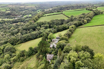
- Price
- Offers in Region of£975,000
- Size
- 66 acres
Login, Whitland, SA34, Cilymaenllwyd, Carmarthenshire SA34 Wales
Added on 23/09/2026Country Estate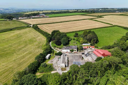
- Price
- Offers in Region of£795,000
- Size
- 40 acres
Ffynnonwen, Coed Y Bryn, Ceredigion. SA44, Troedyraur, Ceredigion SA44 Wales
Added on 07/07/2026Smallholding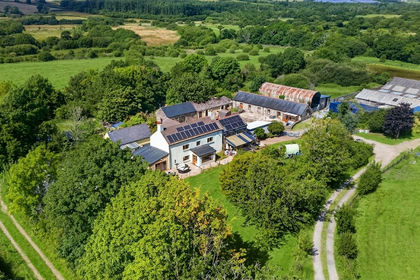
- Price
- Offers in Region of£900,000
- Size
- 48 acres
Added on 04/08/2026Smallholding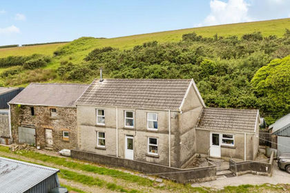
- Price
- Guide Price£725,000
- Size
- 66 acres
Lletty Farm, Llannon, Llanelli, Carmarthenshire, Llannon, Carmarthenshire SA14 Wales
Added on 22/06/2026Smallholding