Catton, Hexham, Northumberland, NE47
- Land size
- 11 acres
- Bedrooms
- 4
- Bathrooms
- 2
Key Features
- Detached four- bedroom property
- Tranquil village location
- Detached double garage
- Circa 11 Acres of land
- Ample parking
- No onward chain
- EPC rating D
Description
Harlow Keep is nestled in the desirable and tranquil hamlet of Old Town, within walking distance of the village of Catton. The impressive and generously proportioned stone-build residence is set within approximately 11 acres and complimented by a double garage and additional timber outbuilding.
Enjoying a breathtaking setting near the quaint rural hamlet of Old Town in the heart of the Northumberland countryside, Harlow Keep is a distinctive detached family residence offering generous accommodation, character features and superb countryside views. The property occupies an elevated site surrounded by approximately 11 acres of land, which include a former stone quarry, a copse of trees and grazing land.
The property welcomes you into a spacious reception hall, with stairs rising to the first floor and access to a convenient ground floor WC/cloakroom. The kitchen is a bright and contemporary space, thoughtfully designed to blend style with everyday practicality. It is fitted with a range of modern wall and base units in a classic shaker style, offering ample storage alongside generous worktop space. A central breakfast island with a contrasting work surface provides an ideal spot for informal dining. Integrated appliances include an oven, hob with overhead extractor, auto-dosing dishwasher, and a boiling water tap.
A separate utility room is located just off the kitchen, complete with an additional sink and mixer tap, along with plumbing for a washing machine/ dryer.
The sitting room forms the heart of the home, featuring a cosy wood-burning stove set within an inglenook fireplace, complemented by warm spotlighting and characterful beamed ceilings. This inviting space also accommodates a dining area towards the rear, making it perfect for both everyday living and entertaining.
From the sitting room, there is direct access to the conservatory, affectionately known by the current owners as ‘The Sunshine Room’. This delightful space is south facing and enjoys views over the garden as well as spectacular far-reaching countryside beyond, creating a wonderful setting to relax and unwind throughout the year. The ground floor accommodation is further complemented by a practical study/home office, ideal for modern living. The property also benefits from app-controlled lighting and heating, along with triple-glazed windows to the south and west elevations, enhancing both comfort and energy efficiency.
To the first floor, there are four generously sized double bedrooms. The principal bedroom features an en-suite comprising a shower cubicle, WC and wash hand basin set within a vanity unit. All bedrooms enjoy fantastic views, while the fourth bedroom benefits from dual-aspect windows, allowing natural light to flood the space. The family bathroom is well-appointed, featuring a freestanding bath, separate shower cubicle, wash hand basin with vanity unit and mirror above, and a low-level WC. A Velux rooflight provides additional natural light, and there is the added benefit of a large storage cupboard.
Externally, Harlow Keep benefits from generous gardens and grounds primarily laid to lawn with mature shrubs, fruit trees and a pond, providing a wonderful outdoor environment for relaxation and recreation. There is a detached double garage with remote controlled electric doors and a connecting storeroom/ workshop with its own access door, a further garden shed provides additional storage. Beyond the wrap-around gardens, the property includes approximately 11 acres of grazing land divided into two fields. The upper field incorporates a former stone quarry and copse, currently providing the potential for a secondary income stream as an attractive campsite.
The surrounding countryside offers excellent opportunities for walking, cycling and enjoying Northumberland’s renowned natural beauty. The property also provides ample parking and the potential for further use of outbuildings or ancillary accommodation, subject to the necessary consents.
Catton is a small, peaceful village located in the county of Northumberland in the northeast of England. Surrounded by rolling countryside and open farmland, it lies a short distance to the west of the market town of Allendale and within easy reach of the North Pennines Area of Outstanding Natural Beauty. The village enjoys a quiet, rural setting characterized by traditional stone buildings, scenic walking routes and expansive views of the surrounding hills. Despite its tranquil atmosphere, Catton is well connected to nearby towns such as Hexham, it offers access to the wider landscapes and heritage attractions that make Northumberland a distinctive and appealing region.
Services
LPG tank provides gas, mains water and electricity is connected, drainage is via a septic tank. There is a 6Kwh array of solar pannels and 10Kwh battery charge from panels and mains. There is also an electrical vehicle charger.
Charges
Northumberland County Council tax band F.
Viewings
Viewings are strictly by appointment. Please contact the Hexham office to arrange a viewing .
Free Market Appraisal
We would be pleased to provide professional, unbiased advice on the current value and marketing of your existing home.
Referrals
In accordance with the Estate Agents’ (Provision of Information) Regulations 1991 and the Consumer Protection from Unfair Trading Regulations 2008, we are obliged to inform you that this Company may offer the following services to sellers and purchasers from which we may earn a related referral fee from on completion, in particular the referral of: Mortgages and related products our commission from a broker would be £100.00 incl VAT for Mortgages and £50 inc VAT for Insurances, however this amount can be proportionally clawed back by the lender should the mortgage and/or related product(s) be cancelled early.
Wayleaves, Easements and Rights of Way
The property is being sold subject to all existing wayleaves, easements and rights of way, whether or not specified within the sales particulars.
Map Location
Property details
- Tenure
- Freehold
- Council Tax Band
- F
- Date Posted
- 2026-06-18
Market Value Analysis
Compared with 34 Homes with Land listings in North East England (10+ acres).
Energy Performance Certificate
Energy Efficiency Rating
Based on UK Energy Performance Certificate standards (EU Directive 2002/91/EC)
Running costs are one side. Planning activity, flood history and ground risks for this location are in the full report.
Utilities & Restrictions
Utilities
- Electricity
- Ask Agent
- Water
- Ask Agent
- Heating
- Ask Agent
- Broadband
- Ask Agent
- Sewerage
- Ask Agent
Rights & Restrictions
- Public Rights of Way
- Ask Agent
- Private Rights of Way
- Ask Agent
- Listed Property
- Ask Agent
- Restrictions
- Ask Agent
Listed status, conservation areas and planning constraints for this location are in the full report.
Property Features
- Accessibility
- Ask Agent
- Parking
- Parking Available
- Garden
- Garden
Beyond the particulars: planning activity, flood history, heritage and ground risks, checked for this exact spot.
Connectivity
Broadband
Fastest speed available at this postcode
1.8 Gbps
Gigabit full fibre
Suitable for
- 4K streaming on every screen
- Full-time home working
- Online gaming & big downloads
Mobile signal
Outdoor predictions; indoor signal depends on building materials.
Ofcom Connected Nations postcode-level predictions. Speeds and signal are modelled, not measured, and vary between addresses and providers.
Signal is the easy part. Planning activity, flood history and protected designations here are in the full report.
Nearest Schools
Primary
- Allendale Primary School2.1 milesNo Ofsted rating
- Ages
- 2 to 11
- Pupils
- 126
- Type
- Community school
- Whitfield CofE Primary School2.4 milesOfsted report card · Jan 2026
- Ages
- 3 to 11
- Pupils
- 22
- Type
- Academy sponsor led
- Faith
- Church of England
- Shaftoe Trust Academy3.9 milesOfsted: Good
- Ages
- 3 to 11
- Pupils
- 102
- Type
- Academy sponsor led
- Henshaw Church of England Primary School4.9 milesOfsted: Good
- Ages
- 4 to 11
- Pupils
- 86
- Type
- Academy converter
- Faith
- Church of England
- Whitley Chapel Church of England First School6.9 milesOfsted: Good *
- Ages
- 3 to 9
- Pupils
- 28
- Type
- Voluntary aided school
- Faith
- Church of England
Secondary
- Haydon Bridge High School4.1 milesOfsted report card · Jan 2026
- Ages
- 11 to 18
- Pupils
- 392
- Type
- Foundation school
- St Joseph's Catholic Middle School, Hexham7.6 milesNo Ofsted rating
- Ages
- 9 to 13
- Pupils
- 168
- Type
- Academy converter
- Faith
- Roman Catholic
- Queen Elizabeth High School7.6 milesOfsted: Good
- Ages
- 13 to 18
- Pupils
- 1,299
- Type
- Academy converter
- Hexham Middle School8.2 milesNo Ofsted rating
- Ages
- 9 to 13
- Pupils
- 619
- Type
- Academy converter
- Samuel King's School9.7 milesNo Ofsted rating
- Ages
- 11 to 16
- Pupils
- 113
- Type
- Foundation school
* Latest graded judgement covers quality of education only; no overall grade was issued under the 2024-25 inspection framework.
Distances are straight-line from the advertised location. Source: the national school registers (DfE, Welsh Government, Scottish Government) and Ofsted.
Schools are just the start: sold prices nearby, planning activity and any flood history are in the full report.
Amenities
Supermarket
GP surgery
Pharmacy
Hospital
Straight-line distances from the advertised location. Sources: NHS records, Geolytix supermarket locations, OS Open Greenspace and the national trails registers.
The area stacks up? Now check the location itself: planning nearby, protected designations and past flooding.
Getting Around
Nearest station
Nearest bus stop
Typical drive times
Straight-line distances from the advertised location; drive times are typical free-flow times over OpenStreetMap road data, so allow more at peak. Public transport locations from DfT NaPTAN.
Easy to reach matters. So do planning activity, flood history and ground risks: all in the full report.
Flood Risk
From Environment Agency flood map open data, checked around the advertised map pin and allowing for the listed acreage where known. This summary comes from LandSale, the advertising platform, not from the listing agent, and is not part of the agent's particulars. Risk can vary across a single holding, so verify anything critical through your own searches before committing.
Rivers and the sea
Surface water
Mapped within the area searched, not at the advertised map pin itself.
The detail behind these bandings
The full report pinpoints where this location sits on the flood maps, and runs the deeper checks that usually only surface after an offer.
- Exact flood zones & annual chances (included in the full report)
- Any recorded past flooding (included in the full report)
- Planning activity nearby (included in the full report)
- Heritage & conservation (included in the full report)
- Protected nature designations (included in the full report)
- Ground risks (included in the full report)
- Sold prices nearby (included in the full report)
£14.99 · one-off purchase
By LandSale, the platform. Not provided by the listing agent. Ready in about a minute.
Important notice: Information, maps and tags on this page are drawn from the advertising agent's marketing materials or generated automatically. LandSale has not verified them. Relying on these details is at your own risk, always carry out independent checks before committing to a purchase.
LandSale full disclaimer
Marketing information only - not formal particulars. The details on this website are provided for general guidance and do not constitute an offer or contract. Neither LandSale nor the advertising estate/land agent accepts responsibility for any inaccuracy.
1. Source of information
- Listing content: Core description, asking price, tenure, measurements, photographs and planning history originate from the marketing materials of the advertising estate or land agent. LandSale does not author this content and cannot guarantee its accuracy.
- Automated tags & categorisation: Property type, land-use class, acreage bands and similar labels may be applied by machine-learning models. They are intended as a helpful guide only and may not reflect the property's legal status or permitted use.
- Third-party & enriched data layers: Maps, boundary outlines, planning designations, soil reports, broadband coverage and other environmental or location-based insights are licensed from external suppliers. Such data are supplied “as is", may be incomplete or out of date and are subject to change without notice.
2. Verification required
Prospective purchasers must verify critical matters, including but not limited to planning permission, title boundaries, public rights of way, environmental constraints, acreage, services, access and VAT status, through their own inspections, specialist surveys, legal advisers and the selling agent before relying on the information or entering into any contract.
3. No warranty or liability
LandSale gives no warranty, express or implied, as to the accuracy, completeness or fitness for any particular purpose of the information displayed. LandSale shall not be liable for any loss, damage, cost or expense arising directly or indirectly from any use of or reliance on such information, save where liability may not be excluded by law.
4. Updates & feedback
If you believe any detail on this listing is inaccurate, please let us know. We will investigate and, where appropriate, update the listing or notify the agent.
© LandSale | Version 1.3 - August 2026
Similar properties for sale
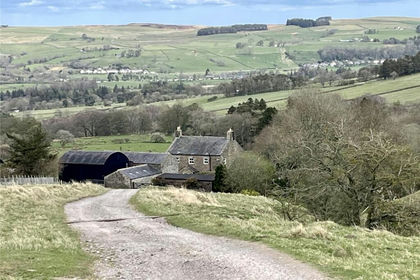
- Price
- Offers in Region of£750,000
- Size
- 6.1 acres
Keenley, Allendale, Northumberland, NE47, Allendale, Northumberland NE47 England
Added on 12/05/2026Farmhouse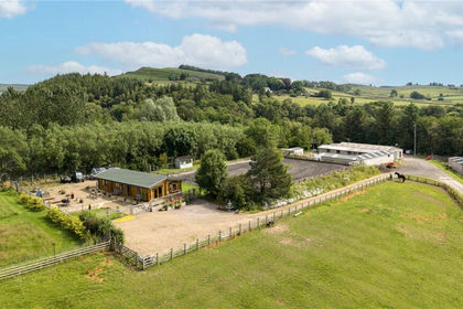
- Price
- Offers Over£700,000
- Size
- 28.51 acres
Bardon Mill, Hexham, Northumberland, NE47, Henshaw, Northumberland NE47 England
Added on 23/07/2026Equestrian property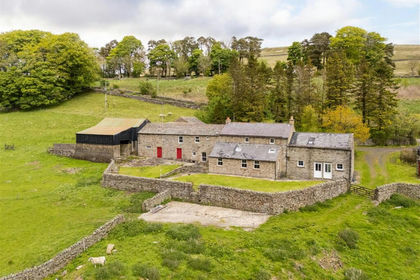
- Price
- £660,000
- Size
- 21.79 acres
Added on 21/07/2026House with Land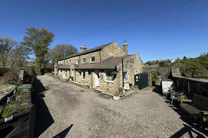
- Price
- £675,000
- Size
- 6 acres
Cherry Tree Cottage Alston, Nenthead, CA9, Alston Moor, Westmorland and Furness CA9 England
Added on 19/08/2026House with Land
- Price
- £775,000
- Size
- 6.5 acres
Spring House Park Alston, Moor, CA9, Alston Moor, Westmorland and Furness CA9 England
Added on 19/08/2026House with Land
- Price
- £850,000
- Size
- 7.34 acres
Edmundbyers, Consett, Durham, DH8, Muggleswick, County Durham DH8 England
Added on 03/07/2026House with Land
- Price
- Offers Over£850,000
- Size
- 11 acres
East Barns, Newton, Stocksfield, Northumberland, Bywell, Northumberland NE43 England
Added on 03/06/2026Development Land
- Price
- Guide Price£565,000
- Size
- 5 acres
West Woodburn, Hexham, Northumberland, NE48, Corsenside, Northumberland NE48 England
Added on 20/08/2026Barn Conversion
- Price
- £825,000
- Size
- 7.1 acres
Langwathby, Penrith, CA10, Hunsonby, Westmorland and Furness CA10 England
Added on 19/08/2026House with Land
- Price
- £790,000
- Size
- 10 acres
Bowlees Farm, Wolsingham. DL13, Wolsingham, County Durham DL13 England
Added on 01/08/2026Farmhouse