1 Davenport Mews, Davenport, CW12
- Bedrooms
- 4
- Bathrooms
- 3
Key Features
- Driveway and Garage
- Open Views Across the Neighbouring Countryside
- Charming Period Barn Conversion
- Walking Distance of the Swettenham Arms
- Mature Gardens
- Exposed Beams and Character Features
Description
Old Barn forms part of a period barn believed to be constructed in the late 1700’s and converted in the 1970’s into three individual properties.
The property has been immaculately maintained by the current owners and offers spacious and well-balanced accommodation throughout.
On the ground floor is a central entrance hall with large understairs cupboard and cloakroom WC. There is an impressive living room with large, exposed brick fireplace with log burning stove, original beams and French doors opening to the garden. The bright breakfast kitchen has shaker style units, wooden worksurfaces with Belfast sink and large Rangemaster stove, there is a built-in breakfast seat and four Velux windows flooding the room with natural light.
In addition, on the ground floor is the dining room, snug, office, utility room and integral garage with electric door.
To the first floor is the spacious landing with charming porthole windows and the impressive principal bedroom with vaulted ceilings and en-suite shower room. There are three further double bedrooms and two bathrooms (1 en-suite).
Externally the property is approached via a shared central courtyard with gravel driveway and turning circle. Old Barn has ample parking for several vehicles and electric car charger.
To the rear are stunning mature gardens with a stone flagged patio, lawn and well stocked beds and mature trees. There is a summer house and the garden enjoys superb open views across the neighbouring countryside.
Old Barn is situated in a idyllic rural position in an enclave of only a handful of homes with beautiful local walks across the Dane Valley and to the Swettenham Arms. The Centres of Holmes Chapel and Congleton are within easy reach which offer everything for day to day needs, local train stations and access to the motorway network.
Important Information
What 3 Words – ///publish.genius.residual
Council Tax – Cheshire East Band G
EPC Rating – E (50/72)
Tenure – Freehold
Heating: Oil Fired Central Heating
Services: Mains Electric & Water, Drainage via septic tank (non-compliant)
Parking: Driveway & Garage
Flood Risk*: Very low risk of flooding
Broadband**: Ultrafast broadband available at the property
Mobile Coverage**: Mobile coverage with main providers (EE, O2, Three & Vodafone).
*Information provided by GOV.UK **Information provided by Ofcom checker.
The information isn't guaranteed. Andrew J Nowell take no responsibility for inaccuracies and advise potential buyers to do their own checks before committing to purchase.
EPC Rating: E
Parking - Driveway
Disclaimer
These particulars are prepared with care to provide a fair overview of the property but do not constitute an offer or contract. All descriptions, dimensions, floor plans and images are given in good faith and believed correct at publication, though accuracy is not guaranteed. Purchasers should rely on their own inspections, surveys and professional advice. Measurements are approximate and floor plans are not to scale. Photography may include wide-angle lenses or digital enhancement. Services, systems, appliances and planning or building regulation matters have not been tested or verified. Fixtures and fittings are excluded unless specifically agreed in writing. We comply with the Consumer Protection from Unfair Trading Regulations 2008 and the Business Protection from Misleading Marketing Regulations 2008, and advise all parties to satisfy themselves as to all aspects before proceeding.
Map Location
Property details
- Tenure
- Ask Agent
- Council Tax Band
- Ask Agent
- Date Posted
- 2026-06-18
Price history
| Date | Change | Price |
|---|---|---|
| 4 Sep 2026 | Reduced 9.1% (−£80,000) | £795,000 |
| Until 4 Sep 2026 | Asking price | £875,000 |
Energy Performance Certificate
Energy Efficiency Rating
Based on UK Energy Performance Certificate standards (EU Directive 2002/91/EC)
Running costs are one side. Planning activity, flood history and ground risks for this location are in the full report.
Utilities & Restrictions
Utilities
- Electricity
- Ask Agent
- Water
- Ask Agent
- Heating
- Ask Agent
- Broadband
- Ask Agent
- Sewerage
- Ask Agent
Rights & Restrictions
- Public Rights of Way
- Ask Agent
- Private Rights of Way
- Ask Agent
- Listed Property
- Ask Agent
- Restrictions
- Ask Agent
Listed status, conservation areas and planning constraints for this location are in the full report.
Property Features
- Accessibility
- Ask Agent
- Parking
- Driveway
- Garden
- Garden
Beyond the particulars: planning activity, flood history, heritage and ground risks, checked for this exact spot.
Connectivity
Broadband
Fastest speed available at this postcode
1.8 Gbps
Gigabit full fibre · available to 92% of premises
Suitable for
- 4K streaming on every screen
- Full-time home working
- Online gaming & big downloads
Mobile signal
Outdoor predictions; indoor signal depends on building materials.
Ofcom Connected Nations postcode-level predictions. Speeds and signal are modelled, not measured, and vary between addresses and providers.
Signal is the easy part. Planning activity, flood history and protected designations here are in the full report.
Nearest Schools
Primary
- Brereton CofE Primary School1.6 milesOfsted report card · May 2026
- Ages
- 4 to 11
- Pupils
- 202
- Type
- Academy converter
- Faith
- Church of England
- Hermitage Primary School2.1 milesOfsted: Good
- Ages
- 4 to 11
- Pupils
- 206
- Type
- Academy converter
- Holmes Chapel Primary School2.5 milesOfsted: Good *
- Ages
- 4 to 11
- Pupils
- 401
- Type
- Academy converter
- Goostrey Community Primary School2.7 milesOfsted report card · Mar 2026
- Ages
- 4 to 11
- Pupils
- 197
- Type
- Community school
- Black Firs Primary School2.9 milesNo Ofsted rating
- Ages
- 3 to 11
- Pupils
- 372
- Type
- Academy converter
Secondary
- Holmes Chapel Comprehensive School2.7 milesOfsted: Good
- Ages
- 11 to 18
- Pupils
- 1,311
- Type
- Academy converter
- Congleton High School2.9 milesNo Ofsted rating
- Ages
- 11 to 18
- Pupils
- 1,174
- Type
- Academy converter
- Sandbach High School and Sixth Form College4.2 milesOfsted: Good
- Ages
- 11 to 18
- Pupils
- 1,340
- Type
- Academy converter
- Gender
- Girls
- Sandbach School4.2 milesOfsted: Good *
- Ages
- 11 to 19
- Pupils
- 1,534
- Type
- Free schools
- Gender
- Boys
- Eaton Bank Academy4.4 milesOfsted: Good *
- Ages
- 11 to 18
- Pupils
- 1,062
- Type
- Academy converter
* Latest graded judgement covers quality of education only; no overall grade was issued under the 2024-25 inspection framework.
Distances are straight-line from the advertised location. Source: the national school registers (DfE, Welsh Government, Scottish Government) and Ofsted.
Schools are just the start: sold prices nearby, planning activity and any flood history are in the full report.
Amenities
Supermarket
GP surgery
Pharmacy
Hospital
Green space
Straight-line distances from the advertised location. Sources: NHS records, Geolytix supermarket locations, OS Open Greenspace and the national trails registers.
The area stacks up? Now check the location itself: planning nearby, protected designations and past flooding.
Getting Around
Nearest station
Nearest bus stop
Typical drive times
Straight-line distances from the advertised location; drive times are typical free-flow times over OpenStreetMap road data, so allow more at peak. Public transport locations from DfT NaPTAN.
Easy to reach matters. So do planning activity, flood history and ground risks: all in the full report.
Flood Risk
From Environment Agency flood map open data, checked around the advertised map pin and allowing for the listed acreage where known. This summary comes from LandSale, the advertising platform, not from the listing agent, and is not part of the agent's particulars. Risk can vary across a single holding, so verify anything critical through your own searches before committing.
Rivers and the sea
Surface water
These bandings are the summary. Where this location sits on the flood maps, plus planning activity, heritage and ground risks, is in the full report.
Important notice: Information, maps and tags on this page are drawn from the advertising agent's marketing materials or generated automatically. LandSale has not verified them. Relying on these details is at your own risk, always carry out independent checks before committing to a purchase.
LandSale full disclaimer
Marketing information only - not formal particulars. The details on this website are provided for general guidance and do not constitute an offer or contract. Neither LandSale nor the advertising estate/land agent accepts responsibility for any inaccuracy.
1. Source of information
- Listing content: Core description, asking price, tenure, measurements, photographs and planning history originate from the marketing materials of the advertising estate or land agent. LandSale does not author this content and cannot guarantee its accuracy.
- Automated tags & categorisation: Property type, land-use class, acreage bands and similar labels may be applied by machine-learning models. They are intended as a helpful guide only and may not reflect the property's legal status or permitted use.
- Third-party & enriched data layers: Maps, boundary outlines, planning designations, soil reports, broadband coverage and other environmental or location-based insights are licensed from external suppliers. Such data are supplied “as is", may be incomplete or out of date and are subject to change without notice.
2. Verification required
Prospective purchasers must verify critical matters, including but not limited to planning permission, title boundaries, public rights of way, environmental constraints, acreage, services, access and VAT status, through their own inspections, specialist surveys, legal advisers and the selling agent before relying on the information or entering into any contract.
3. No warranty or liability
LandSale gives no warranty, express or implied, as to the accuracy, completeness or fitness for any particular purpose of the information displayed. LandSale shall not be liable for any loss, damage, cost or expense arising directly or indirectly from any use of or reliance on such information, save where liability may not be excluded by law.
4. Updates & feedback
If you believe any detail on this listing is inaccurate, please let us know. We will investigate and, where appropriate, update the listing or notify the agent.
© LandSale | Version 1.3 - August 2026
Listing agent
Andrew J Nowell, Alderley Edge
8 London Road, Alderley Edge, SK9 7JS
Similar properties for sale
 Added on 01/07/2026Residential
- Price
- Offers in Excess of£750,000
Willow Barns Newcastle Road South, Brereton, CW11, Brereton, Cheshire East CW11 England
Added on 23/07/2026Barn Conversion
- Price
- Guide Price£600,000
Moss End, Smallwood, Sandbach, CW11, Smallwood, Cheshire East CW11 England
Added on 20/07/2026Barn Conversion
- Price
- £600,000
Astbury Lake, Newcastle Road, Congleton, Cheshire, CW12, Congleton, Cheshire East CW12 England
Added on 29/01/2026Redevelopment Land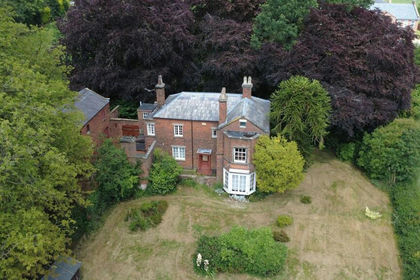
- Price
- Guide Price£825,000
- Size
- 1.1 acres
Added on 29/01/2026House with Land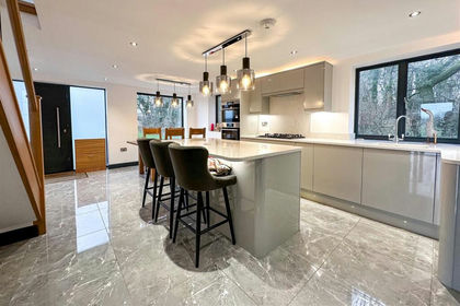
- Price
- £882,000
- Size
- 8.17 acres
Lamberts Lane, Congleton, Congleton, Cheshire East CW12 England
Added on 29/01/2026Barn Conversion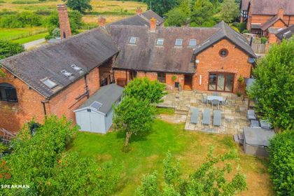
- Price
- Offers Over£625,000
Added on 11/07/2026Barn Conversion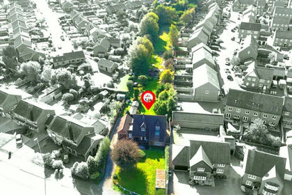 Added on 29/01/2026Development Land
- Price
- £825,000
- Size
- 3 acres
Plant Lane, Moston, Sandbach, Moston, Cheshire East CW11 England
Added on 15/04/2026Cottage
- Price
- £875,000
- Size
- 0.5 acres
Byley Lane, Byley, CW10, Byley, Cheshire West and Chester CW10 England
Added on 20/07/2026Barn Conversion