East Street, Hunton, Maidstone
- Land size
- 6.25 acres
- Bedrooms
- 4
- Bathrooms
- 2
Key Features
- Detached period home (circa 1876) with later extensions
- 4 bedrooms + attic room with potential for additional bedrooms (S.T.P.C)
- High-quality equestrian facilities
- Impressive garage, ripe for conversion into 1-bedroom annexe/holiday let - planning consent granted (pre-application).
- Stable yard with 4 stables (plus additional pony boxes), tack & feed rooms
- 40m x 20m riding arena / menage
- Approx. 6.25 acres of gardens and paddocks
Description
A handsome detached country house set in approximately 6 acres, with exceptional Equestrian facilities and arguably the finest views in Kent.
Set within a peaceful rural enclave sits this attractive and well-maintained country home, enjoying far-reaching views across the beautiful Kentish Weald. Positioned at the end of a long private drive, the property forms part of a pretty cluster of three homes within a working farm landscape of established orchards and vineyards, offering both privacy and a quintessential countryside setting in approximately 6.25 acres of gardens and paddock.
The spacious and impressive garage opposite the main house is ripe for conversion into ancillary accommodation as a useful 1-bedroom annexe / holiday let, having just successfully achieved planning consent (pre-application).
A particular highlight of this handsome family home is the direct access from the front gate to the Hunton/Linton toll ride, providing excellent off-road hacking for equestrian enthusiasts.
Description - Key Features
•Detached period home (circa 1876) with later extensions
•Approx. 6.25 acres of gardens and paddocks
•4 bedrooms + attic room with potential
•Versatile ground floor layout (ideal internal annexe potential)
•Impressive double garage, ripe for conversion into 1-bedroom annexe/holiday let - planning consent now granted (pre-application).
•High-quality equestrian facilities
•40m x 20m riding arena
•Stable yard with 4 stables (plus additional pony boxes), tack & feed rooms
•Workshop & ample parking
•Direct access to toll ride hacking
The Property:
Believed to date from around 1876, the property originally comprised a pair of Victorian cottages that have since been thoughtfully combined and extended to create a spacious and versatile family home. The accommodation is well balanced and adaptable, suited to modern living while retaining a warm, characterful feel.
The ground floor includes a welcoming sitting room, a recently updated and bespoke, high specification kitchen/breakfast room, a formal dining room, and a useful combination of snug and study spaces. These additional rooms offer flexibility and could easily be arranged to create a self-contained area or guest suite if required. A utility/laundry room and practical boot room complete the ground floor layout.
On the first floor, there are four well-proportioned bedrooms with breath-taking views served by an immaculate family bathroom and separate shower room. A further attic room on the second floor presents an opportunity for conversion, subject to the necessary consents, offering scope to expand the living space.
Gardens & Grounds:
The gardens wrap around the rear and side of the house, predominantly laid to lawn and gently sloping down towards the paddocks. A private seating area and rear terrace provide ideal spots to enjoy the open outlook, with a mature willow tree adding charm and character to the setting. A substantial driveway offers ample parking and access to the garage and outbuildings, as well as the stable yard. The spacious and impressive garage opposite the main house is ripe for conversion into ancillary accommodation as a useful 1-bedroom annexe / holiday let and has just successfully achieved planning consent (pre-application).
Equestrian Facilities & Outbuildings:
The property is superbly equipped for equestrian use, with facilities designed and constructed to a high standard. The stable yard includes four principal stables, with one currently subdivided to create two pony boxes (easily reverted if desired), alongside a tack room and feed room with services connected. Additional features include a covered wash area and a useful covered storage/lambing shed.
A riding arena / ménage of approximately 40m x 20m, is conveniently positioned between the stables and paddocks, featuring post and rail fencing and a well-drained sand and rubber surface. The surrounding land is arranged into several south-facing paddocks, ideal for rotational grazing. The land has previously supported both ponies and a small flock of sheep.
Location & Additional Information - Hunton is a charming village set within unspoilt countryside between Maidstone and Marden. The area offers a strong sense of community, with local amenities including a village hall, church, primary school, and recreational facilities such as a cricket club and playing field.
For commuters, mainline rail services are available from nearby Marden and Staplehurst, with journey times to central London of approximately 45 minutes. Maidstone provides a wider range of shopping, schooling, and leisure facilities, while access to the M20 motorway is within easy reach.
Additional Information:
Farmhouse: Mains water and electricity. Hot water & central heating are supplied by an oil-fired boiler. There is a recently installed treatment plant drainage system.
Stable Yard & Outbuildings: Water & Electricity are connected where needed. There is a water boiler and a phone line in the Feed Room.
Council Tax Band: G
EPC: D
Footpath:
There is a single footpath that skirts the boundary of the property (KM164) for a short distance to the north west. It is separated from the garden by a fence and hedge.
For further information use the KCC link below and the postcode ME15 OQY: standardmap.aspx
Plan / Land Area / Boundaries:
The plans included in these sales details, along with the stated acreage, are derived from the most recent Ordnance Survey mapping and are provided for general reference only. Prospective buyers should note that the sale is governed by the owner’s Land Registry title plan(s) and are responsible for confirming the exact boundaries and total area of the land themselves.
These plans are intended solely for illustrative use and, while they are considered to be accurate, no guarantee is given regarding their precision.
Viewings:
Viewings strictly by appointment by the agent, Vale and Marsh.
Map Location
Property details
- Tenure
- Freehold
- Council Tax Band
- G
- Date Posted
- 2026-06-18
Market Value Analysis
Compared with 472 Homes with Land listings in South East England (5+ acres).
Energy Performance Certificate
Energy Efficiency Rating
Based on UK Energy Performance Certificate standards (EU Directive 2002/91/EC)
Running costs are one side. Planning activity, flood history and ground risks for this location are in the full report.
Utilities & Restrictions
Utilities
- Electricity
- Ask Agent
- Water
- Ask Agent
- Heating
- Ask Agent
- Broadband
- Ask Agent
- Sewerage
- Ask Agent
Rights & Restrictions
- Public Rights of Way
- Ask Agent
- Private Rights of Way
- Ask Agent
- Listed Property
- Ask Agent
- Restrictions
- Ask Agent
Listed status, conservation areas and planning constraints for this location are in the full report.
Property Features
- Accessibility
- Ask Agent
- Parking
- Parking Available
- Garden
- Garden
Beyond the particulars: planning activity, flood history, heritage and ground risks, checked for this exact spot.
Connectivity
Broadband
Fastest speed available at this postcode
16 Mbps
Standard (10-30 Mbps)
Suitable for
- Web & social
- Music streaming
- Standard video calls
Mobile signal
Outdoor predictions; indoor signal depends on building materials.
Ofcom Connected Nations postcode-level predictions. Speeds and signal are modelled, not measured, and vary between addresses and providers.
Signal is the easy part. Planning activity, flood history and protected designations here are in the full report.
Nearest Schools
Primary
- Hunton Church of England Primary School0.9 milesNo Ofsted rating
- Ages
- 4 to 11
- Pupils
- 106
- Type
- Voluntary aided school
- Faith
- Church of England
- Coxheath Primary School1.2 milesOfsted: Good
- Ages
- 4 to 11
- Pupils
- 463
- Type
- Academy converter
- East Farleigh Primary School1.8 milesOfsted report card · Jun 2026
- Ages
- 4 to 11
- Pupils
- 199
- Type
- Community school
- Yalding, St Peter and St Paul Church of England Voluntary Controlled Primary School1.8 milesNo Ofsted rating
- Ages
- 5 to 11
- Pupils
- 145
- Type
- Voluntary controlled school
- Faith
- Church of England
- Loose Primary School2.5 milesOfsted: Good
- Ages
- 3 to 11
- Pupils
- 662
- Type
- Academy converter
Secondary
- Cornwallis Academy1.9 milesNo Ofsted rating
- Ages
- 11 to 19
- Pupils
- 1,402
- Type
- Academy sponsor led
- New Line Learning Academy3 milesOfsted: Requires improvement *
- Ages
- 11 to 16
- Pupils
- 826
- Type
- Academy sponsor led
- Oakwood Park Grammar School3.3 milesNo Ofsted rating
- Ages
- 11 to 18
- Pupils
- 1,100
- Type
- Academy converter
- Gender
- Boys
- St Augustine Academy3.4 milesOfsted report card · Mar 2026
- Ages
- 11 to 16
- Pupils
- 673
- Type
- Academy sponsor led
- Faith
- Church of England
- St Simon Stock Catholic School3.5 milesOfsted report card · Jan 2026
- Ages
- 11 to 18
- Pupils
- 1,148
- Type
- Academy converter
- Faith
- Roman Catholic
* Latest graded judgement covers quality of education only; no overall grade was issued under the 2024-25 inspection framework.
Distances are straight-line from the advertised location. Source: the national school registers (DfE, Welsh Government, Scottish Government) and Ofsted.
Schools are just the start: sold prices nearby, planning activity and any flood history are in the full report.
Amenities
Supermarket
GP surgery
Pharmacy
Hospital
Green space
Straight-line distances from the advertised location. Sources: NHS records, Geolytix supermarket locations, OS Open Greenspace and the national trails registers.
The area stacks up? Now check the location itself: planning nearby, protected designations and past flooding.
Getting Around
Nearest station
Nearest bus stop
Typical drive times
Straight-line distances from the advertised location; drive times are typical free-flow times over OpenStreetMap road data, so allow more at peak. Public transport locations from DfT NaPTAN.
Easy to reach matters. So do planning activity, flood history and ground risks: all in the full report.
Flood Risk
From Environment Agency flood map open data, checked around the advertised map pin and allowing for the listed acreage where known. This summary comes from LandSale, the advertising platform, not from the listing agent, and is not part of the agent's particulars. Risk can vary across a single holding, so verify anything critical through your own searches before committing.
Rivers and the sea
Surface water
Mapped within the area searched, not at the advertised map pin itself.
These bandings are the summary. Where this location sits on the flood maps, plus planning activity, heritage and ground risks, is in the full report.
Important notice: Information, maps and tags on this page are drawn from the advertising agent's marketing materials or generated automatically. LandSale has not verified them. Relying on these details is at your own risk, always carry out independent checks before committing to a purchase.
LandSale full disclaimer
Marketing information only - not formal particulars. The details on this website are provided for general guidance and do not constitute an offer or contract. Neither LandSale nor the advertising estate/land agent accepts responsibility for any inaccuracy.
1. Source of information
- Listing content: Core description, asking price, tenure, measurements, photographs and planning history originate from the marketing materials of the advertising estate or land agent. LandSale does not author this content and cannot guarantee its accuracy.
- Automated tags & categorisation: Property type, land-use class, acreage bands and similar labels may be applied by machine-learning models. They are intended as a helpful guide only and may not reflect the property's legal status or permitted use.
- Third-party & enriched data layers: Maps, boundary outlines, planning designations, soil reports, broadband coverage and other environmental or location-based insights are licensed from external suppliers. Such data are supplied “as is", may be incomplete or out of date and are subject to change without notice.
2. Verification required
Prospective purchasers must verify critical matters, including but not limited to planning permission, title boundaries, public rights of way, environmental constraints, acreage, services, access and VAT status, through their own inspections, specialist surveys, legal advisers and the selling agent before relying on the information or entering into any contract.
3. No warranty or liability
LandSale gives no warranty, express or implied, as to the accuracy, completeness or fitness for any particular purpose of the information displayed. LandSale shall not be liable for any loss, damage, cost or expense arising directly or indirectly from any use of or reliance on such information, save where liability may not be excluded by law.
4. Updates & feedback
If you believe any detail on this listing is inaccurate, please let us know. We will investigate and, where appropriate, update the listing or notify the agent.
© LandSale | Version 1.3 - August 2026
Listing agent
Vale and Marsh, Rolvenden
2 Windmill Oast Benenden Road, Rolvenden, TN17 4PF
Contact Vale and Marsh, Rolvenden
2 Windmill Oast Benenden Road, Rolvenden, TN17 4PF
View agent profileSimilar properties for sale
- Price
- £1,395,000
- Size
- 5 acres
Added on 11/05/2026Farmhouse
- Price
- £1,200,000
- Size
- 4.19 acres
Price Range £1.2m-£1.25m | rural mid Kent, Chart Sutton, Kent ME17 England
Added on 29/08/2026Equestrian property
- Price
- Guide Price£1,290,000
- Size
- 4.65 acres
Staplehurst, Tonbridge, Kent, Staplehurst, Kent TN12 England
Added on 18/06/2026Equestrian property
- Price
- £1,500,000
- Size
- 6 acres
Broadwater Road, West Malling, Kent, ME19, East Malling and Larkfield, Kent ME19 England
Added on 06/06/2026House with Land
- Price
- Offers in Excess of£1,500,000
- Size
- 10.55 acres
Added on 20/05/2026Smallholding
- Price
- Guide Price£1,075,000
- Size
- 6 acres
Added on 07/07/2026House with Land
- Price
- Guide Price£1,050,000
- Size
- 6.6 acres
Camden Hill, Sissinghurst, Kent, TN17, Cranbrook & Sissinghurst, Kent TN17 England
Added on 29/01/2026House with Land
- Price
- Guide Price£1,400,000
- Size
- 7.92 acres
Added on 10/07/2026House with Land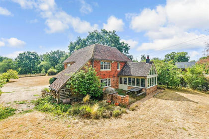
- Price
- Guide Price£1,100,000
- Size
- 9.88 acres
Waterman Quarters, Headcorn, Ashford, Kent, Headcorn, Kent TN27 England
Added on 29/08/2026House with Land
- Price
- Guide Price£1,100,000
- Size
- 4.3 acres
Hastings Road, Matfield, TN12, Brenchley and Matfield, Kent TN12 England
Added on 08/04/2026Equestrian property