The Old Dairy, Wicket Gardens, RH13
- Bedrooms
- 3
- Bathrooms
- 2
Key Features
- Single Story Detached Barn Conversion
- South Facing Garden
- Allocated Parking for 2/3 cars
- 10 Minute Drive to Horsham Town Centre
- Sought After Village Location, next to open fields
- Brand New Kitchen & Appliances
- Stone Worktops with Wireless Charging to Breakfast Bar
- Brand New Gas Boiler
- Luxury Bathrooms
Description
Introducing The Old Dairy; a detached, three bedroom, single story barn conversion nestled within true English farmland located in the quintessential village of Slinfold. Situated next to open fields, this is a hidden gem in the heart of this popular Sussex village!
Upon entering the property, you are greeted by a hallway leading you through to the spacious, open plan kitchen/ dining/family room with French doors taking you out to the south facing patio & garden. High quality engineered oak flooring flows throughout this space. The sleek, modern kitchen comes complete a stone worktop featuring a wireless charging port and with a selection of integrated appliances such as Bosch oven, microwave and induction hob, as well as an integrated dishwasher and fridge freezer.
At the far end of the property you have the principal bedroom which is finished with carpet & also benefitting from French Doors out onto the garden. The en suite to this bedroom features a large walk in shower with marble affect wall tiles, a waterfall shower and handheld shower. This space also features a heated towel rail, sink with vanity storage, LED de mister mirror and has a cupboard housing the washing machine.
There are two further bedrooms also finished with carpet and served by the family bathroom which features a bath with a handheld shower and sink with storage.
Outside, you will find a generous, low maintenance, south facing garden complete with patio and single, featuring space for dedicated soft planting. There are two driveway parking spaces at either side of the property.
Slinfold is a quiet village nestled close to the edge of West Sussex, just 32 miles south of London and 21 miles north of the coast. Home to around only 2000 people the small village offers an array of essential amenities such as a cosy country pub, The Red Lyon, Post Office, Village Shop, Golf Club & Gym and Primary school, whilst being only a 10 minute drive to Horsham town centre for anything else you may need.
Horsham town centre is only a 10 minute drive away providing the essential supermarkets such as Waitrose & John Lewis, Marks & Spencer’s and Sainsburys just to name a few.
You will be spoilt for choice by the wide range of shops, cafes, eateries, and bars across the town that satisfy all tastes and preferences. The town also benefits from the Everyman Cinema providing a wide range of films, food and drinks that can be served right to your seat, Pavilions leisure centre offering a gym, swimming pool and outdoor play facilities for children.
*Images may be digitally dressed to provide an indicative example of finish for the properties. Exact layouts will vary by plot, contact us for more information.
Limitation of Agents Liability – the information included within this brochure and all marketing material for the development is provided for guidance only and is intended to give a fair overall summary of the final specification for the development/property as provided to us by the developer. They do not form part of any contract or offer and should not be relied upon as a statement or representation of fact. As new homes are often not build complete at the time of offer, and even if build complete may be subject to final snags, a full specification of the property should be requested via your solicitor during the conveyancing in addition to the guide that our marketing material provides. It is recommended that all buyers conduct a snagging survey prior to legal completion so that any snags being rectified are a condition of sale. Measurements, areas and distances provided are approximate only. No undertaking is given from the Agent as to the final specification, compliance with building regulations, planning consents or warranties as such matters are handled during the legal conveyance of a new build and are therefore the responsibility of your appointed solicitor to confirm.
Please note, this is a recent conversion of a block and brick built barn. The original structure of the building has been retained and only internal works, plus external insulation and cladding have been completed for the conversion. This is therefore not a new build and as such no new home warranty is available. The builder will provide a two year snags and defects cover from date of purchase.
Map Location
Property details
- Tenure
- Freehold
- Council Tax Band
- Ask Agent
- Date Posted
- 2026-06-17
Utilities & Restrictions
Utilities
- Electricity
- Ask Agent
- Water
- Ask Agent
- Heating
- Ask Agent
- Broadband
- Ask Agent
- Sewerage
- Ask Agent
Rights & Restrictions
- Public Rights of Way
- Ask Agent
- Private Rights of Way
- Ask Agent
- Listed Property
- Ask Agent
- Restrictions
- Ask Agent
Listed status, conservation areas and planning constraints for this location are in the full report.
Property Features
- Accessibility
- Ask Agent
- Parking
- Parking Available
- Garden
- Garden
Beyond the particulars: planning activity, flood history, heritage and ground risks, checked for this exact spot.
Connectivity
Broadband
Fastest speed available at this postcode
80 Mbps
Superfast
Suitable for
- HD streaming
- Video calls
- Web & social
Mobile signal
Predicted 4G and 5G signal; indoor signal depends on building materials.
Ofcom Connected Nations postcode-level predictions. Speeds and signal are modelled, not measured, and vary between addresses and providers.
Signal is the easy part. Planning activity, flood history and protected designations here are in the full report.
Nearest Schools
Primary
- Slinfold CofE Primary School and Pre School373 metresOfsted: Good
- Ages
- 2 to 11
- Pupils
- 137
- Type
- Voluntary controlled school
- Faith
- Church of England
- Shelley Primary School1.9 milesOfsted: Requires improvement *
- Ages
- 4 to 11
- Pupils
- 412
- Type
- Community school
- Rudgwick Primary School2.3 milesOfsted: Good
- Ages
- 4 to 11
- Pupils
- 213
- Type
- Community school
- Warnham CofE Primary School2.6 milesNo Ofsted rating
- Ages
- 4 to 11
- Pupils
- 202
- Type
- Voluntary controlled school
- Faith
- Church of England
- St John's Catholic Primary School2.7 milesNo Ofsted rating
- Ages
- 4 to 11
- Pupils
- 203
- Type
- Voluntary aided school
- Faith
- Roman Catholic
Secondary
- Tanbridge House School2.3 milesOfsted: Outstanding
- Ages
- 11 to 16
- Pupils
- 1,510
- Type
- Community school
- Millais School4.2 milesOfsted: Good
- Ages
- 11 to 16
- Pupils
- 896
- Type
- Community school
- Gender
- Girls
- The Forest School4.3 milesNo Ofsted rating
- Ages
- 11 to 16
- Pupils
- 1,115
- Type
- Academy converter
- Weald School, The4.5 milesOfsted: Good *
- Ages
- 11 to 18
- Pupils
- 1,800
- Type
- Community school
- Bohunt Horsham4.7 milesOfsted: Good
- Ages
- 4 to 16
- Pupils
- 1,294
- Type
- Free schools
* Latest graded judgement covers quality of education only; no overall grade was issued under the 2024-25 inspection framework.
Distances are straight-line from the advertised location. Source: the national school registers (DfE, Welsh Government, Scottish Government) and Ofsted.
Schools are just the start: sold prices nearby, planning activity and any flood history are in the full report.
Amenities
Supermarket
GP surgery
Pharmacy
Hospital
Green space
Straight-line distances from the advertised location. Sources: NHS records, Geolytix supermarket locations, OS Open Greenspace and the national trails registers.
The area stacks up? Now check the location itself: planning nearby, protected designations and past flooding.
Getting Around
Nearest station
Nearest bus stop
Typical drive times
Straight-line distances from the advertised location; drive times are typical free-flow times over OpenStreetMap road data, so allow more at peak. Public transport locations from DfT NaPTAN.
Easy to reach matters. So do planning activity, flood history and ground risks: all in the full report.
Flood Risk
Environment Agency open data, checked around the advertised map pin for the listed acreage. Long-term risk counts flood defences; the planning map's flood zones do not. The map pin for this listing marks the postcode area rather than the exact location, so these readings describe the surrounding area. Provided by LandSale, not the listing agent, and not part of the agent's particulars. Risk varies across a holding, so verify before committing.
Rivers and the sea
Planning map: Flood Zone 1.
Surface water
Not at the pin: mapped about 10 metres away.
These bandings are the summary. Where this location sits on the flood maps, plus planning activity, heritage and ground risks, is in the full report.
Important notice: Information, maps and tags on this page are drawn from the advertising agent's marketing materials or generated automatically. LandSale has not verified them. Relying on these details is at your own risk, always carry out independent checks before committing to a purchase.
LandSale full disclaimer
Marketing information only - not formal particulars. The details on this website are provided for general guidance and do not constitute an offer or contract. Neither LandSale nor the advertising estate/land agent accepts responsibility for any inaccuracy.
1. Source of information
- Listing content: Core description, asking price, tenure, measurements, photographs and planning history originate from the marketing materials of the advertising estate or land agent. LandSale does not author this content and cannot guarantee its accuracy.
- Automated tags & categorisation: Property type, land-use class, acreage bands and similar labels may be applied by machine-learning models. They are intended as a helpful guide only and may not reflect the property's legal status or permitted use.
- Third-party & enriched data layers: Maps, boundary outlines, planning designations, soil reports, broadband coverage and other environmental or location-based insights are licensed from external suppliers. Such data are supplied “as is", may be incomplete or out of date and are subject to change without notice.
2. Verification required
Prospective purchasers must verify critical matters, including but not limited to planning permission, title boundaries, public rights of way, environmental constraints, acreage, services, access and VAT status, through their own inspections, specialist surveys, legal advisers and the selling agent before relying on the information or entering into any contract.
3. No warranty or liability
LandSale gives no warranty, express or implied, as to the accuracy, completeness or fitness for any particular purpose of the information displayed. LandSale shall not be liable for any loss, damage, cost or expense arising directly or indirectly from any use of or reliance on such information, save where liability may not be excluded by law.
4. Updates & feedback
If you believe any detail on this listing is inaccurate, please let us know. We will investigate and, where appropriate, update the listing or notify the agent.
© LandSale | Version 1.3 - August 2026
Similar properties for sale
- Price
- Guide Price£700,000
- Size
- 1.81 acres
Five Oaks Road, Slinfold, RH13, Slinfold, West Sussex RH13 England
Added on 06/10/2026House with Land
- Price
- Guide Price£750,000
- Size
- 1.16 acres
Shambles, Marringdean Road, Billingshurst, West Sussex RH14 England
Added on 21/08/2026Equestrian property
- Price
- Guide Price£750,000
- Size
- 1.16 acres
Marringdean Road, Billingshurst, Billingshurst, West Sussex RH14 England
Added on 21/08/2026House with Land
- Price
- Offers Over£600,000
Added on 02/05/2026Barn Conversion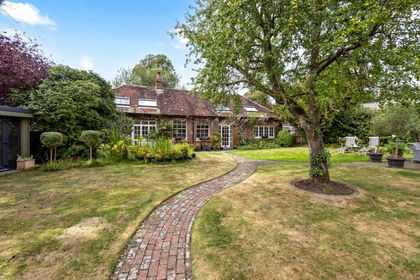
- Price
- Guide Price£650,000
Stane Street, North Heath, RH20, Pulborough, West Sussex RH20 England
Added on 26/09/2026Barn Conversion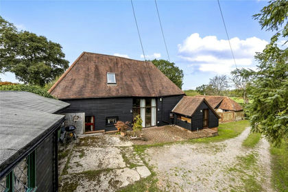
- Price
- Guide Price£795,000
- Size
- 1.5 acres
Gay Street Lane, Pulborough, Pulborough, West Sussex RH20 England
Added on 05/09/2026Barn Conversion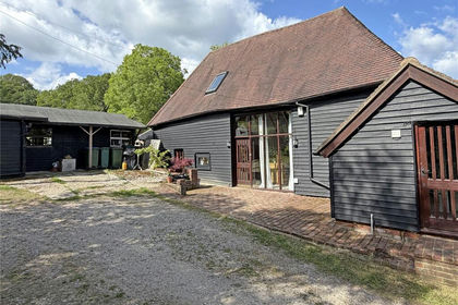
- Price
- Guide Price£795,000
- Size
- 1.47 acres
Nr. Pulborough, West Sussex, Pulborough, West Sussex RH20 England
Added on 29/01/2026Barn Conversion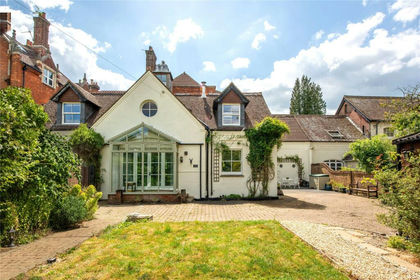
- Price
- Guide Price£795,000
- Size
- 1.4 acres
Ockley Road, Beare Green, Dorking, Surrey, RH5, Capel, Surrey RH5 England
Added on 17/07/2026House with Land
- Price
- Guide Price£800,000
- Size
- 1.28 acres
Stane Street, Codmore Hill, Pulborough, West Sussex RH20 England
Added on 13/07/2026House with Land
- Price
- Guide Price£800,000
- Size
- 3.69 acres
Little Garns, Coolham Road, West Chiltington, Pulborough, RH20, Thakeham, West Sussex RH20 England
Added on 18/09/2026House with Land