Bedford Road, Northill, SG18
- Land size
- 1.3 acres
- Bedrooms
- 4
- Bathrooms
- 2
Key Features
- Plot spanning over 1.3 acres
- Extended detached grade II listed cottage
- Surrounded by woodland and open countryside
- Desirable village of Northill
- Four generous bedrooms
- Stunning living room with wood burner enjoying views over the grounds
- Gated driveway with two garages and further outbuildings
- Direct access from grounds into woodland and countryside walks
- Planning permission approved to further extend
Description
Occupying a plot spanning over 1.3 acres on the outskirts of the desirable village of Northill is this charming Grade II listed cottage. Dating back to the late 18th century, the property backs onto woodland and is surrounded by open countryside to offer a secluded rural setting.
The south-facing garden is a particular feature of the property, with a wide variety of established trees, together with productive fruit trees, ornamental flowering cherries and number of climbing and shrub roses. The garden has been landscaped to include long herbaceous borders and there are a number of seating areas from which you can enjoy different aspects of the garden and in the summer, al fresco dining. A small area of woodland borders a seasonal stream and from it there is gated access directly into Home Wood. The property also includes a poly tunnel and fruit cage offering ideal conditions for growing produce.
The garden has two ponds, one of them designed for wildlife, and the garden attracts a variety of creatures including hare, badgers and deer. The current owners enjoy the wake-up call of Woodpeckers and Red Kites in the morning, with Tawny Owls lulling them to sleep.
The property is accessed via a gated driveway that provides ample parking for multiple vehicles. Off the drive are two garages (one with a workshop area) an outside W/C and an outbuilding set up as a very useful home office. Further outbuildings within the grounds include a summer house overlooking an ornamental pond and a garden cabin, both of which have electricity connected, plus a further garden machinery store.
Formerly an entrance lodge house for the Ickwell Bury Estate, "Hare Cottage" was one of a pair of lodges originally occupied by estate staff. The property was extended in the 1970s and 80s, substantially increasing the footprint of accommodation, and planning permission has recently been gained by the current owners to further extend the living accommodation by creating a spacious kitchen / breakfast room should it be required.
Entering the light-filled property via the front door, you are greeted by a welcoming hallway with doors to the sleeping accommodation and kitchen. The cottage layout is thoughtfully arranged, with the bedrooms and bathrooms separated off from the main living areas. Practically, the boot room to side of the home is used as the everyday entrance to the property, opening directly as it does on to the kitchen and separate living room.
The 18ft living room features an impressive vaulted ceiling with exposed timber beams, double patio doors opening onto a terrace and a wood burning stove perfect for creating a cosy atmosphere during winter months. The living room is adjoined by a separate dining room with both rooms enjoying extensive views over the garden. The home's kitchen includes integrated appliances and hand painted units.
The four well proportioned bedrooms are all accessed directly from the main hall. The primary bedroom is located at the rear of the property with French style doors opening out to the garden and an adjoining en-suite with a generous shower. A four piece family bathroom with shower over bath serves the home's three further double bedrooms. Bedroom two is found in the original "lodge" at the front of the cottage and oozes character with exposed timbers and Ogee Gothic windows. The accommodation is completed by a utility/laundry room.
Being on the edge of Northill, Hare Cottage offers a balance of rural peace and the sense of community that village living gives you. From a gate at the rear of the plot you can follow the Greensand Ridge Walk into Northill in around 10 minutes, or alternatively there are hours of walks to be enjoyed through Home and College Woods and beyond without needing to use a car.
In Home Wood itself you will find a complex of ancient fish ponds, rabbit warren and perimeter ditch. Now a scheduled monument, they were attached to the medieval estate of Northill Manor. Today, the woodland is managed by Forestry England.
Northill's amenities include The Crown which serves food, a parish church, a village hall and a recently expanded lower school. There is a farm shop and café in nearby Hatch and the neighbouring village of Ickwell is within easy walking distance, with a focal point for the village being the large green, with its cricket pitch and pavilion. Ickwell is also famous for its maypole, and its annual 'May Day' event which includes a May Queen procession from Northill to Ickwell. There are also various events and air shows throughout the summer at nearby Shuttleworth House.
For the commuter, Sandy station is approximately 2.2 miles away and Biggleswade is approximately 3 miles away, with links into London Kings Cross and through London via St Pancras. The village is well placed for shopping facilities in Biggleswade, Sandy and Bedford which offer Sainsbury's Tesco and Waitrose superstores. The village's location has great transport links with the A1 being relatively close by.
Disclaimer: Please note we do not test any fixtures, fittings, apparatus or services. Any interested parties should undertake their own investigation into the working order of these items. All measurements provided are approximate and photos are provided for guidance only. Potential buyers are advised to re-check the measurements before committing to any expense. Potential buyers are advised to check and confirm the EPC, estate management charges and council tax before committing to any expense. Floorplans are for illustration purposes only. Cooper Wallace do not verify the legal title of the property and the potential buyers should obtain verification from their solicitors before committing to any expense. TENURE: FREEHOLDCOUNCIL TAX: F EPC: N/A
Entrance Hall
Kitchen
Boot Room
Living Room
Dining Room
Bedroom One
En-suite
Bedroom Two
Bedroom Three
Bedroom Four
Bathroom
Laundry Room (formerly w/c)
Cabin
Outbuilding Currently Used As Home Office
Garage One
Garage Two
Outside W/C
Map Location
Property details
- Tenure
- Freehold
- Council Tax Band
- F
- Date Posted
- 2026-06-16
Market Value Analysis
Compared with 1,144 Homes with Land listings in East Anglia (1+ acres).
Utilities & Restrictions
Utilities
- Electricity
- Ask Agent
- Water
- Ask Agent
- Heating
- Ask Agent
- Broadband
- Ask Agent
- Sewerage
- Ask Agent
Rights & Restrictions
- Public Rights of Way
- Ask Agent
- Private Rights of Way
- Ask Agent
- Listed Property
- Ask Agent
- Restrictions
- Ask Agent
Listed status, conservation areas and planning constraints for this location are in the full report.
Property Features
- Accessibility
- Ask Agent
- Parking
- Parking Available
- Garden
- Garden
Beyond the particulars: planning activity, flood history, heritage and ground risks, checked for this exact spot.
Connectivity
Broadband
Fastest speed available at this postcode
49 Mbps
Superfast
Suitable for
- HD streaming
- Video calls
- Web & social
Mobile signal
Predicted 4G and 5G signal; indoor signal depends on building materials.
Ofcom Connected Nations postcode-level predictions. Speeds and signal are modelled, not measured, and vary between addresses and providers.
Signal is the easy part. Planning activity, flood history and protected designations here are in the full report.
Nearest Schools
Primary
- Northill CofE Academy645 metresNo Ofsted rating
- Ages
- 4 to 11
- Pupils
- 66
- Type
- Academy converter
- Faith
- Church of England
- Caldecote Church of England Academy1.7 milesOfsted: Good
- Ages
- 3 to 11
- Pupils
- 85
- Type
- Academy sponsor led
- Faith
- Church of England
- Moggerhanger Primary School1.7 milesNo Ofsted rating
- Ages
- 2 to 11
- Pupils
- 119
- Type
- Foundation school
- Laburnum Primary School2.3 milesOfsted report card · Nov 2025
- Ages
- 3 to 11
- Pupils
- 174
- Type
- Academy sponsor led
- St Swithun's Church of England VC Primary School2.5 milesNo Ofsted rating
- Ages
- 3 to 11
- Pupils
- 172
- Type
- Voluntary controlled school
- Faith
- Church of England
Secondary
- Sandy Secondary School2.8 milesOfsted: Good *
- Ages
- 11 to 18
- Pupils
- 1,259
- Type
- Foundation school
- Edward Peake CofE VC School3.6 milesOfsted: Good *
- Ages
- 11 to 16
- Pupils
- 359
- Type
- Voluntary controlled school
- Faith
- Church of England
- Stratton School3.8 milesOfsted: Good *
- Ages
- 11 to 18
- Pupils
- 917
- Type
- Academy converter
- Samuel Whitbread Academy4.9 milesNo Ofsted rating
- Ages
- 13 to 18
- Pupils
- 1,657
- Type
- Academy converter
- Robert Bloomfield Academy5 milesOfsted: Outstanding *
- Ages
- 9 to 13
- Pupils
- 962
- Type
- Academy converter
* Latest graded judgement covers quality of education only; no overall grade was issued under the 2024-25 inspection framework.
Distances are straight-line from the advertised location. Source: the national school registers (DfE, Welsh Government, Scottish Government) and Ofsted.
Schools are just the start: sold prices nearby, planning activity and any flood history are in the full report.
Amenities
Supermarket
GP surgery
Pharmacy
Hospital
Straight-line distances from the advertised location. Sources: NHS records, Geolytix supermarket locations, OS Open Greenspace and the national trails registers.
The area stacks up? Now check the location itself: planning nearby, protected designations and past flooding.
Getting Around
Nearest station
Nearest bus stop
Typical drive times
Straight-line distances from the advertised location; drive times are typical free-flow times over OpenStreetMap road data, so allow more at peak. Public transport locations from DfT NaPTAN.
Easy to reach matters. So do planning activity, flood history and ground risks: all in the full report.
Flood Risk
Environment Agency open data, checked around the advertised map pin for the listed acreage. Long-term risk counts flood defences; the planning map's flood zones do not. Provided by LandSale, not the listing agent, and not part of the agent's particulars. Risk varies across a holding, so verify before committing.
Rivers and the sea
Planning map: Flood Zone 1.
Surface water
These bandings are the summary. Where this location sits on the flood maps, plus planning activity, heritage and ground risks, is in the full report.
Important notice: Information, maps and tags on this page are drawn from the advertising agent's marketing materials or generated automatically. LandSale has not verified them. Relying on these details is at your own risk, always carry out independent checks before committing to a purchase.
LandSale full disclaimer
Marketing information only - not formal particulars. The details on this website are provided for general guidance and do not constitute an offer or contract. Neither LandSale nor the advertising estate/land agent accepts responsibility for any inaccuracy.
1. Source of information
- Listing content: Core description, asking price, tenure, measurements, photographs and planning history originate from the marketing materials of the advertising estate or land agent. LandSale does not author this content and cannot guarantee its accuracy.
- Automated tags & categorisation: Property type, land-use class, acreage bands and similar labels may be applied by machine-learning models. They are intended as a helpful guide only and may not reflect the property's legal status or permitted use.
- Third-party & enriched data layers: Maps, boundary outlines, planning designations, soil reports, broadband coverage and other environmental or location-based insights are licensed from external suppliers. Such data are supplied “as is", may be incomplete or out of date and are subject to change without notice.
2. Verification required
Prospective purchasers must verify critical matters, including but not limited to planning permission, title boundaries, public rights of way, environmental constraints, acreage, services, access and VAT status, through their own inspections, specialist surveys, legal advisers and the selling agent before relying on the information or entering into any contract.
3. No warranty or liability
LandSale gives no warranty, express or implied, as to the accuracy, completeness or fitness for any particular purpose of the information displayed. LandSale shall not be liable for any loss, damage, cost or expense arising directly or indirectly from any use of or reliance on such information, save where liability may not be excluded by law.
4. Updates & feedback
If you believe any detail on this listing is inaccurate, please let us know. We will investigate and, where appropriate, update the listing or notify the agent.
© LandSale | Version 1.3 - August 2026
Similar properties for sale
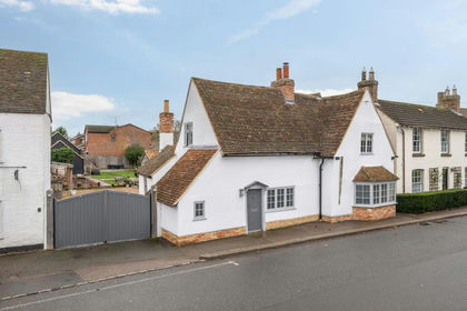
- Price
- Offers in Excess of£700,000
High Street, Great Barford, MK44, Great Barford, Bedford MK44 England
Added on 29/01/2026Cottage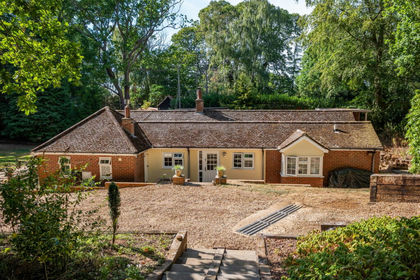
- Price
- Offers in Region of£850,000
- Size
- 1 acres
Standalone Warren, Haynes, Bedford, MK45, Haynes, Central Bedfordshire MK45 England
Added on 23/08/2026Cottage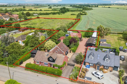
- Price
- Offers in Excess of£1,000,000
- Size
- 3 acres
Cotton End Road, Wilstead, MK45, Wilshamstead, Bedford MK45 England
Added on 03/06/2026House with Land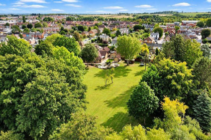
- Price
- Guide Price£1,000,000
- Size
- 1.15 acres
Ampthill Road, Shefford, SG17, Shefford, Central Bedfordshire SG17 England
Added on 08/10/2026House with Land
- Price
- £700,000
- Size
- 1.5 acres
Clifton Road, Henlow, SG16, Henlow, Central Bedfordshire SG16 England
Added on 07/10/2026House with Land Added on 29/09/2026Barn Conversion
- Price
- £900,000
- Size
- 0.4 acres
Honeydon Road, Colmworth, MK44, Colmworth, Bedford MK44 England
Added on 30/04/2026Barn Conversion
- Price
- £750,000
- Size
- 0.49 acres
Land At Home Road, Kempston, Bedford, Kempston Rural, Bedford MK43 England
Added on 07/10/2026Development Land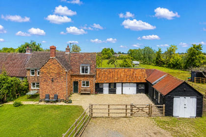
- Price
- Guide Price£650,000
- Size
- 2.5 acres
Cross End, Thurleigh, Bedford, Bedfordshire, MK44, Thurleigh, Bedford MK44 England
Added on 23/07/2026House with Land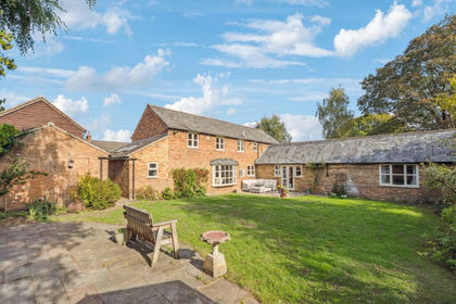
- Price
- Offers Over£1,000,000
Oliver Street, Ampthill, MK45, Ampthill, Central Bedfordshire MK45 England
Added on 29/01/2026Barn Conversion