Pailton Road, Harborough Magna, Rugby
- Land size
- 102.61 acres
- Bedrooms
- 3
- Bathrooms
- 3
Key Features
- Period Farmhouse
- 19,504 sq. ft of Modern and Traditional Buildings
- 102.61 acres of agricultural land
- Convenient position
- Potential for Development (subject to planning)
- Separate detached 2-bedroom bungalow.
Description
An attractive fully equipped residential pasture farm in a convenient location with a traditional farmhouse, a range of traditional and modern farm buildings with scope for redevelopment and a detached bungalow set within 102.61 acres.
Description - Fieldgate Farm is an attractive, a fully equipped residential pasture farm comprising a 3-bedroom farmhouse with a range of traditional and modern farm buildings suitable for a variety of alternative uses (subject to planning) and a separate detached 2-bedroom bungalow extending in all to approximately 102.61 acres (41.48 ha). The property is accessed directly from the public highway via a private driveway which opens out to reveal the farmyard and house.
The farm is being offered for sale as a whole or in up to 3 lots.
Lot 1: (Edged Red) - Fieldgate Farm, Buildings, Bu - Fieldgate Farm is approached direct from the public highway via a private driveway which opens out to reveal the farmyard, house and bungalow, located centrally within the surrounding 85.82 acres of pastureland.
The farmhouse is a 3-bedroom period house of red brick construction with a small, rendered section, under a pitched tile roof with a large number of period features throughout the house. The accommodation is arranged over two floors with scope for further accommodation with internal reconfiguration. The front elevation provides access to a small lawned garden, with access to the buildings gained to the rear of the property, which run along the side elevation of the farmhouse.
Farm Buildings - The farm buildings are shown on the numbered inset and detailed plans. They extend to 19,504 sq. Ft (1,812 sqm) and surround a concrete yard. The agricultural buildings comprise:
1) Traditional two-storey granary barn with brick subdivisions and predominately concrete floor, currently being used for varying uses including agricultural storage and workshop. At the back of the brick barn is Building 1A which is a steel frame lean-to complete with corrugated tin roof and open sides, concrete and part soil floor.
2) A corrugated Nissan hut, open fronted with hardcore floor and electrical supply.
3) Steel frame Dutch barn with steel lean-tos off either side, complete with part asbestos sheet and part tin roof, enclosed with breeze block walls and Yorkshire boarding. Attached to building 3 are two further buildings, 3A (steel frame construction complete with blockwork walls and Yorkshire boarding providing enclosed livestock housing) and 3B (pole barn with corrugated tine roof).
4) Building of timber construction under fibre cement roof and concrete floor, formerly cow cubicles. Attached to building 4 is 4A which is a timber framed barn.
5) A breezeblock two-storey building under asbestos roof and was a former dairy, with the parlour equipment having all been removed but the milking pit is still in place. The cattle entrance doors have been bricked up. The building benefits from three-phase electrical supply.
6) A steel framed lean-to attached to the rear of building 7 under a corrugated tin roof, open fronted with concrete floors, former milking shed.
7) A brick under tiled roof traditional building which is a former milking parlour, now utilised as ancillary accommodation to the farmhouse.
Buildings 7, 1 and the farmhouse provide a traditional old-fashioned U-shape courtyard arrangement, which offers additional storage space and have potential for alternative use subject to planning.
The farmyard is predominantly concrete throughout, with good wide vehicular access. There is a large area of uncovered concrete being the former silage clamps.
Bungalow - The bungalow is of brick construction under a tile roof extending to approximately 876 sq. ft and is accessed separately off the farm drive via a concrete track. There is a small lawned garden surrounding the property with a detached garage sat adjacent to the dwelling.
Agricultural Land - Lot 1 - The ring-fenced Lot 1 land (shown edged red), extends to 85.82 acres and comprises 6 fields of permanent pasture with a small area of woodland, enclosed predominately with a mixture of livestock fencing and mature hedgerows. The land benefits from a mains water supply, with water troughs located throughout the parcels.
The land is identified as being predominantly Grade 3 on the land classification plans for England and Wales being slowly permeable seasonally wet loamy-clay soil with moderate fertility and impeded drainage suitable for pasture and combinable crops.
Located within Field Parcel 0245 is a mound used to screen the motorway. We have been informed that historically this has been made up of former building waste/rubble before being covered with soil and planted.
Agricultural Land - Lot 2 - The land in Lot 2 extends to 7.14 acres, comprising a single field of permanent pasture, with the land benefitting from extensive road frontage, and can be accessed via the Pailton Road with a gateway set back from the highway.
Agricultural Land - Lot 3 - Lot 3 comprises one 6.69-acre field of permanent pasture, again, benefitting from extensive road frontage, and can be accessed via the Pailton Road with a gateway set back from the highway.
All of the land is identified as being Grade 3 on the Land Classification plans for England being slowly permeable seasonally wet slightly acid but base-rich loamy and clayey soils.
The land would be suited to agricultural or equestrian use, subject to obtaining the necessary planning consent.
Tenure & Possession - The property will be sold freehold with vacant possession given upon completion given the provision that the occupier of the farmhouse has the right to remain in the property rent free for a period of 6 months post completion.
Rural Land Register & Environmental Schemes - The land is registered with the Rural Land Register and the fields can be transferred to the purchaser upon completion, from the vendor. The vendors will retain the historic element of previous Basic Payment Scheme claim.
The land is not currently within an SFI scheme or any other environmental management scheme.
Services - Mains water is connected to the Farmhouse with drainage via a private system, mains electricity and oil-fired central heating. The bungalow benefits from mains water and electricity, oil fired central heating, bottle gas for cooking and drainage via a private septic tank.
Some of the buildings are understood to benefit from three-phase electricity and mains water. The land included within Lot 1 benefits from a mains water supply.
A water supply will be provided to Lots 2 and 3 if bought either in conjunction with Lot 1 or together, otherwise if sold separately only Lot 2 will have a water connection and Lot 3 will not benefit from a mains water supply.
The purchasers should make their own enquiries as to availability and adequacy of the services.
Method Of Sale - The property is offered for sale by private treaty and any interested party should submit their unconditional offers to the Agent’s Towcester Office.
Planning - There are elements of the property which may be suitable for alternative uses subject to obtaining the necessary planning consent for that alternative use.
We are of the understanding that the bungalow is subject to an agricultural occupancy condition given its age and therefore the property is sold on the assumption that a standard agricultural occupancy condition is in place as per the below wording:
“The occupation of the dwelling shall be limited to a person solely or mainly employed or last employed in agriculture as defined in Section 290 (1) of the Town & Country Planning Act 1971, or in forestry, (including any dependents of such person residing with him (or widow or widower of such as person).
Development Overage - The vendors will impose a development overage on the entirety of the property as marketed of 30% for a period of 30 years from the date of completion brought about through the grant of each and every non-agricultural or non-equestrian planning consent.
The provisions will be become effective on the earlier of either the implementation of the planning consent or the disposal of the property to which the planning consent relates with the benefit of the consent.
Lotting - The vendor reserves the right to offer the property for sale in any other order than that described in these particulars, subdivide, amalgamate or withdraw the property from sale without prior notice.
Plan, Area & Description - The property is currently unregistered.
Please note field numbers quoted may not match the RPA field numbers and a plan is for identification purposes only.
The plan, area and description are believed to be correct in every way but no claim will be entertained by the vendor or the agents in respect of any error, omissions and misdescriptions.
Rights Of Way - There are low voltage overhead electricity lines crossing parts of the land. We are not aware of any other wayleaves, easements or rights of way that affect the property.
What3words - Using the WhatThreeWords app the following will take you to the entrances of each Lot:
Lot 1: ///unscrew.equal.challenge
Lot 2: ///trades.forkful.waged
Lot 3: ///trending.observes.pressing
Viewing - Viewing is strictly by appointment by contacting Tayla Cave on or email tayla. . Please note this is working farm therefore appropriate health and safety advice and bio-security measures must be taken.
Anti Money Laundering Regulations - We are required under due diligence, as set up under HRMC, to take a full identification (e.g. photo ID and recent utility bill as proof of address) of a potential purchaser prior to accepting an offer on a property.
To enable us to comply with the Money Laundering Regulations we need to verify the buyer’s identity before proceeding with a sale. We charge a small administration fee for conducting an electronic AML verification check via our online provider, MoveButler.
Map Location
Property details
- Tenure
- Freehold
- Council Tax Band
- Ask Agent
- Date Posted
- 2026-05-23
Market Value Analysis
Compared with 20 Farms & Smallholdings listings in West Midlands (100+ acres).
Utilities & Restrictions
Utilities
- Electricity
- Ask Agent
- Water
- Ask Agent
- Heating
- Ask Agent
- Broadband
- Ask Agent
- Sewerage
- Ask Agent
Rights & Restrictions
- Public Rights of Way
- Ask Agent
- Private Rights of Way
- Ask Agent
- Listed Property
- Ask Agent
- Restrictions
- Ask Agent
Listed status, conservation areas and planning constraints for this location are in the full report.
Property Features
- Accessibility
- Ask Agent
- Parking
- Parking Available
- Garden
- Garden
Beyond the particulars: planning activity, flood history, heritage and ground risks, checked for this exact spot.
Connectivity
Broadband
Fastest speed available at this postcode
1.8 Gbps
Gigabit full fibre · available to 25% of premises
Suitable for
- 4K streaming on every screen
- Full-time home working
- Online gaming & big downloads
Mobile signal
Predicted 4G and 5G signal; indoor signal depends on building materials.
Ofcom Connected Nations postcode-level predictions. Speeds and signal are modelled, not measured, and vary between addresses and providers.
Signal is the easy part. Planning activity, flood history and protected designations here are in the full report.
Nearest Schools
Primary
- The Revel CofE (Aided) Primary School1.7 milesNo Ofsted rating
- Ages
- 2 to 11
- Pupils
- 269
- Type
- Voluntary aided school
- Faith
- Church of England
- The Griffin Primary School2.5 milesNo Ofsted rating
- Ages
- 2 to 11
- Pupils
- 124
- Type
- Free schools
- Riverside Academy2.7 milesOfsted: Outstanding
- Ages
- 3 to 11
- Pupils
- 233
- Type
- Academy sponsor led
- Long Lawford Primary School2.7 milesOfsted: Requires improvement
- Ages
- 4 to 11
- Pupils
- 426
- Type
- Community school
- Rugby Free Primary School3 milesNo Ofsted rating
- Ages
- 4 to 11
- Pupils
- 422
- Type
- Free schools
Secondary
- The Avon Valley School and Performing Arts College2.7 milesOfsted: Good
- Ages
- 11 to 16
- Pupils
- 1,096
- Type
- Foundation school
- Lawrence Sheriff School3.9 milesOfsted: Outstanding
- Ages
- 11 to 18
- Pupils
- 1,200
- Type
- Academy converter
- Gender
- Boys
- Bilton School4 milesOfsted report card · Jan 2026
- Ages
- 11 to 18
- Pupils
- 1,127
- Type
- Academy sponsor led
- Harris Church of England Academy4.2 milesOfsted: Good
- Ages
- 11 to 16
- Pupils
- 858
- Type
- Academy sponsor led
- Faith
- Church of England
- Lutterworth High School4.4 milesOfsted: Good
- Ages
- 11 to 16
- Pupils
- 849
- Type
- Academy converter
Distances are straight-line from the advertised location. Source: the national school registers (DfE, Welsh Government, Scottish Government) and Ofsted.
Schools are just the start: sold prices nearby, planning activity and any flood history are in the full report.
Amenities
Supermarket
GP surgery
Pharmacy
Hospital
Green space
Straight-line distances from the advertised location. Sources: NHS records, Geolytix supermarket locations, OS Open Greenspace and the national trails registers.
The area stacks up? Now check the location itself: planning nearby, protected designations and past flooding.
Getting Around
Nearest station
Nearest bus stop
Typical drive times
Straight-line distances from the advertised location; drive times are typical free-flow times over OpenStreetMap road data, so allow more at peak. Public transport locations from DfT NaPTAN.
Easy to reach matters. So do planning activity, flood history and ground risks: all in the full report.
Flood Risk
Environment Agency open data, checked around the advertised map pin for the listed acreage. Long-term risk counts flood defences; the planning map's flood zones do not. Provided by LandSale, not the listing agent, and not part of the agent's particulars. Risk varies across a holding, so verify before committing.
Rivers and the sea
Planning map: Flood Zone 1.
Surface water
Not at the pin: mapped about 40 metres away.
These bandings are the summary. Where this location sits on the flood maps, plus planning activity, heritage and ground risks, is in the full report.
Important notice: Information, maps and tags on this page are drawn from the advertising agent's marketing materials or generated automatically. LandSale has not verified them. Relying on these details is at your own risk, always carry out independent checks before committing to a purchase.
LandSale full disclaimer
Marketing information only - not formal particulars. The details on this website are provided for general guidance and do not constitute an offer or contract. Neither LandSale nor the advertising estate/land agent accepts responsibility for any inaccuracy.
1. Source of information
- Listing content: Core description, asking price, tenure, measurements, photographs and planning history originate from the marketing materials of the advertising estate or land agent. LandSale does not author this content and cannot guarantee its accuracy.
- Automated tags & categorisation: Property type, land-use class, acreage bands and similar labels may be applied by machine-learning models. They are intended as a helpful guide only and may not reflect the property's legal status or permitted use.
- Third-party & enriched data layers: Maps, boundary outlines, planning designations, soil reports, broadband coverage and other environmental or location-based insights are licensed from external suppliers. Such data are supplied “as is", may be incomplete or out of date and are subject to change without notice.
2. Verification required
Prospective purchasers must verify critical matters, including but not limited to planning permission, title boundaries, public rights of way, environmental constraints, acreage, services, access and VAT status, through their own inspections, specialist surveys, legal advisers and the selling agent before relying on the information or entering into any contract.
3. No warranty or liability
LandSale gives no warranty, express or implied, as to the accuracy, completeness or fitness for any particular purpose of the information displayed. LandSale shall not be liable for any loss, damage, cost or expense arising directly or indirectly from any use of or reliance on such information, save where liability may not be excluded by law.
4. Updates & feedback
If you believe any detail on this listing is inaccurate, please let us know. We will investigate and, where appropriate, update the listing or notify the agent.
© LandSale | Version 1.3 - August 2026
Listing agent
Howkins & Harrison LLP, Towcester
98A Watling Street East, Towcester, NN12 6BT
View agent profileSimilar properties for sale
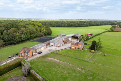
- Price
- Guide Price£2,000,000
- Size
- 33.83 acres
Gossett Lane, Brandon, Coventry, Brandon and Bretford, Warwickshire CV8 England
Added on 08/10/2026Equestrian property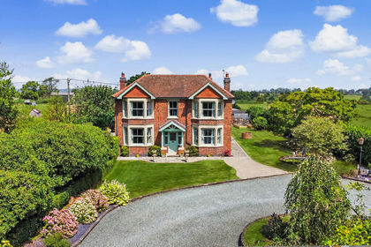
- Price
- Guide Price£1,250,000
- Size
- 12 acres
London Road, Stretton On Dunsmore, Stretton-on-Dunsmore, Warwickshire CV23 England
Added on 21/07/2026House with Land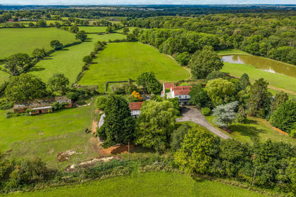
- Price
- Offers in Excess of£1,850,000
- Size
- 20 acres
Princethorpe, Rugby, Stretton-on-Dunsmore, Warwickshire CV23 England
Added on 23/05/2026House with Land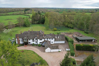
- Price
- Offers in Region of£2,500,000
- Size
- 4.25 acres
Pagets Lane, Bubbenhall, Coventry, Bubbenhall, Warwickshire CV8 England
Added on 29/01/2026Country Home
- Price
- Guide Price£2,400,000
- Size
- 152.37 acres
Braunston, Daventry, NN11, Braunston, West Northamptonshire NN11 England
Added on 08/10/2026Farm
- Price
- Guide Price£1,595,000
The Old Hall Cottage, Willoughby Waterleys, Willoughby Waterleys, Leicestershire LE8 England
Added on 01/05/2026Country Home
- Price
- Guide Price£1,200,000
- Size
- 2.54 acres
Wykin Road, Wykin, LE10, Hinckley and Bosworth, Leicestershire LE10 England
Added on 29/01/2026House with Land
- Price
- Guide Price£1,250,000
- Size
- 4 acres
Brookhill Farmhouse, Main Street, Peatling Magna, Peatling Magna, Leicestershire LE8 England
Added on 26/03/2026Farmhouse
- Price
- Guide Price£1,350,000
- Size
- 3.75 acres
Stareton, The Courtyard, CV8, Stoneleigh, Warwickshire CV8 England
Added on 26/09/2026House with Land
- Price
- Guide Price£1,450,000
- Size
- 1 acres
Berridges Lane, Husbands Bosworth, Leicestershire, Lutterworth, Leicestershire LE17 England
Added on 18/03/2026House with Land