Upwey, Weymouth, Dorset
- Land size
- 4.87 acres
- Bedrooms
- 6
- Bathrooms
- 5
Key Features
- Rare opportunity to acquire a Grade II Listed Mill House beside the River Wey, near Upwey Wishing Well
- Original Mill House dates back to the 18th century, with a striking stone mill built in 1802
- Renewable energy system currently returns power to the grid, earning around £12,000 annually
- Character-filled interiors featuring flagstone floors, original beams, and fireplaces throughout
- Ground floor includes multiple reception rooms, utility room, and walk-in larder
- First floor offers three spacious double bedrooms, all with private en-suite facilities, second floor with further 3 bedrooms
- Additional well-established, 1 bedroom holiday cottage providing a reliable supplementary income stream
- Attractive leafy location in 4.87 ac (1.97 ha) within a conservation area
Description
A Grade II Listed Mill House and original Mill on the banks of the River Wey, set in 4.87 ac (1.97 ha).
The Property - A rare opportunity to acquire a Grade II Listed Mill House, beautifully positioned in front of the Grade II* Listed original mill and set along the banks of the River Wey, just downstream from the charming Upwey Wishing Well.
The Mill house is believed to date back to the 18th century, while the striking stone mill constructed in 1802 is fed by two watercourses. The mill building is currently utilised as a store and workshop, yet still harnesses the river’s flow via a turbine system to generate electricity, returning power to the grid and producing an income of approximately £12,000 per annum. The Mill retains machinery and has potential to be re-established as a working Mill.
The accommodation is rich in character, flagstone flooring, original beams, and attractive fireplaces throughout. The ground floor offers a welcoming entrance hall with cloakroom, 2 sitting rooms, dining room, breakfast room with AGA, and a well-appointed kitchen fitted with a range of wall and base units, along with an AGA, integrated oven and hob. A practical utility room with fitted cupboards and a walk-in larder adds further convenience. To the first floor are three generously proportioned double bedrooms, each benefitting from its own en-suite facilities. The upper floor provides three further bedrooms (one with ensuite) a bathroom serves the two remaining rooms.
In addition to the main house, there is a well-established holiday cottage that provides a consistent supplementary income. The cottage comprises of a ground floor bedroom and bathroom with both a bath and shower cubicle. To the first floor is an open plan living space with fitted kitchen units, integrated appliances and a sitting area with feature fireplace. A door opens to a rear terrace which fronts the Mill race.
Outside - Externally, the grounds extend to approximately 4.87 (1.97 ha) acres and are beautifully established, comprising mature shrubs and trees, areas of woodland, lawned gardens, terraces, a detached store/workshop with WC and part of a former fish farm, creating a truly picturesque and versatile setting.
The Mill building is currently utilised as a store and workshop, yet still harnesses the river’s flow via a turbine system to generate electricity, returning power to the grid and producing an income of approximately £12,000 per annum.
Adjoining the mill is a further range of outbuildings, including a workshop, two stores, and garage. There is ample parking for several vehicles.
Situation - Upwey is a charming conservation village located near beautiful countryside in a Dorset valley, just 3 miles north of Weymouth and 4 miles south of Dorchester. The village is home to the Upwey Wishing Well and Tea Room, St. Laurence Church, two public houses, and a mainline railway station to London/Waterloo and Bristol (Temple Meads). There is also a frequent bus service on the nearby Dorchester Road.
Within approximately 1 mile, you can find a range of amenities, including a general store at Broadwey, florist, veterinary clinic, petrol station, and a sports centre at Redlands.
Both Weymouth and Dorchester town centres are easily accessible and offer a wide range of shops, as well as cultural, recreational, and further educational facilities.
The area also offers opportunities for sailing and water sports, enjoying sandy beaches, walks along the World Heritage Jurassic Coastline, and exploring the rolling countryside.
Directions - What3words///overlaps.cure.often
Services - Mains electricity, gas, water and drainage. Gas fired central heating system. Solar panels to the outbuiding installed 2022 and owned outright by the sellers.
Broadband - Superfast speed available
Mobile - There is mobile coverage in the area. Please refer to Ofcom’s website for more details. (
Council Tax Band: F (Dorset Council - )
Material Information - Mill House is Grade II Listed & The Mill is Grade II* Listed
The property is situated within a conservation area.
We understand the property may be subject to tree preservation orders.
Planning permission was granted in 2001 for conversion of the stores and outbuildings into 3 holiday cottages. Mill Cottage was constructed in 2008. Planning application reference: 01/00075/LBC
Mill Cottage is holiday let generating circa £19,000 gross per annum.
Consent was granted in 2004 for the Installation of a micro-hydro-electric power generation equipment in an under ground pit adjacent to the mill building. The works to install were undertaken between 2006 and 2008. Planning application reference: 04/00727/FUL. Our client has informed us that power is returned to the grid and produces an income of approximately £12,000 per annum.
Flood risk:
The property sits within a Low-lying area fronting and abutting the river and is designated in a high risk flood and groundwater flood alert area. Our clients have informed us that during their ownership they have not experienced any flooding.
Right of Way:
Our clients have informed us of a right of way through the Rookery (woodland to rear), which they have stated has not been used during their ownership of 25 years.
Photos taken May 2026.
Map Location
Property details
- Tenure
- Freehold
- Council Tax Band
- F
- Date Posted
- 2026-05-22
Market Value Analysis
Compared with 1,628 Homes with Land listings in South West England (1+ acres).
Energy Performance Certificate
Energy Efficiency Rating
Based on UK Energy Performance Certificate standards (EU Directive 2002/91/EC)
Running costs are one side. Planning activity, flood history and ground risks for this location are in the full report.
Utilities & Restrictions
Utilities
- Electricity
- Mains
- Water
- Mains
- Heating
- Gas Central Heating
- Broadband
- Ask Agent
- Sewerage
- Mains
Rights & Restrictions
- Public Rights of Way
- Ask Agent
- Private Rights of Way
- Ask Agent
- Listed Property
- Yes
- Restrictions
- Yes
Listed status, conservation areas and planning constraints for this location are in the full report.
Property Features
- Accessibility
- Ask Agent
- Parking
- Parking Available
- Garden
- Garden
Beyond the particulars: planning activity, flood history, heritage and ground risks, checked for this exact spot.
Connectivity
Broadband
Fastest speed available at this postcode
80 Mbps
Superfast · available to 86% of premises
Suitable for
- HD streaming
- Video calls
- Web & social
Mobile signal
Predicted 4G and 5G signal; indoor signal depends on building materials.
Ofcom Connected Nations postcode-level predictions. Speeds and signal are modelled, not measured, and vary between addresses and providers.
Signal is the easy part. Planning activity, flood history and protected designations here are in the full report.
Nearest Schools
Primary
- St Nicholas and St Laurence Church of England Primary School1.5 milesOfsted: Good *
- Ages
- 4 to 11
- Pupils
- 213
- Type
- Academy converter
- Faith
- Church of England
- Bincombe Valley Primary School1.9 milesOfsted report card · Feb 2026
- Ages
- 2 to 11
- Pupils
- 291
- Type
- Community school
- Radipole Primary School2.3 milesNo Ofsted rating
- Ages
- 4 to 11
- Pupils
- 437
- Type
- Community school
- St Andrew's Church of England Primary School2.4 milesOfsted: Good
- Ages
- 3 to 11
- Pupils
- 225
- Type
- Academy sponsor led
- Faith
- Church of England
- Southill Primary School2.6 milesOfsted: Good
- Ages
- 4 to 11
- Pupils
- 212
- Type
- Community school
Secondary
- Wey Valley Academy1.6 milesOfsted: Good
- Ages
- 11 to 16
- Pupils
- 994
- Type
- Academy converter
- The Thomas Hardye School3.2 milesOfsted: Good *
- Ages
- 13 to 18
- Pupils
- 2,014
- Type
- Academy converter
- Dorchester Middle School3.3 milesOfsted report card · Jun 2026
- Ages
- 9 to 13
- Pupils
- 527
- Type
- Academy converter
- St Osmund's Church of England Middle School3.5 milesOfsted: Good
- Ages
- 9 to 13
- Pupils
- 714
- Type
- Academy converter
- Faith
- Church of England
- Budmouth Academy Weymouth3.7 milesOfsted: Requires improvement
- Ages
- 11 to 18
- Pupils
- 1,466
- Type
- Academy sponsor led
* Latest graded judgement covers quality of education only; no overall grade was issued under the 2024-25 inspection framework.
Distances are straight-line from the advertised location. Source: the national school registers (DfE, Welsh Government, Scottish Government) and Ofsted.
Schools are just the start: sold prices nearby, planning activity and any flood history are in the full report.
Amenities
Supermarket
GP surgery
Pharmacy
Hospital
Green space
Walking trail
Straight-line distances from the advertised location. Sources: NHS records, Geolytix supermarket locations, OS Open Greenspace and the national trails registers.
The area stacks up? Now check the location itself: planning nearby, protected designations and past flooding.
Getting Around
Nearest station
Nearest bus stop
Typical drive times
Straight-line distances from the advertised location; drive times are typical free-flow times over OpenStreetMap road data, so allow more at peak. Public transport locations from DfT NaPTAN.
Easy to reach matters. So do planning activity, flood history and ground risks: all in the full report.
Flood Risk
Environment Agency open data, checked around the advertised map pin for the listed acreage. Long-term risk counts flood defences; the planning map's flood zones do not. Provided by LandSale, not the listing agent, and not part of the agent's particulars. Risk varies across a holding, so verify before committing.
Rivers and the sea
Not at the pin: mapped about 10 metres away.
Planning map: Flood Zone 3.
Surface water
Not at the pin: mapped about 20 metres away.
These bandings are the summary. Where this location sits on the flood maps, plus planning activity, heritage and ground risks, is in the full report.
Important notice: Information, maps and tags on this page are drawn from the advertising agent's marketing materials or generated automatically. LandSale has not verified them. Relying on these details is at your own risk, always carry out independent checks before committing to a purchase.
LandSale full disclaimer
Marketing information only - not formal particulars. The details on this website are provided for general guidance and do not constitute an offer or contract. Neither LandSale nor the advertising estate/land agent accepts responsibility for any inaccuracy.
1. Source of information
- Listing content: Core description, asking price, tenure, measurements, photographs and planning history originate from the marketing materials of the advertising estate or land agent. LandSale does not author this content and cannot guarantee its accuracy.
- Automated tags & categorisation: Property type, land-use class, acreage bands and similar labels may be applied by machine-learning models. They are intended as a helpful guide only and may not reflect the property's legal status or permitted use.
- Third-party & enriched data layers: Maps, boundary outlines, planning designations, soil reports, broadband coverage and other environmental or location-based insights are licensed from external suppliers. Such data are supplied “as is", may be incomplete or out of date and are subject to change without notice.
2. Verification required
Prospective purchasers must verify critical matters, including but not limited to planning permission, title boundaries, public rights of way, environmental constraints, acreage, services, access and VAT status, through their own inspections, specialist surveys, legal advisers and the selling agent before relying on the information or entering into any contract.
3. No warranty or liability
LandSale gives no warranty, express or implied, as to the accuracy, completeness or fitness for any particular purpose of the information displayed. LandSale shall not be liable for any loss, damage, cost or expense arising directly or indirectly from any use of or reliance on such information, save where liability may not be excluded by law.
4. Updates & feedback
If you believe any detail on this listing is inaccurate, please let us know. We will investigate and, where appropriate, update the listing or notify the agent.
© LandSale | Version 1.3 - August 2026
Listing agent
Symonds & Sampson, Poundbury, Weymouth & South Dorset
Archpoint House, 7 Queen Mother Square Poundbury, Dorchester, DT1 3BY
Contact Symonds & Sampson, Poundbury, Weymouth & South Dorset
Archpoint House, 7 Queen Mother Square Poundbury, Dorchester, DT1 3BY
View agent profileSimilar properties for sale
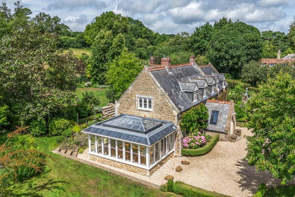
- Price
- Guide Price£1,325,000
- Size
- 4.56 acres
Added on 13/06/2026Country Home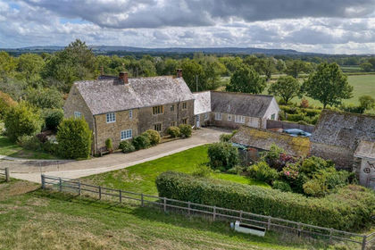
- Price
- Guide Price£1,100,000
- Size
- 4 acres
Kings Stag, Sturminster Newton, Lydlinch, Dorset DT10 England
Added on 05/10/2026Farmhouse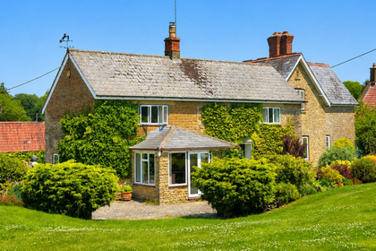
- Price
- Guide Price£999,999
- Size
- 9.15 acres
South Perrott, Beaminster, South Perrott, Dorset DT8 England
Added on 04/07/2026Cottage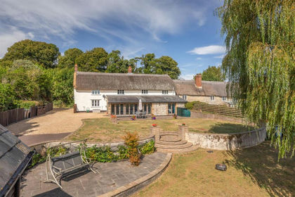
- Price
- Guide Price£999,950
- Size
- 3.72 acres
Seaborough, Beaminster, Dorset, Seaborough, Dorset DT8 England
Added on 21/08/2026House with Land
- Price
- Guide Price£995,000
- Size
- 5 acres
Iwerne Minster, Blandford Forum, Iwerne Minster, Dorset DT11 England
Added on 13/06/2026Small Farm
- Price
- Guide Price£1,335,000
- Size
- 67.15 acres
Gannetts, Todber, Sturminster Newton, Marnhull, Dorset DT10 England
Added on 30/09/2026Farm
- Price
- Guide Price£925,000
- Size
- 30.12 acres
Gannetts, Todber, Sturminster Newton, Marnhull, Dorset DT10 England
Added on 30/09/2026Small Farm
- Price
- Guide Price£1,200,000
- Size
- 4.2 acres
Hull Lane, Charlton Horethorne, Sherborne, Charlton Horethorne, Somerset DT9 England
Added on 31/07/2026House with Land
- Price
- Guide Price£1,050,000
- Size
- 6.3 acres
Shepherd's Hill, Buckhorn Weston, Gillingham, SP8, Gillingham, Dorset SP8 England
Added on 30/09/2026Smallholding
- Price
- Guide Price£1,375,000
- Size
- 17.28 acres
Added on 14/08/2026Smallholding