Iwerne Minster, Blandford Forum
- Land size
- 5 acres
- Bedrooms
- 5
- Bathrooms
- 2
Key Features
- Individually designed single storey dwelling extending to almost 2,000 sq.ft
- Well-presented and neutrally decorated interiors
- Potential for a range of alternative commercial, recreational or development uses
- Woodland, lawned gardens and extensive parking area
- Tucked away in a quiet spot in one of Dorset’s most desirable villages
- Available in 2 lots
Description
A well-presented detached five bedroom bungalow in 5 acres of grounds and ponds located in a peaceful spot in this popular village. Available in 2 lots.
Introduction - Iwerne Springs is set in a beautifully tucked away position in one of the most desirable villages in Dorset. It was initially created as a watercress farm in the 1960's and changed use to a trout farm in the early 1980’s and the dwelling constructed in the mid 1980's. The trout farm was managed, then subsequently purchased by the current vendors. Part of the land was sold in 2020 to develop 6 premium houses known as Talbot Courtyard.
The property is still operated as a commercial trout farm but could be suited to coarse fish, ornamental fish, aquaculture, horticulture, ornamental gardens, commercial recreation or sporting uses or simply lifestyle and residential enjoyment.
The Farmhouse - An individually designed single storey dwelling constructed of brick elevations under a pitched tiled roof which has undergone several alterations and upgrades by the current vendors and now provides very practical and well-presented in neutral colours, family accommodation. The highlights are:
-a large triple aspect main sitting room with a fireplace and French doors onto a lawn overlooking the main lake,
-the main bedroom also has French doors opening on to a private south west facing decked terrace,
-the adjoining bedroom 4 is currently used as a dressing room,
-a dining room with modern Dovre pedestal multifuel burner, stone tiled floor and large open arch to:
-a modern farmhouse style kitchen with plentiful units, a Rangemaster and breakfast bar,
-the original garage has been converted to a much more practical office, shower room and dog room.
The Grounds - The property is accessed along a shared lane which quietly weaves between the playing fields of Clayesmore School and Talbot Courtyard to the double electric gated entrance of Iwerne Springs. A gravel drive leads to the dwelling, a timber workshop and a concrete block machinery store.
It opens out to an area with a series of concrete base raceways and a polytunnel which housed a former trout hatchery and a large level parking area. Located here are two 60 ft deep boreholes with an abstraction licence for 200,000 gallons / day. Off the entrance is a timber stable and field shelter.
The Ponds - The ponds are fed naturally by the River Iwerne, a chalk stream which rises in the village and joins the River Stour at Stourpaine. The river runs along part of the southern boundary with the flow partially directed to the ponds to provide the natural flow required for trout production. The farm currently has a flow through licence for 900,000 gallons / day from the River Iwerne.
There are 9 ponds in total covering 1.53 acres, arranged in 3 sections. The largest pond is an amenity lake for the farmhouse with a pontoon in the garden and a number of willow trees surrounding the lake providing cover for birds and ducks. Near the entrance are 3 linked trout ponds, divided by concrete walls with sluice gates to control water levels. These are only approximately 4ft deep.
Forming the western section of the farm are 5 trout ponds bounded by earth bunds, with a secondary double gated access and vehicular tracks to all 5 and interconnecting culverts and sluices. Beyond the ponds is an area of woodland, wet land and shrubs which provide a wonderfully peaceful woodland path and conservation area.
The Trout Farm - The owner currently contract rears trout from 8 weeks to 8 months old for a major producer. Financial information on the business will be made available exclusively to potential purchasers if required, only after viewing.
Situation - Iwerne Minster has been voted Dorset’s best-kept village in recent years and provides local amenities including general store/sub-post office, the Talbot Hotel public house and Clayesmore independent school and its sports centre which is open to the general public.
The village lies in picturesque open North Dorset countryside on the western edge of the Cranborne Chase Landscape Area and eastern edge of the Blackmore Vale. Shaftesbury and Blandford are both about 6 miles away, offering everyday retail, education and recreational facilities whilst the Jurassic coast and Bournemouth are easily within a 1 hour drive. Mainline train station at Gillingham and Bournemouth Airport at Hurn.
Directions - In the centre of the village turn off the main road opposite the Talbot Hotel into the unmarked lane.
What3words: /// food.like.dumplings
Material Information - Mains electricity, dwelling single phase, farm dual single and 3 phase.
Mains water to the house. River water and two boreholes to the farm.
Oil fired central heating and calor gas Rangemaster.
Mains drainage.
BT broadband connected. Fibre Wessex Internet nearby.
Mobile coverage is variable, see Ofcom’s website.
Council Tax Band: F
Access from the highway is shared with other users and is a public footpath.
Access to Lot 2 is limited to agricultural use only.
The dwelling has never flooded.
Map Location
Property details
- Tenure
- Freehold
- Council Tax Band
- F
- Date Posted
- 2026-06-13
Price history
| Date | Change | Price |
|---|---|---|
| 22 Aug 2026 | Reduced 9.5% (−£105,000) | £995,000 |
| Until 22 Aug 2026 | Asking price | £1,100,000 |
Market Value Analysis
Compared with 96 Farms & Smallholdings listings in South West England (5+ acres).
Energy Performance Certificate
Energy Efficiency Rating
Based on UK Energy Performance Certificate standards (EU Directive 2002/91/EC)
Running costs are one side. Planning activity, flood history and ground risks for this location are in the full report.
Utilities & Restrictions
Utilities
- Electricity
- Mains
- Water
- Mains
- Heating
- Oil Heating
- Broadband
- Fibre (FTTC)
- Sewerage
- Mains
Rights & Restrictions
- Public Rights of Way
- Ask Agent
- Private Rights of Way
- Ask Agent
- Listed Property
- Ask Agent
- Restrictions
- Yes
Listed status, conservation areas and planning constraints for this location are in the full report.
Property Features
- Accessibility
- Ask Agent
- Parking
- Garage, Driveway
- Garden
- Garden
Beyond the particulars: planning activity, flood history, heritage and ground risks, checked for this exact spot.
Connectivity
Broadband
Fastest speed available at this postcode
1 Gbps
Gigabit full fibre
Suitable for
- 4K streaming on every screen
- Full-time home working
- Online gaming & big downloads
Mobile signal
Outdoor predictions; indoor signal depends on building materials.
Ofcom Connected Nations postcode-level predictions. Speeds and signal are modelled, not measured, and vary between addresses and providers.
Signal is the easy part. Planning activity, flood history and protected designations here are in the full report.
Nearest Schools
Primary
- St Andrew's Church of England Primary School1.7 milesOfsted: Good *
- Ages
- 4 to 11
- Pupils
- 101
- Type
- Academy sponsor led
- Faith
- Church of England
- St Nicholas Church of England Primary School, Child Okeford2.3 milesOfsted report card · Mar 2026
- Ages
- 4 to 11
- Pupils
- 125
- Type
- Academy converter
- Faith
- Church of England
- Shillingstone Church of England Primary School3.1 milesOfsted: Good
- Ages
- 4 to 11
- Pupils
- 103
- Type
- Academy converter
- Faith
- Church of England
- Durweston Church of England Primary School3.5 milesOfsted report card · Feb 2026
- Ages
- 3 to 11
- Pupils
- 144
- Type
- Academy converter
- Faith
- Church of England
- Pimperne Church of England VC Primary School3.7 milesNo Ofsted rating
- Ages
- 4 to 11
- Pupils
- 183
- Type
- Academy converter
- Faith
- Church of England
Secondary
- The Blandford School4.6 milesOfsted: Good
- Ages
- 11 to 18
- Pupils
- 1,103
- Type
- Voluntary controlled school
- Sturminster Newton High School4.8 milesOfsted report card · Apr 2026
- Ages
- 11 to 18
- Pupils
- 605
- Type
- Academy converter
- Shaftesbury School5.2 milesOfsted: Good
- Ages
- 11 to 18
- Pupils
- 782
- Type
- Academy converter
- Faith
- Church of England
- Gillingham School8.3 milesOfsted: Good
- Ages
- 11 to 18
- Pupils
- 1,684
- Type
- Voluntary controlled school
- Queen Elizabeth's School12 milesOfsted: Requires improvement
- Ages
- 13 to 18
- Pupils
- 1,375
- Type
- Academy converter
- Faith
- Church of England
* Latest graded judgement covers quality of education only; no overall grade was issued under the 2024-25 inspection framework.
Distances are straight-line from the advertised location. Source: the national school registers (DfE, Welsh Government, Scottish Government) and Ofsted.
Schools are just the start: sold prices nearby, planning activity and any flood history are in the full report.
Amenities
Supermarket
GP surgery
Pharmacy
Hospital
Green space
Straight-line distances from the advertised location. Sources: NHS records, Geolytix supermarket locations, OS Open Greenspace and the national trails registers.
The area stacks up? Now check the location itself: planning nearby, protected designations and past flooding.
Getting Around
Nearest station
Nearest bus stop
Typical drive times
Straight-line distances from the advertised location; drive times are typical free-flow times over OpenStreetMap road data, so allow more at peak. Public transport locations from DfT NaPTAN.
Easy to reach matters. So do planning activity, flood history and ground risks: all in the full report.
Flood Risk
From Environment Agency flood map open data, checked around the advertised map pin and allowing for the listed acreage where known. This summary comes from LandSale, the advertising platform, not from the listing agent, and is not part of the agent's particulars. Risk can vary across a single holding, so verify anything critical through your own searches before committing.
Rivers and the sea
Surface water
Mapped within the area searched, not at the advertised map pin itself.
These bandings are the summary. Where this location sits on the flood maps, plus planning activity, heritage and ground risks, is in the full report.
Important notice: Information, maps and tags on this page are drawn from the advertising agent's marketing materials or generated automatically. LandSale has not verified them. Relying on these details is at your own risk, always carry out independent checks before committing to a purchase.
LandSale full disclaimer
Marketing information only - not formal particulars. The details on this website are provided for general guidance and do not constitute an offer or contract. Neither LandSale nor the advertising estate/land agent accepts responsibility for any inaccuracy.
1. Source of information
- Listing content: Core description, asking price, tenure, measurements, photographs and planning history originate from the marketing materials of the advertising estate or land agent. LandSale does not author this content and cannot guarantee its accuracy.
- Automated tags & categorisation: Property type, land-use class, acreage bands and similar labels may be applied by machine-learning models. They are intended as a helpful guide only and may not reflect the property's legal status or permitted use.
- Third-party & enriched data layers: Maps, boundary outlines, planning designations, soil reports, broadband coverage and other environmental or location-based insights are licensed from external suppliers. Such data are supplied “as is", may be incomplete or out of date and are subject to change without notice.
2. Verification required
Prospective purchasers must verify critical matters, including but not limited to planning permission, title boundaries, public rights of way, environmental constraints, acreage, services, access and VAT status, through their own inspections, specialist surveys, legal advisers and the selling agent before relying on the information or entering into any contract.
3. No warranty or liability
LandSale gives no warranty, express or implied, as to the accuracy, completeness or fitness for any particular purpose of the information displayed. LandSale shall not be liable for any loss, damage, cost or expense arising directly or indirectly from any use of or reliance on such information, save where liability may not be excluded by law.
4. Updates & feedback
If you believe any detail on this listing is inaccurate, please let us know. We will investigate and, where appropriate, update the listing or notify the agent.
© LandSale | Version 1.3 - August 2026
Listing agent
Symonds & Sampson, Sturminster Newton
Agriculture House, Market Place, Sturminster Newton, DT10 1AR
Contact Symonds & Sampson, Sturminster Newton
Agriculture House, Market Place, Sturminster Newton, DT10 1AR
View agent profileSimilar properties for sale
- Price
- Guide Price£875,000
- Size
- 2.82 acres
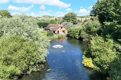
Iwerne Minster, Blandford Forum, Iwerne Minster, Dorset DT11 England
Added on 20/08/2026Small Farm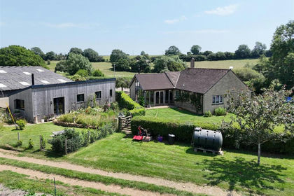
- Price
- Guide Price£1,125,000
- Size
- 13.62 acres
Added on 10/09/2026Smallholding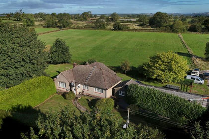
- Price
- Guide Price£925,000
- Size
- 9.93 acres
Small holding - 9.93 acres, Chilcompton, Radstock, BA3, Chilcompton, Somerset BA3 England
Added on 21/05/2026Smallholding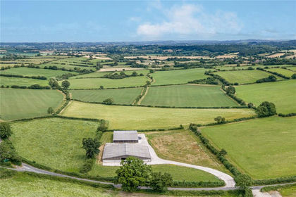
- Price
- Guide Price£1,000,000
- Size
- 68.94 acres
Added on 26/08/2026Farm
- Price
- £1,050,000
- Size
- 3 acres
Bull Hill, Pilley, Lymington, Hampshire, SO41, Boldre, Hampshire SO41 England
Added on 09/09/2026Smallholding
- Price
- Guide Price£1,095,000
- Size
- 27 acres
Cranmore, Isle of Wight, Shalfleet, Isle of Wight PO41 England
Added on 29/01/2026Country Home
- Price
- Guide Price£849,950
- Size
- 2.93 acres
Cranmore, Isle of Wight, Shalfleet, Isle of Wight PO41 England
Added on 29/01/2026Country Home