Waytown, Bridport
- Land size
- 4.56 acres
- Bedrooms
- 4
- Bathrooms
- 2
Key Features
- Detached
- Unlisted character property
- 4 bedrooms
- 4 reception rooms
- Orangery
- Oak framed double carport
- Gardens and paddock of 4.56 acres (1.85ha)
- Extensive country views
- Rural location
Description
An extended four bedroom converted chapel set within its own gardens and with a paddock in all extending to 4.56 acres (1.85ha) in a rural setting.
The Property - Set in 4.56 acres (1.85ha) in an idyllic rural location, The Manse is an impressive English Gothic style property with stone elevations under a slate roof which has been sympathetically extended and enhanced to create a beautiful home. Historically it was a chapel, built in 1906 and there is still some evidence remaining of its past.
Internally this perfectly proportioned home exhibits many fine characteristics including vaulted ceilings and arched windows. These have been combined in perfect symmetry with contemporary enhancements including a stunning orangery.
Externally the gardens wrap around the property with rich beds of colour and produce and then beyond is an orchard and a paddock.
Accommodation - An arched solid wood entrance door opens into a vaulted lobby with Velux windows and bench seating. A door then leads on into the main hall with original parquet flooring and stairs rising up. Moving forward into the breakfast room and kitchen, comprising of a range of bespoke hand built wall and floor units by Dorset Kitchens and these units extend into the summer kitchen/utility. The central feature of the kitchen is an electric AGA. Integrated items include a fridge and freezer, combination oven and electric hob. The summer kitchen also has space for a washing machine and Belfast sink. There is a lobby which links the two rooms with a door opening into the garden and another into a cloakroom. Returning to the kitchen, French doors look out over the rear terrace with garden views. The adjoining breakfast room offers comfortable bespoke seating. Beyond is the spacious family sitting room. This bright and relaxing space has a wood burner as its central feature. The orangery adjoins the sitting room, offering a contemporary extension with a classic lantern overhead and windows on three side. French doors open out to the rear garden, perfect for that indoor, outdoor feel.
The formal sitting room comes off the kitchen. Attractive features found in this room include a solid wood floor, French doors out to the garden terrace and has two stone arched windows framing the fireplace with LPG wood burner set within. It is picture perfect. From this room a door opens into the study, finished with bespoke shelving across one wall for storage and dual aspect windows overlooking the surrounding study garden.
Rising up to the galleried landing you will find hand-built storage set across one wall as well as a small library and study area. The elegant principal bedroom again has bespoke storage and is beautifully light with an adjoining en-suite, which comprises of a shower and separate bath with floating basin and vanity unit. There are three other bedrooms, a twin and two good size doubles. The main guest bedroom has a wonderful vaulted ceiling. The family shower room consists of a glass shower cubicle, floating basin and toilet.
Please see floorplan for accommodation and measurements.
Outside - The garden is a delightful combination of classic formal gardens comprising of deep flower borders complimented by ornamental shrubs and trees with paths meandering through taking you to a productive garden in raised beds with adjoining fruit orchard. The study garden is a mixture of flowers and produce. A west facing terrace leads off the rear of the property, perfect for evening entertaining with a boules court set within the formal lawn.
The land consists of a paddock which wraps around two sides of the garden where there is the start of an arboretum with three stands of birches. The gardens and land amount to 4.56 acres (1.85ha).
Situation - The property is surrounded by the rolling West Dorset countryside, designated a National Landscape (Area of Outstanding Natural Beauty). Close by is Waytown, a small hamlet where the ‘Hare and Hounds’ public house can be found. A short distance further is the larger village of Netherbury which is in a designated conservation area comprising mainly period stone houses and cottages for which the area is well known. It has a church and village hall . Beaminster to the north offers many facilities including a good range of shops, churches, post office, library, two schools, health centres, other professional services and many social and sporting facilities. The vibrant market town of Bridport lies approximately 4 miles to the South and is a gateway to the Jurassic World Heritage coastline at nearby West Bay. It has a variety of independent shops, supermarkets, public houses and restaurants catering for a range of tastes and excellent arts and music events. There are numerous countryside walks within direct access from the property. Main line railway stations are at Crewkerne and Dorchester.
Education - Primary schools in Salway Ash and Beaminster. Good state secondary schools at Beaminster, Bridport and Lyme Regis as well as Colyton Grammer School.
Independent schools include Perrott Hill, Sherborne, Millfield and Milton Abbey.
Services - Mains water and electricity are connected.
Sewerage treatment plant. Oil-fired boiler.
Broadband
Standard and Superfast are available for connection.
Mobile Phone coverage
There is mobile coverage in the area, please refer to
Ofcom’s website for more details.
Local Authority - Dorset Council -
Council Tax Band G.
Directions - What3words
musician.carting.buying
Material Information - Photographs taken June 2025 © Symonds & Sampson.
Map Location
Property details
- Tenure
- Freehold
- Council Tax Band
- G
- Date Posted
- 2026-06-13
Market Value Analysis
Compared with 1,727 Homes with Land listings in South West England (1+ acres).
Energy Performance Certificate
Energy Efficiency Rating
Based on UK Energy Performance Certificate standards (EU Directive 2002/91/EC)
Running costs are one side. Planning activity, flood history and ground risks for this location are in the full report.
Utilities & Restrictions
Utilities
- Electricity
- Mains
- Water
- Mains
- Heating
- Oil Heating
- Broadband
- Fibre (FTTC)
- Sewerage
- Septic Tank / Private
Rights & Restrictions
- Public Rights of Way
- Ask Agent
- Private Rights of Way
- Ask Agent
- Listed Property
- Ask Agent
- Restrictions
- Ask Agent
Listed status, conservation areas and planning constraints for this location are in the full report.
Property Features
- Accessibility
- Ask Agent
- Parking
- Covered Parking, Driveway
- Garden
- Garden
Beyond the particulars: planning activity, flood history, heritage and ground risks, checked for this exact spot.
Connectivity
Broadband
Fastest speed available at this postcode
80 Mbps
Superfast
Suitable for
- HD streaming
- Video calls
- Web & social
Mobile signal
Outdoor predictions; indoor signal depends on building materials.
Ofcom Connected Nations postcode-level predictions. Speeds and signal are modelled, not measured, and vary between addresses and providers.
Signal is the easy part. Planning activity, flood history and protected designations here are in the full report.
Nearest Schools
Primary
- Salway Ash Church of England Voluntary Aided Primary School0.9 milesOfsted: Good
- Ages
- 5 to 11
- Pupils
- 109
- Type
- Voluntary aided school
- Faith
- Church of England
- St Catherine's Roman Catholic School2.3 milesOfsted report card · Jan 2026
- Ages
- 5 to 11
- Pupils
- 100
- Type
- Academy converter
- Faith
- Roman Catholic
- Beaminster St Mary's Academy2.5 milesOfsted: Good
- Ages
- 4 to 11
- Pupils
- 140
- Type
- Academy sponsor led
- Faith
- Church of England
- Loders CofE Primary Academy2.6 milesNo Ofsted rating
- Ages
- 2 to 11
- Pupils
- 72
- Type
- Academy sponsor led
- Faith
- Church of England
- Bridport Primary School2.7 milesOfsted: Good
- Ages
- 4 to 11
- Pupils
- 267
- Type
- Academy converter
Secondary
- The Sir John Colfox Academy2 milesNo Ofsted rating
- Ages
- 11 to 18
- Pupils
- 756
- Type
- Academy converter
- Beaminster School2.8 milesOfsted: Good
- Ages
- 11 to 18
- Pupils
- 673
- Type
- Voluntary controlled school
- Faith
- Christian
- Wadham School7.9 milesOfsted: Requires improvement *
- Ages
- 11 to 16
- Pupils
- 763
- Type
- Voluntary controlled school
- Faith
- Church of England
- The Woodroffe School9.1 milesOfsted: Good
- Ages
- 11 to 18
- Pupils
- 886
- Type
- Foundation school
- Axe Valley Academy11 milesOfsted: Good
- Ages
- 11 to 16
- Pupils
- 741
- Type
- Academy sponsor led
* Latest graded judgement covers quality of education only; no overall grade was issued under the 2024-25 inspection framework.
Distances are straight-line from the advertised location. Source: the national school registers (DfE, Welsh Government, Scottish Government) and Ofsted.
Schools are just the start: sold prices nearby, planning activity and any flood history are in the full report.
Amenities
Supermarket
GP surgery
Pharmacy
Hospital
Straight-line distances from the advertised location. Sources: NHS records, Geolytix supermarket locations, OS Open Greenspace and the national trails registers.
The area stacks up? Now check the location itself: planning nearby, protected designations and past flooding.
Getting Around
Nearest station
Nearest bus stop
Typical drive times
Straight-line distances from the advertised location; drive times are typical free-flow times over OpenStreetMap road data, so allow more at peak. Public transport locations from DfT NaPTAN.
Easy to reach matters. So do planning activity, flood history and ground risks: all in the full report.
Flood Risk
From Environment Agency flood map open data, checked around the advertised map pin and allowing for the listed acreage where known. This summary comes from LandSale, the advertising platform, not from the listing agent, and is not part of the agent's particulars. Risk can vary across a single holding, so verify anything critical through your own searches before committing.
Rivers and the sea
Surface water
These bandings are the summary. Where this location sits on the flood maps, plus planning activity, heritage and ground risks, is in the full report.
Important notice: Information, maps and tags on this page are drawn from the advertising agent's marketing materials or generated automatically. LandSale has not verified them. Relying on these details is at your own risk, always carry out independent checks before committing to a purchase.
LandSale full disclaimer
Marketing information only - not formal particulars. The details on this website are provided for general guidance and do not constitute an offer or contract. Neither LandSale nor the advertising estate/land agent accepts responsibility for any inaccuracy.
1. Source of information
- Listing content: Core description, asking price, tenure, measurements, photographs and planning history originate from the marketing materials of the advertising estate or land agent. LandSale does not author this content and cannot guarantee its accuracy.
- Automated tags & categorisation: Property type, land-use class, acreage bands and similar labels may be applied by machine-learning models. They are intended as a helpful guide only and may not reflect the property's legal status or permitted use.
- Third-party & enriched data layers: Maps, boundary outlines, planning designations, soil reports, broadband coverage and other environmental or location-based insights are licensed from external suppliers. Such data are supplied “as is", may be incomplete or out of date and are subject to change without notice.
2. Verification required
Prospective purchasers must verify critical matters, including but not limited to planning permission, title boundaries, public rights of way, environmental constraints, acreage, services, access and VAT status, through their own inspections, specialist surveys, legal advisers and the selling agent before relying on the information or entering into any contract.
3. No warranty or liability
LandSale gives no warranty, express or implied, as to the accuracy, completeness or fitness for any particular purpose of the information displayed. LandSale shall not be liable for any loss, damage, cost or expense arising directly or indirectly from any use of or reliance on such information, save where liability may not be excluded by law.
4. Updates & feedback
If you believe any detail on this listing is inaccurate, please let us know. We will investigate and, where appropriate, update the listing or notify the agent.
© LandSale | Version 1.3 - August 2026
Listing agent
Symonds & Sampson, Beaminster
36 Hogshill Street, Beaminster, DT8 3AA
Similar properties for sale
- Price
- Guide Price£999,999
- Size
- 9.15 acres
South Perrott, Beaminster, South Perrott, Dorset DT8 England
Added on 04/07/2026Cottage
- Price
- Guide Price£999,950
- Size
- 3.72 acres
Seaborough, Beaminster, Dorset, Seaborough, Dorset DT8 England
Added on 21/08/2026House with Land
- Price
- Guide Price£1,350,000
- Size
- 4.33 acres
Chaffcombe, Chard, Somerset, TA20, Chaffcombe, Somerset TA20 England
Added on 25/06/2026Country Home
- Price
- Guide Price£1,595,000
- Size
- 2 acres
Water Street, Martock, Somerset, TA12, Martock, Somerset TA12 England
Added on 16/04/2026House with Land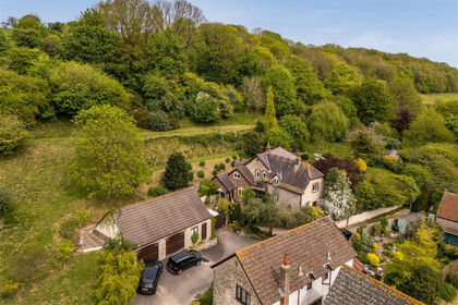
- Price
- Guide Price£995,000
- Size
- 3.27 acres
Added on 02/07/2026Country Home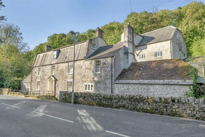
- Price
- Guide Price£1,150,000
- Size
- 4.87 acres
Added on 22/05/2026Country Home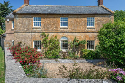
- Price
- Guide Price£1,200,000
- Size
- 4.2 acres
Hull Lane, Charlton Horethorne, Sherborne, Charlton Horethorne, Somerset DT9 England
Added on 31/07/2026House with Land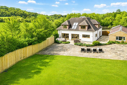
- Price
- Guide Price£1,150,000
- Size
- 2 acres
Littleton, near Street & Somerton, Compton Dundon, Somerset TA11 England
Added on 04/09/2026Country Home
- Price
- Guide Price£1,250,000
- Size
- 3.6 acres
Gosling Street, Barton St. David, Barton St. David, Somerset TA11 England
Added on 01/08/2026Barn Conversion
- Price
- Offers in Region of£1,100,000
- Size
- 4.4 acres
Hadspen, Castle Cary, Somerset, BA7, Pitcombe, Somerset BA7 England
Added on 30/04/2026Country Home