Lot 2, Parsonage Farm, Kyre, Tenbury Wells, Worcestershire
- Land size
- 3.3 acres
Key Features
- Approximately 238 Acres (96Ha) of Arable Land
- Sought-After Location in Well-Established Agricultural Area
- A Courtyard of Buildings Ideal for Agricultural or Commercial Use Set in 3.30 Acres (1.33Ha)
- Variety of Crops
- Mostly Well-Drained
- Available as a Whole or in Five Lots
Description
Situation: Parsonage Farm is nestled in the Worcestershire countryside enjoying an attractive rural setting with generally good road access in a well-established agricultural area. Tenbury Wells, Bromyard, Leominster, Malvern and Ludlow are all within easy reach benefitting from independent shops and cafes, primary and secondary schools, golf courses and sports centres. There is the Three Counties Show Ground at Malvern and Ludlow is also famed for its restaurants, independent shops and festivals. Both Worcester and Birmingham are extremely accessible and provide extensive social, retail and leisure facilities.
The Cathedral city of Worcester has County Cricket within the setting of Worcester Cathedral and Horse Racing on the banks of the River Severn. Notable schools are Tenbury Wells, King Edward’s and Kings School in Worcester, and Moor Park and the Malvern Colleges. Commuter links include Worcester train stations which have direct rail services to Birmingham for onward direct rail connections to London. The M5 is approximately 21 miles away and Birmingham airport can be reached in just over an hour.
Parsonage Farm amounts to four lots of arable land of approximately 238 Acres (96Ha) and a courtyard of buildings set in a yard of 3.30 Acres (1.33 Ha). The land is relatively flat and has been in arable rotation and can be readily cultivated.
Lot 1: A Courtyard of Agricultural Buildings including Grain Store, Barn, Workshop and Yard set in Circa 3.30 Acres (1.33 Ha).
Lot 2: Arable Land totalling 25.11 Acres (10.16 Ha) Direct Access onto Country Lane.
Lot 3: Arable Land totalling 22.36 Acres (9.05 Ha) Direct Access onto Country Lane.
Lot 4: Arable Land totalling 134.31 Acres (54.36 Ha) Comprising of Two Parcels of Grade 1 and 2 Arable Land, Accessed from the Main Road up A Privately Owned Track.
Lot 5: Arable Land totalling 56.44 Acres (22.84ha) Comprising of Two Parcels of Grade 2 Arable Land, Accessed from a Privately Owned Track with a Right of Access.
The overall package is a rare opportunity to acquire a good block of arable land with some buildings in a thriving agricultural area.
General Information
Please refer to the location plan. Postcodes: Lots 1-4 WR15 8RW | Lot 5 WR15 8RL.
Please Note: The property is being managed by Vendors / Executors who may not have personal knowledge of the running of property.
Please Note: The purchasers of lots 2-5 will be given first refusal to purchase Lot 1.
Planning: Any future residential or commercial planning permission for development purposes is subject to a restrictive covenant. This excludes agricultural or equestrian buildings. Please speak to the Selling Agents for further information.
Please Note: Viewing strictly by appointment only. Lot 5 has Tractor access only. Please park at bottom of track and access on foot.
Stewardship Scheme: There is a Stewardship Agreement. Further details are available from the Selling Agents.
Basic Payment Scheme: Entitlements: Subject to Rural Payment Agency regulations.
NVZ: The majority of the land is within an NVZ area.
Sporting and Mineral Rights: We understand the mineral and sporting rights are included on all five lots.
Tenure and Possession: There is a Farm Business Tenancy in place for all of the arable land until September 2026. All Lots are being sold with Vacant Possession. The Vendors / Executors reserve the right to delay completion on Lot 1 for the removal and relocation of equipment if required.
Public Rights of Way: Public footpaths pass through Lots 1 and 4.
Access and Third Party Rights:
Lot 1 - Roadside
Lot 2 - Roadside
Lot 3 - Roadside
Lot 4 - Track in ownership from roadside
Lot 5 - Right of access up track at the end of Vine Lane
Local Authority: Malvern Council
Boundaries, Hedges and Fences: The purchaser(s) shall be deemed to have full knowledge of the boundaries and neither the vendors nor the Agents will be responsible for defining ownership of the boundaries, hedges or fences. All boundaries are deemed to be the responsibility of the purchaser unless expressly stated otherwise. All boundaries are the responsibility of the purchaser.
Land Grade:
Lot 1: Mix of Grade 2 and 3
Lot 2: Grade 1
Lot 3: Grade 2
Lot 4: Mix of Grade 1 and 2
Lot 5: Grade 2
Services:
Lot 1: Mains water on site & BT Line
Lot 2 & 3: Mains water in lane
Lot 4 & 5: Unknown
Flood Risk: Surface water, rivers and sea: Very Low Risk.
Plans, Areas and Schedules: Numbers listed in the lot plan are Ordnance Survey numbers, not Rural Land Registry numbers. These are based on the Ordnance Survey and are for reference only. They have been checked by the Vendors’ Agents and the Purchaser(s) shall be deemed to have satisfied themselves as to the description and acreage of the land. Any errors or misstatements shall not annul a sale or entitle any party to compensation in respect thereof.
Wayleaves, Easements and Rights of Way: Lots 1 and 4 have Wayleaves with national Grid. The property will be sold and with the benefit of all wayleaves, easements and rights of way whether mentioned in these particulars or not.
Health & Safety Notice: Prospective Purchasers should take all necessary care when making an inspection including wearing suitable clothing. Viewings are taken solely at the risk of those who view and neither the Agents nor the owners of the property take responsibility for any injury however caused.
Directions: From Tenbury Wells head south on B4214 sign posted Bromyard and proceed for approximately 4 miles. For Lot 5 turn right onto Vine Line and continue to the end of the lane until Honeycombe Farm. At Honeycombe Farm take the right hand track, park and continue on foot up the track to the land. For Lot 4 Continue along the B214 for approximately 1 mile and the track is on the right hand side indicated by a Balfours sale board. For Lots 1, 2 and 3 continue another 0.5 mile and take the turning on the right to Kyre Church, Bockleton and Kyre Park Garden. Lots 2 and 3 are on the left hand side of the lane as indicated by the sale plan with lot 1 approximately 500m on the right hand side on the bend.
What3Words: armrests.skip.vegans
Map Location
Property details
- Tenure
- Freehold
- Council Tax Band
- TBC
- Date Posted
- 2026-05-16
Market Value Analysis
Compared with 75 Farms & Smallholdings listings in West Midlands (1+ acres).
Utilities & Restrictions
Utilities
- Electricity
- Ask Agent
- Water
- Ask Agent
- Heating
- Ask Agent
- Broadband
- Ask Agent
- Sewerage
- Ask Agent
Rights & Restrictions
- Public Rights of Way
- Ask Agent
- Private Rights of Way
- Ask Agent
- Listed Property
- Ask Agent
- Restrictions
- Ask Agent
Listed status, conservation areas and planning constraints for this location are in the full report.
Property Features
- Accessibility
- Ask Agent
- Parking
- Ask Agent
- Garden
- Garden
Beyond the particulars: planning activity, flood history, heritage and ground risks, checked for this exact spot.
Connectivity
Broadband
Fastest speed available at this postcode
1.8 Gbps
Gigabit full fibre
Suitable for
- 4K streaming on every screen
- Full-time home working
- Online gaming & big downloads
Fixed wireless access may also be an option here.
Mobile signal
Predicted 4G and 5G signal; indoor signal depends on building materials.
Ofcom Connected Nations postcode-level predictions. Speeds and signal are modelled, not measured, and vary between addresses and providers.
Signal is the easy part. Planning activity, flood history and protected designations here are in the full report.
Nearest Schools
Primary
- Tenbury CofE Primary School3.4 milesOfsted: Good
- Ages
- 2 to 11
- Pupils
- 224
- Type
- Academy converter
- Faith
- Church of England
- Burford CofE Primary School3.8 milesOfsted report card · Jun 2026
- Ages
- 5 to 11
- Pupils
- 141
- Type
- Academy converter
- Faith
- Church of England
- Bredenbury Primary School4.5 milesOfsted: Good *
- Ages
- 4 to 11
- Pupils
- 51
- Type
- Academy sponsor led
- Lindridge St Lawrence CE Primary School4.7 milesOfsted: Good
- Ages
- 2 to 11
- Pupils
- 70
- Type
- Voluntary aided school
- Faith
- Church of England
- St Peter's Primary School5.5 milesNo Ofsted rating
- Ages
- 3 to 11
- Pupils
- 201
- Type
- Academy converter
Secondary
- Tenbury High Ormiston Academy3.3 milesOfsted: Good
- Ages
- 11 to 16
- Pupils
- 453
- Type
- Academy sponsor led
- Queen Elizabeth High School5.9 milesNo Ofsted rating
- Ages
- 11 to 16
- Pupils
- 421
- Type
- Academy converter
- The Lacon Childe School8.3 milesOfsted: Requires improvement
- Ages
- 11 to 16
- Pupils
- 563
- Type
- Academy converter
- The Chantry School8.4 milesOfsted: Good
- Ages
- 11 to 16
- Pupils
- 881
- Type
- Academy converter
- Earl Mortimer College8.5 milesOfsted: Good
- Ages
- 11 to 16
- Pupils
- 502
- Type
- Community school
* Latest graded judgement covers quality of education only; no overall grade was issued under the 2024-25 inspection framework.
Distances are straight-line from the advertised location. Source: the national school registers (DfE, Welsh Government, Scottish Government) and Ofsted.
Schools are just the start: sold prices nearby, planning activity and any flood history are in the full report.
Amenities
Supermarket
GP surgery
Pharmacy
Hospital
Straight-line distances from the advertised location. Sources: NHS records, Geolytix supermarket locations, OS Open Greenspace and the national trails registers.
The area stacks up? Now check the location itself: planning nearby, protected designations and past flooding.
Getting Around
Nearest station
Nearest bus stop
Typical drive times
Straight-line distances from the advertised location; drive times are typical free-flow times over OpenStreetMap road data, so allow more at peak. Public transport locations from DfT NaPTAN.
Easy to reach matters. So do planning activity, flood history and ground risks: all in the full report.
Flood Risk
Environment Agency open data, checked around the advertised map pin for the listed acreage. Long-term risk counts flood defences; the planning map's flood zones do not. The map pin for this listing is approximate, so these readings describe the surrounding area. Provided by LandSale, not the listing agent, and not part of the agent's particulars. Risk varies across a holding, so verify before committing.
Rivers and the sea
Planning map: Flood Zone 1.
Surface water
Not at the pin: mapped about 40 metres away.
These bandings are the summary. Where this location sits on the flood maps, plus planning activity, heritage and ground risks, is in the full report.
Important notice: Information, maps and tags on this page are drawn from the advertising agent's marketing materials or generated automatically. LandSale has not verified them. Relying on these details is at your own risk, always carry out independent checks before committing to a purchase.
LandSale full disclaimer
Marketing information only - not formal particulars. The details on this website are provided for general guidance and do not constitute an offer or contract. Neither LandSale nor the advertising estate/land agent accepts responsibility for any inaccuracy.
1. Source of information
- Listing content: Core description, asking price, tenure, measurements, photographs and planning history originate from the marketing materials of the advertising estate or land agent. LandSale does not author this content and cannot guarantee its accuracy.
- Automated tags & categorisation: Property type, land-use class, acreage bands and similar labels may be applied by machine-learning models. They are intended as a helpful guide only and may not reflect the property's legal status or permitted use.
- Third-party & enriched data layers: Maps, boundary outlines, planning designations, soil reports, broadband coverage and other environmental or location-based insights are licensed from external suppliers. Such data are supplied “as is", may be incomplete or out of date and are subject to change without notice.
2. Verification required
Prospective purchasers must verify critical matters, including but not limited to planning permission, title boundaries, public rights of way, environmental constraints, acreage, services, access and VAT status, through their own inspections, specialist surveys, legal advisers and the selling agent before relying on the information or entering into any contract.
3. No warranty or liability
LandSale gives no warranty, express or implied, as to the accuracy, completeness or fitness for any particular purpose of the information displayed. LandSale shall not be liable for any loss, damage, cost or expense arising directly or indirectly from any use of or reliance on such information, save where liability may not be excluded by law.
4. Updates & feedback
If you believe any detail on this listing is inaccurate, please let us know. We will investigate and, where appropriate, update the listing or notify the agent.
© LandSale | Version 1.3 - August 2026
Listing agent
Balfours LLP, Ludlow
1-2 King Street Ludlow SY8 1AQ
Similar properties for sale
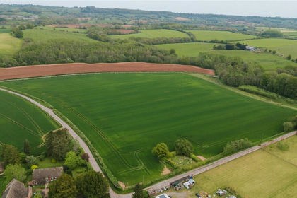
- Price
- £310,000
- Size
- 3.3 acres
Lot 3, Parsonage Farm, Kyre, Tenbury Wells, Worcestershire, Kyre, Worcestershire WR15 England
Added on 16/05/2026Farm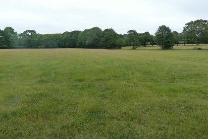
- Price
- Guide Price£400,000
- Size
- 50 acres
Ditton Priors, Bridgnorth, Shropshire, Ditton Priors, Shropshire WV16 England
Added on 08/08/2026Pasture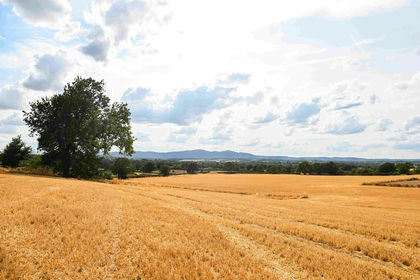
- Price
- Guide Price£395,000
- Size
- 33.03 acres
33.03 Acres Arable Land, Hatfield, Worcester, Norton Juxta Kempsey, Worcestershire WR5 England
Added on 17/08/2026Arable Land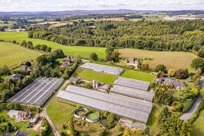
- Price
- Guide Price£300,000
- Size
- 3.16 acres
Added on 25/05/2026Agricultural Land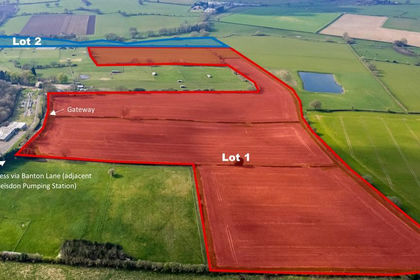
- Price
- Guide Price£400,000
- Size
- 42.7 acres
Ebstree Road, Trysull, Wolverhampton, WV5, Trysull and Seisdon, Staffordshire WV5 England
Added on 04/04/2026Arable Land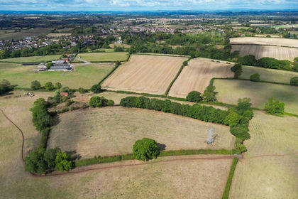
- Price
- Guide Price£325,000
- Size
- 22.7 acres
Inkberrow, Worcestershire, Inkberrow, Worcestershire WR7 England
Added on 24/09/2026Agricultural Land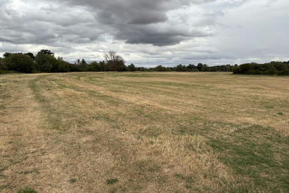
- Price
- Guide Price£395,000
- Size
- 56 acres
Lot 1 Land at Apperley Court, Apperley, Gloucester, GL19, Deerhurst, Gloucestershire GL19 England
Added on 26/08/2026Agricultural Land
- Price
- £300,000
- Size
- 12.15 acres
Phoenix Meadows, Kerne Bridge, Herefordshire, Walford, Herefordshire, County of HR9 England
Added on 27/08/2026Undeveloped Land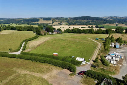
- Price
- Offers in Excess of£400,000
- Size
- 3.89 acres
Gypsy Castle Lane, Hay-on-Wye, Hereford, Hay, Powys HR3 Wales
Added on 29/01/2026Vacant Land
- Price
- Offers in Region of£275,000
- Size
- 41.92 acres
Land at Meadowtown, Shrewsbury, Worthen with Shelve, Shropshire SY5 England
Added on 29/01/2026Grazing Land