Historic Mill in Burnham Overy Town
- Land size
- 1.74 acres
- Bedrooms
- 4
- Bathrooms
- 3
Key Features
- Grade II Listed Property
- Kitchen Family Room
- Dining Room
- First Floor Sitting Room with Balcony
- Principal Bedroom and Bathroom
- Two Further Double Bedrooms
- Two Further Bathrooms
- Fixed Ladder Access to Three Further Floors and the Capstan Balcony with Views to the Sea
- Double Garage with Workshop and Storage Above
- Formal and Informal Gardens in Approx 1.74 Acres (STMS)
Description
Discreetly accessed along a private, tree-lined driveway, just a short walk from the vibrant centre of Burnham Market, Union Mills offers a rare opportunity to own a truly distinctive lifestyle home, steeped in history and set within an exceptional riverside setting on a rare chalk stream, known for its clear waters and abundant wildlife.
Dating back to 1737, this remarkable mill is one of only two in Norfolk uniquely designed to harness both water and wind power from the same site. Originally built to five storeys, with a sixth later added, it evolved alongside the demands of its time. By 1825, its sails featured copper vanes, now lost, though their timbers have been repurposed during the conversion, creating a striking residential tower.
Today, the property has been meticulously restored and extended to create a spacious home of approximately 3,350 sq. ft, maintained to a high standard and ready to move straight into. A stunning ground-floor kitchen/living space overlooks the mill pond and water meadows.
The first-floor sitting room enjoys uninterrupted southerly views over the mill pond and is filled with natural light. This level also includes the principal bedroom and a bathroom.
There are two further double bedrooms with their own bathrooms, both with adjacent balconies offering views over the garden, mill pond, and surrounding countryside. Above, a circular balcony and capstan walkway deliver breathtaking, near 360-degree views, with glimpses of the sea.
Its story is woven throughout, from stone tablets installed in 1814 marking the end of the Napoleonic Wars, to a pencilled inscription in the rafters - “French fleet seen 1798”. Once a working mill, later a barn, it has been transformed into a home of rare character.
BURNHAM OVERY TOWN
Burnham Overy Town is between Burnham Market, half a mile to the west, and Holkham, three miles to the east, Burnham Thorpe, the birthplace of Nelson, is a mile to the southeast. King’s Lynn is 20 miles away with mainline access to Cambridge and London and Norwich is 30 miles away with its international gateway via Schiphol.
Historically Burnham Overy had been the port for the surrounding villages of the Burnhams. Both Overy Town and Overy Staithe lie on the River Burn, and until the end of the Middle Ages trading ships were able to reach the village of Burnham Overy Town. Whenever a ship arrived a gong would be sounded at the top of Gong Lane, to alert the farm workers to unload the incoming goods. Perhaps the town’s most famous resident was Richard Woodget. He first went to sea in coasters plying the waters off the east coast of England. In 1885 he was appointed captain of the Cutty Sark. He made several record breaking journeys between the UK and Australia.
The village has a fine church originally built in the 13th century. There are no shops but Burnham Market is on the doorstep.
SERVICES CONNECTED
Mains water, electricity and drainage. LPG heating.
COUNCIL TAX
Band G.
ENERGY EFFICIENCY RATING
An Energy Performance Certificate is not required for this property due to it being Grade II listed.
TENURE
Freehold.
LOCATION
What3words: ///uplifting.tones.hiking
AGENT’S NOTE
Union Mills, in conjunction with other owners at Mill Farm, jointly owns a further 4.75 acres of amenity land, comprising water meadows and woodland with frontage to the River Burn. This provides a delightful escape to enjoy abundant native wildlife, as well as opportunities to walk, picnic, or fish. A nominal charge is levied by a management company for the upkeep of the shared land, situated to the east of Mill Farm.
Parking - Garage
Parking - Driveway
Disclaimer
These particulars are provided as a guide only and do not form part of any offer or contract. Sowerbys and its representatives have no authority to make or give representations or warranties. All descriptions, measurements, photographs and plans are for guidance only and should not be relied upon as statements of fact. Buyers should satisfy themselves as to the accuracy of the information through inspection or professional advice. Services, appliances and equipment have not been tested and no warranty can be given as to their condition. Planning permissions, building regulations and other consents should be verified by the buyer’s legal adviser. In accordance with Anti-Money Laundering regulations, proceeding buyers must complete a digital ID check through our compliance partner. A charge of £48 including VAT per sale or purchase applies. Leasehold buyers should confirm ground rent, service charges and lease details with their legal adviser.
Map Location
Property details
- Tenure
- Freehold
- Council Tax Band
- G
- Date Posted
- 2026-05-15
Market Value Analysis
Compared with 1,147 Homes with Land listings in East Anglia (1+ acres).
Utilities & Restrictions
Utilities
- Electricity
- Ask Agent
- Water
- Ask Agent
- Heating
- Ask Agent
- Broadband
- Fibre (FTTC)
- Sewerage
- Ask Agent
Rights & Restrictions
- Public Rights of Way
- Ask Agent
- Private Rights of Way
- Ask Agent
- Listed Property
- Ask Agent
- Restrictions
- Ask Agent
Listed status, conservation areas and planning constraints for this location are in the full report.
Property Features
- Accessibility
- Ask Agent
- Parking
- Garage, Driveway
- Garden
- Private Garden
Beyond the particulars: planning activity, flood history, heritage and ground risks, checked for this exact spot.
Connectivity
Broadband
Fastest speed available at this postcode
61 Mbps
Superfast
Suitable for
- HD streaming
- Video calls
- Web & social
Mobile signal
Outdoor predictions; indoor signal depends on building materials.
Ofcom Connected Nations postcode-level predictions. Speeds and signal are modelled, not measured, and vary between addresses and providers.
Signal is the easy part. Planning activity, flood history and protected designations here are in the full report.
Nearest Schools
Primary
- Burnham Market Primary and Nursery School490 metresOfsted: Good
- Ages
- 2 to 11
- Pupils
- 111
- Type
- Academy sponsor led
- Wells-Next-the-Sea Primary and Nursery School4.9 milesOfsted report card · Apr 2026
- Ages
- 3 to 11
- Pupils
- 197
- Type
- Academy sponsor led
- Docking Church of England Primary Academy and Nursery5.9 milesNo Ofsted rating
- Ages
- 3 to 11
- Pupils
- 109
- Type
- Academy converter
- Faith
- Church of England
- Blenheim Park Academy6.5 milesOfsted: Good
- Ages
- 5 to 11
- Pupils
- 70
- Type
- Academy sponsor led
- Walsingham CE VA Primary School6.7 milesOfsted: Requires improvement
- Ages
- 4 to 11
- Pupils
- 30
- Type
- Voluntary aided school
- Faith
- Church of England
Secondary
- Alderman Peel High School4.6 milesOfsted: Good
- Ages
- 11 to 16
- Pupils
- 606
- Type
- Academy converter
- Fakenham Academy8.7 milesNo Ofsted rating
- Ages
- 11 to 18
- Pupils
- 723
- Type
- Academy sponsor led
- Smithdon High School10 milesOfsted: Good
- Ages
- 11 to 16
- Pupils
- 579
- Type
- Academy sponsor led
- Litcham School16 milesOfsted: Good
- Ages
- 4 to 16
- Pupils
- 727
- Type
- Academy converter
- Springwood High School18 milesNo Ofsted rating
- Ages
- 11 to 18
- Pupils
- 1,988
- Type
- Academy converter
Distances are straight-line from the advertised location. Source: the national school registers (DfE, Welsh Government, Scottish Government) and Ofsted.
Schools are just the start: sold prices nearby, planning activity and any flood history are in the full report.
Amenities
Supermarket
GP surgery
Pharmacy
Hospital
Green space
Walking trail
Straight-line distances from the advertised location. Sources: NHS records, Geolytix supermarket locations, OS Open Greenspace and the national trails registers.
The area stacks up? Now check the location itself: planning nearby, protected designations and past flooding.
Getting Around
Nearest station
Nearest bus stop
Typical drive times
Straight-line distances from the advertised location; drive times are typical free-flow times over OpenStreetMap road data, so allow more at peak. Public transport locations from DfT NaPTAN.
Easy to reach matters. So do planning activity, flood history and ground risks: all in the full report.
Flood Risk
From Environment Agency flood map open data, checked around the advertised map pin and allowing for the listed acreage where known. This summary comes from LandSale, the advertising platform, not from the listing agent, and is not part of the agent's particulars. Risk can vary across a single holding, so verify anything critical through your own searches before committing.
Rivers and the sea
Surface water
The detail behind these bandings
The full report pinpoints where this location sits on the flood maps, and runs the deeper checks that usually only surface after an offer.
- Exact flood zones & annual chances (included in the full report)
- Any recorded past flooding (included in the full report)
- Planning activity nearby (included in the full report)
- Heritage & conservation (included in the full report)
- Protected nature designations (included in the full report)
- Ground risks (included in the full report)
- Sold prices nearby (included in the full report)
£14.99 · one-off purchase
By LandSale, the platform. Not provided by the listing agent. Ready in about a minute.
Important notice: Information, maps and tags on this page are drawn from the advertising agent's marketing materials or generated automatically. LandSale has not verified them. Relying on these details is at your own risk, always carry out independent checks before committing to a purchase.
LandSale full disclaimer
Marketing information only - not formal particulars. The details on this website are provided for general guidance and do not constitute an offer or contract. Neither LandSale nor the advertising estate/land agent accepts responsibility for any inaccuracy.
1. Source of information
- Listing content: Core description, asking price, tenure, measurements, photographs and planning history originate from the marketing materials of the advertising estate or land agent. LandSale does not author this content and cannot guarantee its accuracy.
- Automated tags & categorisation: Property type, land-use class, acreage bands and similar labels may be applied by machine-learning models. They are intended as a helpful guide only and may not reflect the property's legal status or permitted use.
- Third-party & enriched data layers: Maps, boundary outlines, planning designations, soil reports, broadband coverage and other environmental or location-based insights are licensed from external suppliers. Such data are supplied “as is", may be incomplete or out of date and are subject to change without notice.
2. Verification required
Prospective purchasers must verify critical matters, including but not limited to planning permission, title boundaries, public rights of way, environmental constraints, acreage, services, access and VAT status, through their own inspections, specialist surveys, legal advisers and the selling agent before relying on the information or entering into any contract.
3. No warranty or liability
LandSale gives no warranty, express or implied, as to the accuracy, completeness or fitness for any particular purpose of the information displayed. LandSale shall not be liable for any loss, damage, cost or expense arising directly or indirectly from any use of or reliance on such information, save where liability may not be excluded by law.
4. Updates & feedback
If you believe any detail on this listing is inaccurate, please let us know. We will investigate and, where appropriate, update the listing or notify the agent.
© LandSale | Version 1.3 - August 2026
Similar properties for sale
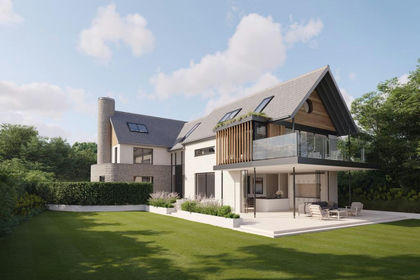
- Price
- Guide Price£1,750,000
Fantastic Land Opportunity, Burnham Market, Burnham Market, Norfolk PE31 England
Added on 29/01/2026Building Plot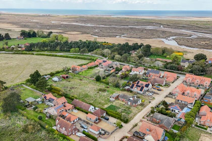
- Price
- Guide Price£1,500,000
- Size
- 1.35 acres
Town Lane, Brancaster Staithe, Brancaster, Norfolk PE31 England
Added on 12/06/2026Building Plot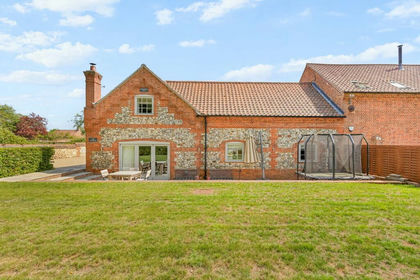
- Price
- Guide Price£1,625,000
Added on 22/06/2026Barn Conversion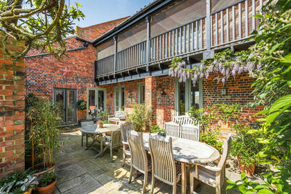 Added on 26/04/2026Barn Conversion
- Price
- Guide Price£2,000,000
- Size
- 1.77 acres
Residential Development - Ringstead Road, Sedgeford, Sedgeford, Norfolk PE36 England
Added on 29/01/2026Building Plot
- Price
- Guide Price£1,650,000
Church Lane, Sedgeford, PE36, Sedgeford, Norfolk PE36 England
Added on 08/08/2026Barn Conversion
- Price
- Guide Price£1,495,000
Added on 08/04/2026Farmhouse
- Price
- Guide Price£1,495,000
- Size
- 1.8 acres
Chapel Street, Wiveton, Holt, Norfolk, NR25, Wiveton, Norfolk NR25 England
Added on 14/07/2026House with Land
- Price
- Guide Price£1,995,000
- Size
- 4.5 acres
Beautiful Barn Conversion in Stibbard, Stibbard, Norfolk NR21 England
Added on 08/04/2026House with Land
- Price
- Guide Price£1,650,000
- Size
- 7.5 acres
Hawthorn House, Dereham, Norfolk, Thurning, Norfolk NR20 England
Added on 29/01/2026Farmhouse