Town Lane, Brancaster Staithe
- Land size
- 1.35 acres
- Bedrooms
- 3
- Bathrooms
- 1
Key Features
- AN EXCEPTIONAL PLOT FOR A REPLACEMENT DWELLING
- STUNNING COASTAL LOCATION
- PLOT OF 1.35 ACRES (0.56 HECTARES)
- OPPORTUNITY TO CUSTOM DESIGN & BUILD A DREAM HOME
- MILES OF COASTAL WALKS FROM THE DOORSTEP
- 2-MINUTE WALK TO THE HARBOUR & SAILING CLUB
- CLOSE TO BURNHAM MARKET & WELLS
- NO ONWARD CHAIN
Description
The Norfolk Agents are delighted to offer the unique opportunity to purchase an individual building plot of around 1.35 acres (0.56 hectares) in one of North Norfolk's most scenic and sought after locations. The site, which is located around 100m north of the coast road (A149) in Brancaster Staithe, is being offered with the opportunity to custom build a brand new home to replace the existing dwelling, which has occupied the plot since the 1930's. Plots of this size are a rare commodity in such a desirable location, providing the opportunity to create a truly remarkable new home.
Aside from the size and location of the plot, the setting is also perfect for exploring the area, as well as catering to a wide range of interests and activities; with the Norfolk Coast Path located just at the end of the road and the Harbour and Sailing Club being just a 2-minute walk away. The area provides no end of opportunities to engage with the local wildlife, whether you're kayaking through the creeks or visiting one of the many nearby wildlife reserves; not to mention the fabulous choice of shops, galleries restaurants and pubs within a 2-mile radius.
The site has been in the ownership of the same family for several generations, with the existing dwelling dating back as far as 1931. Access to the site is obtained from Town Lane and adjoins the boundaries of several other properties to the north and south, with open field views to the west.
LOCATION:
Brancaster Staithe is a highly sought after village on the north coast of Norfolk, complete with its harbour and set within an Area of Outstanding Natural Beauty. The village is part of a stretch of coast which is renowned for its beautiful beaches, wildlife and sailing. The coastal footpath runs along the picturesque coast and is described in the Norfolk Travel Guide as 'One of the most stunning parts of the UK coast, with a million years of history - not to mention huge skies, fabulous beaches and gentle nature'.
Brancaster Harbour is a hub of activity, home to a thriving fishing community, as well as the Sailing Club which attracts visitors from far and wide throughout the summer months. The prestigious White Horse public house and hotel is a year round attraction, with stunning views over the marshes; whilst the Jolly Sailors provides a more traditional and informal place for families to socialise, with a large beer garden and children's playground.
The village also benefits from a village hall and stores, and an active community around St. Mary's church. A short drive along the coast lies the highly ranked Royal West Norfolk Golf Club at Brancaster, whilst Burnham Market is less than 4 miles inland. The pretty fishing town of Wells-next-the-sea is under10 miles away and the Royal Sandringham Estate is within a 20-minute drive. Transport links include a train station at King's Lynn, which runs an hourly into London Kings Cross via Cambridge, whilst Norwich Airport is around 40 miles to the east.
AGENTS NOTES:
- Title to the property benefits from a right of way for all purposes along the western half of Town Lane. A single replacement dwelling would involve no intensification of its use. It is understood the right of way has been used since the 1930's.
- A previous planning consent for multiple units on the site was obtained in 2023 (Ref: 20/01672/O). For more information relating to this scheme please call the agent or visit the King's Lynn & West Norfolk planning website.
- An overage clause will be added to the sale contract, pertaining to the construction of more than one dwelling on the site.
- The fields immediately to the west of the site comprise part of the Branodunum Roman Fort Scheduled Monument.
SERVICES
The property is connected to mains drainage, electricity and water supply.
TENURE: Freehold
TITLE NO: NK485668
COUNCIL TAX BAND: D
EPC RATING: F (35 / 67) - The full certificate can be downloaded or provided by the Norfolk Agents.
1. Purchasers will be asked to produce ID to satisfy money laundering regulations and we would ask for your co-operation in providing the relevant documentation.
2. While we endeavour to make our sales details fair, accurate and reliable, they are only a general guide to the property. If there is any point which is of particular importance to you, please contact the office and we will be pleased to make further investigations.
3. The measurements indicated are supplied for guidance only.
4. Please note we have not tested the services or any of the equipment or appliances in this property. We strongly advise prospective buyers to commission their own survey or service reports before finalising their offer to purchase.
5. THESE PARTICULARS ARE ISSUED IN GOOD FAITH BUT DO NOT FORM PART OF ANY OFFER OR CONTRACT. THE MATTERS REFERRED TO IN THESE PARTICULARS SHOULD BE INDEPENDENTLY VERIFIED BY PROSPECTIVE BUYERS OR TENANTS. THE NORFOLK AGENTS LIMITED NOR ANY OF ITS EMPLOYEES HAS ANY AUTHORITY TO MAKE OR GIVE ANY REPRESENTATION OR WARRANTY WHATSOEVER IN RELATION TO THIS PROPERTY.
Map Location
Property details
- Tenure
- Freehold
- Council Tax Band
- Ask Agent
- Date Posted
- 2026-06-12
Market Value Analysis
Compared with 28 Building Plots listings in East Anglia (1+ acres).
Utilities & Restrictions
Utilities
- Electricity
- Mains
- Water
- Mains
- Heating
- Ask Agent
- Broadband
- Ask Agent
- Sewerage
- Mains
Rights & Restrictions
- Public Rights of Way
- Ask Agent
- Private Rights of Way
- Ask Agent
- Listed Property
- Ask Agent
- Restrictions
- Ask Agent
Listed status, conservation areas and planning constraints for this location are in the full report.
Property Features
- Accessibility
- Ask Agent
- Parking
- Ask Agent
- Garden
- Ask Agent
Beyond the particulars: planning activity, flood history, heritage and ground risks, checked for this exact spot.
Connectivity
Broadband
Fastest speed available at this postcode
80 Mbps
Superfast
Suitable for
- HD streaming
- Video calls
- Web & social
Mobile signal
Outdoor predictions; indoor signal depends on building materials.
Ofcom Connected Nations postcode-level predictions. Speeds and signal are modelled, not measured, and vary between addresses and providers.
Signal is the easy part. Planning activity, flood history and protected designations here are in the full report.
Nearest Schools
Primary
- Burnham Market Primary and Nursery School3 milesOfsted: Good
- Ages
- 2 to 11
- Pupils
- 111
- Type
- Academy sponsor led
- Docking Church of England Primary Academy and Nursery4.7 milesNo Ofsted rating
- Ages
- 3 to 11
- Pupils
- 109
- Type
- Academy converter
- Faith
- Church of England
- Hunstanton Primary School7.5 milesNo Ofsted rating
- Ages
- 4 to 11
- Pupils
- 161
- Type
- Foundation school
- Wells-Next-the-Sea Primary and Nursery School8.1 milesOfsted report card · Apr 2026
- Ages
- 3 to 11
- Pupils
- 197
- Type
- Academy sponsor led
- Blenheim Park Academy8.1 milesOfsted: Good
- Ages
- 5 to 11
- Pupils
- 70
- Type
- Academy sponsor led
Secondary
- Smithdon High School7.3 milesOfsted: Good
- Ages
- 11 to 16
- Pupils
- 579
- Type
- Academy sponsor led
- Alderman Peel High School7.9 milesOfsted: Good
- Ages
- 11 to 16
- Pupils
- 606
- Type
- Academy converter
- Fakenham Academy11 milesNo Ofsted rating
- Ages
- 11 to 18
- Pupils
- 723
- Type
- Academy sponsor led
- Springwood High School17 milesNo Ofsted rating
- Ages
- 11 to 18
- Pupils
- 1,988
- Type
- Academy converter
- Litcham School18 milesOfsted: Good
- Ages
- 4 to 16
- Pupils
- 727
- Type
- Academy converter
Distances are straight-line from the advertised location. Source: the national school registers (DfE, Welsh Government, Scottish Government) and Ofsted.
Schools are just the start: sold prices nearby, planning activity and any flood history are in the full report.
Amenities
Supermarket
GP surgery
Pharmacy
Hospital
Green space
Walking trail
Straight-line distances from the advertised location. Sources: NHS records, Geolytix supermarket locations, OS Open Greenspace and the national trails registers.
The area stacks up? Now check the location itself: planning nearby, protected designations and past flooding.
Getting Around
Nearest station
Nearest bus stop
Typical drive times
Straight-line distances from the advertised location; drive times are typical free-flow times over OpenStreetMap road data, so allow more at peak. Public transport locations from DfT NaPTAN.
Easy to reach matters. So do planning activity, flood history and ground risks: all in the full report.
Flood Risk
From Environment Agency flood map open data, checked around the advertised map pin and allowing for the listed acreage where known. This summary comes from LandSale, the advertising platform, not from the listing agent, and is not part of the agent's particulars. Risk can vary across a single holding, so verify anything critical through your own searches before committing.
Rivers and the sea
Surface water
The detail behind these bandings
The full report pinpoints where this location sits on the flood maps, and runs the deeper checks that usually only surface after an offer.
- Exact flood zones & annual chances (included in the full report)
- Any recorded past flooding (included in the full report)
- Planning activity nearby (included in the full report)
- Heritage & conservation (included in the full report)
- Protected nature designations (included in the full report)
- Ground risks (included in the full report)
- Sold prices nearby (included in the full report)
£14.99 · one-off purchase
By LandSale, the platform. Not provided by the listing agent. Ready in about a minute.
Important notice: Information, maps and tags on this page are drawn from the advertising agent's marketing materials or generated automatically. LandSale has not verified them. Relying on these details is at your own risk, always carry out independent checks before committing to a purchase.
LandSale full disclaimer
Marketing information only - not formal particulars. The details on this website are provided for general guidance and do not constitute an offer or contract. Neither LandSale nor the advertising estate/land agent accepts responsibility for any inaccuracy.
1. Source of information
- Listing content: Core description, asking price, tenure, measurements, photographs and planning history originate from the marketing materials of the advertising estate or land agent. LandSale does not author this content and cannot guarantee its accuracy.
- Automated tags & categorisation: Property type, land-use class, acreage bands and similar labels may be applied by machine-learning models. They are intended as a helpful guide only and may not reflect the property's legal status or permitted use.
- Third-party & enriched data layers: Maps, boundary outlines, planning designations, soil reports, broadband coverage and other environmental or location-based insights are licensed from external suppliers. Such data are supplied “as is", may be incomplete or out of date and are subject to change without notice.
2. Verification required
Prospective purchasers must verify critical matters, including but not limited to planning permission, title boundaries, public rights of way, environmental constraints, acreage, services, access and VAT status, through their own inspections, specialist surveys, legal advisers and the selling agent before relying on the information or entering into any contract.
3. No warranty or liability
LandSale gives no warranty, express or implied, as to the accuracy, completeness or fitness for any particular purpose of the information displayed. LandSale shall not be liable for any loss, damage, cost or expense arising directly or indirectly from any use of or reliance on such information, save where liability may not be excluded by law.
4. Updates & feedback
If you believe any detail on this listing is inaccurate, please let us know. We will investigate and, where appropriate, update the listing or notify the agent.
© LandSale | Version 1.3 - August 2026
Listing agent
The Norfolk Agents, Dersingham
7b Hunstanton Road, Dersingham, PE31 6HH
Similar properties for sale
- Price
- Guide Price£1,750,000
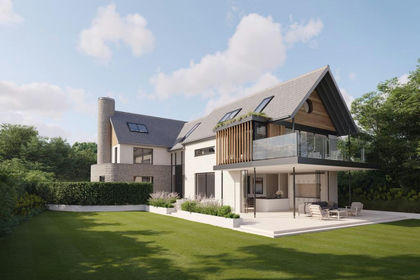
Fantastic Land Opportunity, Burnham Market, Burnham Market, Norfolk PE31 England
Added on 29/01/2026Building Plot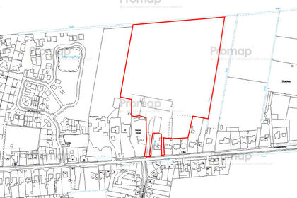
- Price
- £1,250,000
- Size
- 9.5 acres
Roman Road, Moulton Chapel, Spalding, Lincolnshire, PE12, The Moultons, Lincolnshire PE12 England
Added on 18/07/2026Development Land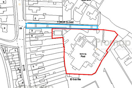
- Price
- Guide Price£1,300,000
- Size
- 1.6 acres
Pinchbeck Road, PE11, South Holland and The Deepings, Lincolnshire PE11 England
Added on 07/09/2026Development Land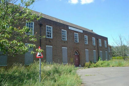
- Price
- Guide Price£1,450,000
- Size
- 2.51 acres
The Charterhouse, Manby Park, Manby, Lincolnshire, LN11, Manby, Lincolnshire LN11 England
Added on 18/06/2026Development Land