Llandrinio, Llanymynech, Powys, SY22
- Land size
- 5.4 acres
- Bedrooms
- 4
- Bathrooms
- 2
Key Features
- A Stunning Detached 4 Bedroom Country Property
- Idyllic Rural Location set off a no through road
- Being a haven for birds and wildlife with riverside setting
- Gardens, Grounds, Orchard and Pasture Land Extending in total to Approximately 5.4 Acres
- Useful Outbuilding with a variety of uses
- Remaining accessible to Welshpool, Shrewsbury and Oswestry
- Viewing Highly Recommended to Appreciate this Spectacular Location and Picturesque Surroundings
- Energy Efficiency Rating: 60 (D) (Expires: 24/07/2035)
Description
Elms Cottage is a fine example of a detached country property being a haven of peace and tranquillity with birds and wildlife in abundance. The property has tremendous appeal to a wide market, potential for equestrian use or smallholding with also the ability to create a degree of self sufficiency or those simply seeking a rural retreat.
The property enjoys great privacy being located off a no-though road, yet remains accessible to Welshpool, Shrewsbury and Oswestry with the larger conurbations beyond. The current owners have largely managed the land in an organic manner evident by the superb array of wildflowers and pollinating insects. The gardens and grounds in total extend to approximately 5.4 Acres which incorporates the main dwelling and a large Steel and Timber Framed Outbuilding/Barn, which has potential for various enterprises.
The character home has been extended and incorporates period features which are complimented by modern appointments.
On the ground floor from the Entrance Hall is a thoroughly charming Sitting Room with exposed brick fireplace to a cast iron woodburning stove, complete with beamed ceiling and to the further side of the house is a large Home Office or Family Room with further exposed beams. A circular flow of the accommodation leads through to the stunning 'L' Shaped Open Plan Kitchen with Dining and Living Areas, which is ideal for contemporary living requirements and a social space for entertaining. The Kitchen has a bespoke range of pine units beneath slate counter tops and breakfast bar with a Belfast sink, integrated dishwasher and duel fuel range cooker. The Living and Dining Area has a part vaulted ceiling and a double aspect with an Inglenook fireplace housing a further Clearview woodburning stove and French doors leading out to the side.
Off the first floor Landing, pine ledge and braced doors lead to the 4 Double Bedrooms, one of which has a well appointed Shower Room with wainscoat wall panelling, low level W.C., wash basin and fully tiled cubicle with mixer shower. The Family Bathroom has a 3 piece suite with a freestanding roll top bath and further shower with an electric unit. The property has Oil Fired Central Heating from a Worcester boiler located in a ground floor Utility Room and Boot Room with a Cloakroom off.
FLOOD RISK (PER NRW)
Flooding from rivers – high risk – risk greater than 3.3% chance each year.
Flooding from the sea - very low risk - risk less than 0.1% chance each year.
Flooding from surface water and small watercourses – very low risk - risk less than 0.1% chance each year.
BT & BROADBAND CHECKER
and-internet/advice-for-consumers/advice/ofcomchecker
From the council maintained no through road a gated private approach leads to the front of the property with mature lawned gardens and wildlife pond with specimen water plants and a home to various wildlife which the current owners having seen otters during their time at the property.
Adjacent to the driveway is the Steel and Timber Framed Barn 13m x 7.5m with galvanised cladding, inset W.C. and outdoor Kitchen area and power and light. Open Car Port 7.20m x 4m Timbe Frame and Clad, Log Store and Oil storage tank.
The natural and level established lawns encompass the house with potential for the cultivation of vegetables. Harvesting of timber within the grounds have provided a self sufficient wood store during the period of ownership of the current sellers. A productive orchard has a variety of fruit trees with various specimen apples, cherry, pear and plum.
Enjoying pasture land over the argae to the River Severn provides the most picturesque backdrop. The pasture land well suited for domestic livestock in the form of a small holding.
Please note that a charge of £36 per person will be applied to cover mandatory anti-money laundering checks.
Map Location
Property details
- Tenure
- Freehold
- Council Tax Band
- G
- Date Posted
- 2026-05-11
Market Value Analysis
Compared with 365 Homes with Land listings in Wales (5+ acres).
Energy Performance Certificate
Energy Efficiency Rating
Based on UK Energy Performance Certificate standards (EU Directive 2002/91/EC)
View official EPC certificate ↗
Running costs are one side. Planning activity, flood history and ground risks for this location are in the full report.
Utilities & Restrictions
Utilities
- Electricity
- Ask Agent
- Water
- Ask Agent
- Heating
- Ask Agent
- Broadband
- Ask Agent
- Sewerage
- Ask Agent
Rights & Restrictions
- Public Rights of Way
- Ask Agent
- Private Rights of Way
- Ask Agent
- Listed Property
- Ask Agent
- Restrictions
- Ask Agent
Listed status, conservation areas and planning constraints for this location are in the full report.
Property Features
- Accessibility
- Ask Agent
- Parking
- Parking Available
- Garden
- Garden
Beyond the particulars: planning activity, flood history, heritage and ground risks, checked for this exact spot.
Connectivity
Broadband
Fastest speed available at this postcode
1.8 Gbps
Gigabit full fibre · available to 83% of premises
Suitable for
- 4K streaming on every screen
- Full-time home working
- Online gaming & big downloads
Fixed wireless access may also be an option here.
Mobile signal
Predicted 4G and 5G signal; indoor signal depends on building materials.
Ofcom Connected Nations postcode-level predictions. Speeds and signal are modelled, not measured, and vary between addresses and providers.
Signal is the easy part. Planning activity, flood history and protected designations here are in the full report.
Nearest Schools
Primary
- Brynhafren C.P. School0.9 miles
- Pupils
- 34
- Type
- Infants & Juniors
- Language
- English medium school / provision
- Llandysilio C.I.W. School3.1 miles
- Pupils
- 55
- Type
- Nursery, Infants & Juniors
- Language
- English medium school / provision
- Arddleen C.P. School3.5 miles
- Pupils
- 111
- Type
- Nursery, Infants & Juniors
- Language
- English medium school / provision
- Carreghofa C.P. School4.2 miles
- Pupils
- 99
- Type
- Nursery, Infants & Juniors
- Language
- English medium school / provision
- Buttington Trewern C.P. School4.4 miles
- Pupils
- 133
- Type
- Nursery, Infants & Juniors
- Language
- English medium school / provision
Secondary
- Welshpool High School7.2 miles
- Pupils
- 816
- Type
- Secondary (ages 11-19)
- Language
- English medium school / provision
- Ysgol Llanfyllin11 miles
- Pupils
- 775
- Type
- Middle (ages 4-19)
- Language
- Dual language school / provision (Welsh and English) (including transitional)
- Ysgol Bro Caereinion14 miles
- Pupils
- 494
- Type
- Middle (ages 4-19)
- Language
- Welsh medium school / provision (including transitional)
- The Maelor School16 miles
- Pupils
- 787
- Type
- Secondary (ages 11-19)
- Language
- English medium school / provision
- Ysgol Rhiwabon17 miles
- Pupils
- 509
- Type
- Secondary (ages 11-19)
- Language
- English medium school / provision
Distances are straight-line from the advertised location. Source: the national school registers (DfE, Welsh Government, Scottish Government) and Ofsted.
Schools are just the start: sold prices nearby, planning activity and any flood history are in the full report.
Amenities
Supermarket
GP surgery
Pharmacy
Straight-line distances from the advertised location. Sources: NHS records, Geolytix supermarket locations, OS Open Greenspace and the national trails registers.
The area stacks up? Now check the location itself: planning nearby, protected designations and past flooding.
Getting Around
Nearest station
Nearest bus stop
Typical drive times
Straight-line distances from the advertised location; drive times are typical free-flow times over OpenStreetMap road data, so allow more at peak. Public transport locations from DfT NaPTAN.
Easy to reach matters. So do planning activity, flood history and ground risks: all in the full report.
Flood Risk
Natural Resources Wales open data, checked around the advertised map pin for the listed acreage. Long-term risk counts flood defences; the planning map's flood zones do not. Provided by LandSale, not the listing agent, and not part of the agent's particulars. Risk varies across a holding, so verify before committing.
Rivers and the sea
Planning map: Flood Zone 3.
Surface water
Not at the pin: mapped about 50 metres away.
These bandings are the summary. Where this location sits on the flood maps, plus planning activity, heritage and ground risks, is in the full report.
Important notice: Information, maps and tags on this page are drawn from the advertising agent's marketing materials or generated automatically. LandSale has not verified them. Relying on these details is at your own risk, always carry out independent checks before committing to a purchase.
LandSale full disclaimer
Marketing information only - not formal particulars. The details on this website are provided for general guidance and do not constitute an offer or contract. Neither LandSale nor the advertising estate/land agent accepts responsibility for any inaccuracy.
1. Source of information
- Listing content: Core description, asking price, tenure, measurements, photographs and planning history originate from the marketing materials of the advertising estate or land agent. LandSale does not author this content and cannot guarantee its accuracy.
- Automated tags & categorisation: Property type, land-use class, acreage bands and similar labels may be applied by machine-learning models. They are intended as a helpful guide only and may not reflect the property's legal status or permitted use.
- Third-party & enriched data layers: Maps, boundary outlines, planning designations, soil reports, broadband coverage and other environmental or location-based insights are licensed from external suppliers. Such data are supplied “as is", may be incomplete or out of date and are subject to change without notice.
2. Verification required
Prospective purchasers must verify critical matters, including but not limited to planning permission, title boundaries, public rights of way, environmental constraints, acreage, services, access and VAT status, through their own inspections, specialist surveys, legal advisers and the selling agent before relying on the information or entering into any contract.
3. No warranty or liability
LandSale gives no warranty, express or implied, as to the accuracy, completeness or fitness for any particular purpose of the information displayed. LandSale shall not be liable for any loss, damage, cost or expense arising directly or indirectly from any use of or reliance on such information, save where liability may not be excluded by law.
4. Updates & feedback
If you believe any detail on this listing is inaccurate, please let us know. We will investigate and, where appropriate, update the listing or notify the agent.
© LandSale | Version 1.3 - August 2026
Listing agent
Morris Marshall & Poole, Welshpool
28 Broad Street, Welshpool, SY21 7RW
Similar properties for sale
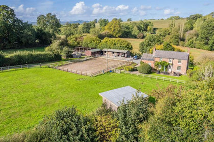
- Price
- Offers in Region of£585,000
- Size
- 2.74 acres
Added on 05/08/2026Smallholding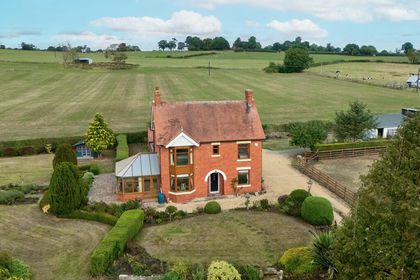
- Price
- Offers in Region of£675,000
- Size
- 3 acres
Sherfield, Ellesmere Road, Wem, Shrewsbury, Shropshire, Wem Urban, Shropshire SY4 England
Added on 07/09/2026House with Land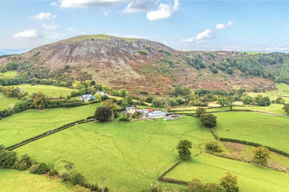
- Price
- Guide Price£450,000
- Size
- 36.14 acres
Gelli (Lot 3), Llanfair Caereinion, Welshpool, Powys, SY21, Llanfair Caereinion, Powys SY21 Wales
Added on 29/07/2026Farm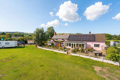
- Price
- Guide Price£685,000
- Size
- 3 acres
The Firs, Colebatch, Bishops Castle, Colebatch, Shropshire SY9 England
Added on 05/10/2026Smallholding
- Price
- Offers in Region of£612,500
- Size
- 3.5 acres
Ingleside Prees Heath, Prees Heath, Whitchurch, Whitchurch Rural, Shropshire SY13 England
Added on 14/09/2026Smallholding
- Price
- £680,000
- Size
- 45 acres
Horseshoe Pass, Llangollen, Llantysilio, Denbighshire LL20 Wales
Added on 29/01/2026Smallholding
- Price
- Guide Price£549,995
- Size
- 7.11 acres
Llidiartywaun, Llanidloes, Powys, SY18, Llandinam, Powys SY18 Wales
Added on 22/05/2026House with Land
- Price
- Offers Over£450,000
- Size
- 3 acres
Newport Road, Woodseaves, ST20, High Offley, Staffordshire ST20 England
Added on 01/10/2026Smallholding
- Price
- Guide Price£625,000
- Size
- 6.5 acres
Llangurig, Llanidloes, Powys, SY18, Llangurig, Powys SY18 Wales
Added on 29/01/2026Smallholding
- Price
- £595,000
- Size
- 4.95 acres
Added on 01/07/2026Country Home