Weaversbrook Lane, Old Heathfield, East Sussex, TN21
- Land size
- 1.6 acres
- Bedrooms
- 4
- Bathrooms
- 2
Key Features
- Set in approx 1.6 acres
- Edge of village with surrounding fields
- Five minutes to the centre of Heathfield
- Sweeping driveway with ample parking
- Local primary & secondary schools nearby
- 15 minutes from mainline station
- Large garage and workshop with power
- Drawing room, snug & study
Description
Situated just outside the beautiful village of Old Heathfield and surrounded by fields. This beautifully presented four bedroom semi-detached cottage has a wealth of period charm and sits in approximately 1.6 acres of grounds, including a paddock. The cottage is approximately five minutes from the centre of Heathfield with local primary & secondary schools nearby, and is 15 minutes from mainline stations to London and the South Coast. Large sweeping driveway for multiple vehicles and a generous garage/workshop.
There are two reception rooms and a study on the ground floor. The generous westerly-facing drawing room has sliding doors to the garden and has a large brick fireplace, flanked by arched feature windows. The snug is a lovely space and has a log burner with shelving in the alcoves on either side of the chimney breast. Off the entrance hall is the study, which is westerly facing and has a decorative fireplace, complementing the property's character and charm. The kitchen/diner is beautifully appointed, fitted with cabinetry including an integrated dishwasher, a kitchen island integrated fridge, Belfast sink set into the oak worktop and a five-ring LPG Rangemaster cooker, available by separate negotiation. The floors are tiled, and double doors open onto the terrace abutting the cottage. Near the kitchen is a vestibule, off which is the downstairs cloakroom and the utility room, which houses the oil-fired boiler, with space for a washing machine and tumble dryer, plumbing for an American fridge/freezer and a door leading to the rear terrace.
Stairs in the entrance hall lead to the first floor landing, which houses the airing cupboard. Bedroom one is a large double overlooking the garden and countryside beyond, with plenty of space for furniture and there is additional eaves storage. Large en suite, comprising a claw foot bath, separate shower, pedestal wash basin and a w.c.. Bedroom two is a large double bedroom with a decorative fireplace. Bedroom three is another double benefitting from integral storage and bedroom four is a single bedroom with space for furniture. The family bathroom completes the internal accommodation and has a suite comprising bath with mixer tap, separate shower cubicle, wash basin, and a w.c. The bathroom faces east, ideal for those who enjoy a morning bath.
Outside: The grounds are approximately 1.6 acres separated into several areas, including a terrace, paddock, pond and gardens. The large east facing tiered flagstone terrace adjacent to the rear of the house, is also home to a large log store. A set of steps leads to the paddock, which extends to the property's boundary and is bordered by trees for privacy. A brick path from the house to the sweeping gated stone driveway has plenty of space for multiple vehicles. The driveway leads to the lower garden, which consists primarily of lawn, with a large raised decked area and slopes down to a large pond at the far end with a stream beyond. Hidden away is a large timber garage/workshop with power, accessed via steps from the driveway. A second driveway leads down towards a gate, which provides a right of access across the neighbouring property and onto Weaversbrook Lane.
Oil Fired Central Heating. Private Drainage. Council Tax Band: D.
Old Heathfield is a sought after village on the outskirts of Heathfield market town. It has a cricket ground, village school, church, and pub and Heathfield Community College is within walking distance. Heathfield High Street is 1.8 miles way and offers a good selection of local shops, amenities and four supermarkets including Waitrose and Sainsbury's. Public footpaths go in several directions into fields and woodlands. The nearest mainline station is at Stonegate, which is a 15 minute drive (Charing Cross/London Bridge), and the Victoria line is accessed from Jarvis Brook, Uckfield and Buxted (20 minutes drive). The larger towns of Tunbridge Wells and Eastbourne are both reached in 30/35 minutes respectively.
Directions: From Heathfield High Street, proceed in an easterly direction towards Burwash. At the top of Mutton Hall Hill go straight over the traffic lights and turn right onto the B2096. Battle Road. Take the next right-hand turn passing Heathfield Community College, and at the Oak Tree, turn right into Old Heathfield. Continue along the road and through Old Heathfield for just under 1km where School Hill joins Nettlesworth Lane. Just after the junction with Weaversbrook Lane, the driveway is on the right hand side.
Agents Note:
Please note that these details have been prepared as a general guide and do not form part of a contract. We have not carried out a detailed survey, nor tested the services, appliances and specific fittings. Room sizes are approximate and should not be relied upon. Any verbal statements or information given about this property, again, should not be relied on and should not form part of a contract or agreement to purchase.
AML
Agents are required by law to conduct anti-money laundering checks on all those buying a property. We outsource the initial checks to partner suppliers Coadjute who will contact you once you have had an offer accepted on a property you wish to buy. The cost of these checks is £32.40 inc VAT per person. This is a non-refundable fee. These charges cover the cost of obtaining relevant data, any manual checks and monitoring which might be required. This fee will need to be paid and the checks completed in advance of the office issuing a memorandum of sale on the property you would like to buy.
Map Location
Property details
- Tenure
- Freehold
- Council Tax Band
- TBC
- Date Posted
- 2026-04-03
Market Value Analysis
Compared with 1,854 Homes with Land listings in South East England (1+ acres).
Energy Performance Certificate
Energy Efficiency Rating
Based on UK Energy Performance Certificate standards (EU Directive 2002/91/EC)
View official EPC certificate ↗
Running costs are one side. Planning activity, flood history and ground risks for this location are in the full report.
Utilities & Restrictions
Utilities
- Electricity
- Ask Agent
- Water
- Ask Agent
- Heating
- Ask Agent
- Broadband
- Ask Agent
- Sewerage
- Ask Agent
Rights & Restrictions
- Public Rights of Way
- Ask Agent
- Private Rights of Way
- Ask Agent
- Listed Property
- Ask Agent
- Restrictions
- Ask Agent
Listed status, conservation areas and planning constraints for this location are in the full report.
Property Features
- Accessibility
- Ask Agent
- Parking
- Parking Available
- Garden
- Garden
Beyond the particulars: planning activity, flood history, heritage and ground risks, checked for this exact spot.
Connectivity
Broadband
Fastest speed available at this postcode
1.8 Gbps
Gigabit full fibre
Suitable for
- 4K streaming on every screen
- Full-time home working
- Online gaming & big downloads
Mobile signal
Outdoor predictions; indoor signal depends on building materials.
Ofcom Connected Nations postcode-level predictions. Speeds and signal are modelled, not measured, and vary between addresses and providers.
Signal is the easy part. Planning activity, flood history and protected designations here are in the full report.
Nearest Schools
Primary
- Parkside Community Primary School482 metresOfsted report card · Mar 2026
- Ages
- 2 to 11
- Pupils
- 225
- Type
- Community school
- All Saints' and St Richard's Church of England Primary School591 metresOfsted report card · Apr 2026
- Ages
- 4 to 11
- Pupils
- 86
- Type
- Voluntary aided school
- Faith
- Church of England
- Maynards Green Community Primary School1.2 milesOfsted: Good
- Ages
- 4 to 11
- Pupils
- 205
- Type
- Community school
- Cross-in-Hand Church of England Primary School1.4 milesOfsted: Good
- Ages
- 5 to 11
- Pupils
- 379
- Type
- Voluntary controlled school
- Faith
- Church of England
- Punnetts Town Community Primary and Nursery School1.5 milesOfsted: Good *
- Ages
- 2 to 11
- Pupils
- 121
- Type
- Community school
Secondary
- Heathfield Community College0.7 milesOfsted: Good
- Ages
- 11 to 18
- Pupils
- 1,416
- Type
- Community school
- Hailsham Academy6.4 milesOfsted: Inadequate
- Ages
- 2 to 18
- Pupils
- 1,577
- Type
- Academy converter
- Uckfield College7.4 milesOfsted: Outstanding
- Ages
- 11 to 18
- Pupils
- 1,671
- Type
- Community school
- Uplands Academy7.7 milesNo Ofsted rating
- Ages
- 11 to 18
- Pupils
- 699
- Type
- Academy converter
- Beacon Academy8 milesOfsted: Outstanding
- Ages
- 11 to 18
- Pupils
- 1,642
- Type
- Academy converter
* Latest graded judgement covers quality of education only; no overall grade was issued under the 2024-25 inspection framework.
Distances are straight-line from the advertised location. Source: the national school registers (DfE, Welsh Government, Scottish Government) and Ofsted.
Schools are just the start: sold prices nearby, planning activity and any flood history are in the full report.
Amenities
Supermarket
GP surgery
Pharmacy
Hospital
Green space
Straight-line distances from the advertised location. Sources: NHS records, Geolytix supermarket locations, OS Open Greenspace and the national trails registers.
The area stacks up? Now check the location itself: planning nearby, protected designations and past flooding.
Getting Around
Nearest station
Nearest bus stop
Typical drive times
Straight-line distances from the advertised location; drive times are typical free-flow times over OpenStreetMap road data, so allow more at peak. Public transport locations from DfT NaPTAN.
Easy to reach matters. So do planning activity, flood history and ground risks: all in the full report.
Flood Risk
From Environment Agency flood map open data, checked around the advertised map pin and allowing for the listed acreage where known. This summary comes from LandSale, the advertising platform, not from the listing agent, and is not part of the agent's particulars. Risk can vary across a single holding, so verify anything critical through your own searches before committing.
Rivers and the sea
Surface water
The detail behind these bandings
The full report pinpoints where this location sits on the flood maps, and runs the deeper checks that usually only surface after an offer.
- Exact flood zones & annual chances (included in the full report)
- Any recorded past flooding (included in the full report)
- Planning activity nearby (included in the full report)
- Heritage & conservation (included in the full report)
- Protected nature designations (included in the full report)
- Ground risks (included in the full report)
- Sold prices nearby (included in the full report)
£14.99 · one-off purchase
By LandSale, the platform. Not provided by the listing agent. Ready in about a minute.
Important notice: Information, maps and tags on this page are drawn from the advertising agent's marketing materials or generated automatically. LandSale has not verified them. Relying on these details is at your own risk, always carry out independent checks before committing to a purchase.
LandSale full disclaimer
Marketing information only - not formal particulars. The details on this website are provided for general guidance and do not constitute an offer or contract. Neither LandSale nor the advertising estate/land agent accepts responsibility for any inaccuracy.
1. Source of information
- Listing content: Core description, asking price, tenure, measurements, photographs and planning history originate from the marketing materials of the advertising estate or land agent. LandSale does not author this content and cannot guarantee its accuracy.
- Automated tags & categorisation: Property type, land-use class, acreage bands and similar labels may be applied by machine-learning models. They are intended as a helpful guide only and may not reflect the property's legal status or permitted use.
- Third-party & enriched data layers: Maps, boundary outlines, planning designations, soil reports, broadband coverage and other environmental or location-based insights are licensed from external suppliers. Such data are supplied “as is", may be incomplete or out of date and are subject to change without notice.
2. Verification required
Prospective purchasers must verify critical matters, including but not limited to planning permission, title boundaries, public rights of way, environmental constraints, acreage, services, access and VAT status, through their own inspections, specialist surveys, legal advisers and the selling agent before relying on the information or entering into any contract.
3. No warranty or liability
LandSale gives no warranty, express or implied, as to the accuracy, completeness or fitness for any particular purpose of the information displayed. LandSale shall not be liable for any loss, damage, cost or expense arising directly or indirectly from any use of or reliance on such information, save where liability may not be excluded by law.
4. Updates & feedback
If you believe any detail on this listing is inaccurate, please let us know. We will investigate and, where appropriate, update the listing or notify the agent.
© LandSale | Version 1.3 - August 2026
Listing agent
Foresters, Heathfield
17 High Street, Heathfield, TN21 8LU
Similar properties for sale
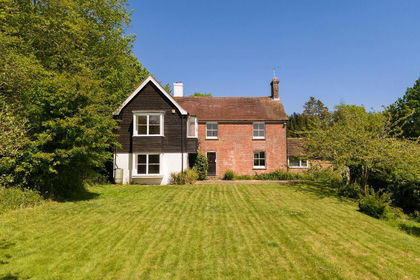
- Price
- Offers in Region of£950,000
- Size
- 1.2 acres
Church Street, Old Heathfield, East Sussex, TN21, Heathfield and Waldron, East Sussex TN21 England
Added on 13/05/2026House with Land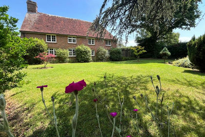
- Price
- Guide Price£850,000
- Size
- 2.6 acres
Maynards Green, Heathfield, TN21, Horam, East Sussex TN21 England
Added on 01/07/2026House with Land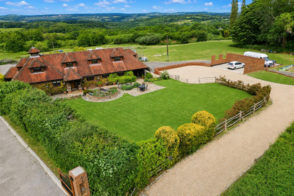
- Price
- Guide Price£1,100,000
- Size
- 2 acres
Street End Lane, Broad Oak, TN21, Heathfield and Waldron, East Sussex TN21 England
Added on 17/02/2026House with Land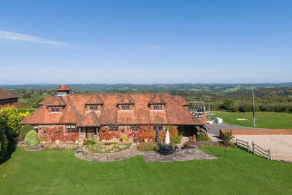
- Price
- Guide Price£1,100,000
- Size
- 2 acres
Added on 29/01/2026House with Land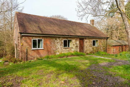
- Price
- Offers Over£750,000
- Size
- 7 acres
Magreed Lane, Broad Oak, TN21, Heathfield and Waldron, East Sussex TN21 England
Added on 10/04/2026Cottage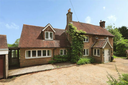
- Price
- £950,000
- Size
- 1.13 acres
Marklye Lane, Heathfield, East Sussex, TN21, Heathfield and Waldron, East Sussex TN21 England
Added on 12/06/2026House with Land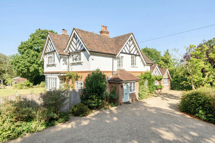
- Price
- Guide Price£1,000,000
- Size
- 1.5 acres
Added on 01/08/2026House with Land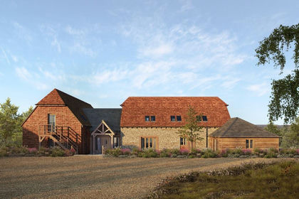
- Price
- £850,000
- Size
- 3.7 acres
Single Plot at Swife Lane, Broad Oak, TN21, Heathfield and Waldron, East Sussex TN21 England
Added on 23/07/2026Self Build Plot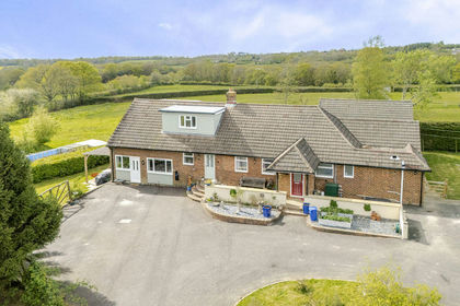
- Price
- Guide Price£995,000
- Size
- 3 acres
Turners Green, Heathfield, Warbleton, East Sussex TN21 England
Added on 22/04/2026House with Land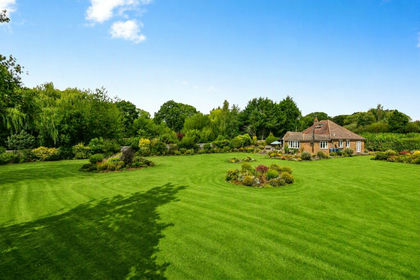
- Price
- Guide Price£795,000
- Size
- 2 acres
Hammer Lane, Vines Cross, Heathfield, East Sussex, TN21, Warbleton, East Sussex TN21 England
Added on 20/08/2026House with Land