Colebatch, Bishop's Castle, Shropshire, SY9
- Land size
- 15.31 acres
- Bedrooms
- 2
- Bathrooms
- 1
Key Features
- Open Plan Kitchen/Dining Room
- Sitting Room
- Utility Room and Cloakroom
- Two Double Bedrooms
- Family Bathroom
- Garden
- Open Plan Lodge with Garage/Workshop
- Ample Parking Space
- Farm Buildings and Grade 3 Pasture Land
- EPC Rating B
Description
A super barn conversion, separate lodge and farm buildings set in 15.31 acres (tbv) and enjoying fine views across rolling countryside.
Open Plan Kitchen/Dining Room, Sitting Room, Utility Room, Cloakroom, Two Double Bedrooms, Family Bathroom, Garden, Open Plan Lodge with Garage/Workshop, Ample Parking Space, Farm Buildings, Grade 3 Pasture Land, EPC Rating B.
APPROXIMATE DISTANCES (MILES)
Bishop´s Castle - 0.8,
Craven Arms - 11,
Knighton - 12,
Ludlow - 20,
Shrewsbury - 22.
DIRECTIONS From the A488/B4385 crossroads at Bishop's Castle head south-west on the A488 signed Clun/Knighton and after 0.5 mile turn right into The Pines and follow the drive straight on up to The Pines Barn as indicated by a Nick Champion 'For Sale' board.
SITUATION AND DESCRIPTION The Pines Barn is pleasantly situated just off the A488 on the edge of the Shropshire Hills AONB and is within 0.8 mile's walking distance of the centre of Bishop's Castle, a historic market town on the Shropshire/Welsh border.
The Pines Barn is a highly insulated barn conversion with weatherboard clad elevations under a slate tiled roof completed in 2016. The property has underfloor heating, a ground source heat pump and quality fittings throughout. The Pines Lodge is a separate bijou unit with roof mounted solar panels and holiday letting/AirBnB income potential within a popular tourist area. A useful modern farm building and Dutch barn complement the grassland and offer the potential for equestrian use. The property in total extends to about 15.31 acres, 6.186 ha. The property is offered for sale with no upward chain.
THE PINES BARN A part glazed door opens into the entrance hall with cloaks cupboard and a cloakroom with a vanity hand basin and wc. The sitting room has an engineered oak floor, an inset electric fire and fitted shelving. The open plan kitchen/dining room has a dining area with French doors to outside, an understairs cupboard, built-in storage cupboards with shelving which also house the Nibe Ground Source Heat Pump and unvented water cylinder, and the kitchen has a range of pale sage fitted units incorporating a stainless steel sink/drainer, and integral appliances including a Hotpoint electric double oven, a Stoves induction hob with extractor hood over, a Hotpoint dishwasher, and a Zanussi fridge and freezer. The adjacent utility room has pale sage fitted base units incorporating a stainless steel sink/drainer, plumbing for a washing machine, space for a tumble drier, and has a part glazed door to outside. Stairs from the entrance hall rise up to the first-floor landing leading to two spacious double bedrooms, each with fitted wardrobes and shelving units, and the bathroom which has a bath with a thermostatic shower over, a vanity basin, wc and heated towel rail.
THE PINES LODGE A 'Kingsland' timber building erected in 2010 as an agricultural mess room/store has a fully pine clad living room with an opening through to a kitchen area with wooden fitted units incorporating a stainless steel sink/drainer, an integral electric hob, and space for an undercounter fridge. The shower room has a Triton T80 electric shower in a large cubicle, a pedestal basin, wc and heated towel rail. A ladder from the living room gives access to a spacious mezzanine sleeping platform. The attached garage/store/workshop has power and light.
OUTSIDE The Pines Barn is approached via a shared driveway leading to a stoned parking and turning area with steps and a paved path leading up past a raised shrub and flower bed to the property which is enveloped by a lawn with paved seating areas.
THE FARM BUILDINGS Adjoining the drive is a useful modern three bay steel framed livestock/machinery/feed shed (48' x 24') constructed of concrete block and Yorkshire boarded elevations with a corrugated sheet roof which has twin sheeted gates to the front, with fitted concrete troughs, hay racks, water troughs, a feed passageway to the rear, and an adjacent secure storage area (22' x 10'6" internal) with external and internal access. A partially clad steel two bay Dutch barn (30' x 11') provides fodder and machinery storage and adjoins the gated driveway leading through to an informal grassed parking area for The Pines Lodge.
SERVICES The Pines Barn and The Pines Lodge - separate mains electricity and water (metered).
Shared private drainage - the septic tank and drainage field is located on neighbouring land with the benefit of an easement for emptying and maintaining the system.
The Pines Barn - Ground source heat pump - underfloor heating to the ground floor.
The Pines Lodge - Electric water heater and electric panel heating. Roof mounted solar panels (RHI).
ENERGY PERFORMANCE CERTIFICATE
EPC Rating B - Full details available on request or by following the link:
TENURE
Freehold - Land Registry Title Number (part) SL237549
LOCAL AUTHORITY
Shropshire Council - Tel: 0345 678 9000
Council Tax Band C
PLANNING 10/00105/AGR and 14/03916/PMBPA are the relevant consents relating to the property with documentation available to view on Shropshire Council online planning portal.
COUNTRYSIDE STEWARDSHIP The farm is registered on the RLR and is not in a Countryside Stewardship Scheme or SFI.
Rural Payments Agency - Tel: 03000 200 301
NITRATE VULNERABLE ZONE (NVZ) The farm is not in a Nitrate Vulnerable Zone.
EASEMENTS, WAYLEAVES AND RIGHTS OF WAY Two public footpaths cross over the farm. Applicants are advised to clarify matters relating to easements, rights of way, wayleaves etc. with their Solicitor and/or Surveyor.
FIXTURES AND FITTINGS Only those mentioned in the particulars are included in the sale; all other items are excluded.
PLAN AND BOUNDARIES The plan reproduced within these particulars is based on Ordnance Survey data and is provided for illustration purposes only. It is believed to be correct, but its accuracy is not guaranteed. The Purchaser should be deemed to have full knowledge of all boundaries and the extent of ownership. Neither the Vendor nor the Vendor's Agents will be responsible for defining boundaries or the ownership thereof.
METHOD OF SALE The property is for sale by private treaty.
GUIDE PRICE: £650,000
VIEWING Strictly by prior appointment with the Sole Agents: -
Nick Champion Tel: 01584 810555 E-mail: To view all of our properties for sale and to let go to:-
what3words: ///sardine.retailing.likes
Photographs taken on 24th February 2026
Particulars prepared March 2026 Particulars updated 20th May 2026 and 16th September 2026
Flood Risk (Checked on 20.03.26 on
Surface water: Very Low Rivers and the sea: Very Low
Groundwater: This location is outside of a groundwater flood alert area.
Reservoirs: Flooding from reservoirs is unlikely in this area.
Mobile Coverage (Checked on Ofcom: 20.03.26)
EE, O2, Vodafone and Three: Good outdoor, variable in-home
Broadband Availability (Checked on Ofcom: 20.03.26)
Standard: 16 Mbps (highest download) / 1 Mbps (highest upload)
Superfast: 38 Mbps (highest download) / 6 Mbps (highest upload)
Ultrafast - Not available ANTI-MONEY LAUNDERING
We are legally obligated to undertake anti-money laundering checks on all property purchasers. Whilst we are responsible for ensuring that these checks, and any ongoing monitoring, are conducted properly; the initial checks will be handled on our behalf by a specialist company, HIPLA, who will reach out to you once your offer has been accepted. The charge for these checks is £35 + VAT (£42 including VAT) per purchaser, which covers the necessary data collection and any manual checks or monitoring that may be required. This cost must be paid in advance, directly to HIPLA, before a memorandum of sale can be issued, and is non-refundable. We thank you for your cooperation.
Map Location
Property details
- Tenure
- Freehold
- Council Tax Band
- C
- Date Posted
- 2026-04-03
Price history
| Date | Change | Price |
|---|---|---|
| 17 Sep 2026 | Reduced 6.5% (−£45,000) | £650,000 |
| Until 17 Sep 2026 | Asking price | £695,000 |
Market Value Analysis
Compared with 108 Homes with Land listings in West Midlands (10+ acres).
Energy Performance Certificate
View the official EPC certificate for detailed energy efficiency information.
View official EPC certificate ↗
Running costs are one side. Planning activity, flood history and ground risks for this location are in the full report.
Utilities & Restrictions
Utilities
- Electricity
- Mains
- Water
- Mains
- Heating
- Ground Source Heat Pump
- Broadband
- Standard Copper (ADSL)
- Sewerage
- Septic Tank / Private
Rights & Restrictions
- Public Rights of Way
- Ask Agent
- Private Rights of Way
- Ask Agent
- Listed Property
- Ask Agent
- Restrictions
- Ask Agent
Listed status, conservation areas and planning constraints for this location are in the full report.
Property Features
- Accessibility
- Ask Agent
- Parking
- Garage, Off-Street Parking
- Garden
- Garden
Beyond the particulars: planning activity, flood history, heritage and ground risks, checked for this exact spot.
Connectivity
Broadband
No premises records for this postcode, which is common for bare land and rural plots. A new connection would be quoted by the provider.
Mobile signal
No address-level signal records for this postcode, which is common for bare land.
Ofcom Connected Nations postcode-level predictions. Speeds and signal are modelled, not measured, and vary between addresses and providers.
Signal is the easy part. Planning activity, flood history and protected designations here are in the full report.
Nearest Schools
Primary
- Bishops Castle Primary School0.6 milesOfsted: Good
- Ages
- 4 to 11
- Pupils
- 128
- Type
- Academy converter
- Lydbury North Church of England Primary School2.2 milesNo Ofsted rating
- Ages
- 2 to 11
- Pupils
- 37
- Type
- Academy converter
- Faith
- Church of England
- Norbury Primary School and Nursery4.1 milesOfsted: Outstanding *
- Ages
- 2 to 11
- Pupils
- 70
- Type
- Foundation school
- Stiperstones CofE Primary School4.1 milesNo Ofsted rating
- Ages
- 4 to 11
- Pupils
- 25
- Type
- Voluntary controlled school
- Faith
- Church of England
- St George's CofE Academy, Clun4.6 milesNo Ofsted rating
- Ages
- 3 to 11
- Pupils
- 110
- Type
- Academy converter
- Faith
- Church of England
Secondary
- The Community College, Bishop's Castle690 metresNo Ofsted rating
- Ages
- 11 to 16
- Pupils
- 507
- Type
- Foundation school
- Church Stretton School9.3 milesNo Ofsted rating
- Ages
- 11 to 16
- Pupils
- 539
- Type
- Academy converter
- Mary Webb School and Science College12 milesOfsted: Good
- Ages
- 11 to 16
- Pupils
- 632
- Type
- Academy converter
- Wigmore School13 milesNo Ofsted rating
- Ages
- 11 to 19
- Pupils
- 467
- Type
- Academy converter
- Ludlow Church of England School14 milesOfsted: Requires improvement *
- Ages
- 11 to 16
- Pupils
- 626
- Type
- Academy converter
- Faith
- Church of England
* Latest graded judgement covers quality of education only; no overall grade was issued under the 2024-25 inspection framework.
Distances are straight-line from the advertised location. Source: the national school registers (DfE, Welsh Government, Scottish Government) and Ofsted.
Schools are just the start: sold prices nearby, planning activity and any flood history are in the full report.
Amenities
Supermarket
GP surgery
Pharmacy
Hospital
Green space
Straight-line distances from the advertised location. Sources: NHS records, Geolytix supermarket locations, OS Open Greenspace and the national trails registers.
The area stacks up? Now check the location itself: planning nearby, protected designations and past flooding.
Getting Around
Nearest station
Nearest bus stop
Typical drive times
Straight-line distances from the advertised location; drive times are typical free-flow times over OpenStreetMap road data, so allow more at peak. Public transport locations from DfT NaPTAN.
Easy to reach matters. So do planning activity, flood history and ground risks: all in the full report.
Flood Risk
Environment Agency open data, checked around the advertised map pin for the listed acreage. Long-term risk counts flood defences; the planning map's flood zones do not. Provided by LandSale, not the listing agent, and not part of the agent's particulars. Risk varies across a holding, so verify before committing.
Rivers and the sea
Planning map: Flood Zone 1.
Surface water
Not at the pin: mapped about 60 metres away.
These bandings are the summary. Where this location sits on the flood maps, plus planning activity, heritage and ground risks, is in the full report.
Important notice: Information, maps and tags on this page are drawn from the advertising agent's marketing materials or generated automatically. LandSale has not verified them. Relying on these details is at your own risk, always carry out independent checks before committing to a purchase.
LandSale full disclaimer
Marketing information only - not formal particulars. The details on this website are provided for general guidance and do not constitute an offer or contract. Neither LandSale nor the advertising estate/land agent accepts responsibility for any inaccuracy.
1. Source of information
- Listing content: Core description, asking price, tenure, measurements, photographs and planning history originate from the marketing materials of the advertising estate or land agent. LandSale does not author this content and cannot guarantee its accuracy.
- Automated tags & categorisation: Property type, land-use class, acreage bands and similar labels may be applied by machine-learning models. They are intended as a helpful guide only and may not reflect the property's legal status or permitted use.
- Third-party & enriched data layers: Maps, boundary outlines, planning designations, soil reports, broadband coverage and other environmental or location-based insights are licensed from external suppliers. Such data are supplied “as is", may be incomplete or out of date and are subject to change without notice.
2. Verification required
Prospective purchasers must verify critical matters, including but not limited to planning permission, title boundaries, public rights of way, environmental constraints, acreage, services, access and VAT status, through their own inspections, specialist surveys, legal advisers and the selling agent before relying on the information or entering into any contract.
3. No warranty or liability
LandSale gives no warranty, express or implied, as to the accuracy, completeness or fitness for any particular purpose of the information displayed. LandSale shall not be liable for any loss, damage, cost or expense arising directly or indirectly from any use of or reliance on such information, save where liability may not be excluded by law.
4. Updates & feedback
If you believe any detail on this listing is inaccurate, please let us know. We will investigate and, where appropriate, update the listing or notify the agent.
© LandSale | Version 1.3 - August 2026
Similar properties for sale
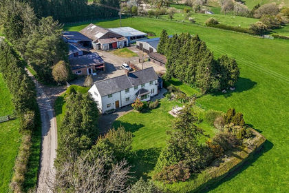
- Price
- Offers in Region of£800,000
- Size
- 26 acres
Added on 13/05/2026Farm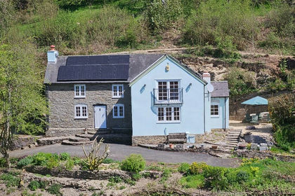
- Price
- Guide Price£700,000
- Size
- 23 acres
Woodmans Cottage, Chapel Lawn, Bucknall SY7, Clun, Shropshire SY7 England
Added on 14/05/2026Cottage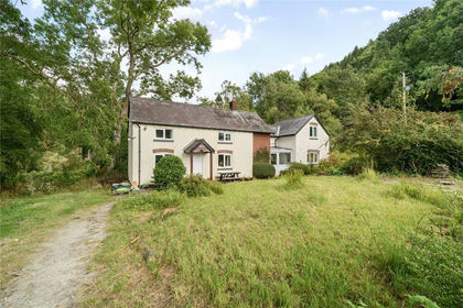
- Price
- Offers in Region of£600,000
- Size
- 11.18 acres
Park Lane, Craven Arms, Shropshire, Craven Arms, Shropshire SY7 England
Added on 11/02/2026House with Land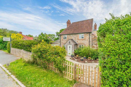
- Price
- Guide Price£650,000
- Size
- 7 acres
Wild Rose Cottage, Gravels Bank, Minsterley, Shrewsbury, Worthen with Shelve, Shropshire SY5 England
Added on 29/01/2026House with Land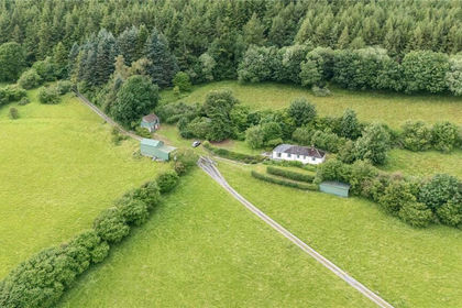
- Price
- £560,000
- Size
- 17 acres
Added on 17/06/2026House with Land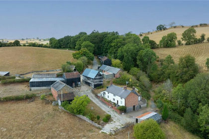
- Price
- £700,000
- Size
- 59.44 acres
Aberhafesp, Newtown, Powys, SY16, Betws Cedewain, Powys SY16 Wales
Added on 01/10/2026Farm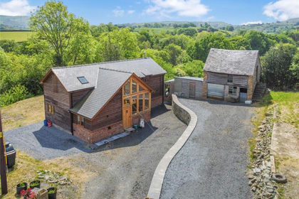
- Price
- Offers Over£600,000
- Size
- 9.86 acres
Mochdre, Newtown, Powys, SY16, Mochdre with Penstrowed, Powys SY16 Wales
Added on 07/05/2026House with Land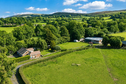
- Price
- Offers Over£600,000
- Size
- 15 acres
Clee St. Margaret, Craven Arms, SY7, Clee St. Margaret, Shropshire SY7 England
Added on 07/09/2026Equestrian property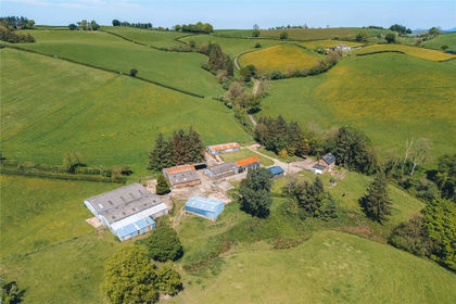
- Price
- £775,000
- Size
- 27 acres
Castle Caereinion, Welshpool, Powys, Castle Caereinion, Powys SY21 Wales
Added on 08/07/2026Smallholding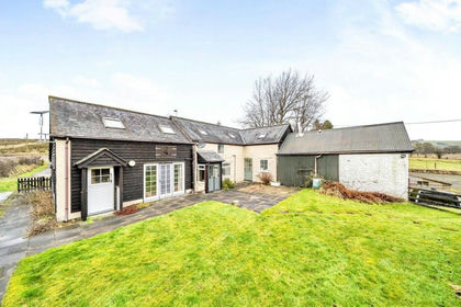
- Price
- Guide Price£595,000
- Size
- 8.5 acres
Llanbister, Llandrindod Wells, Powys, Llanbister, Powys LD1 Wales
Added on 08/09/2026House with Land