Privacy, Design and Far Reaching Coastal Views in West Runton
- Land size
- 12 acres
- Bedrooms
- 4
- Bathrooms
- 2
Key Features
- Elevated Coastal Position with Far-Reaching Sea Views
- Set Within Approximately 12 Acres (STMS) of Private Grounds within National Trust Woodland
- Exceptional Open-Plan ‘Great Room’ with Panoramic Glazing
- Bespoke Kitchen with Luxury Integrated Appliances and AGA
- Principal Suite with Dressing Room and En-Suite
- Three Further Generous Double Bedrooms
- Family Bathroom and Separate Cloakroom
- Beautifully Landscaped Gardens with Rhododendrons and Azaleas
- Woodland Walks Leading to a Bluebell Clearing
- Garaging, Outbuildings, Boules Court, Gazebo and Shepherd’s Hut
Description
Elevated close to one of the highest points in North Norfolk and set within over 200 acres of protected National Trust woodland, Heath Cottage offers an exceptional combination of privacy, design and far reaching coastal views. From its commanding position, the outlook stretches across rolling countryside from Sheringham to West Runton and out across the North Sea, creating a constantly shifting backdrop throughout the day and seasons.
Originally dating from the 1930s and comprehensively reimagined, the house has been transformed into a refined contemporary home, where considered design and high-quality materials sit comfortably alongside its original character. The result is a distinctive coastal residence, equally suited to relaxed day-to-day living and more formal entertaining.
At the heart of the home lies an impressive open-plan ‘Great Room’, a beautifully executed space that brings together kitchen, dining and sitting areas beneath one expansive volume. Flooded with natural light, floor-to ceiling triple-glazed windows and sliding doors frame the surrounding landscape, all fitted with integral blinds and discreet fly screens to allow for effortless ventilation and uninterrupted views. Whether hosting or unwinding, the setting provides a striking yet calming environment, further enhanced by hydronic underfloor heating running throughout both floors.
The bespoke kitchen has been thoughtfully designed with both form and function in mind. Granite worktops, sourced as a single block from Verona, ensure continuity across both the kitchen and utility while allowing the principal sink to be seamlessly carved into the surface without joins. This pairs beautifully with travertine marble flooring from Florence and a comprehensive range of integrated appliances, including a Sub-Zero refrigerator and double-drawer dishwasher. A four oven gas AGA introduces a sense of traditional warmth, balancing the contemporary finish with a more classic touch.
A separate utility room sits discreetly to one side, maintaining the clean lines of the main living space, and also provides access, via a characterful stained glass door, to a conveniently positioned cloakroom.
The principal suite offers a peaceful retreat, complete with a dressing room and a well appointed en-suite bathroom. Upstairs, three further double bedrooms provide generous and versatile accommodation, one benefitting from its own dressing area, all served by a stylish family bathroom.
The grounds extend to approximately 12 acres (stms) and are integral to the overall appeal. A long driveway winds through greenery, gradually revealing the house and enhancing the sense of arrival and seclusion. The immediate gardens have been carefully landscaped, with gently sloping lawns interspersed with established planting, including rhododendrons and azaleas that bring seasonal colour and structure.
Beyond this, the grounds transition into more naturalistic areas, where pathways lead through woodland and open spaces designed for exploration and quiet enjoyment. A particularly special feature is the bluebell woodland clearing, offering a peaceful and atmospheric setting beneath a canopy of trees.
Throughout the gardens, a variety of seating areas have been positioned to make the most of both sunlight and the far-reaching views, creating ideal spaces for outdoor dining or simply taking in the surroundings. Despite the expansive outlook, there remains a strong sense of privacy and shelter.
Further enhancing the lifestyle offering are a range of outbuildings and amenities, including garaging, a boules court, gazebo, shepherd’s hut and additional practical spaces.
Heath Cottage represents a rare opportunity to acquire a coastal home of real distinction, combining elevation, design and complete tranquillity within one of North Norfolk’s most remarkable settings.
WEST RUNTON
Between the Victorian seaside resorts of Cromer and Sheringham, West Runton has good road connections and a small railway station with regular services to Norwich. West Runton also has a pub - The Village Inn, restaurants, a post office, an independent school and village store. It also has a golf links course and there are nearby National Trust woodland walks. The village is famous for the West Runton Woolly Mammoth, a huge 6-700,000 year old fossilised elephant, discovered in the 1990s. West Runton is also home to the Hilltop Shirehorse Centre.
With an elegant pier, Pavilion Theatre and grand Victorian villas, many with panoramic views over the pebble and sand beach, it’s easy to see why Cromer has perennial appeal to staycationers and permanent residents alike. Banksy recently visited the town on a headline-making ‘spraycation’ which focused the media’s attention on the east side of the Norfolk coast. Spend a morning exploring the pretty boutiques and follow the lanes towards the seafront to pick up a Cromer crab – widely regarded as one of the best found in English waters, the eight-legged crustacean still provides a major source of income for the town’s fishermen and simply served with bread makes an unbeatable lunch or supper!
Or push the boat out with fish and chips from No 1 Cromer, Galton Blackiston’s award winning Cromer eatery perched on the clifftop. Treat yourself to a relaxing lunch at the Upstairs Restaurant where stunning sea views meet tasty seafood, or join the queue downstairs and enjoy your takeaway sitting on the wall as the seagulls soar above you for a fully immersive ‘beside the seaside’ experience. Follow the slope down from the clifftop to the beach and walk the shoreline or practise your hand at an afternoon skimming stones out to the horizon line.
SERVICES CONNECTED
Mains water and electricity. Drainage via septic tank. Heating via ground source heat pump.
COUNCIL TAX
Band G.
ENERGY EFFICIENCY RATING
F. Ref:- 0330-2919-6670-2776-8021
To retrieve the Energy Performance Certificate for this property please visit https://find energy-certificate.digital.communities.gov.uk/find-a-certificate/search-by-reference-number and enter in the reference number above. Alternatively, the full certificate can be obtained through Sowerbys.
TENURE
Freehold.
LOCATION
What3words: ///gift.devalued.inspects
WEBSITE TAGS
bloom-blossom
perfect-views
room-to-roam
sea-breeze
family-life
EPC Rating: F
Parking - Garage
Parking - Car port
Parking - Driveway
Disclaimer
These particulars are provided as a guide only and do not form part of any offer or contract. Sowerbys and its representatives have no authority to make or give representations or warranties. All descriptions, measurements, photographs and plans are for guidance only and should not be relied upon as statements of fact. Buyers should satisfy themselves as to the accuracy of the information through inspection or professional advice. Services, appliances and equipment have not been tested and no warranty can be given as to their condition. Planning permissions, building regulations and other consents should be verified by the buyer’s legal adviser. In accordance with Anti-Money Laundering regulations, proceeding buyers must complete a digital ID check through our compliance partner. A charge of £48 including VAT per sale or purchase applies. Leasehold buyers should confirm ground rent, service charges and lease details with their legal adviser.
Map Location
Property details
- Tenure
- Freehold
- Council Tax Band
- G
- Date Posted
- 2026-03-31
Market Value Analysis
Compared with 68 Homes with Land listings in East Anglia (10+ acres).
Energy Performance Certificate
Energy Efficiency Rating
Based on UK Energy Performance Certificate standards (EU Directive 2002/91/EC)
Running costs are one side. Planning activity, flood history and ground risks for this location are in the full report.
Utilities & Restrictions
Utilities
- Electricity
- Mains
- Water
- Mains
- Heating
- Ground Source Heat Pump
- Broadband
- Fibre (FTTC)
- Sewerage
- Septic Tank / Private
Rights & Restrictions
- Public Rights of Way
- Ask Agent
- Private Rights of Way
- Ask Agent
- Listed Property
- Ask Agent
- Restrictions
- Ask Agent
Listed status, conservation areas and planning constraints for this location are in the full report.
Property Features
- Accessibility
- Ask Agent
- Parking
- Garage, Covered Parking, Driveway
- Garden
- Private Garden
Beyond the particulars: planning activity, flood history, heritage and ground risks, checked for this exact spot.
Connectivity
Broadband
Fastest speed available at this postcode
80 Mbps
Superfast
Suitable for
- HD streaming
- Video calls
- Web & social
Mobile signal
Predicted 4G and 5G signal; indoor signal depends on building materials.
Ofcom Connected Nations postcode-level predictions. Speeds and signal are modelled, not measured, and vary between addresses and providers.
Signal is the easy part. Planning activity, flood history and protected designations here are in the full report.
Nearest Schools
Primary
- Sheringham Community Primary School1.6 milesNo Ofsted rating
- Ages
- 3 to 11
- Pupils
- 398
- Type
- Community school
- Gresham Village School and Nursery2.1 milesNo Ofsted rating
- Ages
- 3 to 11
- Pupils
- 138
- Type
- Academy converter
- Cromer Junior School2.8 milesOfsted: Good
- Ages
- 7 to 11
- Pupils
- 255
- Type
- Academy converter
- Suffield Park Infant and Nursery School, Cromer2.9 milesOfsted: Good *
- Ages
- 4 to 7
- Pupils
- 126
- Type
- Community school
- St Mary's Church of England Primary Academy3.9 milesNo Ofsted rating
- Ages
- 2 to 11
- Pupils
- 61
- Type
- Academy converter
- Faith
- Church of England
Secondary
- Sheringham High School1.7 milesOfsted: Good
- Ages
- 11 to 18
- Pupils
- 630
- Type
- Academy converter
- Cromer Academy2.8 milesNo Ofsted rating
- Ages
- 11 to 16
- Pupils
- 665
- Type
- Academy converter
- Aylsham High School9.2 milesNo Ofsted rating
- Ages
- 11 to 16
- Pupils
- 1,138
- Type
- Foundation school
- North Walsham High School10 milesOfsted: Good
- Ages
- 11 to 16
- Pupils
- 641
- Type
- Academy converter
- Reepham High School and College13 milesOfsted: Good *
- Ages
- 11 to 18
- Pupils
- 959
- Type
- Academy converter
* Latest graded judgement covers quality of education only; no overall grade was issued under the 2024-25 inspection framework.
Distances are straight-line from the advertised location. Source: the national school registers (DfE, Welsh Government, Scottish Government) and Ofsted.
Schools are just the start: sold prices nearby, planning activity and any flood history are in the full report.
Amenities
Supermarket
GP surgery
Pharmacy
Hospital
Green space
Walking trail
Straight-line distances from the advertised location. Sources: NHS records, Geolytix supermarket locations, OS Open Greenspace and the national trails registers.
The area stacks up? Now check the location itself: planning nearby, protected designations and past flooding.
Getting Around
Nearest station
Nearest bus stop
Typical drive times
Straight-line distances from the advertised location; drive times are typical free-flow times over OpenStreetMap road data, so allow more at peak. Public transport locations from DfT NaPTAN.
Easy to reach matters. So do planning activity, flood history and ground risks: all in the full report.
Flood Risk
Environment Agency open data, checked around the advertised map pin for the listed acreage. Long-term risk counts flood defences; the planning map's flood zones do not. Provided by LandSale, not the listing agent, and not part of the agent's particulars. Risk varies across a holding, so verify before committing.
Rivers and the sea
Planning map: Flood Zone 1.
Surface water
These bandings are the summary. Where this location sits on the flood maps, plus planning activity, heritage and ground risks, is in the full report.
Important notice: Information, maps and tags on this page are drawn from the advertising agent's marketing materials or generated automatically. LandSale has not verified them. Relying on these details is at your own risk, always carry out independent checks before committing to a purchase.
LandSale full disclaimer
Marketing information only - not formal particulars. The details on this website are provided for general guidance and do not constitute an offer or contract. Neither LandSale nor the advertising estate/land agent accepts responsibility for any inaccuracy.
1. Source of information
- Listing content: Core description, asking price, tenure, measurements, photographs and planning history originate from the marketing materials of the advertising estate or land agent. LandSale does not author this content and cannot guarantee its accuracy.
- Automated tags & categorisation: Property type, land-use class, acreage bands and similar labels may be applied by machine-learning models. They are intended as a helpful guide only and may not reflect the property's legal status or permitted use.
- Third-party & enriched data layers: Maps, boundary outlines, planning designations, soil reports, broadband coverage and other environmental or location-based insights are licensed from external suppliers. Such data are supplied “as is", may be incomplete or out of date and are subject to change without notice.
2. Verification required
Prospective purchasers must verify critical matters, including but not limited to planning permission, title boundaries, public rights of way, environmental constraints, acreage, services, access and VAT status, through their own inspections, specialist surveys, legal advisers and the selling agent before relying on the information or entering into any contract.
3. No warranty or liability
LandSale gives no warranty, express or implied, as to the accuracy, completeness or fitness for any particular purpose of the information displayed. LandSale shall not be liable for any loss, damage, cost or expense arising directly or indirectly from any use of or reliance on such information, save where liability may not be excluded by law.
4. Updates & feedback
If you believe any detail on this listing is inaccurate, please let us know. We will investigate and, where appropriate, update the listing or notify the agent.
© LandSale | Version 1.3 - August 2026
Similar properties for sale
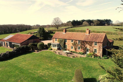
- Price
- Guide Price£1,850,000
- Size
- 39.5 acres
Small Hopes Farm, Workhouse Lane, Norfolk, NR24, Briston, Norfolk NR24 England
Added on 10/04/2026Smallholding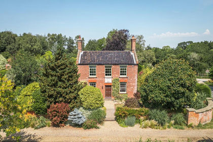
- Price
- Guide Price£1,250,000
- Size
- 8 acres
Impressive Grade II Listed Period Country House in Wood Norton, Wood Norton, Norfolk NR20 England
Added on 27/08/2026House with Land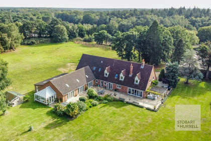
- Price
- Guide Price£1,650,000
- Size
- 13 acres
Lorne House, Shorthorn Road, Stratton Strawless, Norfolk, Stratton Strawless, Norfolk NR10 England
Added on 28/07/2026Country Home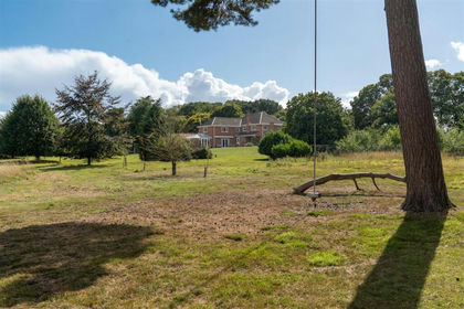
- Price
- Guide Price£1,350,000
- Size
- 20 acres
Weston Longville, NR9, Weston Longville, Norfolk NR9 England
Added on 20/08/2026Country Estate
- Price
- £1,600,000
- Size
- 12 acres
Upper King Street, Norwich, Norfolk, Norwich South, Norfolk NR3 England
Added on 28/07/2026House with Land
- Price
- Offers in Excess of£1,350,000
- Size
- 19.47 acres
Added on 22/06/2026Agricultural Land
- Price
- Guide Price£1,650,000
- Size
- 12 acres
Added on 23/04/2026Country Home
- Price
- Guide Price£1,250,000
- Size
- 6.1 acres
Littlebeck Lane, Brooke, Norfolk, NR15, Brooke, Norfolk NR15 England
Added on 30/07/2026House with Land
- Price
- Guide Price£1,500,000
- Size
- 115.64 acres
Church Farm, Bungay Road, Thwaite, Thwaite, Norfolk NR35 England
Added on 27/02/2026Farm
- Price
- £1,950,000
- Size
- 6 acres
Lowestoft Road, Hopton on Sea, Hopton-on-Sea, Norfolk NR31 England
Added on 18/04/2026Equestrian property