Impressive Grade II Listed Period Country House in Wood Norton
- Land size
- 8 acres
- Bedrooms
- 3
- Bathrooms
- 1
Key Features
- Impressive Grade II Listed Period Country House
- Approximately 4 Acres (STMS) of Gardens, Grounds and Paddocks
- Exceptional Established Gardens Extending to Almost 2 Acres (STMS)
- Significant Horticultural History, Including Hoecroft Plants
- Detached Grade II Listed Barn with Conversion Potential STPP
- Separate Two-Bedroom Holiday Cottage
- Established Holiday Letting Opportunity
- Beautiful Walled Garden and Extensive Formal Planting
- Further 4 Acres of Paddock with Potential for Alternative uses STPP
- Peaceful Rural Setting with Considerable Commercial and Lifestyle Potential
Description
The main Grade II listed house retains the proportions and character of its period origins, with formal reception rooms to the front, each benefiting from open fireplaces. To the rear is a kitchen and separate utility room, while the first floor provides three bedrooms and a newly fitted bathroom. The accommodation offers a comfortable basis for family living, with the character of the original house providing scope for further personalisation.
Within the grounds stands a substantial detached also Grade II listed barn, an attractive building with its own distinctive architectural character. Currently used for storage, it offers considerable potential for alternative use or conversion, subject to the necessary planning and listed building consents. Its black-glazed pantile roof, crenellated gables and decorative details, including carved stone heads and terracotta figures, make it an interesting building in its own right. Within the four acres (STMS) is a convenient four bay cart shed currently being used for cars. Beyond the barn is a beautiful walled garden, providing another secluded area within the extensive grounds.
A separate two-bedroom holiday cottage forms an important part of the property and is currently used successfully as a holiday let. With two reception rooms as well as the bedrooms, it provides useful independent accommodation and the opportunity to continue an established income stream, or alternatively to provide space for family, guests or other uses.
Severals Grange is difficult to compare with a conventional country house. It combines a historic and architecturally interesting home with an exceptional horticultural setting, extensive land, an independent holiday cottage and a listed barn with significant potential. For those looking for a property where the gardens, land and additional buildings are as important as the house itself, this is a rare and highly versatile opportunity in the North Norfolk countryside.
The impressive Grade II listed period country house set within approximately eight acres of beautifully maintained gardens and grounds, Severals Grange is a property of considerable character and versatility. With a detached Grade II listed barn, separate holiday cottage, extensive gardens and a long-established horticultural and commercial history, it presents a particularly unusual opportunity in the North Norfolk countryside.
The house dates from the mid-19th century and was built by local farmer William Skinner Phillipo. Constructed in red brick beneath a pantile roof, the property retains a wealth of period detail, including sash windows, decorative brickwork, distinctive battlemented parapets and a well at the back of the property. There are also some wonderfully individual touches which reflect the character of its original owner, including the marble plaque above the entrance recording his claimed family history and connections to Agincourt and Hastings.
While the house provides a comfortable and characterful home, it is the gardens which truly set Severals Grange apart. Almost four acres (STMS) have been developed into an exceptional series of formal and informal gardens, creating a remarkable variety of spaces within the grounds. Immediately surrounding the house is a two acre (STMS) formal garden with mature shrubbery, two useful outbuildings and a delightful standalone conservatory. A functioning well also provides a useful and charming feature within the grounds. From here, the gardens extend through a succession of carefully planted areas, with formally arranged herbaceous borders framed by mature trees and established planting.
The grounds have a particular horticultural pedigree, having previously been associated with Hoecroft Plants, a nursery noted for its collection of unusual grasses and foliage plants. This history is still evident in the character of the gardens, where planting has been used to create interest through texture, form and seasonal colour. Paths lead onwards through the trees to further beds and garden areas, with glimpses across the wider grounds and paddocks beyond. There is a genuine sense of discovery as the gardens unfold, with each area offering something different.
The gardens have also been opened to visitors through the National Garden Scheme, reflecting their quality and importance as a horticultural landscape. For those with a passion for gardening, there is considerable scope to continue developing the established framework, while for others the gardens simply provide an exceptional setting in which to enjoy the peace and privacy of the property.
Beyond the principal gardens, the land extends across the track to the front of the house, where approximately four further acres are currently laid to paddock. This provides valuable additional land and, subject to the necessary planning consents, offers potential for a variety of uses.
WOOD NORTON
A typical small Norfolk village. Wood Norton was owned by Christ Church Oxford up until then 1950s.
Just 8 miles away a strong sense of community thrives among the proud residents and local businesses of Holt, and many of the latter champion the local ‘Love Holt’ initiative which waves the flag for the independent shops that add vibrancy to the Georgian town centre. Throughout the year, there are plenty of local events including a summer Holt Festival and 1940s Weekend, which takes over the town and ‘Poppy Line’ heritage railway that runs between here and Sheringham.
With a traditional butcher, fishmonger and greengrocer, the town even has its own department store and food hall, Bakers and Larners, a local landmark which has been run by the same family since 1770.
The town and its surrounding yards house a collection of chic boutiques and luxe lifestyle stores to explore and fill your home and wardrobe with beautiful things – linger and choose your favourite locally made fragrance at Norfolk Natural Living.
Life moves at a leisurely pace in Holt, and there are plenty of places to idle over a coffee or bite to eat. Believed to be the oldest house in town, Byfords deli and café is a central landmark and fabulous place to stop and watch the world go by. There’s no need to hurry home – relax and enjoy country life! On the edge of town is the eponymous Gresham’s school.
SERVICES CONNECTED
Mains water and electricity. Oil fired central heating. Drainage via septic tank.
COUNCIL TAX
Band D.
ENERGY EFFICIENCY RATING
An Energy Performance Certificate is not required for this property due to it being Grade II listed.
TENURE
Freehold.
LOCATION
What3words: ///courts.uppermost.majority
WEBSITE TAGS
cosy-cottages
bloom-blossom
room-to-roam
historical-homes
Parking - Driveway
Disclaimer
These particulars are provided as a guide only and do not form part of any offer or contract. Sowerbys and its representatives have no authority to make or give representations or warranties. All descriptions, measurements, photographs and plans are for guidance only and should not be relied upon as statements of fact. Buyers should satisfy themselves as to the accuracy of the information through inspection or professional advice. Services, appliances and equipment have not been tested and no warranty can be given as to their condition. Planning permissions, building regulations and other consents should be verified by the buyer’s legal adviser. In accordance with Anti-Money Laundering regulations, proceeding buyers must complete a digital ID check through our compliance partner. A charge of £48 including VAT per sale or purchase applies. Leasehold buyers should confirm ground rent, service charges and lease details with their legal adviser.
Map Location
Property details
- Tenure
- Freehold
- Council Tax Band
- D
- Date Posted
- 2026-08-27
Market Value Analysis
Compared with 197 Homes with Land listings in East Anglia (5+ acres).
Utilities & Restrictions
Utilities
- Electricity
- Mains
- Water
- Mains
- Heating
- Oil Heating, Wood Burner
- Broadband
- Ask Agent
- Sewerage
- Septic Tank / Private
Rights & Restrictions
- Public Rights of Way
- Ask Agent
- Private Rights of Way
- Ask Agent
- Listed Property
- Yes
- Restrictions
- Ask Agent
Listed status, conservation areas and planning constraints for this location are in the full report.
Property Features
- Accessibility
- Ask Agent
- Parking
- Driveway
- Garden
- Private Garden
Beyond the particulars: planning activity, flood history, heritage and ground risks, checked for this exact spot.
Connectivity
Broadband
Fastest speed available at this postcode
40 Mbps
Superfast · available to 25% of premises
Suitable for
- HD streaming
- Video calls
- Web & social
Mobile signal
Predicted 4G and 5G signal; indoor signal depends on building materials.
Ofcom Connected Nations postcode-level predictions. Speeds and signal are modelled, not measured, and vary between addresses and providers.
Signal is the easy part. Planning activity, flood history and protected designations here are in the full report.
Nearest Schools
Primary
- All Saints Stibbard Church of England Primary Academy and Nursery1.7 milesOfsted: Requires improvement
- Ages
- 2 to 11
- Pupils
- 208
- Type
- Academy converter
- Faith
- Church of England
- Foulsham Primary School Academy2.9 milesOfsted: Good *
- Ages
- 5 to 11
- Pupils
- 61
- Type
- Academy converter
- Astley Primary School3.8 milesOfsted: Good
- Ages
- 5 to 11
- Pupils
- 200
- Type
- Academy converter
- Little Snoring Community Primary Academy3.8 milesOfsted: Good *
- Ages
- 4 to 11
- Pupils
- 65
- Type
- Academy converter
- Hindringham Church of England Primary School4.8 milesNo Ofsted rating
- Ages
- 5 to 11
- Pupils
- 35
- Type
- Voluntary aided school
- Faith
- Church of England
Secondary
- Fakenham Academy5.8 milesNo Ofsted rating
- Ages
- 11 to 18
- Pupils
- 723
- Type
- Academy sponsor led
- Reepham High School and College6.9 milesOfsted: Good *
- Ages
- 11 to 18
- Pupils
- 959
- Type
- Academy converter
- Northgate High School9.3 milesOfsted: Good
- Ages
- 11 to 18
- Pupils
- 1,203
- Type
- Academy converter
- Dereham Neatherd High School9.7 milesOfsted: Requires improvement *
- Ages
- 11 to 18
- Pupils
- 1,079
- Type
- Academy converter
- Litcham School10 milesOfsted: Good
- Ages
- 4 to 16
- Pupils
- 727
- Type
- Academy converter
* Latest graded judgement covers quality of education only; no overall grade was issued under the 2024-25 inspection framework.
Distances are straight-line from the advertised location. Source: the national school registers (DfE, Welsh Government, Scottish Government) and Ofsted.
Schools are just the start: sold prices nearby, planning activity and any flood history are in the full report.
Amenities
Supermarket
GP surgery
Pharmacy
Hospital
Green space
Straight-line distances from the advertised location. Sources: NHS records, Geolytix supermarket locations, OS Open Greenspace and the national trails registers.
The area stacks up? Now check the location itself: planning nearby, protected designations and past flooding.
Getting Around
Nearest station
Nearest bus stop
Typical drive times
Straight-line distances from the advertised location; drive times are typical free-flow times over OpenStreetMap road data, so allow more at peak. Public transport locations from DfT NaPTAN.
Easy to reach matters. So do planning activity, flood history and ground risks: all in the full report.
Flood Risk
Environment Agency open data, checked around the advertised map pin for the listed acreage. Long-term risk counts flood defences; the planning map's flood zones do not. Provided by LandSale, not the listing agent, and not part of the agent's particulars. Risk varies across a holding, so verify before committing.
Rivers and the sea
Planning map: Flood Zone 1.
Surface water
Not at the pin: mapped about 60 metres away.
These bandings are the summary. Where this location sits on the flood maps, plus planning activity, heritage and ground risks, is in the full report.
Important notice: Information, maps and tags on this page are drawn from the advertising agent's marketing materials or generated automatically. LandSale has not verified them. Relying on these details is at your own risk, always carry out independent checks before committing to a purchase.
LandSale full disclaimer
Marketing information only - not formal particulars. The details on this website are provided for general guidance and do not constitute an offer or contract. Neither LandSale nor the advertising estate/land agent accepts responsibility for any inaccuracy.
1. Source of information
- Listing content: Core description, asking price, tenure, measurements, photographs and planning history originate from the marketing materials of the advertising estate or land agent. LandSale does not author this content and cannot guarantee its accuracy.
- Automated tags & categorisation: Property type, land-use class, acreage bands and similar labels may be applied by machine-learning models. They are intended as a helpful guide only and may not reflect the property's legal status or permitted use.
- Third-party & enriched data layers: Maps, boundary outlines, planning designations, soil reports, broadband coverage and other environmental or location-based insights are licensed from external suppliers. Such data are supplied “as is", may be incomplete or out of date and are subject to change without notice.
2. Verification required
Prospective purchasers must verify critical matters, including but not limited to planning permission, title boundaries, public rights of way, environmental constraints, acreage, services, access and VAT status, through their own inspections, specialist surveys, legal advisers and the selling agent before relying on the information or entering into any contract.
3. No warranty or liability
LandSale gives no warranty, express or implied, as to the accuracy, completeness or fitness for any particular purpose of the information displayed. LandSale shall not be liable for any loss, damage, cost or expense arising directly or indirectly from any use of or reliance on such information, save where liability may not be excluded by law.
4. Updates & feedback
If you believe any detail on this listing is inaccurate, please let us know. We will investigate and, where appropriate, update the listing or notify the agent.
© LandSale | Version 1.3 - August 2026
Listing agent
Sowerbys, Holt
1 Market Place Holt NR25 6BE
Similar properties for sale
- Price
- Guide Price£1,150,000
- Size
- 10 acres
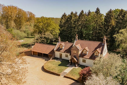
Quaint Country Home within 10 Acres in Corpusty, Corpusty and Saxthorpe, Norfolk NR11 England
Added on 13/08/2026House with Land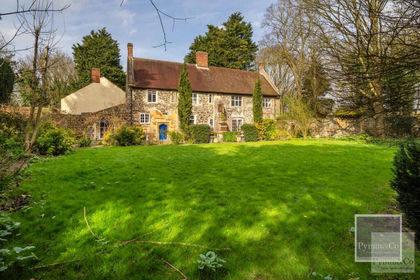
- Price
- Offers in Excess of£1,100,000
- Size
- 6.1 acres
Church Street, Horsham St Faith, Horsham St. Faith and Newton St. Faith, Norfolk NR10 England
Added on 31/03/2026Country Home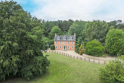
- Price
- Guide Price£1,400,000
- Size
- 5.3 acres
Detached Home set in 5.3 Acres (STMS) in West Harling, Harling, Norfolk NR16 England
Added on 27/06/2026House with Land
- Price
- Guide Price£1,150,000
- Size
- 12 acres
Added on 29/05/2026Country Home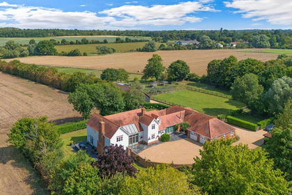
- Price
- Guide Price£1,500,000
- Size
- 6.7 acres
Added on 11/09/2026House with Land