Development Site For 5no. Dwellings, Brin View, Black Dog, Crediton, EX17
- Land size
- 2.48 acres
Key Features
- Residential Development Site
- Conversion to 5no. dwellings with Class Q Prior Approval
- Adjoining pasture land
- Property extends to approximately 2.48 acres (1 hectare)
- Rural location in the heart of Devon
Description
Residential development site comprising agricultural buildings and yard for conversion to 5no. dwellings with Class Q Prior Approval, together with an adjoining parcel of pasture land.
The property extends in total to approximately 2.48 acres (1 hectare).
LOCATION
The site at Brin View Farm enjoys a peaceful, rural setting, east of the village of Black Dog, within the parish of Woolfardisworthy in Mid Devon. The surrounding area is characterised by open countryside, farmland and individual residential dwellings.
The nearby market town of Crediton (approx. 8.4 miles south) provides a full range of amenities, including shops, schools, healthcare facilities and transport links.
For those who enjoy outdoor pursuits, it is well located between the rugged beauty of Exmoor National Park and Dartmoor National Park offering superb walking, cycling, and riding opportunities.
It is also well located in terms of proximity to the city of Exeter, offering an ideal balance of countryside living and accessibility.
SITE
The residential development site comprises a principally hardcore and compacted earth yard area and a range of agricultural buildings, along with an area of track and pastureland to the north, and an adjoining enclosure of pastureland to the south. The area offered for sale extends in total to approximately 2.48 acres (1 hectare).
“Barn A” and “Barn B”, as depicted on the coloured site layout plan within these particulars comprise the following:
“Barn A” — contiguous range of timber framed agricultural buildings with principally corrugated metal sheeted elevations, beneath a GI roof. This run of buildings will form Units 3, 4 and 5.
“Barn B” — further run of buildings centred on principally block built buildings with corrugated metal roof sand some sheeted metal or timber space boarded elevations in part.. This run of buildings will form Units 1 and 2.
Please note that there are further timber framed covered yards lying to the north of “Barn A” and east of “Barn B” which are proposed for demolition as part of the development scheme and have therefore not been described. Please refer to the approved plans for details.
In addition to the main barns, lying to the western side of the yards, is a further 4-bay timber framed open-fronted building with a GI roof.
An existing residential dwelling lies on the opposite side of the Council lane, to the east of the site, otherwise the site is bounded by agricultural land to the north, south and west.
The site benefits from two existing vehicular accesses from the adjoining public highway to the east of the site.
The site that is being offered for sale is shown outlined red on the site plan within these particulars. It is shown for identification purposes only and is not to be relied upon.
CLASS Q PRIOR APPROVAL
Mid Devon District Council granted Class Q Prior Approval (PA) (application number: 25/01131/PNCOU) dated 5th November 2025. This is for the change of use of two of the farm buildings from agricultural use to 5no. residential dwellings.
PROPOSED BARN CONVERSIONS
The proposed barns for conversion (once converted) will comprise 5no. dwellings.
The approved scheme includes:
Unit 1: 3-bedroom house, GIA approximately 126m2 (1356.25ft2) and 3 parking spaces.
Unit 2: 2-bedroom house, GIA approximately 73m2 (785.77ft2) and 2 parking spaces.
Unit 3: 3-bedroom house, GIA approximately 116m2 (1248.61ft2) and 3 parking spaces.
Unit 4: 3-bedroom house, GIA approximately 109m2 (1173.27ft2)and 3 parking spaces.
Unit 5: 3-bedroom house, GIA approximately 105m2 (1130.21ft2) and 3 parking spaces.
SECTION 106 AGREEMENT
We understand the threshold for Section 106 Agreement contributions has not been met by the Class Q planning application; therefore, there will not be any contributions.
LOCAL AUTHORITY
Phoenix House, Phoenix Lane, Tiverton, EX16 6PP
T: (01884) 255255 W: Mid Devon District Council
TENURE AND POSSESSION
The seller owns the freehold (title absolute) of the site being offered for sale. It is registered with the Land Registry as part of title number: DN377945.
METHOD OF SALE
We are offering the freehold for sale by private treaty, with vacant possession on completion.
GUIDE PRICE
The guide price is £375,000. Offers are invited on an unconditional basis.
VALUE ADDED TAX
The seller will not opt to tax; therefore, VAT will not be payable in addition to the purchase price.
All interested parties should make their own enquiries with HMRC.
VIEWINGS
All viewings are strictly by appointment with Greenslade Taylor Hunt.
SERVICES
The site is currently served by a mains electricity sub-supply and water supply.
Details of provision for the disposal of foul and surface water shall be submitted to and approved by the Local Planning Authority (LPA) prior to occupation.
All interested parties should make their own enquiries with the Statutory Utility Providers.
DIRECTIONS
Sat Nav: EX17 4QX
What3words: //////strides.mission.grounding
COMMUNICATIONS
Road – From Tiverton town centre, head east from Angel Hill and take the second exit at the roundabout onto Saint Paul Street (A396). Turn left onto Leat Street (B3137) and continue onto Longdrag Hill, following the B3137 for approximately 5.6 miles, before taking the left fork signposted to Puddington/Black Dog. After 3 miles you will pass through Puddington village, turn left and continue for approximately 1 mile before taking a slight left. Continue for 0.2 miles and Brin View Farm will be on your right.
Rail – Tiverton Parkway railway station approx. 18.6 miles to the north east, providing mainline services to Exeter, Bristol, Plymouth, Penzance, London Paddington and Aberdeen.
Air – Exeter Airport is approximately 22 miles to the south east, via the A396 or M5. It offers both domestic and international flights, with a wide range of scheduled and chartered flights to European and UK destinations. For international travel, Bristol International Airport is about 66 miles to the north east via the M5 motorway.
ADDITIONAL INFORMATION
The planning documents are available, via the link set out below:-
Mobile Coverage: Ofcom states available via EE, O2, THREE and variable coverage for VODAFONE. For an indication of specific speeds and supply or coverage in the area we recommend contacting your own provider.
Flooding: The land is considered to have a very low annual chance of flooding, with no significant risk from groundwater or reservoirs. Detailed flood risk data and associated maps are available via the Gov.uk flood risk service.
Rights of Way, Easements, Wayleaves, etc: The property is offered for sale subject to and with the benefit of all matters contained in or referred to in the property charges register of the registered title, together with all rights of support, public and private rights of way, wayleaves, water, light, drainage and other easements, quasi-easements, all or any other like rights, whether these are specifically referred to or not.
PLANNING
Our Planning department will be delighted to provide prospective buyers with planning advice on the reserved matters application.
The department’s telephone number is: (01823) 334466 and its email address is: [email protected]
NEW HOMES
Our New Homes department will be delighted to provide prospective buyers with its opinion of the likely Gross Development Value of the proposed new home and advice on marketing the property. The department’s telephone number is: (01823) 334466 and its email address is: [email protected]
HEALTH AND SAFETY POLICY
Our Health and Safety policy requires all interested parties undertaking viewings of this site to be accompanied by a member of our staff.
They must wear their own Personal Protection Equipment (PPE).
If interested parties do not adhere to our policy and view the site unaccompanied or without PPE then they do so at their own risk and we/the seller cannot be held liable for any personal injury or associated claim for compensation.
IMPORTANT NOTICE
Greenslade Taylor Hunt, their clients and any joint agents give notice that:-
1. They are not authorised to make or give any representations or warranties in relation to the property either here or elsewhere, either on their own behalf or on behalf of their client or otherwise. They assume no responsibility for any statement that may be made in these particulars. These particulars do not form part of any offer or contract and must not be relied upon as statements or representations of fact.
2. Any areas, measurements or distances are approximate. The text, photographs and plans are for guidance only and are not necessarily comprehensive. It should not be assumed that the property has all necessary planning, building regulation or other consents and Greenslade Taylor Hunt has not tested any services, equipment or facilities. Purchasers must satisfy themselves by inspection or otherwise.
3. We have not made any investigations into the existence or otherwise of any issues concerning pollution of land, air or water contamination and the purchaser is responsible for making his own enquiries in this regard.
4. No responsibility can be accepted for any expenses incurred by any intending purchasers inspecting properties that have been sold, let or withdrawn.
v.2.3 - TIV250285 - prepared 01/12/2025
Map Location
Property details
- Tenure
- Ask Agent
- Council Tax Band
- TBC
- Date Posted
- 2026-01-29
Market Value Analysis
Compared with 12 Conversion Land listings in South West England (1+ acres).
Property Brochure
Seen the details? The full report adds the independent checks: planning activity, flood history, heritage and ground.
Utilities & Restrictions
Utilities
- Electricity
- Ask Agent
- Water
- Ask Agent
- Heating
- Ask Agent
- Broadband
- Ask Agent
- Sewerage
- Ask Agent
Rights & Restrictions
- Public Rights of Way
- Ask Agent
- Private Rights of Way
- Ask Agent
- Listed Property
- Ask Agent
- Restrictions
- Ask Agent
Listed status, conservation areas and planning constraints for this location are in the full report.
Property Features
- Accessibility
- Ask Agent
- Parking
- Parking Available
- Garden
- Garden
Beyond the particulars: planning activity, flood history, heritage and ground risks, checked for this exact spot.
Connectivity
Broadband
Fastest speed available at this postcode
3 Mbps
Gigabit full fibre · available to 17% of premises
Suitable for
- Basic browsing & email
Fixed wireless access may also be an option here.
Mobile signal
Predicted 4G and 5G signal; indoor signal depends on building materials.
Ofcom Connected Nations postcode-level predictions. Speeds and signal are modelled, not measured, and vary between addresses and providers.
Signal is the easy part. Planning activity, flood history and protected designations here are in the full report.
Nearest Schools
Primary
- Witheridge Church of England Primary Academy2.6 milesOfsted report card · Jan 2026
- Ages
- 2 to 11
- Pupils
- 135
- Type
- Academy converter
- Faith
- Church of England
- Morchard Bishop Church of England Primary School3.5 milesNo Ofsted rating
- Ages
- 2 to 11
- Pupils
- 101
- Type
- Academy converter
- Faith
- Church of England
- East Worlington Primary School3.6 milesNo Ofsted rating
- Ages
- 0 to 11
- Pupils
- 75
- Type
- Academy converter
- Cheriton Fitzpaine Primary School4 milesNo Ofsted rating
- Ages
- 2 to 11
- Pupils
- 91
- Type
- Community school
- Sandford School4.8 milesOfsted: Good
- Ages
- 3 to 11
- Pupils
- 74
- Type
- Community school
Secondary
- Queen Elizabeth's6.1 milesOfsted report card · May 2026
- Ages
- 11 to 18
- Pupils
- 1,096
- Type
- Academy converter
- Tiverton High School8.3 milesOfsted: Inadequate *
- Ages
- 11 to 16
- Type
- Academy sponsor led
- Chulmleigh Community College8.9 milesNo Ofsted rating
- Ages
- 11 to 16
- Pupils
- 735
- Type
- Academy converter
- Thomas Hall School11 milesOfsted: Requires improvement
- Ages
- 4 to 16
- Pupils
- 438
- Type
- Free schools
- South Molton Community College11 milesOfsted: Good *
- Ages
- 11 to 16
- Pupils
- 656
- Type
- Foundation school
* Latest graded judgement covers quality of education only; no overall grade was issued under the 2024-25 inspection framework.
Distances are straight-line from the advertised location. Source: the national school registers (DfE, Welsh Government, Scottish Government) and Ofsted.
Schools are just the start: sold prices nearby, planning activity and any flood history are in the full report.
Amenities
Supermarket
GP surgery
Pharmacy
Hospital
Green space
Straight-line distances from the advertised location. Sources: NHS records, Geolytix supermarket locations, OS Open Greenspace and the national trails registers.
The area stacks up? Now check the location itself: planning nearby, protected designations and past flooding.
Getting Around
Nearest station
Nearest bus stop
Typical drive times
Straight-line distances from the advertised location; drive times are typical free-flow times over OpenStreetMap road data, so allow more at peak. Public transport locations from DfT NaPTAN.
Easy to reach matters. So do planning activity, flood history and ground risks: all in the full report.
Flood Risk
Environment Agency open data, checked around the advertised map pin for the listed acreage. Long-term risk counts flood defences; the planning map's flood zones do not. Provided by LandSale, not the listing agent, and not part of the agent's particulars. Risk varies across a holding, so verify before committing.
Rivers and the sea
Planning map: Flood Zone 1.
Surface water
These bandings are the summary. Where this location sits on the flood maps, plus planning activity, heritage and ground risks, is in the full report.
Important notice: Information, maps and tags on this page are drawn from the advertising agent's marketing materials or generated automatically. LandSale has not verified them. Relying on these details is at your own risk, always carry out independent checks before committing to a purchase.
LandSale full disclaimer
Marketing information only - not formal particulars. The details on this website are provided for general guidance and do not constitute an offer or contract. Neither LandSale nor the advertising estate/land agent accepts responsibility for any inaccuracy.
1. Source of information
- Listing content: Core description, asking price, tenure, measurements, photographs and planning history originate from the marketing materials of the advertising estate or land agent. LandSale does not author this content and cannot guarantee its accuracy.
- Automated tags & categorisation: Property type, land-use class, acreage bands and similar labels may be applied by machine-learning models. They are intended as a helpful guide only and may not reflect the property's legal status or permitted use.
- Third-party & enriched data layers: Maps, boundary outlines, planning designations, soil reports, broadband coverage and other environmental or location-based insights are licensed from external suppliers. Such data are supplied “as is", may be incomplete or out of date and are subject to change without notice.
2. Verification required
Prospective purchasers must verify critical matters, including but not limited to planning permission, title boundaries, public rights of way, environmental constraints, acreage, services, access and VAT status, through their own inspections, specialist surveys, legal advisers and the selling agent before relying on the information or entering into any contract.
3. No warranty or liability
LandSale gives no warranty, express or implied, as to the accuracy, completeness or fitness for any particular purpose of the information displayed. LandSale shall not be liable for any loss, damage, cost or expense arising directly or indirectly from any use of or reliance on such information, save where liability may not be excluded by law.
4. Updates & feedback
If you believe any detail on this listing is inaccurate, please let us know. We will investigate and, where appropriate, update the listing or notify the agent.
© LandSale | Version 1.3 - August 2026

Listing agent
Greenslade Taylor Hunt, Tiverton
5 Fore Street, Tiverton, EX16 6LN
Similar properties for sale
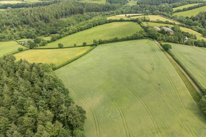
- Price
- Guide Price£280,000
- Size
- 30.47 acres
Added on 03/07/2026Vacant Land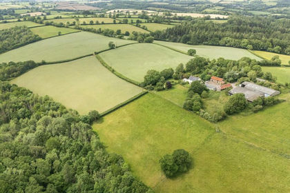
- Price
- Guide Price£295,000
- Size
- 33.03 acres
Added on 03/07/2026Farm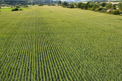
- Price
- Offers in Excess of£375,000
- Size
- 46 acres
Added on 28/04/2026Farmland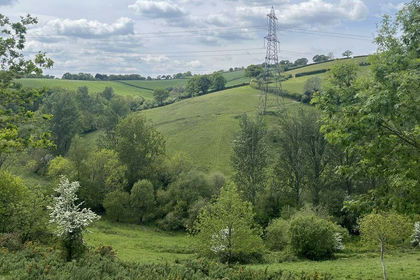
- Price
- £312,000
- Size
- 35.37 acres
Lot 1: 35.37 of Land at Bolsters Wood, Exeter, Exeter, Devon EX4 England
Added on 29/01/2026Vacant Land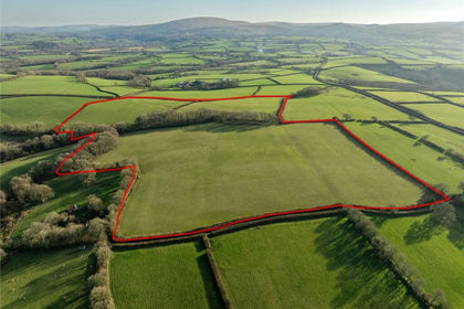
- Price
- Guide Price£295,000
- Size
- 34.64 acres
Sampford Courtenay, Okehampton, EX20, Sampford Courtenay, Devon EX20 England
Added on 28/04/2026Farmland
- Price
- £400,000
- Size
- 5.57 acres
North Devon, Land at Cleave Hill, Hilltop, Cleave Hill, Winkleigh, EX19, Dolton, Devon EX19 England
Added on 17/07/2026Agricultural Land
- Price
- Offers in Excess of£375,000
- Size
- 36.7 acres
Added on 01/09/2026Agricultural Land
- Price
- Guide Price£350,000
- Size
- 20 acres
20 Acres of land and building, Barnstaple, Devon EX32 England
Added on 23/05/2026Agricultural Land
- Price
- Offers in Excess of£300,000
- Size
- 9.2 acres
Added on 18/06/2026Development Land
- Price
- Guide Price£300,000
- Size
- 43.34 acres
Land At Newcott Barton, Hemyock, Cullompton, EX15, Cullompton, Devon EX15 England
Added on 11/09/2026Agricultural Land