Longlands, Cartmel, LA11
- Land size
- 3.28 acres
- Bedrooms
- 10
- Bathrooms
- 8
Key Features
- Grade II Listed country house
- Within the Lake District National Park
- Three reception rooms, study, dining kitchen, Butler's pantry and cellars
- 10 bedrooms, six are en suite and two bathrooms
- Seven cottages currently used as holiday lets
- The Hay Barn - a detached stone and slate two storey barn
- Beautiful walled garden with orangery, greenhouses and ornamental pond
- A successful holiday let portfolio
- In all, 3.28 acres (1.33 hectares)
- Accessible location at the foot of Hampsfell and enjoying magnificent views across Cartmel Valley
Description
A handsome Grade II Listed Georgian country residence with impressive primary living accommodation as well as seven cottages, a detached barn, a range of outbuildings and a wonderful walled garden and grounds.
The main house is extremely welcoming and beautifully presented, light and bright with high ceilings and well proportioned rooms. The principal rooms enjoy the stunning outlook towards Hampsfell or across parkland to the west.
There's an abundance of attractive period features with ceiling roses, decorative cornicing, deep skirtings, dado and picture rails, panelled door reveals, stone flag and oak floors, mahogany six panelled doors some with brass door furniture, sash windows, some with working shutters, marble fireplaces to name but a few.
The accommodation is set over two floors with a gross internal area of c. 6239 sq ft (579.6 sq m) with cellars c. 1022 sq ft (95 sq m) and the cottages c. 4440 sq ft (412.5 sq m) in total.
Ground floor
Step inside to the welcoming reception hall with wood floor and decorative arch with doric columns. Off the hall are three reception rooms: the elegant drawing room is dual aspect with decorative marble fireplace with multi-fuel stove and double doors opening up to the cosy sitting room with a marble (open) fireplace and slate hearth. The stately dining room is dual aspect with arched recess and a decorative (open) fireplace and a tiled hearth. An inner hall with flagged floor and built-in cupboards leads to a study with fitted bookshelves. A rear hall has a two piece cloakroom, access to the cellar rooms and a boot room. It also provides access to the dining kitchen and staircase to the first floor east wing.
The dining kitchen is situated at the rear - a great space for entertaining with a black and white chequered floor, decorative carved (open) fireplace and two tall windows and a glazed door out to the courtyard. The kitchen has an island unit, Belfast sinks, dresser unit, two oven cream electric Aga and electric combi oven in island unit.
Backing up the kitchen is the Butler's Pantry with sink unit, plumbing for a washing machine, electric meters for the cottage and access to a rear porch. There is also a second staircase to the east wing first floor.
Stone steps lead to the vaulted cellar rooms with flag floors and external access. Wine store with stone bins, room 2 with stone benches, room 3 with Belfast sink, boiler and hot water
cylinder and room 4 provides excellent storage.
First floor
From the entrance hall, the striking curved stone staircase with wrought iron balustrade and mahogany handrail leads to the main landing with dome window and arch with columns mirroring the entrance hall.
There are four double bedrooms and a fifth single, all with en suites; bedrooms 1, 2 and 5 enjoy the lovely aspect across parkland to the front and bedroom 4 has a splendid outlook towards the Lakeland Fells. The rear staircase leads to the east wing with four further double bedrooms, one being en suite, a fifth single and two bathrooms, all overlooking the courtyard and towards Hampsfell.
Cottages
Set around a courtyard to the rear are a collection of individual dual aspect cottages, formerly outbuildings housing washhouse, laundry, back kitchen and stables.
To the south of the main house in the south wing are a pair of semi-detached cottages; Huntsman Cottage with open plan living/dining kitchen, two double bedrooms and a bathroom and The Grooms Quarters with open plan living/dining kitchen, a bedroom and bathroom. To the southeast, The Coach House is a detached one bedroom cottage with bathroom and an open plan living/dining kitchen.
To the north, a row of four terraced cottages - Old Kitchen Cottage with original ceiling hooks in the living/dining kitchen has a cloakroom and ground floor bedroom with en suite and two double bedrooms and bathroom to the first floor. Milkmaids Parlour is a mid-terrace cottage with open plan living/dining kitchen, a bedroom and bathroom. Gamekeepers Retreat Cottage, another mid terrace cottage with a large living/dining kitchen, bedroom and bathroom. Laundrymaid's Cottage is an end terrace cottage with open plan living/dining kitchen, bedroom and bathroom.
The Hay Barn
Located to the east of the house and completely rebuilt in 2015, a detached two storey stone and slate 'party barn' with games rooms, storeroom, inner hall with terracotta and black tiled floor, cloakrooms and games rooms with slate floor and larch ceiling and walls. To the first floor, there is one large room, open to the apex, with exposed roof timbers, conservation skylight windows, a wood burning stove set to one corner and glazed, double doors providing external access via the hay ramp and splendid views of Hampsfell.
Gardens & Grounds
Breathtaking from the moment you arrive, Longlands is approached via a third party gravel track to a large parking area with gravel driveway. This leads to an arrival terrace to the front of the main house.
A delightful walled garden, situated to the south east, has been restored over recent years to create a romantic ornamental garden with central pond, productive vegetable/ fruit garden, deep planted herbaceous beds and seating areas including two arbours. Within the garden is a recently built south facing orangery with two lean to greenhouses either side - all with great views of Hampsfell. The gardens wrap around the main house, cottages and Hay Barn with large level lawns, well stocked herbaceous borders providing all year round interest and established shrubs and trees. Depending on the time of day, there are various seating areas situated throughout the gardens and grounds offering different views of the gardens and countryside beyond. It's a great space for entertaining.
A useful range of outbuildings are situated within the grounds including a stone and slate folly, potting sheds, garden and wood stores. In all, 3.28 acres (1.33 hectares).
Map Location
Property details
- Tenure
- Freehold
- Council Tax Band
- Ask Agent
- Date Posted
- 2026-01-29
Market Value Analysis
Compared with 781 Homes with Land listings in North West England (1+ acres).
Utilities & Restrictions
Utilities
- Electricity
- Ask Agent
- Water
- Ask Agent
- Heating
- Ask Agent
- Broadband
- Ask Agent
- Sewerage
- Ask Agent
Rights & Restrictions
- Public Rights of Way
- Ask Agent
- Private Rights of Way
- Ask Agent
- Listed Property
- Ask Agent
- Restrictions
- Ask Agent
Listed status, conservation areas and planning constraints for this location are in the full report.
Property Features
- Accessibility
- Ask Agent
- Parking
- Parking Available
- Garden
- Garden
Beyond the particulars: planning activity, flood history, heritage and ground risks, checked for this exact spot.
Connectivity
Broadband
Fastest speed available at this postcode
50 Mbps
Superfast
Suitable for
- HD streaming
- Video calls
- Web & social
Fixed wireless access may also be an option here.
Mobile signal
Predicted 4G and 5G signal; indoor signal depends on building materials.
Ofcom Connected Nations postcode-level predictions. Speeds and signal are modelled, not measured, and vary between addresses and providers.
Signal is the easy part. Planning activity, flood history and protected designations here are in the full report.
Nearest Schools
Primary
- Cartmel CofE Primary School0.7 milesOfsted: Good
- Ages
- 4 to 11
- Pupils
- 47
- Type
- Voluntary controlled school
- Faith
- Church of England
- Grange CofE Primary School1.5 milesOfsted: Good
- Ages
- 3 to 11
- Pupils
- 192
- Type
- Voluntary controlled school
- Faith
- Church of England
- Allithwaite CofE Primary School1.7 milesNo Ofsted rating
- Ages
- 3 to 11
- Pupils
- 109
- Type
- Voluntary controlled school
- Faith
- Church of England
- Lindale CofE Primary School1.8 milesOfsted: Good
- Ages
- 3 to 11
- Pupils
- 47
- Type
- Voluntary controlled school
- Faith
- Church of England
- Flookburgh CofE Primary School2.8 milesNo Ofsted rating
- Ages
- 3 to 11
- Pupils
- 58
- Type
- Foundation school
- Faith
- Church of England
Secondary
- Cartmel Priory CofE School0.8 milesOfsted report card · May 2026
- Ages
- 11 to 16
- Pupils
- 371
- Type
- Academy converter
- Faith
- Church of England
- Ulverston Victoria High School6.5 milesOfsted: Good *
- Ages
- 11 to 18
- Pupils
- 1,319
- Type
- Community school
- Dallam School7 milesOfsted report card · Apr 2026
- Ages
- 11 to 18
- Pupils
- 761
- Type
- Academy converter
- Carnforth High School9.2 milesOfsted report card · Apr 2026
- Ages
- 11 to 16
- Pupils
- 657
- Type
- Academy converter
- Morecambe Bay Academy9.8 milesOfsted: Good
- Ages
- 11 to 18
- Pupils
- 1,045
- Type
- Academy sponsor led
* Latest graded judgement covers quality of education only; no overall grade was issued under the 2024-25 inspection framework.
Distances are straight-line from the advertised location. Source: the national school registers (DfE, Welsh Government, Scottish Government) and Ofsted.
Schools are just the start: sold prices nearby, planning activity and any flood history are in the full report.
Amenities
Supermarket
GP surgery
Pharmacy
Hospital
Straight-line distances from the advertised location. Sources: NHS records, Geolytix supermarket locations, OS Open Greenspace and the national trails registers.
The area stacks up? Now check the location itself: planning nearby, protected designations and past flooding.
Getting Around
Nearest station
Nearest bus stop
Typical drive times
Straight-line distances from the advertised location; drive times are typical free-flow times over OpenStreetMap road data, so allow more at peak. Public transport locations from DfT NaPTAN.
Easy to reach matters. So do planning activity, flood history and ground risks: all in the full report.
Flood Risk
Environment Agency open data, checked around the advertised map pin for the listed acreage. Long-term risk counts flood defences; the planning map's flood zones do not. Provided by LandSale, not the listing agent, and not part of the agent's particulars. Risk varies across a holding, so verify before committing.
Rivers and the sea
Planning map: Flood Zone 1.
Surface water
Not at the pin: mapped about 20 metres away.
These bandings are the summary. Where this location sits on the flood maps, plus planning activity, heritage and ground risks, is in the full report.
Important notice: Information, maps and tags on this page are drawn from the advertising agent's marketing materials or generated automatically. LandSale has not verified them. Relying on these details is at your own risk, always carry out independent checks before committing to a purchase.
LandSale full disclaimer
Marketing information only - not formal particulars. The details on this website are provided for general guidance and do not constitute an offer or contract. Neither LandSale nor the advertising estate/land agent accepts responsibility for any inaccuracy.
1. Source of information
- Listing content: Core description, asking price, tenure, measurements, photographs and planning history originate from the marketing materials of the advertising estate or land agent. LandSale does not author this content and cannot guarantee its accuracy.
- Automated tags & categorisation: Property type, land-use class, acreage bands and similar labels may be applied by machine-learning models. They are intended as a helpful guide only and may not reflect the property's legal status or permitted use.
- Third-party & enriched data layers: Maps, boundary outlines, planning designations, soil reports, broadband coverage and other environmental or location-based insights are licensed from external suppliers. Such data are supplied “as is", may be incomplete or out of date and are subject to change without notice.
2. Verification required
Prospective purchasers must verify critical matters, including but not limited to planning permission, title boundaries, public rights of way, environmental constraints, acreage, services, access and VAT status, through their own inspections, specialist surveys, legal advisers and the selling agent before relying on the information or entering into any contract.
3. No warranty or liability
LandSale gives no warranty, express or implied, as to the accuracy, completeness or fitness for any particular purpose of the information displayed. LandSale shall not be liable for any loss, damage, cost or expense arising directly or indirectly from any use of or reliance on such information, save where liability may not be excluded by law.
4. Updates & feedback
If you believe any detail on this listing is inaccurate, please let us know. We will investigate and, where appropriate, update the listing or notify the agent.
© LandSale | Version 1.3 - August 2026
Listing agent
Davis & Bowring, Kirkby Lonsdale
Lane House, Kendal Road, Kirkby Lonsdale, Via Carnforth, LA6 2HH
Contact Davis & Bowring, Kirkby Lonsdale
Lane House, Kendal Road, Kirkby Lonsdale, Via Carnforth, LA6 2HH
View agent profileSimilar properties for sale
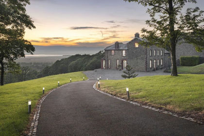
- Price
- £2,250,000
- Size
- 8 acres
Added on 04/07/2026Country Home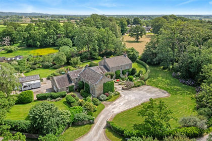
- Price
- Offers in Region of£1,950,000
- Size
- 10.6 acres
Stony Lane, Clifton Hill, Forton, Preston, Forton, Lancashire PR3 England
Added on 11/06/2026Country Home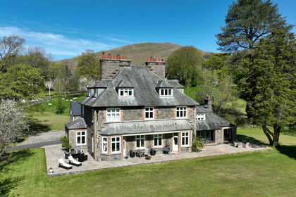
- Price
- Guide Price£1,950,000
- Size
- 1.85 acres
The Old Parsonage, Sedbergh, LA10, Sedbergh, Westmorland and Furness LA10 England
Added on 28/04/2026Country Home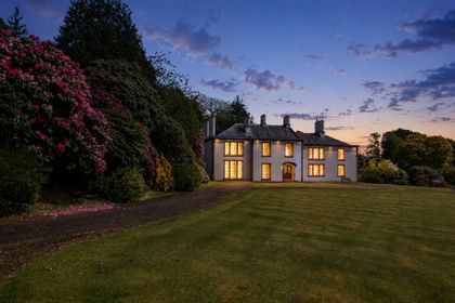
- Price
- £2,500,000
- Size
- 20 acres
Greenlands Hall Estate, Holmrook, Cumbria, CA19, Drigg and Carleton, Cumberland CA19 England
Added on 17/09/2026Country Home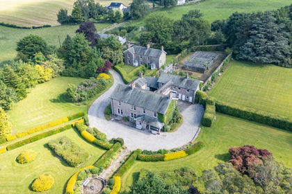
- Price
- Guide Price£2,000,000
- Size
- 4.95 acres
Pooley Bridge, Penrith, CA10, Barton and Pooley Bridge, Westmorland and Furness CA10 England
Added on 03/07/2026Country Home