Healeywood Farm, Morpeth, Northumberland
- Land size
- 289.85 acres
Key Features
- 117.2 hectares (289.85 acres) or thereabouts in all
- An accessible and viable stand alone unit located to the East of Morpeth
- Good quality Grade 3 arable land extending to approximately 275 acres
- Woodland and grassland parcels offering amenity and potential for natural capital opportunities extending to approximately 15 acres
- Modern agricultural building constructed in 2020 suitable for grain and machinery storage extending to 465 square metres
Description
SITUATION
Healeywood Farm is situated in Mid Northumberland approximately 1.5 miles to the east of the popular market town of Morpeth and lies only 18 miles to the north of region's main city Newcastle upon Tyne.
The land lies adjacent to the A196 Morpeth to Ashington road which provides good access to the local road network making the holding accessible for modern farming operations.
Coupled with the desirable local area the property lies in an area recognised for the productivity and output of the farmland and the ability to grow good quality arable crops.
DESCRIPTION
Healeywood Farm is good sized block of principally arable land held in a ring fence and varies in height from 30 meters above sea level on the eastern boundary up to 52 meters at the western boundary and access to the holding.
The farm is a productive arable unit and includes a recently constructed modern farm building suitable for grain and machinery storage. Combined this presents Healeywood as an opportunity to acquire a quality stand alone unit or equally a substantial block to complement existing farming operations.
The property is offered for sale by private treaty as a whole.
HISTORY
The farm has belonged to the current family owners for three generations and has been farmed to a high standard in a conventional arable rotation during that time.
More recently the family have taken advantage of changing agricultural policy and entered into Countryside Stewardship options that complement the arable cropping and expand the existing environmental attributes of the holding.
The holding currently offers huge potential for purchasers to continue and enhance the current farming system or indeed look to maximise production of quality land capable of producing good crops.
Land
Traditional farming operations by the owners over recent years combined with current environmental stewardship options allows the land to maintain a rotation focused around main crops of wheat and barley with beans (historically oil seed ) implemented as a break crop.
Currently the farm comprises of approximately 111 hectares (275 acres) of arable cropping, 6 hectares (15 acres) of grassland margins and amenity woodland.
The Agricultural Land Classification Map North East Region (ALC001) shows the land being classified as Grade 3. The Rural Land Registry classifies all of the land as Non Severely Disadvantaged (Non SDA).
Formal land classifications aside, it is clear on inspection that the arable land is capable of supporting good crops with grassland margins delivering environmental benefits complementing the overall diversity of the farm.
The arable fields consist of good sized regularly shaped parcels, making them well-suited for modern farming operations. Internal access tracks and margins allow good access throughout the holding.
Located to the eastern boundary of the farm lies a small burn that is flanked by deciduous trees leading into a pleasant area of amenity woodland with a pond and wetland area offering natural wildlife habitat.
Modern Building and Retained Land
Complementing the holding and supporting the 290 acres of productive land is a recently constructed (2020) modern farm building perfectly suited to grain and machinery storage. The building is situated to the west of the main holding which will be retained by the vendors. The retained land is hatched red on the plan below.
The necessary right for (agricultural) access will be granted to the purchasers over the retained land to utilise existing access tracks into and through the holding as required.
Tenure
Healeywood Farm is offered for sale with vacant possession upon completion
Sporting Rights & Mineral Rights
Sporting rights are held in hand and included with the sale. The mineral rights are excepted and not included in the sale.
Plans, Areas and Schedules
These are based on the areas provided by the Rural Land Registry and Ordnance Survey and are for reference only. Although they have been carefully checked, the purchaser shall be deemed to have satisfied themselves as to the description of the property and any errors shall not annul the sale nor entitle either party to compensation in respect thereof.
Wayleaves, Easements and Rights of Way
The property is sold subject to and with the benefits of all rights of way whether public or private, water, light, drain, sewage, support and easements and other restrictive covenants and existing and proposed wayleaves for masts, pylons, cables, drains, water, gas and other pipes whether mentioned in these particulars or not. There is a gas pipeline that passes through the property. Further details of the location are available on request.
Method of Sale
The land is initially being offered for sale as a whole by private treaty on behalf of the Executors of FL Proctor (Deceased).
Services
The Property is only served by a natural water supply being the small minor burn to the easter boundary.
Currently the modern building is not connected to a mains water or electricity supply. If required, the purchaser(s) will need to express an interest to connect to services located on the retained land.
General Binding Regulations (GBR) 2020
Details on the condition of the farm's septic system are unknown. However the Vendor nevertheless does not give any undertaking that the property fully satisfies the GBR 2020 and any expressions of interest or offers made should take this into consideration.
Viewings
Strictly by prior appointment with the selling agents;
Map Location
Property details
- Tenure
- Freehold
- Council Tax Band
- Ask Agent
- Date Posted
- 2026-01-29
Market Value Analysis
Compared with 5 Farmland & Pasture listings in North East England (100+ acres).
Utilities & Restrictions
Utilities
- Electricity
- Ask Agent
- Water
- Ask Agent
- Heating
- Ask Agent
- Broadband
- Ask Agent
- Sewerage
- Ask Agent
Rights & Restrictions
- Public Rights of Way
- Ask Agent
- Private Rights of Way
- Ask Agent
- Listed Property
- Ask Agent
- Restrictions
- Ask Agent
Listed status, conservation areas and planning constraints for this location are in the full report.
Property Features
- Accessibility
- Ask Agent
- Parking
- Ask Agent
- Garden
- Ask Agent
Beyond the particulars: planning activity, flood history, heritage and ground risks, checked for this exact spot.
Connectivity
Broadband
Fastest speed available at this postcode
1.8 Gbps
Gigabit full fibre
Suitable for
- 4K streaming on every screen
- Full-time home working
- Online gaming & big downloads
Mobile signal
Predicted 4G and 5G signal; indoor signal depends on building materials.
Ofcom Connected Nations postcode-level predictions. Speeds and signal are modelled, not measured, and vary between addresses and providers.
Signal is the easy part. Planning activity, flood history and protected designations here are in the full report.
Nearest Schools
Primary
- Morpeth Stobhillgate First School1.2 milesOfsted: Good *
- Ages
- 3 to 9
- Pupils
- 165
- Type
- Academy converter
- Choppington Primary School1.7 milesOfsted: Good *
- Ages
- 2 to 11
- Pupils
- 109
- Type
- Community school
- Morpeth First School1.7 milesOfsted: Good
- Ages
- 3 to 9
- Pupils
- 320
- Type
- Community school
- Pegswood Primary School1.8 milesNo Ofsted rating
- Ages
- 3 to 11
- Pupils
- 133
- Type
- Community school
- Mowbray Primary School1.9 milesOfsted: Good *
- Ages
- 3 to 11
- Pupils
- 238
- Type
- Community school
Secondary
- St Benet Biscop Catholic Academy2.3 milesOfsted: Good
- Ages
- 11 to 18
- Pupils
- 994
- Type
- Academy converter
- Faith
- Roman Catholic
- The King Edward VI School2.3 milesOfsted: Good *
- Ages
- 13 to 18
- Pupils
- 1,426
- Type
- Academy converter
- Morpeth Chantry Middle School2.5 milesOfsted report card · Mar 2026
- Ages
- 9 to 13
- Pupils
- 525
- Type
- Academy converter
- Morpeth Newminster Middle School2.5 milesOfsted report card · Jan 2026
- Ages
- 9 to 13
- Pupils
- 521
- Type
- Academy converter
- Ashington Academy2.8 milesOfsted: Good
- Ages
- 11 to 18
- Pupils
- 964
- Type
- Academy sponsor led
* Latest graded judgement covers quality of education only; no overall grade was issued under the 2024-25 inspection framework.
Distances are straight-line from the advertised location. Source: the national school registers (DfE, Welsh Government, Scottish Government) and Ofsted.
Schools are just the start: sold prices nearby, planning activity and any flood history are in the full report.
Amenities
Supermarket
GP surgery
Pharmacy
Hospital
Green space
Straight-line distances from the advertised location. Sources: NHS records, Geolytix supermarket locations, OS Open Greenspace and the national trails registers.
The area stacks up? Now check the location itself: planning nearby, protected designations and past flooding.
Getting Around
Nearest station
Nearest bus stop
Typical drive times
Straight-line distances from the advertised location; drive times are typical free-flow times over OpenStreetMap road data, so allow more at peak. Public transport locations from DfT NaPTAN.
Easy to reach matters. So do planning activity, flood history and ground risks: all in the full report.
Flood Risk
Environment Agency open data, checked around the advertised map pin for the listed acreage. Long-term risk counts flood defences; the planning map's flood zones do not. Provided by LandSale, not the listing agent, and not part of the agent's particulars. Risk varies across a holding, so verify before committing.
Rivers and the sea
Planning map: Flood Zone 2, about 370 metres away.
Surface water
Not at the pin: mapped about 70 metres away.
These bandings are the summary. Where this location sits on the flood maps, plus planning activity, heritage and ground risks, is in the full report.
Important notice: Information, maps and tags on this page are drawn from the advertising agent's marketing materials or generated automatically. LandSale has not verified them. Relying on these details is at your own risk, always carry out independent checks before committing to a purchase.
LandSale full disclaimer
Marketing information only - not formal particulars. The details on this website are provided for general guidance and do not constitute an offer or contract. Neither LandSale nor the advertising estate/land agent accepts responsibility for any inaccuracy.
1. Source of information
- Listing content: Core description, asking price, tenure, measurements, photographs and planning history originate from the marketing materials of the advertising estate or land agent. LandSale does not author this content and cannot guarantee its accuracy.
- Automated tags & categorisation: Property type, land-use class, acreage bands and similar labels may be applied by machine-learning models. They are intended as a helpful guide only and may not reflect the property's legal status or permitted use.
- Third-party & enriched data layers: Maps, boundary outlines, planning designations, soil reports, broadband coverage and other environmental or location-based insights are licensed from external suppliers. Such data are supplied “as is", may be incomplete or out of date and are subject to change without notice.
2. Verification required
Prospective purchasers must verify critical matters, including but not limited to planning permission, title boundaries, public rights of way, environmental constraints, acreage, services, access and VAT status, through their own inspections, specialist surveys, legal advisers and the selling agent before relying on the information or entering into any contract.
3. No warranty or liability
LandSale gives no warranty, express or implied, as to the accuracy, completeness or fitness for any particular purpose of the information displayed. LandSale shall not be liable for any loss, damage, cost or expense arising directly or indirectly from any use of or reliance on such information, save where liability may not be excluded by law.
4. Updates & feedback
If you believe any detail on this listing is inaccurate, please let us know. We will investigate and, where appropriate, update the listing or notify the agent.
© LandSale | Version 1.3 - August 2026
Listing agent
Richard Brown & Partners, Belford
The Office, South Bellshill, Bellshill, Belford, NE70 7HP
Contact Richard Brown & Partners, Belford
The Office, South Bellshill, Bellshill, Belford, NE70 7HP
View agent profileSimilar properties for sale
- Price
- Offers Over£3,000,000
- Size
- 60 acres
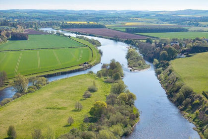
WARK ESTATE FISHINGS, Wark, Cornhill on Tweed, Carham, Northumberland TD12 England
Added on 11/08/2026River property
- Price
- Offers Over£2,190,000
- Size
- 57 acres
Added on 26/02/2026Commercial Land
- Price
- Offers Over£1,750,000
- Size
- 276.76 acres
Added on 13/08/2026Timberland
- Price
- Offers Over£1,800,000
- Size
- 14.5 acres
Added on 26/07/2026Development Land
- Price
- Guide Price£1,750,000
Added on 30/07/2026Redevelopment Land- Price
- Guide Price£1,750,000
Added on 24/09/2026Development Land