Coldingham Loch Estate, Coldingham Loch Fly Fishery & Holiday Lets, Coldingham, Eyemouth, TD14
- Land size
- 57 acres
- Dwelling size
- 2400 sqft
- Bedrooms
- 3
- Bathrooms
- 2
Key Features
- Superb modern house built in traditional style overlooking the loch with 2 reception rooms, 3 bedrooms and 3 bathroom/shower rooms
- Useful outbuildings, garaging and kennels
- Courtyard steading and Stable Cottage, laundry/store, workshop, coach house and loft with considerable
- Gate Lodge & Boathouse Cottage
- 5 well-managed timber holiday chalets
- 22 acre natural eutrophic loch
- Renowned trout fly fishery, member’s clubhouse, stone pump room housing aerator and stores
Description
The Coldingham Loch fishery and holiday letting enterprise is an exceptional rural business catering to the local and wider national market, offering unique and flexible options in a stunning and accessible location.
The loch, on which the whole property is centred, covers about 22 acres and is surrounded by about 35 acres of land with gorse banks, open grazing and newly planted woodland and is only a short walk to the cliff tops, having spectacular coastline views. It is the only naturally eutrophic loch in the Scottish Borders, which means it is of particularly high nutrient value, as it is filled by one above ground burn and four underground springs which issue from an aquifer at the northern reaches of the Yorkshire Limestone pavement and is a rare habitat in Britain.
The business is based around a first class trout fishery on Coldingham Loch; one of the oldest and most established fisheries in the country. The Fishery is operated on a members only basis with no day tickets currently available except for guests of members, visiting angling club members and holiday guests; a management decision. Membership is renewed and reviewed annually, and anglers are entitled to use the loch three times per week, in season, from either bank or boat, and have access to the Member’s Angling Hut and storage facilities, for an annual membership fee.
The loch has a stock of breeding brown trout but is also regularly stocked with Blue, Rainbow, Brown and Tiger trout. Members are drawn predominantly from Southern Scotland and Northumberland and has a well-earned reputation for being a fantastic place to enjoy a top quality days fishing.
The holiday letting enterprise is based around self-catering from two traditional stone built cottages being the Lodge Cottage and Loch Side Cottage & Boathouse. Stable Cottage lies within a beautiful stone-built former coach house, which offers considerable scope for further development, and beside which is the Old Dairy which now acts as the laundry.
In the woodland behind the Lodge are five timber built chalets, three of which have been refurbished in recent times and the remaining two, habitable, but requiring upgrading inside.
All eight cottages have their own outdoor space as well as plenty of parking. The cottages are available to guests all year round along with fly fishing on the Loch in the season.
Further details of the fishing and accommodation can be found at the Coldingham Cottages & Fly Fishing website.
THE LOCH HOUSE
The Loch House is set in an elevated position with spectacular views over the loch and the sea beyond. It is a spacious, newly built, two storey house, in an attractive traditional style, using high quality modern materials, highly insulated and has double glazing throughout and with an air-source heat pump making it efficient to run.
The accommodation is set out over two floors and designed to take maximum advantage of the stunning outlook.
Ground Floor: vestibule, hall, utility room/boot room, w.c, open plan kitchen/dining room/snug/study and separate sitting room.
First Floor: three double bedrooms, two bath/shower rooms (one en-suite).
There is a lovely sunny terrace to the west and a gravelled terrace on the east, both overlooking the loch and sea and informal gardens blend the property into its natural surroundings. Outside are a useful range of outbuildings and stores, also newly built, and which include kennels.
DISTANCES
Coldingham Village 1.5 miles, Eyemouth 4.7 miles, Reston Train Station 4.6 miles, Berwick upon Tweed 14 miles, Dunbar 19 miles, North Berwick 30 miles, Haddington 29 miles, Edinburgh 47 miles. (All distances are approximate)
Map Location
Property details
- Tenure
- Freehold
- Council Tax Band
- G
- Date Posted
- 2026-02-26
Energy Performance Certificate
Energy Efficiency Rating
Based on UK Energy Performance Certificate standards (EU Directive 2002/91/EC)
Running costs are one side. Planning activity, flood history and ground risks for this location are in the full report.
Utilities & Restrictions
Utilities
- Electricity
- National Grid
- Water
- Direct Main Waters
- Heating
- Ask Agent
- Broadband
- Ask Agent
- Sewerage
- Septic Tank
Rights & Restrictions
- Public Rights of Way
- Ask Agent
- Private Rights of Way
- Ask Agent
- Listed Property
- Ask Agent
- Restrictions
- Ask Agent
Listed status, conservation areas and planning constraints for this location are in the full report.
Property Features
- Accessibility
- Ask Agent
- Parking
- Off street (1)
- Garden
- Garden
Beyond the particulars: planning activity, flood history, heritage and ground risks, checked for this exact spot.
Connectivity
Broadband
Fastest speed available at this postcode
1.8 Gbps
Gigabit full fibre · available to 71% of premises
Suitable for
- 4K streaming on every screen
- Full-time home working
- Online gaming & big downloads
Mobile signal
Predicted 4G and 5G signal; indoor signal depends on building materials.
Ofcom Connected Nations postcode-level predictions. Speeds and signal are modelled, not measured, and vary between addresses and providers.
Signal is the easy part. Planning activity, flood history and protected designations here are in the full report.
Nearest Schools
Primary
- Coldingham Primary School1.4 miles
- Pupils
- 57
- Type
- Non-denominational
- Eyemouth Primary School3.9 miles
- Pupils
- 324
- Type
- Non-denominational
- Reston Primary School4.1 miles
- Pupils
- 37
- Type
- Non-denominational
- Ayton Primary School4.8 miles
- Pupils
- 70
- Type
- Non-denominational
- Chirnside Primary School7.7 miles
- Pupils
- 168
- Type
- Non-denominational
Secondary
- Eyemouth High School4.4 miles
- Pupils
- 495
- Type
- Non-denominational
- Berwickshire High School12 miles
- Pupils
- 574
- Type
- Non-denominational
- Dunbar Grammar School15 miles
- Pupils
- 1,120
- Type
- Non-denominational
- Kelso High School23 miles
- Pupils
- 592
- Type
- Non-denominational
- North Berwick High School24 miles
- Pupils
- 1,045
- Type
- Non-denominational
Distances are straight-line from the advertised location. Source: the national school registers (DfE, Welsh Government, Scottish Government) and Ofsted.
Schools are just the start: planning activity, heritage and any flood history here are in the full report.
Amenities
Supermarket
GP surgery
Pharmacy
Straight-line distances from the advertised location. Sources: NHS records, Geolytix supermarket locations, OS Open Greenspace and the national trails registers.
The area stacks up? Now check the location itself: planning nearby, protected designations and past flooding.
Getting Around
Nearest station
Nearest bus stop
Typical drive times
Straight-line distances from the advertised location; drive times are typical free-flow times over OpenStreetMap road data, so allow more at peak. Public transport locations from DfT NaPTAN.
Easy to reach matters. So do planning activity, flood history and ground risks: all in the full report.
Flood Risk
SEPA open data, checked around the advertised map pin for the listed acreage. Provided by LandSale, not the listing agent, and not part of the agent's particulars. Risk varies across a holding, so verify before committing.
Rivers and the sea
Surface water
Not at the pin: mapped about 40 metres away.
These bandings are the summary. Where this location sits on the flood maps, plus planning activity, heritage and ground risks, is in the full report.
Important notice: Information, maps and tags on this page are drawn from the advertising agent's marketing materials or generated automatically. LandSale has not verified them. Relying on these details is at your own risk, always carry out independent checks before committing to a purchase.
LandSale full disclaimer
Marketing information only - not formal particulars. The details on this website are provided for general guidance and do not constitute an offer or contract. Neither LandSale nor the advertising estate/land agent accepts responsibility for any inaccuracy.
1. Source of information
- Listing content: Core description, asking price, tenure, measurements, photographs and planning history originate from the marketing materials of the advertising estate or land agent. LandSale does not author this content and cannot guarantee its accuracy.
- Automated tags & categorisation: Property type, land-use class, acreage bands and similar labels may be applied by machine-learning models. They are intended as a helpful guide only and may not reflect the property's legal status or permitted use.
- Third-party & enriched data layers: Maps, boundary outlines, planning designations, soil reports, broadband coverage and other environmental or location-based insights are licensed from external suppliers. Such data are supplied “as is", may be incomplete or out of date and are subject to change without notice.
2. Verification required
Prospective purchasers must verify critical matters, including but not limited to planning permission, title boundaries, public rights of way, environmental constraints, acreage, services, access and VAT status, through their own inspections, specialist surveys, legal advisers and the selling agent before relying on the information or entering into any contract.
3. No warranty or liability
LandSale gives no warranty, express or implied, as to the accuracy, completeness or fitness for any particular purpose of the information displayed. LandSale shall not be liable for any loss, damage, cost or expense arising directly or indirectly from any use of or reliance on such information, save where liability may not be excluded by law.
4. Updates & feedback
If you believe any detail on this listing is inaccurate, please let us know. We will investigate and, where appropriate, update the listing or notify the agent.
© LandSale | Version 1.3 - August 2026

Listing agent
Paton & Co, Berwick-upon-Tweed
Paton & Co Estate Agents, 17F Windmill Way West, Ramparts Business Park, Berwick-upon-Tweed, TD15 1TB
Contact Paton & Co, Berwick-upon-Tweed
Paton & Co Estate Agents, 17F Windmill Way West, Ramparts Business Park, Berwick-upon-Tweed, TD15 1TB
View agent profileSimilar properties for sale
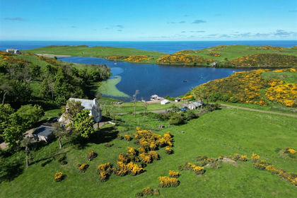
- Price
- Offers Over£2,190,000
- Size
- 57 acres
Added on 29/01/2026Fishery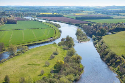
- Price
- Offers Over£3,000,000
- Size
- 60 acres
WARK ESTATE FISHINGS, Wark, Cornhill on Tweed, Carham, Northumberland TD12 England
Added on 11/08/2026River property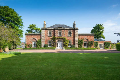
- Price
- Offers Over£2,995,000
- Size
- 2.5 acres
The Glebe House, 4 Law Road, North Berwick, East Lothian, Lothian East, East Lothian EH39 Scotland
Added on 06/04/2026House with Land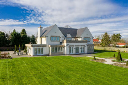
- Price
- Fixed Price£1,600,000
- Size
- 1 acres
Rose Bank, Longniddry, Lothian East, East Lothian EH32 Scotland
Added on 29/01/2026House with Land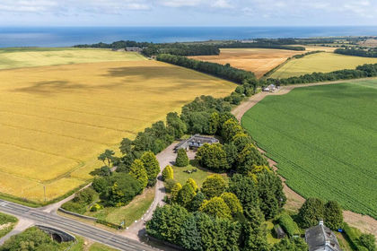
- Price
- Offers Over£3,000,000
- Size
- 2 acres
The Old Station B & B, Stravithie, St. Andrews, North East Fife, Fife KY16 Scotland
Added on 17/07/2026House with Land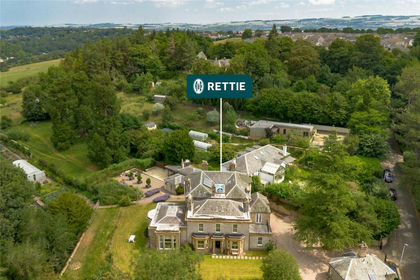
- Price
- Offers Over£1,650,000
- Size
- 1.4 acres
Briary House & Gate Lodge, 29 & 31 Polton Bank, Lasswade, Midlothian, Midlothian EH18 Scotland
Added on 24/08/2026House with Land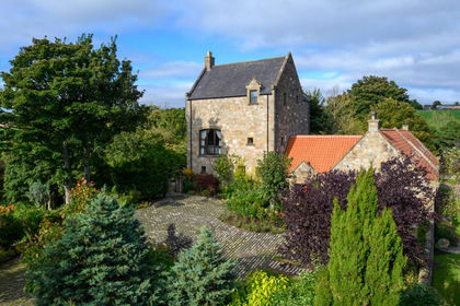
- Price
- Offers Over£1,900,000
- Size
- 1.68 acres
Pirwindy Keep, Leven, Fife, North East Fife, Fife KY8 Scotland
Added on 29/01/2026Country Home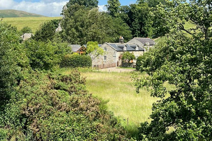
- Price
- Guide Price£1,400,000
Low Alwinton Cottages, Alwinton, Morpeth, Northumberland, Alwinton, Northumberland NE65 England
Added on 29/01/2026Multiple Dwelling Property
- Price
- Offers in Excess of£1,450,000
- Size
- 7.05 acres
32a Old Pentland Road, Damhead, Edinburgh, Midlothian, Midlothian EH10 Scotland
Added on 07/10/2026Commercial Land
- Price
- Offers Over£1,575,000
- Size
- 351.39 acres
Pomathorn Farm, Penicuik, Midlothian, EH26, Midlothian, Midlothian EH26 Scotland
Added on 29/01/2026Farm