Main Road, Langrick, Boston, Lincolnshire, PE22
- Land size
- 3.95 acres
- Bedrooms
- 3
Key Features
- Barn Conversion with Outbuildings, Display Areas and Touring Caravan Site
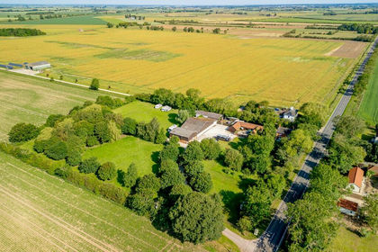
- Located in Just Under 4 Acres, 1.6 Hectares of Woodland
- Superb Modern 3 Bedroomed Barn Conversion with Open Plan Kitchen Living Area
- Suitable to Annexe
- Over 400sqm, 4,300sqft of Open Plan Workshops
- Currently Arranged as a Museum with Licenced Café
- Touring and Camping Site with 10 Electrical Hook Ups and Amenities
- Viewing Highly Recommended
- Possible Transfer Trading as a Going Concern
Description
Location...
The village of Langrick is located on the B1192 approximately 6 miles to the north-west of Boston, a large South Lincolnshire market town with a population of approximately 73,000 residents.
Lincoln is approximately 25 miles to the north-east, the A1 trunk road is approximately 20 miles to the west and the A17 trunk road and A16 trunk road are approximately 8 miles to the south.
The village of Langrick is on the road between Boston and Coningsby, the property being located approximately 3 miles to the north of Langrick Bridge on the west side of the road just before the turning known as Haven Bank.
Description...
The property comprises a unique opportunity to purchase a barn conversion, workshop and a campsite in a woodland setting.
A purchaser may look to continue the existing business or alternatively work from home. It is felt that the property would also be of appeal to those of an equestrian nature, classic car enthusiasts or other hobbyists.
A sweeping treelined gated driveway leads through to a parking area with space for over 20 vehicles either side of which are located the barn conversion to the north of the plot and the museum workshops to the west of the parking area.
To the eastern side is a paddock with trees and fenced area, the western side is arranged to provide an area of woodland and a campsite for 10 touring caravans with electrical hook ups, chemical waste disposal point, amenities and a washing area and a rally paddock on the south half.
The property includes a significant range of outbuildings extending to around 4,300sqft in total.
Clover Farm Barn
Main Barn Conversion
An Entrance Courtyard gives access to the Main Living Area /Kitchen, having a vaulted ceiling.
Kitchen/Living Room........................................9m x 5m
Comprising a modern fitted kitchen with breakfast bar and Rayburn, having a range of units comprising high level cupboards with display windows, integrated extractor fan, complementing worktops with stainless steel sink with drainer, complementing splash backs, 9 door base units with 5 drawers, ceiling lights and exposed ceiling beams. The lounge area has a multi fuel boiler and fireplace.
Utility Room
Accessed from the Courtyard.
Covered Barbeque Area
East Wing
Master Bedroom..................................4.8m x 4.3m max
Having a range of fitted cupboards and double height ceiling with exposed beams.
En-Suite Bathroom.........................................4.1m x 3m
Having roll top bath with WC, pedestal hand basin, heated towel rail and walk-in airing cupboard with high pressure tank.
West Wing
Inner Hall
Bedroom 2.............................................4.9m x 4.2m max
Having full height ceilings with exposed beams and central heating radiator.
Thru Office....................................................2.7m x 2.8m
Shower Room
Having walk-in shower, pedestal hand basin, low level WC and heated towel rail.
Bedroom 3.....................................................4.8m x 4.6m
Having the original former feeding troughs incorporated to form a storage shelf.
The layout of the West Wing is suitable to be annexed.
Main Café Tearooms.....................................10.2m x 8.7m
Arranged to provide 40 covers, having a licensed bar and serving area, tiled floor, multi fuel boiler with plumbed in central heating radiators.
Kitchenette .....................................................2.9m x 2.1m
Having a range of modern fitted kitchen units, stainless steel sink with 1½ bowl drainer, space for fridge and cooker.
Amenity Area
To the rear of the tearooms is an amenity area.
Male and Female WCs
Disabled WC
Wash Down Area
With washing machine for campers and storage cupboard. A rear door leads through to the rear campsite.
Campsite
The campsite is arranged to provide space for 10 electrical hook ups ad also space for campers.
The south side of the field has previously been used as a rally for various vehicle displays.
Museum
To the north of the tearooms is the public entrance to the museum being a framed building with mezzanine display area.
The museum is arranged to provide a display for over 40 vehicles with a number of areas with various other domestic historical displays.
Main Display Area.......................28.6m x 13.9m, 400sqm
Having a minimum internal eaves height of 4.5m, open plan concrete floor displaying over 30 vehicles, various display areas.
Mezzanine Display Area.............13.4m x 8.5m, 114sqm Currently arranged for displaying 11 vehicles and 11 bikes with various display cabinets.
Agent's Notes...
The site is a well-regarded car museum. A full inventory of available vehicles is available on request and of course it is possible that they can be incorporated into the sale along with an inventory of fixtures and fittings.
Tenure...
The property is available for sale freehold with vacant possession.
Outgoings...
The property is assessed for Business Rates and has a Rateable Value of £3,800 therefore qualifying businesses may be eligible for relief.
Viewing...
All viewings are to be made by appointment through the agent.
Poyntons Consultancy.
Map Location
Property details
- Tenure
- Ask Agent
- Council Tax Band
- Ask Agent
- Date Posted
- 2026-01-28
Market Value Analysis
Compared with 708 Homes with Land listings in East Midlands (1+ acres).
Utilities & Restrictions
Utilities
- Electricity
- Ask Agent
- Water
- Ask Agent
- Heating
- Ask Agent
- Broadband
- Ask Agent
- Sewerage
- Ask Agent
Rights & Restrictions
- Public Rights of Way
- Ask Agent
- Private Rights of Way
- Ask Agent
- Listed Property
- Ask Agent
- Restrictions
- Ask Agent
Listed status, conservation areas and planning constraints for this location are in the full report.
Property Features
- Accessibility
- Ask Agent
- Parking
- Parking Available
- Garden
- Garden
Beyond the particulars: planning activity, flood history, heritage and ground risks, checked for this exact spot.
Connectivity
Broadband
Fastest speed available at this postcode
1.8 Gbps
Gigabit full fibre · available to 64% of premises
Suitable for
- 4K streaming on every screen
- Full-time home working
- Online gaming & big downloads
Fixed wireless access may also be an option here.
Mobile signal
Predicted 4G and 5G signal; indoor signal depends on building materials.
Ofcom Connected Nations postcode-level predictions. Speeds and signal are modelled, not measured, and vary between addresses and providers.
Signal is the easy part. Planning activity, flood history and protected designations here are in the full report.
Nearest Schools
Primary
- Gipsey Bridge Academy1.5 milesNo Ofsted rating
- Ages
- 5 to 11
- Pupils
- 97
- Type
- Academy converter
- Boston West Academy5.1 milesOfsted: Good
- Ages
- 4 to 11
- Pupils
- 412
- Type
- Academy converter
- Coningsby St Michael's Church of England Primary School5.1 milesOfsted: Good
- Ages
- 4 to 11
- Pupils
- 249
- Type
- Academy converter
- Faith
- Church of England
- Park Academy5.3 milesOfsted: Good
- Ages
- 4 to 11
- Pupils
- 300
- Type
- Academy converter
- Tattershall Holy Trinity Church of England Primary School5.5 milesOfsted: Good *
- Ages
- 4 to 11
- Pupils
- 92
- Type
- Academy converter
- Faith
- Church of England
Secondary
- The Barnes Wallis Academy5.4 milesNo Ofsted rating
- Ages
- 11 to 16
- Pupils
- 483
- Type
- Academy sponsor led
- Haven High Academy5.4 milesOfsted: Inadequate
- Ages
- 11 to 16
- Pupils
- 1,229
- Type
- Academy converter
- Boston High School5.8 milesNo Ofsted rating
- Ages
- 11 to 18
- Pupils
- 837
- Type
- Academy converter
- Gender
- Girls
- The Boston Grammar School6.1 milesOfsted report card · Apr 2026
- Ages
- 11 to 18
- Pupils
- 924
- Type
- Academy converter
- Gender
- Boys
- William Lovell Church of England Academy6.6 milesOfsted report card · Mar 2026
- Ages
- 11 to 16
- Pupils
- 347
- Type
- Academy converter
- Faith
- Church of England
* Latest graded judgement covers quality of education only; no overall grade was issued under the 2024-25 inspection framework.
Distances are straight-line from the advertised location. Source: the national school registers (DfE, Welsh Government, Scottish Government) and Ofsted.
Schools are just the start: sold prices nearby, planning activity and any flood history are in the full report.
Amenities
Supermarket
GP surgery
Pharmacy
Hospital
Straight-line distances from the advertised location. Sources: NHS records, Geolytix supermarket locations, OS Open Greenspace and the national trails registers.
The area stacks up? Now check the location itself: planning nearby, protected designations and past flooding.
Getting Around
Nearest station
Nearest bus stop
Typical drive times
Straight-line distances from the advertised location; drive times are typical free-flow times over OpenStreetMap road data, so allow more at peak. Public transport locations from DfT NaPTAN.
Easy to reach matters. So do planning activity, flood history and ground risks: all in the full report.
Flood Risk
Environment Agency open data, checked around the advertised map pin for the listed acreage. Long-term risk counts flood defences; the planning map's flood zones do not. Provided by LandSale, not the listing agent, and not part of the agent's particulars. Risk varies across a holding, so verify before committing.
Rivers and the sea
Not at the pin: mapped about 60 metres away.
Planning map: Flood Zone 3, about 50 metres away.
Surface water
Not at the pin: mapped about 60 metres away.
These bandings are the summary. Where this location sits on the flood maps, plus planning activity, heritage and ground risks, is in the full report.
Important notice: Information, maps and tags on this page are drawn from the advertising agent's marketing materials or generated automatically. LandSale has not verified them. Relying on these details is at your own risk, always carry out independent checks before committing to a purchase.
LandSale full disclaimer
Marketing information only - not formal particulars. The details on this website are provided for general guidance and do not constitute an offer or contract. Neither LandSale nor the advertising estate/land agent accepts responsibility for any inaccuracy.
1. Source of information
- Listing content: Core description, asking price, tenure, measurements, photographs and planning history originate from the marketing materials of the advertising estate or land agent. LandSale does not author this content and cannot guarantee its accuracy.
- Automated tags & categorisation: Property type, land-use class, acreage bands and similar labels may be applied by machine-learning models. They are intended as a helpful guide only and may not reflect the property's legal status or permitted use.
- Third-party & enriched data layers: Maps, boundary outlines, planning designations, soil reports, broadband coverage and other environmental or location-based insights are licensed from external suppliers. Such data are supplied “as is", may be incomplete or out of date and are subject to change without notice.
2. Verification required
Prospective purchasers must verify critical matters, including but not limited to planning permission, title boundaries, public rights of way, environmental constraints, acreage, services, access and VAT status, through their own inspections, specialist surveys, legal advisers and the selling agent before relying on the information or entering into any contract.
3. No warranty or liability
LandSale gives no warranty, express or implied, as to the accuracy, completeness or fitness for any particular purpose of the information displayed. LandSale shall not be liable for any loss, damage, cost or expense arising directly or indirectly from any use of or reliance on such information, save where liability may not be excluded by law.
4. Updates & feedback
If you believe any detail on this listing is inaccurate, please let us know. We will investigate and, where appropriate, update the listing or notify the agent.
© LandSale | Version 1.3 - August 2026
Listing agent
Poyntons Consultancy Commercial, Lincolnshire Office
Poyntons Consultancy Ltd - Commercial, 24,26 and 28, South Street, Boston, Lincolnshire, PE21 6HT
Contact Poyntons Consultancy Commercial, Lincolnshire Office
Poyntons Consultancy Ltd - Commercial, 24,26 and 28, South Street, Boston, Lincolnshire, PE21 6HT
View agent profileSimilar properties for sale
- Price
- £750,000
- Size
- 3.95 acres
Main Road, Langrick, Boston, Lincolnshire, PE22, Langriville, Lincolnshire PE22 England
Added on 18/07/2026Barn Conversion
- Price
- £575,000
- Size
- 8.57 acres
Gipsey Drove, Boston, Lincolnshire, PE22, Langriville, Lincolnshire PE22 England
Added on 24/05/2026Farmhouse
- Price
- Offers in Excess of£700,000
- Size
- 1 acres
Thornton Le Fen LINCOLNSHIRE, Wildmore, Lincolnshire LN4 England
Added on 08/10/2026Kennels Property
- Price
- Guide Price£720,000
- Size
- 16.46 acres
Browns Drove, Swineshead Bridge, Holland Fen with Brothertoft, Lincolnshire PE20 England
Added on 29/01/2026Small Farm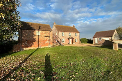
- Price
- Guide Price£720,000
- Size
- 15.86 acres
Catlins Farm, Swineshead Bridge, Swineshead, Lincolnshire PE20 England
Added on 11/02/2026Agricultural Land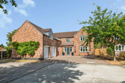
- Price
- Guide Price£620,000
- Size
- 2.2 acres
Kingfisher Court, South Kyme, Lincoln, LN4, South Kyme, Lincolnshire LN4 England
Added on 02/10/2026House with Land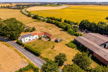
- Price
- £575,000
- Size
- 2.5 acres
Baythorpe, Swineshead, Boston, Lincolnshire, PE20, Swineshead, Lincolnshire PE20 England
Added on 23/07/2026House with Land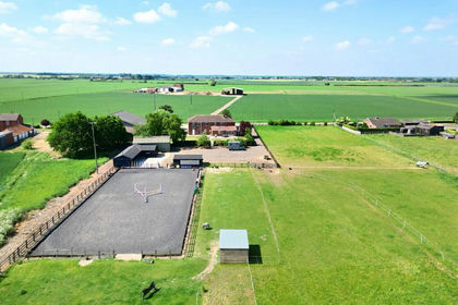
- Price
- Guide Price£895,000
- Size
- 5 acres
North Kyme LINCOLNSHIRE, North Kyme, Lincolnshire LN4 England
Added on 08/10/2026House with Land
- Price
- £575,000
- Size
- 1 acres
Added on 01/07/2026House with Land
- Price
- Offers Over£585,000
- Size
- 3 acres
Ferry Lane, North Kyme, Lincoln, Lincolnshire, LN4, North Kyme, Lincolnshire LN4 England
Added on 04/06/2026House with Land