All Stretton, Church Stretton, Shropshire
- Land size
- 8.69 acres
Description
An exciting opportunity to acquire productive upland pasture situated within the stunning surroundings of the Shropshire Hills AONB and Long Mynd SSSI, amounting to approximately 8.69 acres (3.52 hectares) of exclusive grazing ideal for livestock and equestrian use, whilst offering amenity, lifestyle and environmental purposes. Benefiting from panoramic views across the surrounding unspoilt Shropshire landscape, small open-fronted shelter, natural water supplies, and simply an idyllic retreat for any to relish, whilst being accessible to the neighbouring popular market town of Church Stretton and its amenities. Development & Diversification Opportunities (subject to the necessary consents).
.
The land is situated in a secluded corner of the upland area of All Stretton, amidst the renowned and stunning area of common land within the Shropshire Hills Area of Outstanding Natural Beauty (ANOB), having direct access to 20 square miles of National Trust owned land known as the Long Mynd with valleys and moorland offering a haven for walkers, horse riders and country lovers generally. It presents an ideal refuge for sheep, horses or humans alike, who are wishing to invest in ‘country life’, whilst having the potential of diversification opportunities, if desired.
..
The land is laid to permanent pasture, in one enclosure, having a small coppice on the southern boundary, natural water supplies, and an open fronted corrugated iron field shelter, extending in total to approximately 8.67 acres (3.51 hectares) in a ring fence, as shown delineated red on the attached plan. It offers a productive block of sloping unimproved permanent grassland bound by stock fencing and trees providing shelter and biodiversity.
...
The land benefits from good, gated access off Castle Hill Road, with stunning 360-degree views of the surrounding area with sites of The Wrekin and the Lawley. The land has been currently used for grazing livestock and horses, having potential for other uses, but could offer future opportunities for investment in natural capital, carbon sequestration and biodiversity.
....
Set amidst the stunning common land just off the A49, Ludlow to Shrewsbury thoroughfare, approximately 9.4 miles from Craven Arms and 14 miles from Bishops Castle, with the county town of Shrewsbury approximately 13 miles north. Shropshire lies between the Welsh border and the West Midlands and is equally well placed for visits to the Welsh coast or Birmingham and beyond.
.....
All Stretton is a delightful and convenient village, which dates to the early 16th century. The scenic market town of Church Stretton often referred to as Little Switzerland is ideally placed midway between the county town of Shrewsbury and the renowned historic town of Ludlow. The town offers a comprehensive range of everyday and specialist shops with a full range of facilities. There is a mainline railway station with connections to London and a dual carriageway link at Shrewsbury to the national motorway system.
SPORTING & MINERAL RIGHTS
These are in hand and will pass with the sale of the freehold.
TIMBER
All sanding timber is included in the sale.
RURAL PAYMENT AGENCY & POLICY
The land is registered with the Rural Payments Agency. The land is not entered into any Environmental or Countryside Stewardship agreements.
TENURE
We have been informed that the property is freehold, with vacant possession given on completion.
FIXTURES AND FITTINGS
Those items mentioned in the sale particulars are included in the freehold sale. All other fixtures and fittings and furnishings are expressly excluded.
EASEMENTS, WAYLEAVES AND RIGHTS OF WAY
The property is offered subject to, and with the benefit of, any rights-of-way both public and private, all wayleaves, easements and other rights whether or not specifically referred to.
AUTHORITIES
Shropshire Council: RPA:
UPLIFT CLAUSE
The land is being offered for sale subject to an uplift clause (excluding agricultural and equestrian) stating that if within 25 years from the purchase date the buyer develops the land or obtains planning permission for such, 25% of any increase in value is payable to the current seller.
SOLICITORS
METHOD OF SALE
The property is offered for sale as a whole, by Informal Tender (unless previously sold). The tender forms will be available from the Vendor’s agents Tenders close Thursday 12th June 2025 at 12 noon. Tenders are to be delivered to; McCartneys LLP, Corvedale Road, Craven Arms, Shropshire, SY7 9NE marked “Tender – Land at Lady Lye, Castle Hill”. The Vendor reserves the right not to accept the highest, or indeed, any offer. The Vendor reserves the right to accept offers prior to the tender date.
TOWN AND COUNTRY PLANNING
The property is offered subject to any development plans, tree preservation orders, ancient orders, public rights-of-way, town planning schedules, or resolutions which may be or may come into force. The purchaser(s) will be deemed to have full knowledge of these and have satisfied themselves as to the effects such matters have on the property.
PLANS, AREAS AND SCHEDULES
These are based on Ordnance Survey and are for reference only. They have been checked and compiled by the vendor’s agents and the purchaser(s) shall be deemed to have satisfied themselves as to the description of the property. Any error or misstatement shall not annul a sale or entitle any party to compensation in respect thereof.
BOUNDARIES, ROADS AND FENCES
The purchaser(s) shall be deemed to have full knowledge of the boundaries and neither the Vendor nor the Vendors agents will be responsible for defining the boundaries of ownership thereof.
VIEWINGS & WHAT3WORDS
Strictly by appointment through the selling agents. ///interlude.wide.crusaders
HEALTH AND SAFETY
The agents advise all prospective purchasers when viewing the property to take due care
ANTI MONEY LAUNDERING
The successful purchaser should please provide a photographic form of ID such as driver’s licence or passport, and a utility bill or bank statement confirming their home address.
Map Location
Property details
- Tenure
- Freehold
- Council Tax Band
- TBC
- Date Posted
- 2026-01-29
Market Value Analysis
Compared with 124 Farmland & Pasture listings in West Midlands (5+ acres).
Utilities & Restrictions
Utilities
- Electricity
- Ask Agent
- Water
- Ask Agent
- Heating
- Ask Agent
- Broadband
- Ask Agent
- Sewerage
- Ask Agent
Rights & Restrictions
- Public Rights of Way
- Ask Agent
- Private Rights of Way
- Ask Agent
- Listed Property
- Ask Agent
- Restrictions
- Ask Agent
Listed status, conservation areas and planning constraints for this location are in the full report.
Property Features
- Accessibility
- Ask Agent
- Parking
- Ask Agent
- Garden
- Ask Agent
Beyond the particulars: planning activity, flood history, heritage and ground risks, checked for this exact spot.
Connectivity
Broadband
Fastest speed available at this postcode
54 Mbps
Superfast · available to 58% of premises
Suitable for
- HD streaming
- Video calls
- Web & social
Fixed wireless access may also be an option here.
Mobile signal
Predicted 4G and 5G signal; indoor signal depends on building materials.
Ofcom Connected Nations postcode-level predictions. Speeds and signal are modelled, not measured, and vary between addresses and providers.
Signal is the easy part. Planning activity, flood history and protected designations here are in the full report.
Nearest Schools
Primary
- St Lawrence CofE Primary School1 mileNo Ofsted rating
- Ages
- 2 to 11
- Pupils
- 222
- Type
- Voluntary controlled school
- Faith
- Church of England
- Longnor CofE Primary School3.5 milesOfsted: Outstanding
- Ages
- 3 to 11
- Pupils
- 116
- Type
- Voluntary controlled school
- Faith
- Church of England
- Rushbury CofE Primary School4.3 milesOfsted: Good
- Ages
- 4 to 11
- Pupils
- 64
- Type
- Voluntary controlled school
- Faith
- Church of England
- St Edward's CofE Primary School4.5 milesOfsted report card · Jun 2026
- Ages
- 4 to 11
- Pupils
- 31
- Type
- Academy sponsor led
- Faith
- Church of England
- Stiperstones CofE Primary School5.9 milesNo Ofsted rating
- Ages
- 4 to 11
- Pupils
- 25
- Type
- Voluntary controlled school
- Faith
- Church of England
Secondary
- Church Stretton School0.9 milesNo Ofsted rating
- Ages
- 11 to 16
- Pupils
- 539
- Type
- Academy converter
- Mary Webb School and Science College7 milesOfsted: Good
- Ages
- 11 to 16
- Pupils
- 632
- Type
- Academy converter
- Meole Brace School9.4 milesOfsted: Good
- Ages
- 11 to 16
- Pupils
- 1,316
- Type
- Academy converter
- The Community College, Bishop's Castle9.5 milesNo Ofsted rating
- Ages
- 11 to 16
- Pupils
- 507
- Type
- Foundation school
- The Priory School9.6 milesOfsted: Good
- Ages
- 11 to 16
- Pupils
- 852
- Type
- Academy converter
Distances are straight-line from the advertised location. Source: the national school registers (DfE, Welsh Government, Scottish Government) and Ofsted.
Schools are just the start: sold prices nearby, planning activity and any flood history are in the full report.
Amenities
Supermarket
GP surgery
Pharmacy
Hospital
Green space
Straight-line distances from the advertised location. Sources: NHS records, Geolytix supermarket locations, OS Open Greenspace and the national trails registers.
The area stacks up? Now check the location itself: planning nearby, protected designations and past flooding.
Getting Around
Nearest station
Nearest bus stop
Typical drive times
Straight-line distances from the advertised location; drive times are typical free-flow times over OpenStreetMap road data, so allow more at peak. Public transport locations from DfT NaPTAN.
Easy to reach matters. So do planning activity, flood history and ground risks: all in the full report.
Flood Risk
Environment Agency open data, checked around the advertised map pin for the listed acreage. Long-term risk counts flood defences; the planning map's flood zones do not. Provided by LandSale, not the listing agent, and not part of the agent's particulars. Risk varies across a holding, so verify before committing.
Rivers and the sea
Planning map: Flood Zone 1.
Surface water
Not at the pin: mapped about 40 metres away.
These bandings are the summary. Where this location sits on the flood maps, plus planning activity, heritage and ground risks, is in the full report.
Important notice: Information, maps and tags on this page are drawn from the advertising agent's marketing materials or generated automatically. LandSale has not verified them. Relying on these details is at your own risk, always carry out independent checks before committing to a purchase.
LandSale full disclaimer
Marketing information only - not formal particulars. The details on this website are provided for general guidance and do not constitute an offer or contract. Neither LandSale nor the advertising estate/land agent accepts responsibility for any inaccuracy.
1. Source of information
- Listing content: Core description, asking price, tenure, measurements, photographs and planning history originate from the marketing materials of the advertising estate or land agent. LandSale does not author this content and cannot guarantee its accuracy.
- Automated tags & categorisation: Property type, land-use class, acreage bands and similar labels may be applied by machine-learning models. They are intended as a helpful guide only and may not reflect the property's legal status or permitted use.
- Third-party & enriched data layers: Maps, boundary outlines, planning designations, soil reports, broadband coverage and other environmental or location-based insights are licensed from external suppliers. Such data are supplied “as is", may be incomplete or out of date and are subject to change without notice.
2. Verification required
Prospective purchasers must verify critical matters, including but not limited to planning permission, title boundaries, public rights of way, environmental constraints, acreage, services, access and VAT status, through their own inspections, specialist surveys, legal advisers and the selling agent before relying on the information or entering into any contract.
3. No warranty or liability
LandSale gives no warranty, express or implied, as to the accuracy, completeness or fitness for any particular purpose of the information displayed. LandSale shall not be liable for any loss, damage, cost or expense arising directly or indirectly from any use of or reliance on such information, save where liability may not be excluded by law.
4. Updates & feedback
If you believe any detail on this listing is inaccurate, please let us know. We will investigate and, where appropriate, update the listing or notify the agent.
© LandSale | Version 1.3 - August 2026
Listing agent
McCartneys LLP, Craven Arms
Corvedale Road, Craven Arms, SY7 9NE
Similar properties for sale
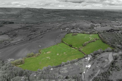
- Price
- £125,000
- Size
- 16.6 acres
Land at Meadowtown, Shrewsbury, Worthen with Shelve, Shropshire SY5 England
Added on 29/01/2026Pasture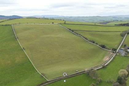
- Price
- Guide Price£100,000
- Size
- 16.28 acres
Obley, Bucknell, Shropshire, Clunbury, Shropshire SY7 England
Added on 24/04/2026Grazing Land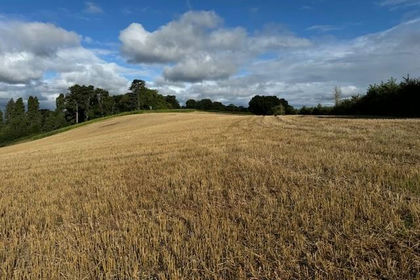
- Price
- Offers in Region of£125,000
- Size
- 14.8 acres
Added on 25/08/2026Arable Land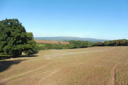
- Price
- Guide Price£110,000
- Size
- 11.36 acres
LAND - 11.36 Acres Hanley William WR15, Hanley, Worcestershire WR15 England
Added on 29/01/2026Agricultural Land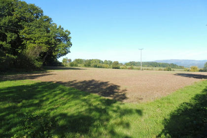
- Price
- Guide Price£120,000
- Size
- 24 acres
LAND - 12.64 Acres Hanley Broadheath WR15, Hanley, Worcestershire WR15 England
Added on 02/09/2026Agricultural Land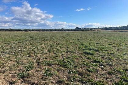
- Price
- Guide Price£75,000
- Size
- 5.65 acres
Added on 14/09/2026Farmland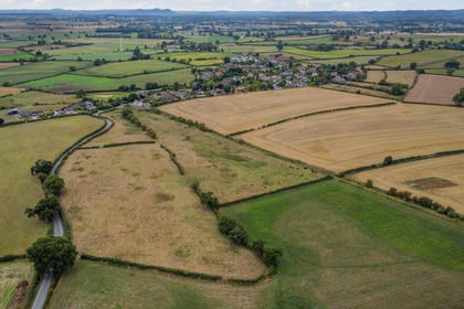
- Price
- £120,000
- Size
- 67.78 acres
Land at Tetchill (Lot 1), Ellesmere, SY12, Ellesmere Rural, Shropshire SY12 England
Added on 29/01/2026Farmland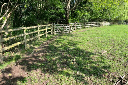
- Price
- Offers in Excess of£100,000
- Size
- 6.42 acres
Gunstone Lane, Codsall, WV8, Codsall, Staffordshire WV8 England
Added on 29/01/2026Grazing Land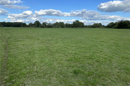
- Price
- Offers in Excess of£100,000
- Size
- 15.74 acres
Land On The North Side Of Trefeglwys Road, Caersws, Powys, SY17, Caersws, Powys SY17 Wales
Added on 29/01/2026Pasture
- Price
- Guide Price£75,000
- Size
- 6.7 acres
Added on 23/09/2026Woodland