Brynisa Road, Brynteg
Description
Located in Wrexham, the plot of land in question has undergone recent improvements that enhance its appeal and marketability. One notable change is the removal of the resident parking, allowing for a more spacious and visually appealing environment. Furthermore, a significant development on the plot involves the introduction of a protection zone around the existing trees on the site, particularly the hedge line. This decision not only ensures the preservation of the natural landscape but also adds to the overall attractiveness of the property, making it more desirable to potential buyers or developers.
Details - Please refer to application code P/2021/2410. Outline application to erect one detached dwelling and garage.
Please note amended planning subject to confirmation. For any further information, please refer to Wrexham County Borough Council planning with reference to planning codes.
P/2021/2410 -
Proposed Elevation -
Proposed Ground Floor -
Proposed First Floor -
Viewings - Strictly by prior appointment with Town & Country Wrexham on .
To Make An Offer - If you would like to make an offer, please contact the office and one of the team will assist you further.
Services - The agents have not tested any of the appliances listed in the particulars.
Additional Information - We would like to point out that all measurements, floor plans and photographs are for guidance purposes only (photographs may be taken with a wide angled/zoom lens), and dimensions, shapes and precise locations may differ to those set out in these sales particulars which are approximate and intended for guidance purposes only.
Property Particulars Disclaimer - IMPORTANT NOTICE – PROPERTY PARTICULARS DISCLAIMER
These particulars have been prepared by the Agent for general information and guidance only. They are intended to provide prospective purchasers with an overview of the property and do not constitute, nor form any part of, an offer, contract, warranty or representation.
Whilst reasonable care has been taken in preparing these particulars, neither the Agent nor the Seller gives any representation, warranty or guarantee, express or implied, as to the accuracy, completeness or reliability of any information provided. Prospective purchasers must not rely upon these particulars as statements or representations of fact and should satisfy themselves as to the accuracy of any information which is important to their decision to purchase.
All descriptions, measurements, dimensions, areas, distances, photographs, floorplans, maps, boundaries and other particulars are approximate and provided for guidance only. Photographs and marketing materials may not represent the property’s current condition, and floorplans are intended to illustrate general layout only and should not be relied upon for measurements, boundaries, construction, alterations or any other purpose.
No statement made by the Agent regarding the condition, construction, structure, foundations, roof, state of repair, defects or suitability of the property should be regarded as a survey, structural assessment or professional opinion. Neither the Agent nor the Seller warrants that the property is structurally sound or free from defects. Prospective purchasers are strongly advised to commission their own appropriate survey, inspection and/or specialist reports from suitably qualified professionals before entering into a binding commitment.
The Agent has not tested any appliances, equipment, fixtures, fittings, heating systems, boilers, electrical installations, plumbing, drainage, utilities, telecommunications or other services unless expressly stated otherwise in writing. No warranty is given that any such items or services are present, connected, in working order, safe, compliant with applicable requirements or suitable for the purchaser’s intended use. Purchasers should arrange their own inspections and testing where required.
Information concerning tenure, title, boundaries, rights of way, easements, covenants, restrictions, leases, service charges, ground rent, council tax, planning permissions, building regulations, alterations, extensions, guarantees, certificates, utilities and other legal or regulatory matters is provided for guidance only and should be independently verified by the purchaser’s solicitor or other appropriately qualified adviser.
Any reference to development potential, possible alterations, extensions, conversions or alternative uses of the property does not constitute confirmation that the necessary planning permission, building regulations approval, consents or other permissions have been or will be granted. Purchasers must make their own enquiries with the appropriate authorities and professional advisers.
The inclusion of any fixture, fitting, appliance, furniture or other item in photographs or particulars does not necessarily mean that it is included in the sale. The purchaser should confirm with their solicitor which items are included or excluded.
Prospective purchasers should undertake their own due diligence and obtain such legal, financial, surveying, structural, environmental and other professional advice as they consider appropriate before exchange of contracts or otherwise becoming legally committed to the purchase.
The property may be sold, withdrawn or otherwise become unavailable without notice, and prospective purchasers are advised to confirm availability with the Agent before travelling to view.
No employee, representative or negotiator of the Agent has authority to give any representation, warranty or guarantee in relation to the property unless expressly confirmed in writing by an authorised person.
Nothing in this disclaimer is intended to exclude, restrict or limit any liability or consumer right which cannot lawfully be excluded, restricted or limited.
These particulars are provided for guidance only and are subject to verification and, where applicable, the Seller’s approval
Map Location
Property details
- Tenure
- Freehold
- Council Tax Band
- Ask Agent
- Date Posted
- 2026-01-29
Utilities & Restrictions
Utilities
- Electricity
- Ask Agent
- Water
- Ask Agent
- Heating
- Ask Agent
- Broadband
- Ask Agent
- Sewerage
- Ask Agent
Rights & Restrictions
- Public Rights of Way
- Ask Agent
- Private Rights of Way
- Ask Agent
- Listed Property
- Ask Agent
- Restrictions
- Ask Agent
Listed status, conservation areas and planning constraints for this location are in the full report.
Property Features
- Accessibility
- Ask Agent
- Parking
- Parking Available
- Garden
- Ask Agent
Beyond the particulars: planning activity, flood history, heritage and ground risks, checked for this exact spot.
Connectivity
Broadband
Fastest speed available at this postcode
80 Mbps
Superfast
Suitable for
- HD streaming
- Video calls
- Web & social
Mobile signal
Predicted 4G and 5G signal; indoor signal depends on building materials.
Ofcom Connected Nations postcode-level predictions. Speeds and signal are modelled, not measured, and vary between addresses and providers.
Signal is the easy part. Planning activity, flood history and protected designations here are in the full report.
Nearest Schools
Primary
- Brynteg C P School297 metres
- Pupils
- 166
- Type
- Nursery, Infants & Juniors
- Language
- English medium school / provision
- Ysgol Penrhyn New Broughton CP808 metres
- Pupils
- 218
- Type
- Nursery, Infants & Juniors
- Language
- English medium school / provision
- Ysgol Heulfan0.7 miles
- Pupils
- 331
- Type
- Nursery, Infants & Juniors
- Language
- English medium school / provision
- Ysgol Tan-y-Fron0.7 miles
- Pupils
- 139
- Type
- Nursery, Infants & Juniors
- Language
- English medium school / provision
- Black Lane C P School0.7 miles
- Pupils
- 151
- Type
- Nursery, Infants & Juniors
- Language
- English medium school / provision
Secondary
- Ysgol Bryn Alyn0.8 miles
- Pupils
- 701
- Type
- Secondary (ages 11-16)
- Language
- English medium school / provision
- Ysgol Clywedog1.8 miles
- Pupils
- 801
- Type
- Secondary (ages 11-16)
- Language
- English medium school / provision
- St Joseph's Catholic and Anglican High2.4 miles
- Pupils
- 748
- Type
- Secondary (ages 11-16)
- Language
- English medium school / provision
- Rhosnesni High School2.6 miles
- Pupils
- 1,091
- Type
- Secondary (ages 11-16)
- Language
- English medium school / provision
- Ysgol Morgan Llwyd2.8 miles
- Pupils
- 930
- Type
- Secondary (ages 11-19)
- Language
- Welsh medium school / provision (including transitional)
Distances are straight-line from the advertised location. Source: the national school registers (DfE, Welsh Government, Scottish Government) and Ofsted.
Schools are just the start: sold prices nearby, planning activity and any flood history are in the full report.
Amenities
Supermarket
GP surgery
Pharmacy
Green space
Straight-line distances from the advertised location. Sources: NHS records, Geolytix supermarket locations, OS Open Greenspace and the national trails registers.
The area stacks up? Now check the location itself: planning nearby, protected designations and past flooding.
Getting Around
Nearest station
Nearest bus stop
Typical drive times
Straight-line distances from the advertised location; drive times are typical free-flow times over OpenStreetMap road data, so allow more at peak. Public transport locations from DfT NaPTAN.
Easy to reach matters. So do planning activity, flood history and ground risks: all in the full report.
Flood Risk
Natural Resources Wales open data, checked around the advertised map pin for the listed acreage. Long-term risk counts flood defences; the planning map's flood zones do not. The map pin for this listing marks the postcode area rather than the exact location, so these readings describe the surrounding area. Provided by LandSale, not the listing agent, and not part of the agent's particulars. Risk varies across a holding, so verify before committing.
Rivers and the sea
Planning map: Flood Zone 1.
Surface water
These bandings are the summary. Where this location sits on the flood maps, plus planning activity, heritage and ground risks, is in the full report.
Important notice: Information, maps and tags on this page are drawn from the advertising agent's marketing materials or generated automatically. LandSale has not verified them. Relying on these details is at your own risk, always carry out independent checks before committing to a purchase.
LandSale full disclaimer
Marketing information only - not formal particulars. The details on this website are provided for general guidance and do not constitute an offer or contract. Neither LandSale nor the advertising estate/land agent accepts responsibility for any inaccuracy.
1. Source of information
- Listing content: Core description, asking price, tenure, measurements, photographs and planning history originate from the marketing materials of the advertising estate or land agent. LandSale does not author this content and cannot guarantee its accuracy.
- Automated tags & categorisation: Property type, land-use class, acreage bands and similar labels may be applied by machine-learning models. They are intended as a helpful guide only and may not reflect the property's legal status or permitted use.
- Third-party & enriched data layers: Maps, boundary outlines, planning designations, soil reports, broadband coverage and other environmental or location-based insights are licensed from external suppliers. Such data are supplied “as is", may be incomplete or out of date and are subject to change without notice.
2. Verification required
Prospective purchasers must verify critical matters, including but not limited to planning permission, title boundaries, public rights of way, environmental constraints, acreage, services, access and VAT status, through their own inspections, specialist surveys, legal advisers and the selling agent before relying on the information or entering into any contract.
3. No warranty or liability
LandSale gives no warranty, express or implied, as to the accuracy, completeness or fitness for any particular purpose of the information displayed. LandSale shall not be liable for any loss, damage, cost or expense arising directly or indirectly from any use of or reliance on such information, save where liability may not be excluded by law.
4. Updates & feedback
If you believe any detail on this listing is inaccurate, please let us know. We will investigate and, where appropriate, update the listing or notify the agent.
© LandSale | Version 1.3 - August 2026
Listing agent
Town & Country Estate Agents, Wrexham
Imperial Buildings, King Street, Wrexham, LL11 1HE
Contact Town & Country Estate Agents, Wrexham
Imperial Buildings, King Street, Wrexham, LL11 1HE
View agent profileSimilar properties for sale
- Price
- Guide Price£127,700
- Size
- 25.54 acres
25.54 Acres (10.33 Ha) Amenity Land At Cefn Y Bedd, Nr Wrexham, Llay, Wrexham LL12 Wales
Added on 16/10/2026Amenity Land
- Price
- Offers Over£150,000
- Size
- 0.5 acres
Added on 29/01/2026Development Land Added on 29/01/2026Self Build Plot
- Price
- Guide Price£140,000
Llantysilio, Llangollen, Llantysilio, Denbighshire LL20 Wales
Added on 28/01/2026Building Plot
- Price
- Offers in Region of£135,000
Added on 01/10/2026Development Land
- Price
- Guide Price£150,000
2/2A Dock Road/334 High Street, Connah's Quay, Connah's Quay, Flintshire CH5 Wales
Added on 19/08/2026Development Land
- Price
- Guide Price£180,000
- Size
- 12 acres
Northwood, Ellesmere., Welshampton and Lyneal, Shropshire SY12 England
Added on 24/09/2026Equestrian property
- Price
- £180,000
- Size
- 0.44 acres
Added on 28/01/2026Building Plot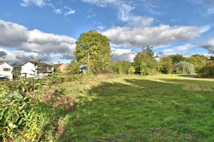
- Price
- £175,000
- Size
- 0.17 acres
Llanfair Dyffryn Clwyd, Ruthin, LL15, Llanfair Dyffryn Clwyd, Denbighshire LL15 Wales
Added on 10/10/2026Building Plot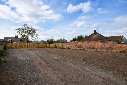
- Price
- Offers in Region of£120,000
Building Plot on Kingsway, Whitchurch, Whitchurch Urban, Shropshire SY13 England
Added on 18/06/2026Building Plot