Gibbons Brook, Sellindge
- Land size
- 1.47 acres
- Bedrooms
- 5
- Bathrooms
- 3
Key Features
- Unique & charming, Grade II listed farmhouse set in a peaceful brook with just 3 houses in a beautiful rural location
- Original features & character throughout including exposed beams & well supplying free water to the property
- Impressive 32 ft x 16 ft living/dining room with Inglenook fireplace & log burner
- Spacious country style kitchen/breakfast room, additional sitting room & sun room
- 4 double bedrooms & study on the first floor
- 2 bedrooms with en-suite shower rooms & separate family bathroom
- Sizeable loft space which could be converted STPP
- Large & established south facing garden with spacious terrace, lawn & separate field to the rear, approx 1.47 acres in total
- Large outbuilding including a garage, 2 workshops & log store. Driveway parking for several vehicles
- 1.4 miles from Sellindge Primary School with an Good Ofsted rating. Excellent village amenities including a Co-op & doctors surgery
Description
Property Description: Guide Price £700,000 - £750,000. Set within the serene Gibbons Brook, this charming and unique Grade II listed farmhouse is one of just three properties in this idyllic rural setting and provides a blend of historic character and comfortable family living, all set within approximately 1.47 acres of established grounds.
Stepping inside, you are immediately enveloped by the property's rich history and original features with half of the house being built in the 14th Century and the other half built in the 17th Century. Exposed beams adorn many of the rooms, providing character that speaks to the farmhouse's heritage. A truly distinctive feature is the well, which supplies free water to the property, providing both an eco-friendly benefit and a charming nod to its past. The current owners have also installed a brand new water tank and filtration system.
The heart of this home is undoubtedly the impressive 32 ft x 16 ft living/dining room. This expansive space is perfect for both grand entertaining and cosy family evenings, centred around a magnificent Inglenook fireplace housing a log burner. Adjacent to this, a spacious country style kitchen/breakfast room provides ample space for culinary creativity with a traditional aesthetic that complements the farmhouse feel. Further ground floor accommodation includes an additional sitting room, providing a more intimate space for relaxation, and a delightful sun room, perfect for enjoying the garden views throughout the seasons.
On the first floor, you will find four generously proportioned double bedrooms, each offering comfort and privacy. A dedicated study provides an ideal space for remote working or quiet contemplation and could also be used as a fifth bedroom if required. The property has three well appointed bathrooms, two of the double bedrooms have en-suite shower rooms, while a separate family bathroom serves the remaining bedrooms. The layout is thoughtfully designed to accommodate a large family or guests with ease.
Adding to the property's potential, a sizeable loft space presents an exciting opportunity for future expansion, subject to obtaining the necessary planning permissions
Outside: The exterior of this farmhouse is equally captivating. A large and established south-facing garden is a true highlight, featuring a spacious terrace perfect for al fresco dining and entertaining, a sprawling lawn ideal for children's play or leisurely afternoons, and a separate field to the rear, culminating in approximately 1.47 acres of private outdoor space. A large, detached outbuilding includes a garage, two versatile workshops, and a convenient log store, whiles the generous driveway provides ample parking for several vehicles, ensuring convenience for residents and visitors alike.
Location: Sellindge is a civil parish and village on the A20 road between Ashford and Folkestone in Kent. Situated approximately 2 miles from Junction 11 of the M20 you have easy access to London or the coast. Westenhanger station is just 3.6 miles away with connecting trains to Ashford International Station where the High Speed service will take you into London St Pancras in 38 minutes. The Channel Tunnel is approximately 5 miles away giving easy access to Europe. The village has good facilities with a local Co-op, a church, a doctors’ surgery and a primary school. The Dukes Head is very popular with both locals and visitors offering a booking service for great food. Sellindge is part of North Downs West Ward of Folkestone and Hythe Town Council but part of the Elham ward of Kent County Council. The village plays host to the annual Sellindge Steam Fair every year with displays including traction engines, steam, diesel, electric locomotive units, buses and lorries.
Directions: SatNav = TN25 6HL / What3Words = needed.acoustics.snows
Council Tax: Band G (correct at time of marketing). To check council tax for this property, please refer to the local authority website.
Local Authority: Folkestone & Hythe Borough Council Kent County Council 03000
Services: Oil fired central heating, mains electricity, private water and drainage. For broadband and mobile coverage, we advise you check your providers website or refer to an online checker.
Tenure: This property is freehold and is sold with vacant possession upon completion.
Disclaimer: Sandersons and their clients state that these details are for general guidance only and accuracy cannot be guaranteed. They do not form any part of any contract. All measurements are approximate, and floor plans are for general indication only and are not measured accurate drawings. No guarantees are given with any mentioned planning permission or fitness for purpose. No appliances, equipment, fixture or fitting has been tested by us and items shown in photographs are not necessarily included. Buyers must satisfy themselves on all matters by inspection or through the conveyancing process.
Identity verification: Please note, Sandersons UK are obligated by law to undertake Anti Money Laundering (AML) Regulations checks on any purchaser who has an offer accepted on a property. We are required to use a specialist third party service to verify your identity. The cost of these checks is £60 inc.VAT per property and accepted offer. This is payable at the point an offer is accepted and our purchaser information form is completed, prior to issuing Memorandum of Sales to both parties respective conveyancing solicitors. This is a legal requirement and the charge is non-refundable.
Disclaimer: Please note the image with the boundary line is for indicative purposes only and will be need to be confirmed via Land Registry during the conveyancing process.
Additional Property Notes: The property is of traditional construction and has had no adaptions for accessibility. There is a garage and driveway parking for several vehicles. The driveway is owned by the property but neighbours have right of access, the well also supplies water to a neighbouring property which they have access to when required.
Register for new listings before the portal launch
Map Location
Property details
- Tenure
- Freehold
- Council Tax Band
- G
- Date Posted
- 2026-01-29
Price history
| Date | Change | Price |
|---|---|---|
| 19 Aug 2026 | Reduced 6.7% (−£50,000) | £700,000 |
| Until 19 Aug 2026 | Asking price | £750,000 |
Market Value Analysis
Compared with 1,736 Homes with Land listings in South East England (1+ acres).
Energy Performance Certificate
Energy Efficiency Rating
Based on UK Energy Performance Certificate standards (EU Directive 2002/91/EC)
Running costs are one side. Planning activity, flood history and ground risks for this location are in the full report.
Utilities & Restrictions
Utilities
- Electricity
- Mains
- Water
- Private Supply
- Heating
- Oil Heating
- Broadband
- Ask Agent
- Sewerage
- Septic Tank / Private
Rights & Restrictions
- Public Rights of Way
- Ask Agent
- Private Rights of Way
- Ask Agent
- Listed Property
- Ask Agent
- Restrictions
- Ask Agent
Listed status, conservation areas and planning constraints for this location are in the full report.
Property Features
- Accessibility
- Ask Agent
- Parking
- Garage
- Garden
- Rear Garden
Beyond the particulars: planning activity, flood history, heritage and ground risks, checked for this exact spot.
Connectivity
Broadband
No premises records for this postcode, which is common for bare land and rural plots. A new connection would be quoted by the provider.
Mobile signal
No address-level signal records for this postcode, which is common for bare land.
Ofcom Connected Nations postcode-level predictions. Speeds and signal are modelled, not measured, and vary between addresses and providers.
Signal is the easy part. Planning activity, flood history and protected designations here are in the full report.
Nearest Schools
Primary
- Sellindge Primary School1 mileOfsted: Good
- Ages
- 4 to 11
- Pupils
- 198
- Type
- Community school
- Stowting Church of England Primary School2.3 milesOfsted: Good
- Ages
- 4 to 11
- Pupils
- 106
- Type
- Voluntary controlled school
- Faith
- Church of England
- Lympne Church of England Primary School2.3 milesOfsted report card · Feb 2026
- Ages
- 4 to 11
- Pupils
- 195
- Type
- Voluntary controlled school
- Faith
- Church of England
- Brabourne Church of England Primary School2.4 milesNo Ofsted rating
- Ages
- 5 to 11
- Pupils
- 104
- Type
- Voluntary controlled school
- Faith
- Church of England
- Smeeth Community Primary School2.7 milesOfsted: Good
- Ages
- 4 to 11
- Pupils
- 120
- Type
- Foundation school
Secondary
- Brockhill Park Performing Arts College2.6 milesOfsted report card · Jan 2026
- Ages
- 11 to 18
- Pupils
- 1,314
- Type
- Academy converter
- Turner Free School5.6 milesOfsted: Good
- Ages
- 11 to 18
- Pupils
- 997
- Type
- Free schools
- The Folkestone School for Girls6 milesOfsted: Good
- Ages
- 11 to 18
- Pupils
- 1,145
- Type
- Academy converter
- Gender
- Girls
- The Harvey Grammar School6 milesNo Ofsted rating
- Ages
- 11 to 18
- Pupils
- 1,005
- Type
- Academy converter
- Gender
- Boys
- Folkestone Academy6.3 milesOfsted report card · May 2026
- Ages
- 11 to 19
- Pupils
- 936
- Type
- Academy sponsor led
Distances are straight-line from the advertised location. Source: the national school registers (DfE, Welsh Government, Scottish Government) and Ofsted.
Schools are just the start: sold prices nearby, planning activity and any flood history are in the full report.
Amenities
Supermarket
GP surgery
Pharmacy
Hospital
Green space
Straight-line distances from the advertised location. Sources: NHS records, Geolytix supermarket locations, OS Open Greenspace and the national trails registers.
The area stacks up? Now check the location itself: planning nearby, protected designations and past flooding.
Getting Around
Nearest station
Nearest bus stop
Typical drive times
Straight-line distances from the advertised location; drive times are typical free-flow times over OpenStreetMap road data, so allow more at peak. Public transport locations from DfT NaPTAN.
Easy to reach matters. So do planning activity, flood history and ground risks: all in the full report.
Flood Risk
Environment Agency open data, checked around the advertised map pin for the listed acreage. Long-term risk counts flood defences; the planning map's flood zones do not. Provided by LandSale, not the listing agent, and not part of the agent's particulars. Risk varies across a holding, so verify before committing.
Rivers and the sea
Planning map: Flood Zone 1.
Surface water
Not at the pin: mapped about 20 metres away.
These bandings are the summary. Where this location sits on the flood maps, plus planning activity, heritage and ground risks, is in the full report.
Important notice: Information, maps and tags on this page are drawn from the advertising agent's marketing materials or generated automatically. LandSale has not verified them. Relying on these details is at your own risk, always carry out independent checks before committing to a purchase.
LandSale full disclaimer
Marketing information only - not formal particulars. The details on this website are provided for general guidance and do not constitute an offer or contract. Neither LandSale nor the advertising estate/land agent accepts responsibility for any inaccuracy.
1. Source of information
- Listing content: Core description, asking price, tenure, measurements, photographs and planning history originate from the marketing materials of the advertising estate or land agent. LandSale does not author this content and cannot guarantee its accuracy.
- Automated tags & categorisation: Property type, land-use class, acreage bands and similar labels may be applied by machine-learning models. They are intended as a helpful guide only and may not reflect the property's legal status or permitted use.
- Third-party & enriched data layers: Maps, boundary outlines, planning designations, soil reports, broadband coverage and other environmental or location-based insights are licensed from external suppliers. Such data are supplied “as is", may be incomplete or out of date and are subject to change without notice.
2. Verification required
Prospective purchasers must verify critical matters, including but not limited to planning permission, title boundaries, public rights of way, environmental constraints, acreage, services, access and VAT status, through their own inspections, specialist surveys, legal advisers and the selling agent before relying on the information or entering into any contract.
3. No warranty or liability
LandSale gives no warranty, express or implied, as to the accuracy, completeness or fitness for any particular purpose of the information displayed. LandSale shall not be liable for any loss, damage, cost or expense arising directly or indirectly from any use of or reliance on such information, save where liability may not be excluded by law.
4. Updates & feedback
If you believe any detail on this listing is inaccurate, please let us know. We will investigate and, where appropriate, update the listing or notify the agent.
© LandSale | Version 1.3 - August 2026
Listing agent
Sandersons, Covering Ashford
Covering Ashford
Similar properties for sale
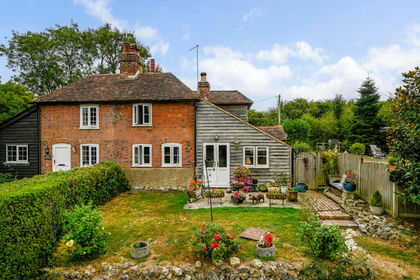
- Price
- £649,000
- Size
- 2.8 acres
Gyminge Brook Cottage, Gibbons Brook, Sellindge, Kent, Stanford, Kent TN25 England
Added on 26/08/2026House with Land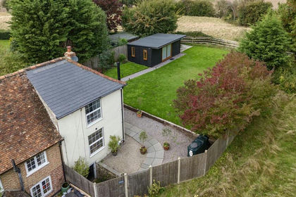
- Price
- Guide Price£650,000
- Size
- 1.76 acres
Added on 29/01/2026Cottage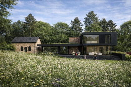
- Price
- £649,000
- Size
- 3.75 acres
Land At Blue House, Bluehouse Lane, Saltwood, Saltwood, Kent CT21 England
Added on 12/10/2026Building Plot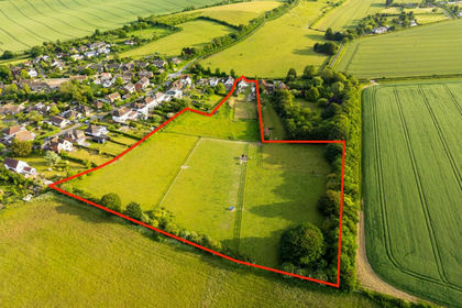
- Price
- Guide Price£870,000
- Size
- 5.42 acres
Added on 29/01/2026House with Land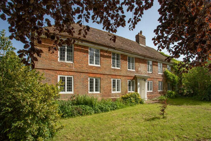
- Price
- £650,000
- Size
- 1 acres
Added on 31/05/2026Historic House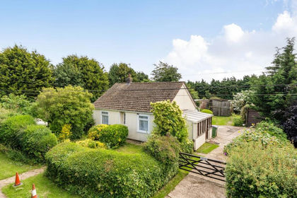
- Price
- Guide Price£575,000
- Size
- 1.5 acres
Added on 01/07/2026Cottage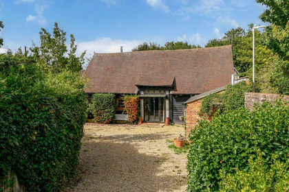
- Price
- Guide Price£575,000
The Street, Mersham, Ashford, Kent, TN25, Mersham, Kent TN25 England
Added on 23/09/2026Barn Conversion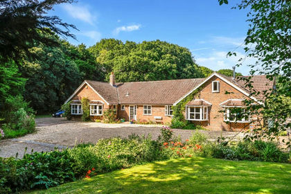
- Price
- £725,000
- Size
- 2.5 acres
Stelling Minnis, Canterbury, Kent, CT4, Elham, Kent CT4 England
Added on 29/01/2026House with Land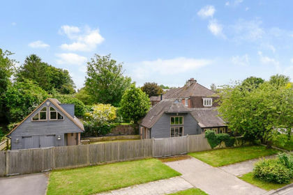
- Price
- Guide Price£650,000
Churchfield Way, Wye, Ashford, Kent, TN25, Wye with Hinxhill, Kent TN25 England
Added on 22/06/2026Barn Conversion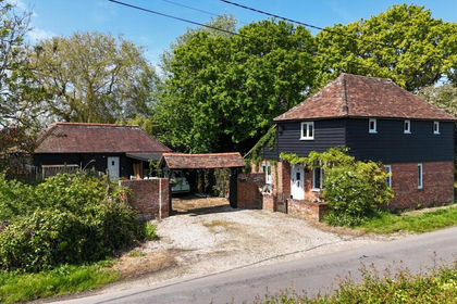
- Price
- Guide Price£695,000
Added on 19/05/2026Barn Conversion