Upper Lumb Farm, Deep Lane, Triangle, Sowerby Bridge, HX6
- Land size
- 31.81 acres
- Bedrooms
- 4
- Bathrooms
- 1
Key Features
- Historic Grade II listed farmhouse dating back to 1627
- Set within approximately 31.81 acres of prime south-facing grazing land
- Enjoys breathtaking panoramic views across the Cottonstones hills
- Includes a substantial stone barn with exciting conversion potential (STP)
- Four-bedroom farmhouse with beams, fireplaces, and original period features
- Spacious dual-aspect kitchen diner with Hunter multi-fuel stove
- Stunning countryside views from most windows, and rustic interiors
- Idyllic rural setting offering exceptional equestrian or agricultural potential
- Includes single garage, driveway parking, and numerous outbuildings
- Peaceful yet accessible location near Sowerby Bridge, Halifax, and the M62
Description
A HISTORIC FARMSTEAD WITH LAND, VIEWS, AND OPPORTUNITY
Dating back to 1627, Upper Lumb Farm is a remarkable Grade II listed semi-detached farmhouse set within approximately 31.81 acres of prime grazing land. South-facing, steeped in history, and enjoying panoramic views across the rolling hills of Cottonstones, the estate comprises the main farmhouse, a substantial stone barn with exciting conversion potential (subject to necessary planning consents), and a collection of fields and grounds that together create a rare lifestyle opportunity.
“You can imagine what it was like growing up here… it gave us the most idyllic childhood. We were always playing out in the fields with our friends, and our parents thrived on the community feel. It’s so peaceful and picturesque, with so much wildlife and incredible views. There really is nowhere quite like it.” - Scott Crabtree
THE FARMHOUSE
A four-bedroom character home, the farmhouse offers period charm in abundance. Deep-set windows frame sweeping views, exposed beams nod to the property’s heritage, and feature fireplaces add warmth and character.
GROUND FLOOR
- PORCH AND HALLWAY – a welcoming entrance with space for coats and boots, leading through to a hallway with countryside views.
- KITCHEN DINER – dual aspect with spectacular views. The kitchen features a Whirlpool oven, four-ring gas hob, and extractor. In the dining area, there’s an original Hunter multi-fuel fire, and exposed beams add rustic charm.
- LOUNGE – a beautiful reception room featuring a log burner set into an exposed stone wall, beams, plush carpets, and peacock-motif wallpaper reflecting the estate’s resident birds.
FIRST FLOOR
- PRINCIPAL BEDROOM – a spacious double with window seating, extensive fitted wardrobes, and stunning views.
- DOUBLE BEDROOM – vaulted ceiling, exposed beams.
- SINGLE/SMALL DOUBLE BEDROOM – fitted wardrobes.
- DOUBLE BEDROOM – dual aspect with hillside views, fitted storage.
- BATHROOM – wet-room style with shower, sink, toilet, heated towel rail, and storage cupboard.
Additional features: roof replaced last year, electric heating.
---
THE BARN
A large stone barn set over split levels, currently housing stalls and pens, with scope to convert into one, two, or three dwellings (subject to necessary planning consents). Generous open spaces, original features, and large barn doors to both ends make this a versatile outbuilding ready for transformation.
---
LAND AND EXTERNALS
- 31.81 acres of south-facing grazing land, divided into fields with excellent drainage
- A historic disused quarry, from which stone was once used to build the local church
- Driveway access
- Breathtaking open countryside views from every angle
- Single garage with storeroom to the rear
The land offers superb equestrian, agricultural, or lifestyle potential, with endless opportunities for those seeking space and self-sufficiency.
---
LOCATION
Set amidst the peaceful hills of Cottonstones, Upper Lumb Farm balances rural tranquillity with excellent accessibility. The property sits within easy reach of Sowerby Bridge with its supermarkets, cafés, restaurants, and train station offering direct services to Leeds and Manchester. The market town of Halifax provides further shopping, cultural attractions, and well-regarded schooling.
Outdoor enthusiasts will appreciate immediate access to moorland walks, bridleways, and the Calder Valley countryside, with the Pennine Way close at hand. Excellent road links via the M62 motorway ensure that regional business hubs and airports remain highly accessible.
---
KEY INFORMATION
- Fixtures and fittings: Only fixtures and fittings mentioned in the sales particulars are included in the sale.
- Wayleaves, easements and rights of way: The sale is subject to all of these rights whether public or private, whether mentioned in these particulars or not.
- Local authority: Calderdale
- Council tax band: D
- Tenure: Freehold
- Property type: Semi-detached farmhouse
- Property construction: Stone
- Electricity supply: Octopus Energy
- Gas supply: No gas supply
- Water supply: Yorkshire Water
- Sewerage: Yorkshire Water
- Heating: Electric heaters and multifuel burners
- Broadband: Connected
- Mobile signal/coverage: Good outdoor, variable in-home (Ofcom Mobile Checker)
- Parking: Single garage for one car, plus private driveway for multiple cars
---
Viewing is essential to fully appreciate the unique nature and lifestyle opportunities Upper Lumb Farm has to offer.
Please contact Charnock Bates to arrange your private tour.
Map Location
Property details
- Tenure
- Freehold
- Council Tax Band
- D
- Date Posted
- 2026-01-28
Market Value Analysis
Compared with 13 Homes with Land listings in Yorkshire and The Humber (25+ acres).
Utilities & Restrictions
Utilities
- Electricity
- Mains
- Water
- Mains
- Heating
- Electric Heating
- Broadband
- Ask Agent
- Sewerage
- Mains
Rights & Restrictions
- Public Rights of Way
- Ask Agent
- Private Rights of Way
- Ask Agent
- Listed Property
- Ask Agent
- Restrictions
- Ask Agent
Listed status, conservation areas and planning constraints for this location are in the full report.
Property Features
- Accessibility
- Ask Agent
- Parking
- Garage, Driveway
- Garden
- Garden
Beyond the particulars: planning activity, flood history, heritage and ground risks, checked for this exact spot.
Connectivity
Broadband
Fastest speed available at this postcode
56 Mbps
Superfast · available to 80% of premises
Suitable for
- HD streaming
- Video calls
- Web & social
Fixed wireless access may also be an option here.
Mobile signal
Predicted 4G and 5G signal; indoor signal depends on building materials.
Ofcom Connected Nations postcode-level predictions. Speeds and signal are modelled, not measured, and vary between addresses and providers.
Signal is the easy part. Planning activity, flood history and protected designations here are in the full report.
Nearest Schools
Primary
- St Mary's CofE (VC) J and I School637 metresOfsted: Good
- Ages
- 4 to 11
- Pupils
- 61
- Type
- Voluntary controlled school
- Faith
- Church of England
- Triangle CofE VC Primary School0.9 milesOfsted: Good
- Ages
- 4 to 11
- Pupils
- 173
- Type
- Voluntary controlled school
- Faith
- Church of England
- Trinity Academy St Peter's1.2 milesOfsted: Good
- Ages
- 4 to 11
- Pupils
- 94
- Type
- Academy sponsor led
- Faith
- Church of England
- Ripponden Junior and Infant School1.3 milesNo Ofsted rating
- Ages
- 4 to 11
- Pupils
- 171
- Type
- Community school
- Sacred Heart Catholic Voluntary Academy1.7 milesNo Ofsted rating
- Ages
- 4 to 11
- Pupils
- 150
- Type
- Academy converter
- Faith
- Roman Catholic
Secondary
- Ryburn Valley High School1.3 milesNo Ofsted rating
- Ages
- 11 to 18
- Pupils
- 1,589
- Type
- Academy converter
- Trinity Academy Grammar2.5 milesOfsted: Good
- Ages
- 11 to 16
- Pupils
- 968
- Type
- Academy sponsor led
- The Calder Learning Trust2.9 milesOfsted: Good
- Ages
- 4 to 16
- Pupils
- 1,250
- Type
- Academy converter
- The Halifax Academy3.4 milesOfsted: Good
- Ages
- 4 to 16
- Pupils
- 1,461
- Type
- Academy converter
- The Crossley Heath School3.5 milesOfsted: Good
- Ages
- 11 to 18
- Pupils
- 1,179
- Type
- Academy converter
Distances are straight-line from the advertised location. Source: the national school registers (DfE, Welsh Government, Scottish Government) and Ofsted.
Schools are just the start: sold prices nearby, planning activity and any flood history are in the full report.
Amenities
Supermarket
GP surgery
Pharmacy
Hospital
Straight-line distances from the advertised location. Sources: NHS records, Geolytix supermarket locations, OS Open Greenspace and the national trails registers.
The area stacks up? Now check the location itself: planning nearby, protected designations and past flooding.
Getting Around
Nearest station
Nearest bus stop
Typical drive times
Straight-line distances from the advertised location; drive times are typical free-flow times over OpenStreetMap road data, so allow more at peak. Public transport locations from DfT NaPTAN.
Easy to reach matters. So do planning activity, flood history and ground risks: all in the full report.
Flood Risk
Environment Agency open data, checked around the advertised map pin for the listed acreage. Long-term risk counts flood defences; the planning map's flood zones do not. The map pin for this listing is approximate, so these readings describe the surrounding area. Provided by LandSale, not the listing agent, and not part of the agent's particulars. Risk varies across a holding, so verify before committing.
Rivers and the sea
Planning map: Flood Zone 1.
Surface water
Not at the pin: mapped about 50 metres away.
These bandings are the summary. Where this location sits on the flood maps, plus planning activity, heritage and ground risks, is in the full report.
Important notice: Information, maps and tags on this page are drawn from the advertising agent's marketing materials or generated automatically. LandSale has not verified them. Relying on these details is at your own risk, always carry out independent checks before committing to a purchase.
LandSale full disclaimer
Marketing information only - not formal particulars. The details on this website are provided for general guidance and do not constitute an offer or contract. Neither LandSale nor the advertising estate/land agent accepts responsibility for any inaccuracy.
1. Source of information
- Listing content: Core description, asking price, tenure, measurements, photographs and planning history originate from the marketing materials of the advertising estate or land agent. LandSale does not author this content and cannot guarantee its accuracy.
- Automated tags & categorisation: Property type, land-use class, acreage bands and similar labels may be applied by machine-learning models. They are intended as a helpful guide only and may not reflect the property's legal status or permitted use.
- Third-party & enriched data layers: Maps, boundary outlines, planning designations, soil reports, broadband coverage and other environmental or location-based insights are licensed from external suppliers. Such data are supplied “as is", may be incomplete or out of date and are subject to change without notice.
2. Verification required
Prospective purchasers must verify critical matters, including but not limited to planning permission, title boundaries, public rights of way, environmental constraints, acreage, services, access and VAT status, through their own inspections, specialist surveys, legal advisers and the selling agent before relying on the information or entering into any contract.
3. No warranty or liability
LandSale gives no warranty, express or implied, as to the accuracy, completeness or fitness for any particular purpose of the information displayed. LandSale shall not be liable for any loss, damage, cost or expense arising directly or indirectly from any use of or reliance on such information, save where liability may not be excluded by law.
4. Updates & feedback
If you believe any detail on this listing is inaccurate, please let us know. We will investigate and, where appropriate, update the listing or notify the agent.
© LandSale | Version 1.3 - August 2026
Listing agent
Charnock Bates, Covering West Yorkshire
Property House, Lister Lane, Halifax, HX1 5AS
View agent profileSimilar properties for sale
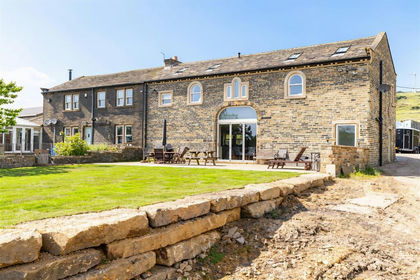
- Price
- Offers Over£1,350,000
- Size
- 22 acres
Added on 22/06/2026Equestrian property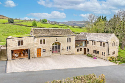
- Price
- Offers Over£1,500,000
- Size
- 24 acres
Royd Road, Meltham, Holmfirth, HD9, Meltham, Kirklees HD9 England
Added on 21/05/2026Country Home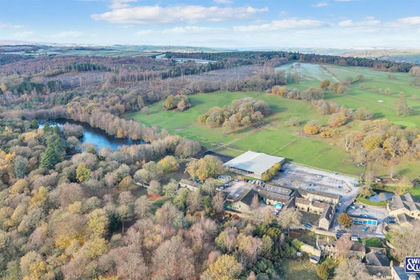
- Price
- £1,300,000
- Size
- 22 acres
Farm House and St Ives Equestrian Centre, Harden, Bradford BD16 England
Added on 29/01/2026Equestrian propertyLeasehold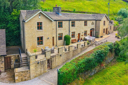
- Price
- £1,195,000
- Size
- 15 acres
Wood Vale Farm, Ellers Road, Sutton In Craven, BD20, Sutton, North Yorkshire BD20 England
Added on 22/04/2026House with Land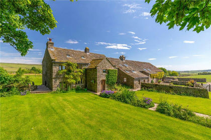
- Price
- Guide Price£1,250,000
- Size
- 17.72 acres
Green Lane, Silsden, West Yorkshire, BD20, Silsden, Bradford BD20 England
Added on 24/04/2026Farmhouse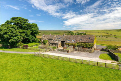
- Price
- Guide Price£1,250,000
- Size
- 17.7 acres
Green Lane, Silsden, West Yorkshire, BD20, Silsden, Bradford BD20 England
Added on 03/07/2026Smallholding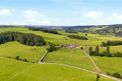
- Price
- Guide Price£1,395,000
- Size
- 48.92 acres
Farnley Lane, Farnley, Otley, North Yorkshire, LS21, Farnley, North Yorkshire LS21 England
Added on 25/08/2026House with Land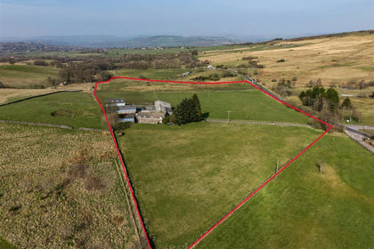
- Price
- Offers in Region of£1,150,000
- Size
- 18.32 acres
Cock Knoll Farm, Mudhurst Lane, Disley, Disley, Cheshire East SK12 England
Added on 29/03/2026Farm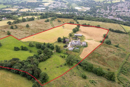
- Price
- £1,690,000
- Size
- 26.21 acres
Mosley Hall Farm, Whaley Bridge, High Peak, Whaley Bridge, Derbyshire SK23 England
Added on 14/09/2026Smallholding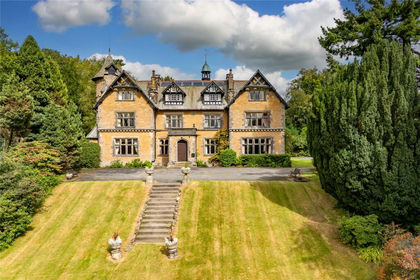
- Price
- Guide Price£1,750,000
- Size
- 50 acres
Clitheroe Road, Dutton, Preston, Lancashire, Dutton, Lancashire PR3 England
Added on 03/04/2026Country Estate