Mill Lane SO32
- Land size
- 11.88 acres
Key Features
- SEE AND PRINT PDF SALES PARTICULARS AVAILABLE BELOW
- SEE DRONE VIDEO FOOTAGE ON THE VIRTUAL TOUR TAB
- EXTENDS TO APPROX. 11.88 ACRES
- PLANNING CONSENT FOR 6 STABLES, TACK ROOM, HAY STORE AND WASHDOWN AREA
- CARAVAN FOR WELFARE USE
- PASTURE LAND APPROX. 11. 45 ACRES
- CLOSE TO THE A32
- ROAD FRONTAGE
- ADJACENT TO THE MEON VALLEY TRAIL
- WITHIN THE SOUTH DOWNS NATIONAL PARK
Description
VIEWING INSTRUCTIONS: STRICTLY BY PRIOR APPOINTMENT ONLY. It is essential to view the drone video footage available on the Selling Agent's website prior to contacting the Selling Agent to arrange an appointment and visiting the Property.
VIDEO DRONE FOOTAGE: See the Selling Agent's website for further details, photographs and drone video footage is available showing the whole property.
LOCATION: See Location Plans. Postcode: SO32 3QH. The Property is located off Mill Lane, Soberton. What3words of Vehicular Access:
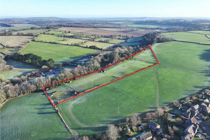
DESCRIPTION: The Property extends to approx. 11.88 acres (4.81 ha) including approx. 11.45 acres of permanent pasture land divided into 10 paddocks by post and rail fencing, approx. 0.24 acres of woodland and approx. 0.19 acres of trackway. The boundaries comprise mainly of post and rail fencing in front of mature hedgerows and trees. There are also several mature trees scattered across the eastern part of the pasture land.
The land is currently in use for equestrian grazing. It benefits from road frontage along its eastern boundary with Mill Lane with access via a hardstanding track from the gate on Mill Lane (see arrow on the Site Plan). The Meon Valley Trail runs immediately adjacent to the northern boundary.
According to the Agricultural Land Classification Survey the land is Grade 4. The Geological Survey Map indicates that the Property is within an area of slowly permeable seasonally wet slightly acid but base-rich loamy and clayey soils. The land has a northerly aspect and slopes into the valley towards the River Meon ranging from around 70m above sea level to around 55m above sea level.
CONSENT FOR STABLES: By Planning Consent SDNP/24/02731/FUL dated 11th June 2025, permission has been granted for the erection of timber barn (approx. 18m by 13m) containing 6 stables (4 x14ft by 12ft and 2 x 21ft by 12ft), a tack room, hay store and washdown area. The use of the land has also been changed from agricultural to equestrian use.
Conditions on the Decision Notice include the limitation of the use of the building to the keeping of horses for private recreational use; limitation on the number of horses occupying the stables to 8; restrictions on vehicles parked on-site (1 small caravan for welfare; 1 horsebox; 1 manure trailer and 3 cars); restrictions on the erection of horse jumps, outside storage and the subdivision of fields and requirements relating to external lighting, manure and waste management, ecology, biodiversity net gain, tree/hedgerow planting and construction of the access track/parking area. See Decision Notice available on the Selling Agents website.
The approximate location of the proposed building is indicated by the blue dashed outline on the Site Plan. The Floorplan/Elevations for the proposed building are included below. Full details of the application can be obtained via the South Downs Local Planning Authority Website -SDNP/24/02731/FUL.
FIELD SHELTERS: There are currently two timber field shelters on the land at the positions marked S on the Site Plan which will be included with the sale.
CARAVAN: There is currently a caravan positioned on the Property to the immediate west of the field shelters. This caravan has been used for welfare purposes. It is limited to this use by Condition 7 of Planning Consent SDNP/24/02731/FUL.
MEON VALLEY TRAIL: The picturesque Meon Valley Trail which passes immediately adjacent to the northern boundary provides an excellent hacking opportunity and can currently be accessed from Mill Lane. As the boundary is adjacent, there is potential to open an access directly from the Property through the hedgerow onto the Trail. The Trail, a disused railway line, provides an easy and safe route from Wickham approximately 2 miles south-west to West Meon approximately 7 miles north-east passing through other settlements on the way and connecting with other parts of the public rights of way network. It can be used for walking, cycling or horse riding.
LAND REGISTRY: The Property comprises part of Land Registry Title HP870676. Copy of Land Registry Title Plan and Register available on the Selling Agent's website.
PLANNING DESIGATIONS: The Property is within the South Downs National Park and the Local Plan shows the land to be 'Countryside'. There is a mineral safeguarding area protecting sharp sand and gravel resources affecting a part of the land on the southern boundary and another protecting clay resources on part of the land on the northern boundary - see link to Planning Policy Map - Planning Policy Map.
PLANNING APPLICATIONS: There are a number of recent planning applications relating to the Property including several unsuccessful attempts to obtain consent for stables and a menage prior to the successful application described above - SDNP/24/02731/FUL. For a full list of recent planning applications relating to the Property, please see the Selling Agent's website.
DESIGNATIONS: The property is situated within the South Downs National Park and the South Hampshire Lowlands National Character area. No other significant environmental designations have been identified.
OTHER RIGHTS: By Deed of Grant dated 12th July 2010, an easement was granted for the benefit of Portsmouth Water relating to three water pipes which pass under the Property. As is usual with an easement of this kind, there are restrictions within the easement width (from 5m and 10m on different parts of the Property) preventing the erection of buildings/structures, the planting of trees and any other operations likely to interfere with the water pipes in these areas. To understand the locations of these water pipe easements, please review the Deed of Grant and Easement Plan available on the Selling Agent's website.
There are overhead electricity wires present on the western part of the Property. The Vendors are not aware that any wayleave payments have been received relating to the electricity poles and wires during their ownership. Other rights are referred to on the Land Registry Title Register and we recommend that interested parties familiarise themselves with the Land Registry Title Register and Plan available on the Selling Agent's website.
PUBLIC RIGHTS OF WAY: No public rights of way cross the Property.
BUSINESS RATES: Not currently demanded or assessed.
SERVICES: No services are currently connected. Services are understood to be available in Heath Road. The current owner does carry out some rainwater harvesting off the field shelter roofs.
LOCAL AUTHORITY: Winchester City Council, City Offices, Colebrook Street, Winchester SO23 9LJ.
PLANNING AUTHORITY: South Downs National Park (SDNP), South Downs Centre, North Street, Midhurst, West Sussex, GU29 9DH.
Map Location
Property details
- Tenure
- Freehold
- Council Tax Band
- Ask Agent
- Date Posted
- 2026-01-29
Price history
| Date | Change | Price |
|---|---|---|
| 16 Sep 2026 | Reduced 1.3% (−£5,000) | £375,000 |
| Until 16 Sep 2026 | Asking price | £380,000 |
Market Value Analysis
Compared with 39 Equestrian listings in South East England (10+ acres).
Utilities & Restrictions
Utilities
- Electricity
- Ask Agent
- Water
- Ask Agent
- Heating
- Ask Agent
- Broadband
- Ask Agent
- Sewerage
- Ask Agent
Rights & Restrictions
- Public Rights of Way
- Ask Agent
- Private Rights of Way
- Ask Agent
- Listed Property
- Ask Agent
- Restrictions
- Ask Agent
Listed status, conservation areas and planning constraints for this location are in the full report.
Property Features
- Accessibility
- Ask Agent
- Parking
- Parking Available
- Garden
- Garden
Beyond the particulars: planning activity, flood history, heritage and ground risks, checked for this exact spot.
Connectivity
Broadband
Fastest speed available at this postcode
51 Mbps
Superfast
Suitable for
- HD streaming
- Video calls
- Web & social
Mobile signal
Predicted 4G and 5G signal; indoor signal depends on building materials.
Ofcom Connected Nations postcode-level predictions. Speeds and signal are modelled, not measured, and vary between addresses and providers.
Signal is the easy part. Planning activity, flood history and protected designations here are in the full report.
Nearest Schools
Primary
- Newtown Soberton Infant School1.3 milesOfsted: Good *
- Ages
- 4 to 7
- Pupils
- 73
- Type
- Community school
- Swanmore Church of England Aided Primary School1.9 milesNo Ofsted rating
- Ages
- 4 to 11
- Pupils
- 409
- Type
- Voluntary aided school
- Faith
- Church of England
- St John the Baptist Church of England Primary School2.2 milesOfsted: Good
- Ages
- 4 to 11
- Pupils
- 202
- Type
- Voluntary controlled school
- Faith
- Church of England
- Wickham Church of England Primary School2.3 milesOfsted report card · Mar 2026
- Ages
- 4 to 11
- Pupils
- 300
- Type
- Voluntary controlled school
- Faith
- Church of England
- Droxford Junior School2.5 milesOfsted: Outstanding
- Ages
- 7 to 11
- Pupils
- 164
- Type
- Academy converter
Secondary
- Swanmore College2 milesNo Ofsted rating
- Ages
- 11 to 16
- Pupils
- 1,338
- Type
- Community school
- Cams Hill School5.2 milesOfsted: Good
- Ages
- 11 to 16
- Pupils
- 1,265
- Type
- Academy converter
- The Henry Cort Community College5.4 milesOfsted report card · Jan 2026
- Ages
- 11 to 16
- Pupils
- 807
- Type
- Community school
- Castle View Academy5.5 milesOfsted report card · Jun 2026
- Ages
- 11 to 16
- Pupils
- 757
- Type
- Academy converter
- Portchester Community School5.8 milesOfsted: Good
- Ages
- 11 to 16
- Pupils
- 688
- Type
- Community school
* Latest graded judgement covers quality of education only; no overall grade was issued under the 2024-25 inspection framework.
Distances are straight-line from the advertised location. Source: the national school registers (DfE, Welsh Government, Scottish Government) and Ofsted.
Schools are just the start: sold prices nearby, planning activity and any flood history are in the full report.
Amenities
Supermarket
GP surgery
Pharmacy
Hospital
Green space
Straight-line distances from the advertised location. Sources: NHS records, Geolytix supermarket locations, OS Open Greenspace and the national trails registers.
The area stacks up? Now check the location itself: planning nearby, protected designations and past flooding.
Getting Around
Nearest station
Nearest bus stop
Typical drive times
Straight-line distances from the advertised location; drive times are typical free-flow times over OpenStreetMap road data, so allow more at peak. Public transport locations from DfT NaPTAN.
Easy to reach matters. So do planning activity, flood history and ground risks: all in the full report.
Flood Risk
Environment Agency open data, checked around the advertised map pin for the listed acreage. Long-term risk counts flood defences; the planning map's flood zones do not. Provided by LandSale, not the listing agent, and not part of the agent's particulars. Risk varies across a holding, so verify before committing.
Rivers and the sea
Planning map: Flood Zone 1.
Surface water
Not at the pin: mapped about 80 metres away.
These bandings are the summary. Where this location sits on the flood maps, plus planning activity, heritage and ground risks, is in the full report.
Important notice: Information, maps and tags on this page are drawn from the advertising agent's marketing materials or generated automatically. LandSale has not verified them. Relying on these details is at your own risk, always carry out independent checks before committing to a purchase.
LandSale full disclaimer
Marketing information only - not formal particulars. The details on this website are provided for general guidance and do not constitute an offer or contract. Neither LandSale nor the advertising estate/land agent accepts responsibility for any inaccuracy.
1. Source of information
- Listing content: Core description, asking price, tenure, measurements, photographs and planning history originate from the marketing materials of the advertising estate or land agent. LandSale does not author this content and cannot guarantee its accuracy.
- Automated tags & categorisation: Property type, land-use class, acreage bands and similar labels may be applied by machine-learning models. They are intended as a helpful guide only and may not reflect the property's legal status or permitted use.
- Third-party & enriched data layers: Maps, boundary outlines, planning designations, soil reports, broadband coverage and other environmental or location-based insights are licensed from external suppliers. Such data are supplied “as is", may be incomplete or out of date and are subject to change without notice.
2. Verification required
Prospective purchasers must verify critical matters, including but not limited to planning permission, title boundaries, public rights of way, environmental constraints, acreage, services, access and VAT status, through their own inspections, specialist surveys, legal advisers and the selling agent before relying on the information or entering into any contract.
3. No warranty or liability
LandSale gives no warranty, express or implied, as to the accuracy, completeness or fitness for any particular purpose of the information displayed. LandSale shall not be liable for any loss, damage, cost or expense arising directly or indirectly from any use of or reliance on such information, save where liability may not be excluded by law.
4. Updates & feedback
If you believe any detail on this listing is inaccurate, please let us know. We will investigate and, where appropriate, update the listing or notify the agent.
© LandSale | Version 1.3 - August 2026
Listing agent
Giles Wheeler-Bennett, Southampton
West Court, Lower Basingwell Street, Bishop's Waltham, SO32 1AJ
Contact Giles Wheeler-Bennett, Southampton
West Court, Lower Basingwell Street, Bishop's Waltham, SO32 1AJ
View agent profileSimilar properties for sale
- Price
- Guide Price£300,000
- Size
- 7.12 acres
Butts Farm, Rareridge Lane, SO32, Bishops Waltham, Hampshire SO32 England
Added on 29/01/2026Pasture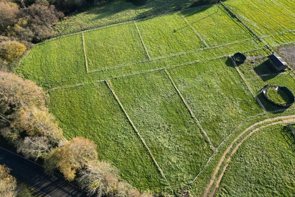
- Price
- Guide Price£365,000
- Size
- 5.55 acres
Fontley Road, Fareham, Hampshire, PO15, Wickham and Knowle, Hampshire PO15 England
Added on 29/01/2026Equestrian property
- Price
- Guide Price£350,000
- Size
- 5.1 acres
Glen Road, Sarisbury Green, Hampshire, Hamble Valley, Hampshire SO31 England
Added on 11/07/2026Agricultural Land
- Price
- Guide Price£290,000
- Size
- 9.75 acres
Stoner Hill Road, GU32, Froxfield and Privett, Hampshire GU32 England
Added on 29/01/2026Pasture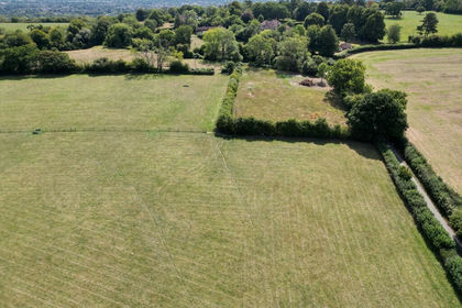
- Price
- Guide Price£390,000
- Size
- 10.84 acres
Stoner Hill Road, GU32, Froxfield and Privett, Hampshire GU32 England
Added on 29/01/2026Pasture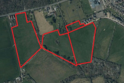
- Price
- £290,000
- Size
- 19.28 acres
Land at Heytesbury Farm, Newport and Carisbrooke, Isle of Wight PO30 England
Added on 29/01/2026Agricultural Land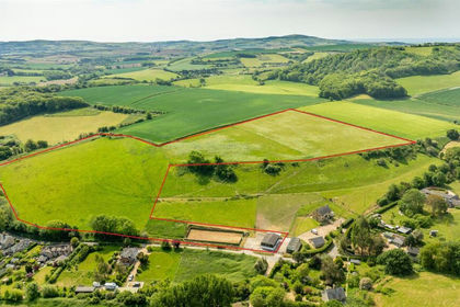
- Price
- Guide Price£350,000
- Size
- 18.33 acres
Added on 25/06/2026Agricultural Land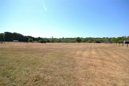
- Price
- Guide Price£425,000
- Size
- 9.25 acres
Added on 10/09/2026Agricultural Land
- Price
- Guide Price£400,000
- Size
- 9.49 acres
Eden, Milford Road, Everton, Lymington, Hordle, Hampshire SO41 England
Added on 02/06/2026Equestrian property
- Price
- Offers in Excess of£395,000
- Size
- 77.2 acres
Broad Lane, Upper Bucklebury, Reading, Berkshire, RG7, Bucklebury, West Berkshire RG7 England
Added on 28/01/2026Woodland