RAMSGATE: Residential Site with Full Planning Permission
- Land size
- 0.22 acres
Key Features
- Town Centre Location
- Planning Ref: R/TH/23/1261
- Excellent Transport Links
- Nearby Public Car Park
- Good Public Transport Links
- Planning for 26 two bed & 4 one bed flats
- 0.2 miles to the Harbour Arm & Beach
- Planning includes a Commercial Unit
Description
Residential Development site with Full Planning Permission for 30 flats and a retail shop.
The site comprises a retail store on a plot of some 0.22 acres (0.09 hectares) found approximately a 4 minute walk of the sea front and harbor, with its mix of restaurants, bars and cafes. Planning permission has been granted for the demolition of the existing building and erection of a four storey building comprising 26 two bedroom flats, 4 bedsit flats and a retail shop of 689 sq.ft (64 sq.m).
The site is found in Broad Street which runs parallel with High Street and within a 2-minute walk of the King Street, Queen Street, Harbour Street and High Street pedestrianized crossing. All four streets provide a selection of retail, café and restaurant occupiers with the intersection being the center of the town.
Directly to the east of the property from Cleaver Lane is the Staffordshire Street overground Car Park, providing 254 spaces. Ramsgate mainline railway station with services to London St Pancras International and London Victoria in 1 hour 15 minutes, and 2 hours respectively.
DESCRIPTION
The site is currently a two-storey commercial property with almost 100% site coverage, having frontages to Broad Street, Turner Street and Cleaver Lane. Directly behind the property is a Council owned car park which we understand has in the past been used as a materials store for another development in the street.
PLANNING
Outline planning permission was granted in January 2021 for the “Erection of a 5 storey building for up to 26No 2 bed, 4No 1 bed and 1No 3 bed self-contained flats with a retail unit at ground floor level following demolition of existing buildings.” (Reference: OL/TH/19/0484) This was amended in the application for reserved matters which was approved in June 2024.
The site has planning permission to provide a total of 26 two bedroom flats and 4 bedsit flats arranged over 4 floors. In addition the scheme will provide 689 sq.ft (64 sq.m) of retail space. Full details of the application can be found on Thanet District Council's planning site under reference R/TH/23/1261. The planning permission provides for no social housing but a financial contribution to SAMM.
VAT
VAT will be payable if applicable.
VIEWINGS & INFORMATION
For further information and the marketing pack please contact sellers' sole agents Clarke & Crittenden.
Map Location
Property details
- Tenure
- Freehold
- Council Tax Band
- Ask Agent
- Date Posted
- 2026-01-29
Utilities & Restrictions
Utilities
- Electricity
- Ask Agent
- Water
- Ask Agent
- Heating
- Ask Agent
- Broadband
- Ask Agent
- Sewerage
- Ask Agent
Rights & Restrictions
- Public Rights of Way
- Ask Agent
- Private Rights of Way
- Ask Agent
- Listed Property
- Ask Agent
- Restrictions
- Ask Agent
Property Features
- Accessibility
- Ask Agent
- Parking
- Parking Available
- Garden
- Ask Agent
Important notice: Information, maps and tags on this page are supplied by the advertising agent or generated automatically. LandSale has not verified them. Relying on these details is at your own risk, always carry out independent checks before committing to a purchase.
LandSale full disclaimer
Marketing information only - not formal particulars. The details on this website are provided for general guidance and do not constitute an offer or contract. Neither LandSale nor the advertising estate/land agent accepts responsibility for any inaccuracy.
1. Source of information
- Agent-supplied content: Core description, asking price, tenure, measurements, photographs and planning history are uploaded by the appointed agent, who remains solely responsible for their accuracy.
- Automated tags & categorisation: Property type, land-use class, acreage bands and similar labels may be applied by machine-learning models. They are intended as a helpful guide only and may not reflect the property's legal status or permitted use.
- Third-party & enriched data layers: Maps, boundary outlines, planning designations, soil reports, broadband coverage and other environmental or location-based insights are licensed from external suppliers. Such data are supplied “as is", may be incomplete or out of date and are subject to change without notice.
2. Verification required
Prospective purchasers must verify critical matters, including but not limited to planning permission, title boundaries, public rights of way, environmental constraints, acreage, services, access and VAT status, through their own inspections, specialist surveys, legal advisers and the selling agent before relying on the information or entering into any contract.
3. No warranty or liability
LandSale gives no warranty, express or implied, as to the accuracy, completeness or fitness for any particular purpose of the information displayed. LandSale shall not be liable for any loss, damage, cost or expense arising directly or indirectly from any use of or reliance on such information, save where liability may not be excluded by law.
4. Updates & feedback
If you believe any detail on this listing is inaccurate, please let us know. We will investigate and, where appropriate, update the listing or notify the agent.
© LandSale | Version 1.2 - January 2026
Listing agent
Clarke & Crittenden, Canterbury
105 Station Road, Birchington, Kent, CT7 9RE
Contact Clarke & Crittenden, Canterbury
105 Station Road, Birchington, Kent, CT7 9RE
View agent profileSimilar properties for sale

- Price
- £1,250,000
- Size
- 4.7 acres
Added on 16/04/2026Development Land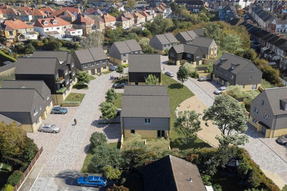
- Price
- Offers in Region of£1,850,000
- Size
- 2.25 acres
Moat Farm Road, Folkestone, Kent, CT19, Folkestone, Kent CT19 5DJ England
Added on 29/01/2026Development Land
- Price
- £1,850,000
- Size
- 2.25 acres
Moat Farm Road, Folkestone, CT19, Folkestone, Kent CT19 5QZ England
Added on 28/01/2026Development Land
- Price
- £1,525,000
Added on 29/01/2026Development Land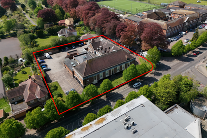
- Price
- Guide Price£1,350,000
- Size
- 0.82 acres
Added on 12/06/2026Development Land
- Price
- £1,300,000
- Size
- 4.9 acres
Redbrook Street, Woodchurch, Ashford, TN26, Woodchurch, Kent TN26 3QP England
Added on 29/01/2026Development Land
- Price
- Offers in Excess of£1,750,000
- Size
- 13 acres
Added on 10/06/2026Industrial Land
- Price
- Offers in Region of£1,500,000
- Size
- 11 acres
Added on 05/04/2026Development Land
- Price
- £1,750,000
- Size
- 2 acres
DEVELOPMENT LAND - Clacton Road, Weeley Heath, Essex, Weeley, Essex CO16 9EF England
Added on 22/06/2026Development Land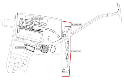
- Price
- Guide Price£1,500,000
Boughton Monchelsea, Maidstone, Boughton Monchelsea, Kent ME17 4JW England
Added on 09/06/2026Development Land