Mablethorpe Road, Theddlethorpe, Mablethorpe
- Land size
- 0.4 acres
- Bedrooms
- 3
- Bathrooms
- 2
Key Features
- Detached Historic Character Coastal Farm House
- Grade II Listed
- Three Bedrooms (One En-Suite) to Farm House
- Sun Room & Dual Living Room
- Numerous Outbuildings to include Workshops
- Three Traditional Brick-Built Stables
- Two Holiday Cottages (one partially complete)
- Small Paddock & Ponds
- Coastal Location Close to Nature Reserves & Beaches
- Energy Performance Rating: 'E'
Description
This Grade II Listed Farm House with an abundance of history dating back to the 1700's, offers the rare opportunity to be part of the ongoing chronicle of the historic holding. With three bedrooms (one being en-suite), sun room, cottage gardens, numerous outbuildings to include workshops, open-fronted agricultural building and three brick-built stables, planning permission for two holiday cottages (one of which is partially completed), located in a prominent coastal location with paddock and ponds, this holding offers a wealth of opportunity to the new owner.
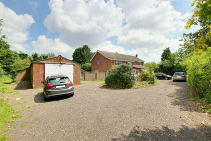
Property Entrance - With chalk based driveway leading to wide central yard space providing parking for ample vehicles and access to all buildings.
Front Of Farm House - Wrap-around gardens, with areas of patio and pathways of traditional brick, wooden five-bar gate, walled archways with wrought iron gate, raised flowerbeds with dwarf walls, feature well pump and trough, lawns and mature cottage garden borders.
Front Porch - With wooden front door and porch (0.9m x 0.9m) leading into Living Dining Room
Open Plan Living Dining Room - 10.0m max x 4.0m (32'9" max x 13'1" ) - Divided by a central chimney breast once used as a bread oven, with fireplace, surround and hearth to two sides, two electric heaters, telephone point, spiral staircase, wooden sash windows to the front of the property and tiled flooring.
Inner Hallway - 3.1m x 3.5m (10'2" x 11'5" ) - With feature corner fireplace and hearth, shelving alcoves, under-stairs storage cupboard and quarry tile flooring.
Kitchen Diner - 2.3m x 9.1m (7'6" x 29'10") - With base units, sink with 1.5 bowls, mixer tap and drainer, integrated LPG gas hob with stainless steel splashback, full height storage cupboard housing fuse box, electric heater, half-glazed wooden external door, windows to three aspects of the property and quarry tile flooring.
Shower Room - 1.0m x 3.1m (3'3" x 10'2" ) - With WC, wash basin, shower cubicle with electric shower, extractor fan, electric heater, window to the rear of the property and tiled flooring.
Conservatory - 4.3m x 3.8m (14'1" x 12'5" ) - Of brick wall and wooden double glazed window construction, double glazed roof panels, French Doors leading to the rear garden and tiled flooring.
Bedroom One - 4.9m x 3.2m (16'0" x 10'5" ) - With high vaulted ceilings, WC, sink vanity unit, built-in storage cupboards, electric heater, windows to three aspects and wooden flooring.
First Floor Landing - 2.9m x 1.7m (9'6" x 5'6" ) - With original beams and wooden flooring.
Bedroom Two - 4.0m max x 3.8m (13'1" max x 12'5" ) - 'L' shaped room with television point, full height storage cupboard, windows to the front and rear of the property and wooden flooring.
En-Suite - 4.1m x 2.4m (13'5" x 7'10" ) - With WC, wash basin, central roll-top bath, built-in storage cupboard housing the immersion tank, window to the front of the property and tiled flooring.
Bedroom Three - 3.9m x 3.0m (12'9" x 9'10" ) - With two full height storage cupboards, radiator, window to the front of the property and wooden flooring.
Utility Outbuilding With Shower Room - 4.5m x 3.9m max (14'9" x 12'9" max) - With French Doors to the front, window to the right hand side and concrete flooring.
Shower Room (2.7m x 1.1m) / 8'10" x 3'7"
With WC, sink vanity unit, shower enclosure with electric shower, extractor fan and tiled flooring.
Gardens - With areas of patio and pathways of traditional brick, summerhouse, raised flowerbeds with dwarf walls, areas of lawn, vegetables gardens and cottage gardens, property boundaries of fencing, mature hedging and trees.
Holiday Cottage No 1 - With planning permission in place for a holiday cottage. Full planning details can be found on East Lindsey Planning portal under application N/180/01066/18.
Cottage No 1 Kitchen - 4.2m x 4.5m (13'9" x 14'9" ) - Dual aspect kitchen with wall and base units, sink with mixer tap and drainer, integrated double over and LPG gas hob with extractor over, space and plumbing for washing machine, under-stairs storage cupboard, wooden stable style external door, open plan stair case to first floor, windows to the front and side of the property and tiled flooring.
Cottage No 1 Living Room - 4.6m x 4.3m (15'1" x 14'1" ) - With fireplace, surround and hearth, full height storage cupboard housing the fuse box, French Doors leading to patio area, wooden windows to the side of the property and laminated flooring.
Cottage No 1 Bedroom One - 4.2m x 2.8m (13'9" x 9'2" ) - With fully vaulted ceilings, built-in storage cupboards, two wooden Velux windows and carpeted flooring.
Cottage No 1 En-Suite - 4.5m x 2.1m (14'9" x 6'10" ) - With WC, sink with vanity unit, bath with electric shower over, extractor fan, built in storage cupboards housing the electric immersion tank, Velux window and vinyl tiled flooring.
Partially Converted Holiday Cottage No 2 - 12.3m x 4.5m (40'4" x 14'9" ) - Partially converted former 'Stable' building with planning permission in place for a holiday cottage for occupation between 15th March - 31st October. Full planning details can be found on East Lindsey Planning portal under application N/180/02318/19. The property has a combination of wooden single and double glazed windows and doors to include an original large round feature window in the living room.
Cottage No 2 Kitchen - 3.6m x 4.4m max (11'9" x 14'5" max) - Triple aspect room with newly installed kitchen consisting of a range of base units, stainless steel sink with drainer and mixer tap, space for free standing electric cooker, space for slimline under counter fridge, log burner with hearth, wooden flooring, feature circular window and additional window with views over open fields, double French doors to the side and full height window to the front.
Cottage No 2 Hallway - 4.5m x 0.8m (14'9" x 2'7") - Leading to all rooms and accessed via half single glazed wooden external door with stained glass panels and full height window to the side, with high level fuse box and chipboard flooring.
Cottage No 2 Bathroom - 2.2m x 2.7m (7'2" x 8'10") - Bathroom suite yet to be fitted however plumbing is currently in place, this bathroom is designed to have 'Jack and Jill' access to both bedrooms and has a high level window to the rear.
Cottage No 2 Bedroom One - 3.4m x 3.7m (11'1" x 12'1") - With feature sliding door to bathroom, chipboard flooring and windows to three sides and double glazed French door to the rear of the property.
Cottage No 2 Bedroom Two - 3.0m x 2.7m (9'10" x 8'10") - With chipboard flooring, window and double glazed French door with open aspects over fields.
Open-Fronted Agricultural Building - 16.5m x 8.5m (54'1" x 27'10") - Open fronted four bay general purposes agricultural building with concrete flooring.
Workshop - 7.1m x 3.7m (23'3" x 12'1" ) - With power and lighting, open plan roof joists and concrete flooring.
Rear Lean To Workshop - 18.5m x 4.1m (60'8" x 13'5" ) - With full width door, block walls, water, power and lighting are connected, personnel door and concrete flooring.
Stable One - 3.7m x 3.8m (12'1" x 12'5" ) - With power and lighting, concrete flooring.
Stable Two - 3.4m x 3.7m (11'1" x 12'1" ) - With power and lighting, concrete flooring.
Stable Three - 3.3m x 3.6m (10'9" x 11'9") - With power and lighting, concrete flooring.
Paddock & Ponds - Extending to circa 0.4 acres of grass paddock adjacent to the property which includes an area of pond, fruit trees and rural views.
Additional Information - We are informed the property is partially affected by the Viking CCS project and further details can be obtained from the vendor on viewing or the sales agent.
Services - We understand that mains water and electricity are connected to the property. Drainage is understood to be to two private systems. Heating is provided via electric storage heaters.
Local Authority - Council Tax Band 'C' payable to Local Authority: East Lindsey District Council, The Hub, Mareham Road, Horncastle, Lincs, LN9 6PH. Tel: .
Energy Performance Certificate - The Farm House has an energy rating of 'E'. The full report is available from the agents or by visiting Reference Number: 2100-2966-0722-1497-3143
The Annex has an energy rating of 'E'. The full report is available from the agents or by visiting Reference Number: 9261-3008-6201-3394-4200
Directions - From Mablethorpe, take the A1031 north towards the village of Theddlethorpe St Helen. The property can be found on the right after two miles.
What3Words///sprinting.glitz.cycle
Viewing - Viewing is strictly by appointment with the Alford office at the address shown below.
Map Location
Property details
- Tenure
- Freehold
- Council Tax Band
- C
- Date Posted
- 2026-11-16
Energy Performance Certificate
Energy Efficiency Rating
Based on UK Energy Performance Certificate standards (EU Directive 2002/91/EC)
Running costs are one side. Planning activity, flood history and ground risks for this location are in the full report.
Utilities & Restrictions
Utilities
- Electricity
- Mains
- Water
- Mains
- Heating
- Electric Heating, Open Fire
- Broadband
- Ask Agent
- Sewerage
- Septic Tank / Private
Rights & Restrictions
- Public Rights of Way
- Ask Agent
- Private Rights of Way
- Ask Agent
- Listed Property
- Yes
- Restrictions
- Ask Agent
Listed status, conservation areas and planning constraints for this location are in the full report.
Property Features
- Accessibility
- Ask Agent
- Parking
- Driveway
- Garden
- Garden
Beyond the particulars: planning activity, flood history, heritage and ground risks, checked for this exact spot.
Connectivity
Broadband
Fastest speed available at this postcode
26 Mbps
Standard (10-30 Mbps)
Suitable for
- Web & social
- Music streaming
- Standard video calls
Fixed wireless access may also be an option here.
Mobile signal
Predicted 4G and 5G signal; indoor signal depends on building materials.
Ofcom Connected Nations postcode-level predictions. Speeds and signal are modelled, not measured, and vary between addresses and providers.
Signal is the easy part. Planning activity, flood history and protected designations here are in the full report.
Nearest Schools
Primary
- Theddlethorpe Academy763 metresOfsted: Good
- Ages
- 3 to 11
- Pupils
- 98
- Type
- Academy sponsor led
- Mablethorpe Primary Academy2.1 milesNo Ofsted rating
- Ages
- 3 to 11
- Pupils
- 320
- Type
- Academy sponsor led
- The St Margaret's Church of England School, Withern4.3 milesNo Ofsted rating
- Ages
- 4 to 11
- Pupils
- 75
- Type
- Voluntary controlled school
- Faith
- Church of England
- Sutton-on-Sea Community Primary School4.5 milesOfsted: Good
- Ages
- 5 to 11
- Pupils
- 112
- Type
- Community school
- Grimoldby Primary School5.2 milesNo Ofsted rating
- Ages
- 3 to 11
- Pupils
- 207
- Type
- Foundation school
Secondary
- Somercotes Academy6.8 milesNo Ofsted rating
- Ages
- 11 to 16
- Pupils
- 395
- Type
- Academy sponsor led
- John Spendluffe Foundation Technology College7.4 milesOfsted: Good
- Ages
- 11 to 16
- Pupils
- 650
- Type
- Academy converter
- Queen Elizabeth's Grammar Alford - A Selective Academy7.5 milesOfsted report card · May 2026
- Ages
- 11 to 18
- Pupils
- 565
- Type
- Academy converter
- Louth Academy8.9 milesOfsted: Good
- Ages
- 11 to 16
- Pupils
- 891
- Type
- Academy sponsor led
- King Edward VI Grammar School9.5 milesOfsted: Good
- Ages
- 11 to 18
- Pupils
- 900
- Type
- Academy converter
Distances are straight-line from the advertised location. Source: the national school registers (DfE, Welsh Government, Scottish Government) and Ofsted.
Schools are just the start: sold prices nearby, planning activity and any flood history are in the full report.
Amenities
Supermarket
GP surgery
Pharmacy
Hospital
Green space
Straight-line distances from the advertised location. Sources: NHS records, Geolytix supermarket locations, OS Open Greenspace and the national trails registers.
The area stacks up? Now check the location itself: planning nearby, protected designations and past flooding.
Getting Around
Nearest station
Nearest bus stop
Typical drive times
Straight-line distances from the advertised location; drive times are typical free-flow times over OpenStreetMap road data, so allow more at peak. Public transport locations from DfT NaPTAN.
Easy to reach matters. So do planning activity, flood history and ground risks: all in the full report.
Flood Risk
Environment Agency open data, checked around the advertised map pin for the listed acreage. Long-term risk counts flood defences; the planning map's flood zones do not. Provided by LandSale, not the listing agent, and not part of the agent's particulars. Risk varies across a holding, so verify before committing.
Rivers and the sea
Not at the pin: mapped about 10 metres away.
Planning map: Flood Zone 3.
Surface water
These bandings are the summary. Where this location sits on the flood maps, plus planning activity, heritage and ground risks, is in the full report.
Important notice: Information, maps and tags on this page are drawn from the advertising agent's marketing materials or generated automatically. LandSale has not verified them. Relying on these details is at your own risk, always carry out independent checks before committing to a purchase.
LandSale full disclaimer
Marketing information only - not formal particulars. The details on this website are provided for general guidance and do not constitute an offer or contract. Neither LandSale nor the advertising estate/land agent accepts responsibility for any inaccuracy.
1. Source of information
- Listing content: Core description, asking price, tenure, measurements, photographs and planning history originate from the marketing materials of the advertising estate or land agent. LandSale does not author this content and cannot guarantee its accuracy.
- Automated tags & categorisation: Property type, land-use class, acreage bands and similar labels may be applied by machine-learning models. They are intended as a helpful guide only and may not reflect the property's legal status or permitted use.
- Third-party & enriched data layers: Maps, boundary outlines, planning designations, soil reports, broadband coverage and other environmental or location-based insights are licensed from external suppliers. Such data are supplied “as is", may be incomplete or out of date and are subject to change without notice.
2. Verification required
Prospective purchasers must verify critical matters, including but not limited to planning permission, title boundaries, public rights of way, environmental constraints, acreage, services, access and VAT status, through their own inspections, specialist surveys, legal advisers and the selling agent before relying on the information or entering into any contract.
3. No warranty or liability
LandSale gives no warranty, express or implied, as to the accuracy, completeness or fitness for any particular purpose of the information displayed. LandSale shall not be liable for any loss, damage, cost or expense arising directly or indirectly from any use of or reliance on such information, save where liability may not be excluded by law.
4. Updates & feedback
If you believe any detail on this listing is inaccurate, please let us know. We will investigate and, where appropriate, update the listing or notify the agent.
© LandSale | Version 1.3 - August 2026
Similar properties for sale
- Price
- £425,000
- Size
- 1.4 acres
Mablethorpe Road, Theddlethorpe, Mablethorpe, Theddlethorpe St Helen, Lincolnshire LN12 England
Added on 29/01/2026House with Land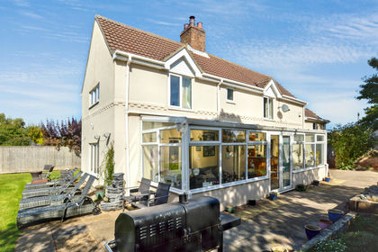
- Price
- Offers in Excess of£450,000
- Size
- 1.85 acres
Added on 25/10/2026Farmhouse
- Price
- £450,000
- Size
- 1.5 acres
Bucknalls Meadow, Sutton-On-Sea, Mablethorpe, Mablethorpe and Sutton, Lincolnshire LN12 England
Added on 07/07/2026House with Land
- Price
- Offers Over£400,000
- Size
- 2.7 acres
Louth Road, Gayton Le Marsh, Alford, Gayton le Marsh, Lincolnshire LN13 England
Added on 29/01/2026Development Land Added on 20/05/2026Barn Conversion
- Price
- £375,000
- Size
- 2 acres
Main Road, Withern, Alford, Reston, Lincolnshire LN11 England
Added on 29/04/2026House with Land
- Price
- £375,000
- Size
- 5.5 acres
Alford Road, Thoresthorpe, Alford, Beesby with Saleby, Lincolnshire LN13 England
Added on 17/07/2026House with Land
- Price
- £350,000
- Size
- 1.5 acres
Building Plots, Mumby Road, Huttoft, Huttoft, Lincolnshire LN13 England
Added on 05/05/2026Development Land
- Price
- Offers in Excess of£348,000
- Size
- 2.5 acres
Huttoft Road, Mumby, LN13, Anderby, Lincolnshire LN13 England
Added on 10/11/2026House with Land
- Price
- £350,000
- Size
- 1 acres
Roman Bank, Anderby PE24, Anderby, Lincolnshire PE24 England
Added on 20/10/2026Smallholding