High Street, Warboys, PE28
- Land size
- 0.3 acres
- Bedrooms
- 5
- Bathrooms
- 2
Key Features
- STEEPED in LOCAL HISTORY, ‘LINDON HOUSE’ is an IMPRESSIVE 2,309 sq ft FIVE BEDROOM PERIOD RESIDENCE
- Occupying a SUBSTANTIAL 0.30 acre plot (sts) with a BEAUTIFULLY LANDSCAPED and MATURE REAR GARDEN
- A property of GENUINE HERITAGE SIGNIFICANCE, it is a Grade II LISTED HOMES, formally recognised in 1982 for its SPECIAL ARCHITECTURAL and HISTORIC INTEREST
- Lindon House stands among the most distinguished period homes on Warboys High Street; a substantial and elegant Georgian village residence, abundant in character & steeped in history
- LARGE GATED DRIVEWAY with PARKING AVAILABLE FOR A SIGNIFICANT AMOUNT OF VEHICLES AND LARGE OUTBUILDING
- GUIDE PRICE of £675,000 to £700,000
- Walking distance to sought after Local Primary School and Local Shops
- 7.1 Miles from Huntingdon Train Station - London Kings cross reachable in just 50 minutes
- 23 Miles from Cambridge City Centre
Description
STEEPED in LOCAL HISTORY, ‘LINDON HOUSE’ is an IMPRESSIVE 2,309 sq ft FIVE BEDROOM PERIOD RESIDENCE, occupying a SUBSTANTIAL 0.30 acre plot (sts) on WARBOYS HIGH STREET. A property of GENUINE HERITAGE SIGNIFICANCE, it is a Grade II LISTED HOME, formally recognised in 1982 for its SPECIAL ARCHITECTURAL and HISTORIC INTEREST. According to HISTORIC ENGLAND, ‘LINDON HOUSE’ dates from the mid-18th century, having likely been built between 1740 and 1765 during the GEORGIAN PERIOD, making it approximately 260 to 280 years old today. Its construction came at a time when Warboys was thriving as a PROSPEROUS AGRICULTURAL VILLAGE. Across RURAL ENGLAND, older timber-framed cottages were increasingly being replaced or complemented by elegant brick-built Georgian homes that reflected growing wealth and changing tastes. Lindon House was part of this transformation and remains prominently positioned on the north side of the High Street, within the historic heart of the village. In its day, substantial brick houses such as this were clear symbols of status and standing within the local community.
Architecturally, Lindon House is a handsome example of Georgian domestic design, built in red brick with a rendered front façade beneath a plain tiled gabled roof, with end chimney stacks and two storeys. Its formal symmetrical frontage is characteristic of the era, while one of its most striking features is the early 19th-century entrance doorcase, complete with half-round fluted Doric columns supporting a plain entablature — a refined classical enhancement added around 1800 to 1830.
Today, Lindon House stands among the most distinguished period homes on Warboys High Street; a substantial and elegant Georgian village residence, abundant in character, steeped in history, and offering enduring heritage appeal.
PROPERTY MEASUREMENTS
LIVING ROOM - 3.87m x 3.81m
FAMILY ROOM - 4.30m x 3.85m
DINING ROOM - 4.48m x 3.52m
KITCHEN/BREAKFAST ROOM - 4.55m x 4.26m
UTILITY ROOM - 3.87m x 3.64m
BOOT ROOM - 1.93m x 1.92m
WC - 1.23m x 1.18m
MASTER BEDROOM - 4.08m x 4.01m
EN-SUITE SHOWER ROOM - 3.52m x 1.33m
BEDROOM TWO - 4.33m x 4.14m
BEDROOM THREE - 4.28m x 3.80m
BEDROOM FOUR - 3.58m x 2.13m
BEDROOM FIVE - 2.82m x 1.37m
FAMILY BATHROOM - 3.43m x 1.94m
OUTBUILDING - 4.58m x 3.30m
OUTBUILDING SECOND ROOM - 3.35m x 2.40m
ABOUT WARBOYS
The pleasant village of Warboys, with it's centrally located landmark Clock Tower built to commemorate the Golden Jubilee of Queen Victoria, is located within the District of Cambridgeshire. The village offers a range of amenities and community activities including bakery and tea room, library, pharmacy, convenience stores, Post Office, dental and doctors surgeries, Primary school and public houses as well as playgroups and special interest clubs.
The nearby towns of Huntingdon (approx 8.5 miles), Ramsey (approx 4 miles) and St Ives (approx 8 miles) all have leisure centres offering a variety of facilities and activities alongside shopping in national chain, supermarket and independent stores. Fast trains to London Kings Cross can also be taken from Huntingdon.
PROPERTY DISCLAIMER
We are required by law to conduct anti-money laundering checks on all those selling
or buying a property as prescribed by the Money Laundering Regulations 2017.
Whilst we retain responsibility for ensuring checks and any ongoing monitoring are
carried out correctly, the initial checks are carried out on our behalf by Coadjute who
will contact you once you have agreed to instruct us in your sale or had an offer
accepted on a property you wish to buy. The cost of these checks is £45 + VAT, which covers the cost of obtaining relevant data and any manual checks and
monitoring which might be required. This fee will need to be paid by you in advance
of us publishing your property (in the case of a vendor) or issuing a memorandum of
sale (in the case of a buyer), directly to Coadjute, and is non-refundable. We will
receive some of the fee taken by Coadjute to compensate for its role in the provision of these checks
1. Money Laundering Regulations: Intending purchasers will be asked to produce identification documentation at a later stage and we would ask for your co-operation in order that there will be no delay in agreeing the sale.
2. General: While we endeavour to make our sales particulars fair, accurate and reliable, they are only a general guide to the property and, accordingly, if there is any point which is of particular importance to you, please contact the office and we will be pleased to check the position for you, especially if you are contemplating travelling some distance to view the property.
3. The measurements indicated are supplied for guidance only and as such must be considered incorrect.
4. Services: Please note we have not tested the services or any of the equipment or appliances in this property, accordingly we strongly advise prospective buyers to commission their own survey or service reports before finalising their offer to purchase.
5. These particulars are issued in good faith but do not constitute representations of fact or form part of any offer or contract. The matters referred to in these details should be independently verified by prospective buyers. Neither Lennon James or any of its employees have any authority to make or give any representation or warranty in relation to this property.
Map Location
Property details
- Tenure
- Freehold
- Council Tax Band
- F
- Date Posted
- 2026-11-16
Utilities & Restrictions
Utilities
- Electricity
- Ask Agent
- Water
- Ask Agent
- Heating
- Ask Agent
- Broadband
- Ask Agent
- Sewerage
- Ask Agent
Rights & Restrictions
- Public Rights of Way
- Ask Agent
- Private Rights of Way
- Ask Agent
- Listed Property
- Ask Agent
- Restrictions
- Ask Agent
Listed status, conservation areas and planning constraints for this location are in the full report.
Property Features
- Accessibility
- Ask Agent
- Parking
- Parking Available
- Garden
- Garden
Beyond the particulars: planning activity, flood history, heritage and ground risks, checked for this exact spot.
Connectivity
Broadband
Fastest speed available at this postcode
1.8 Gbps
Gigabit full fibre
Suitable for
- 4K streaming on every screen
- Full-time home working
- Online gaming & big downloads
Mobile signal
Predicted 4G and 5G signal; indoor signal depends on building materials.
Ofcom Connected Nations postcode-level predictions. Speeds and signal are modelled, not measured, and vary between addresses and providers.
Signal is the easy part. Planning activity, flood history and protected designations here are in the full report.
Nearest Schools
Primary
- Warboys Primary Academy311 metresOfsted: Requires improvement
- Ages
- 5 to 11
- Pupils
- 302
- Type
- Academy converter
- Bury CofE Primary School2.6 milesOfsted: Good *
- Ages
- 4 to 11
- Pupils
- 207
- Type
- Academy converter
- Faith
- Church of England
- Upwood Primary Academy3 milesOfsted: Good
- Ages
- 5 to 11
- Pupils
- 202
- Type
- Academy converter
- Ramsey Spinning Infant School3.3 milesNo Ofsted rating
- Ages
- 5 to 7
- Pupils
- 223
- Type
- Academy converter
- Ramsey Junior School3.4 milesNo Ofsted rating
- Ages
- 7 to 11
- Pupils
- 272
- Type
- Academy converter
Secondary
- Abbey College, Ramsey3.1 milesOfsted: Good
- Ages
- 11 to 18
- Pupils
- 1,096
- Type
- Academy converter
- St Ivo Academy5 milesOfsted: Good
- Ages
- 11 to 18
- Pupils
- 1,378
- Type
- Academy converter
- St Peter's School6.2 milesOfsted report card · May 2026
- Ages
- 11 to 18
- Pupils
- 1,506
- Type
- Academy converter
- Cromwell Community College6.6 milesOfsted: Good
- Ages
- 4 to 18
- Pupils
- 1,539
- Type
- Academy converter
- Hinchingbrooke School7.2 milesOfsted report card · May 2026
- Ages
- 11 to 18
- Pupils
- 2,173
- Type
- Academy converter
* Latest graded judgement covers quality of education only; no overall grade was issued under the 2024-25 inspection framework.
Distances are straight-line from the advertised location. Source: the national school registers (DfE, Welsh Government, Scottish Government) and Ofsted.
Schools are just the start: sold prices nearby, planning activity and any flood history are in the full report.
Amenities
Supermarket
GP surgery
Pharmacy
Hospital
Green space
Straight-line distances from the advertised location. Sources: NHS records, Geolytix supermarket locations, OS Open Greenspace and the national trails registers.
The area stacks up? Now check the location itself: planning nearby, protected designations and past flooding.
Getting Around
Nearest station
Nearest bus stop
Typical drive times
Straight-line distances from the advertised location; drive times are typical free-flow times over OpenStreetMap road data, so allow more at peak. Public transport locations from DfT NaPTAN.
Easy to reach matters. So do planning activity, flood history and ground risks: all in the full report.
Flood Risk
Environment Agency open data, checked around the advertised map pin for the listed acreage. Long-term risk counts flood defences; the planning map's flood zones do not. Provided by LandSale, not the listing agent, and not part of the agent's particulars. Risk varies across a holding, so verify before committing.
Rivers and the sea
Planning map: Flood Zone 1.
Surface water
Not at the pin: mapped about 20 metres away.
These bandings are the summary. Where this location sits on the flood maps, plus planning activity, heritage and ground risks, is in the full report.
Important notice: Information, maps and tags on this page are drawn from the advertising agent's marketing materials or generated automatically. LandSale has not verified them. Relying on these details is at your own risk, always carry out independent checks before committing to a purchase.
LandSale full disclaimer
Marketing information only - not formal particulars. The details on this website are provided for general guidance and do not constitute an offer or contract. Neither LandSale nor the advertising estate/land agent accepts responsibility for any inaccuracy.
1. Source of information
- Listing content: Core description, asking price, tenure, measurements, photographs and planning history originate from the marketing materials of the advertising estate or land agent. LandSale does not author this content and cannot guarantee its accuracy.
- Automated tags & categorisation: Property type, land-use class, acreage bands and similar labels may be applied by machine-learning models. They are intended as a helpful guide only and may not reflect the property's legal status or permitted use.
- Third-party & enriched data layers: Maps, boundary outlines, planning designations, soil reports, broadband coverage and other environmental or location-based insights are licensed from external suppliers. Such data are supplied “as is", may be incomplete or out of date and are subject to change without notice.
2. Verification required
Prospective purchasers must verify critical matters, including but not limited to planning permission, title boundaries, public rights of way, environmental constraints, acreage, services, access and VAT status, through their own inspections, specialist surveys, legal advisers and the selling agent before relying on the information or entering into any contract.
3. No warranty or liability
LandSale gives no warranty, express or implied, as to the accuracy, completeness or fitness for any particular purpose of the information displayed. LandSale shall not be liable for any loss, damage, cost or expense arising directly or indirectly from any use of or reliance on such information, save where liability may not be excluded by law.
4. Updates & feedback
If you believe any detail on this listing is inaccurate, please let us know. We will investigate and, where appropriate, update the listing or notify the agent.
© LandSale | Version 1.3 - August 2026
Listing agent
Lennon James Property, Abbots RiptonUnit 2 Green Farm The Green Abbots Ripton Huntingdon PE28 2PF
Contact Lennon James Property, Abbots Ripton
Unit 2 Green Farm The Green Abbots Ripton Huntingdon PE28 2PF
View agent profileSimilar properties for sale
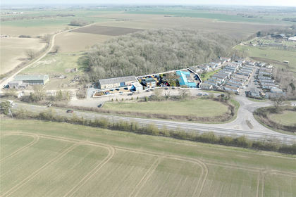
- Price
- Guide Price£815,000
- Size
- 0.83 acres
Land Off Warboys Road, Old Hurst, Huntingdon, PE28, Huntingdon, Cambridgeshire PE28 England
Added on 16/09/2026Commercial Land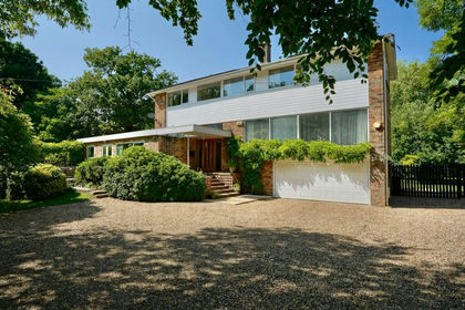
- Price
- Offers in Excess of£650,000
- Size
- 1 acres
Hollow Lane, Ramsey, PE26, Ramsey, Cambridgeshire PE26 England
Added on 29/01/2026House with Land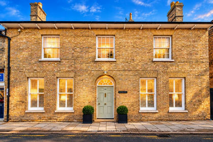
- Price
- Guide Price£775,000
- Size
- 0.33 acres
High Street, Ramsey, PE26, Ramsey, Cambridgeshire PE26 England
Added on 16/11/2026Residential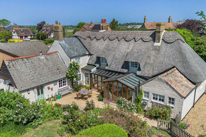
- Price
- £675,000
- Size
- 0.39 acres
Great Raveley, Huntingdon, Cambridgeshire., Upwood and the Raveleys, Cambridgeshire PE28 England
Added on 16/11/2026Cottage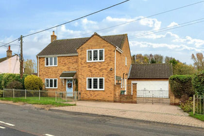
- Price
- Guide Price£765,000
- Size
- 4.6 acres
Somersham CAMBRIDGESHIRE, Somersham, Cambridgeshire PE28 England
Added on 08/10/2026Smallholding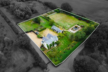
- Price
- Guide Price£675,000
- Size
- 1.5 acres
Added on 27/10/2026House with Land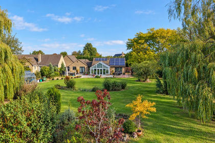
- Price
- Guide Price£750,000
- Size
- 1.5 acres
Added on 26/08/2026House with Land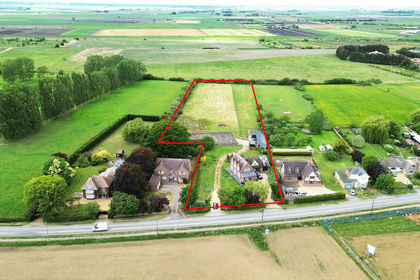
- Price
- Offers in Excess of£800,000
- Size
- 3.5 acres
London Road, Chatteris, Cambs., PE16, Chatteris, Cambridgeshire PE16 England
Added on 22/02/2026House with Land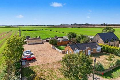
- Price
- £700,000
- Size
- 4.5 acres
Iretons Way, Chatteris, PE16, Manea, Cambridgeshire PE16 England
Added on 30/09/2026House with Land Added on 17/09/2026Development Land