
Ballyhaugh, Isle of Coll, PA78
- Land size
- 71.71 acres
Description
A rare opportunity to acquire a well-established, versatile property with scope for mixed-use, including commercial, residential, and holiday-let accommodation
Established in 1990, Ballyhaugh, also known as The Hebridean Centre, operates as both the administrative base and residential facility for Project Trust, an international charity dedicated to youth volunteering overseas.
Set within a striking south-facing location, Ballyhaugh enjoys expansive views across Loch Ballyhaugh towards Ben Hogh. The property began life as a traditional farmhouse, with a collection of outbuildings arranged in a distinctive horseshoe layout. Since the late 1980s, the buildings have been thoughtfully reconfigured and upgraded, transforming the original stone structures beneath slate roofs into a well-equipped and capacious residential centre.
The centre can accommodate up to 46 residents and balances its historic character with modern functionality. Environmental considerations are an integral feature of the property, which includes two 18-metre wind turbines (5kW each) to reduce reliance on grid electricity, alongside an electric vehicle charging point. Ballyhaugh is also supported by a private water supply and private septic system, and is largely double-glazed throughout.
Accommodation is primarily arranged on the ground floor and includes ten shared sleeping rooms, each equipped with two sets of bunk beds, along with three double bedrooms, two of which are located on the first floor. Facilities also include a commercial scale kitchen and dining area with an adjoining dry store, a large utility room, several meeting and activity rooms, and extensive storage throughout the building.
The centre offers generous communal and social spaces, including a comfortable living area, a traditional ceilidh hall, and a spacious residents’ lounge featuring a licensed bar and open fireplace. Additional practical amenities comprise a large boot room, five bath and shower rooms, and separate male and female toilet facilities. Enhancement works carried out in 2012 further modernised the property, creating a bright open plan office environment with breakout and meeting rooms, a dedicated staff kitchen, and a clearly defined main office entrance, supporting both residential use and day to day operations.
The building is set within generous garden grounds and enjoys a convenient position within easy walking distance of Hogh Bay, an ideal spot for refreshing sea swimming. Looking beyond the bay, the horizon stretches uninterrupted towards Barra.
The grounds extend to approximately 0.40 hectares (around 1 acre) of grassland and are enclosed by a stock fenced boundary, offering privacy along with expansive, open views. These outdoor areas provide excellent space for outdoor dining, gatherings, and social use. At the heart of the site lies a distinctive courtyard, linking to the original farmhouse that forms the focal point of the building.
A shed positioned on the north side of the property offers useful storage for gardening tools or outdoor equipment. In addition, there is substantial hardstanding within the grounds, allowing for parking of multiple vehicles.
Extending to approximately 71.71 acres, the land offers a productive landscape with wide areas of grazing suitable for livestock or ponies.
Around Totamore, the land includes enclosed inbye ground and gathering pens, all clearly defined by a combination of stock proof fencing and traditional stone dykes.
At its heart lies Ballyhaugh Loch, a scenic freshwater body extending to around 20 acres. The loch is framed by a rich mosaic of woodland and wetland, supporting a thriving natural environment. Reed beds, rushes, and water lilies flourish within the surrounding marshes, while the loch attracts a wide variety of birdlife. Ducks, geese, swans, and herons are regularly seen, and seasonal migrations bring additional species, making the area particularly appealing to wildlife enthusiasts.
Ballyhaugh (The Hebridean Centre) is situated around 20 minutes’ drive from the coastal village of Arinagour. The village hosts a wide range of facilities including a church, post office, doctor’s surgery, general store, hotel, café, fuel station, fire station and gift shop. There is also a well-established primary school, award-winning hotel and a vibrant community centre with a sports hall and theatre facilities.
The Isle of Coll enjoys a rugged beauty and an enviable wildlife population including corncrakes, geese, waders, seals and otters. There are frequent sightings of basking sharks, minke whales, dolphins and seals in the surrounding waters.
The island enjoys official ‘Dark Sky’ status with no light pollution to speak of and is renowned for its tranquillity. The Island is connected to the mainland via either a regular Caledonian MacBrayne vehicular ferry which takes approximately 160 minutes from Oban or by a regular scheduled air service from Oban which takes approximately 30 minutes.
Directions
The Isle of Coll is accessible via a regular ferry service from Oban, as well as a scheduled air service from Connel Airport. Upon disembarking the ferry, follow the B8070 through the village of Arinagour, then bear right and continue along the island road for approximately 2 miles. At the T-junction, turn left and proceed for a further 2.8 miles, where Ballyhaugh will be found on the right-hand side. Parking is available at the property.
Specifications for the property include mains electric, electric storage heating, open fires, private drainage, BT broadband.
Fixtures and Fittings to be included in this sale by express agreement
Map Location
Property details
- Tenure
- Freehold
- Council Tax Band
- Ask Agent
- Date Posted
- 2026-11-09
Market Value Analysis
Compared with 9 Homes with Land listings in Scotland (50+ acres).
Energy Performance Certificate
Energy Efficiency Rating
Based on UK Energy Performance Certificate standards (EU Directive 2002/91/EC)
Running costs are one side. Planning activity, flood history and ground risks for this location are in the full report.
Utilities & Restrictions
Utilities
- Electricity
- Ask Agent
- Water
- Ask Agent
- Heating
- Ask Agent
- Broadband
- Ask Agent
- Sewerage
- Ask Agent
Rights & Restrictions
- Public Rights of Way
- Ask Agent
- Private Rights of Way
- Ask Agent
- Listed Property
- Ask Agent
- Restrictions
- Ask Agent
Listed status, conservation areas and planning constraints for this location are in the full report.
Property Features
- Accessibility
- Ask Agent
- Parking
- Ask Agent
- Garden
- Ask Agent
Beyond the particulars: planning activity, flood history, heritage and ground risks, checked for this exact spot.
Connectivity
Broadband
Fastest speed available at this postcode
66 Mbps
Superfast · available to 2% of premises
Suitable for
- HD streaming
- Video calls
- Web & social
Mobile signal
Predicted 4G and 5G signal; indoor signal depends on building materials.
Ofcom Connected Nations postcode-level predictions. Speeds and signal are modelled, not measured, and vary between addresses and providers.
Signal is the easy part. Planning activity, flood history and protected designations here are in the full report.
Nearest Schools
Primary
- Arinagour Primary School3.1 miles
- Pupils
- 4
- Type
- Non-denominational
- Tiree High School14 miles
- Pupils
- 17
- Type
- Non-denominational
- Tiree Primary Gaelic Unit14 miles
- Pupils
- 36
- Type
- Non-denominational
- Dervaig Primary School16 miles
- Pupils
- 15
- Type
- Non-denominational
- Kilchoan Primary School20 miles
- Pupils
- 13
- Type
- Non-denominational
Secondary
- Tiree High School14 miles
- Pupils
- 37
- Type
- Non-denominational
- Tobermory High School21 miles
- Pupils
- 151
- Type
- Non-denominational
- Mallaig High School39 miles
- Pupils
- 101
- Type
- Non-denominational
- Ardnamurchan High School40 miles
- Pupils
- 126
- Type
- Non-denominational
- Castlebay School41 miles
- Pupils
- 92
- Type
- Non-denominational
Distances are straight-line from the advertised location. Source: the national school registers (DfE, Welsh Government, Scottish Government) and Ofsted.
Schools are just the start: planning activity, heritage and any flood history here are in the full report.
Amenities
Supermarket
GP surgery
Pharmacy
Walking trail
Straight-line distances from the advertised location. Sources: NHS records, Geolytix supermarket locations, OS Open Greenspace and the national trails registers.
The area stacks up? Now check the location itself: planning nearby, protected designations and past flooding.
Getting Around
Nearest station
Nearest bus stop
Typical drive times
Straight-line distances from the advertised location; drive times are typical free-flow times over OpenStreetMap road data, so allow more at peak. Public transport locations from DfT NaPTAN.
Easy to reach matters. So do planning activity, flood history and ground risks: all in the full report.
Flood Risk
SEPA open data, checked around the advertised map pin for the listed acreage. The map pin for this listing is approximate, so these readings describe the surrounding area. Provided by LandSale, not the listing agent, and not part of the agent's particulars. Risk varies across a holding, so verify before committing.
Rivers and the sea
Not at the pin: mapped about 90 metres away.
Surface water
Not at the pin: mapped about 50 metres away.
These bandings are the summary. Where this location sits on the flood maps, plus planning activity, heritage and ground risks, is in the full report.
Important notice: Information, maps and tags on this page are drawn from the advertising agent's marketing materials or generated automatically. LandSale has not verified them. Relying on these details is at your own risk, always carry out independent checks before committing to a purchase.
LandSale full disclaimer
Marketing information only - not formal particulars. The details on this website are provided for general guidance and do not constitute an offer or contract. Neither LandSale nor the advertising estate/land agent accepts responsibility for any inaccuracy.
1. Source of information
- Listing content: Core description, asking price, tenure, measurements, photographs and planning history originate from the marketing materials of the advertising estate or land agent. LandSale does not author this content and cannot guarantee its accuracy.
- Automated tags & categorisation: Property type, land-use class, acreage bands and similar labels may be applied by machine-learning models. They are intended as a helpful guide only and may not reflect the property's legal status or permitted use.
- Third-party & enriched data layers: Maps, boundary outlines, planning designations, soil reports, broadband coverage and other environmental or location-based insights are licensed from external suppliers. Such data are supplied “as is", may be incomplete or out of date and are subject to change without notice.
2. Verification required
Prospective purchasers must verify critical matters, including but not limited to planning permission, title boundaries, public rights of way, environmental constraints, acreage, services, access and VAT status, through their own inspections, specialist surveys, legal advisers and the selling agent before relying on the information or entering into any contract.
3. No warranty or liability
LandSale gives no warranty, express or implied, as to the accuracy, completeness or fitness for any particular purpose of the information displayed. LandSale shall not be liable for any loss, damage, cost or expense arising directly or indirectly from any use of or reliance on such information, save where liability may not be excluded by law.
4. Updates & feedback
If you believe any detail on this listing is inaccurate, please let us know. We will investigate and, where appropriate, update the listing or notify the agent.
© LandSale | Version 1.3 - August 2026
Similar properties for sale
- Price
- Offers Over£695,000
- Size
- 5.98 acres
Added on 29/01/2026House with Land
- Price
- Offers Over£895,000
- Size
- 1.25 acres
Druimard House, Dervaig, Isle of Mull, PA75, Isle of Mull, Argyll and Bute PA75 Scotland
Added on 29/01/2026Country Home
- Price
- £895,000
- Size
- 1.5 acres
Added on 29/01/2026Holiday Let Property
- Price
- Offers Over£445,000
- Size
- 1 acres
Added on 27/05/2026House with Land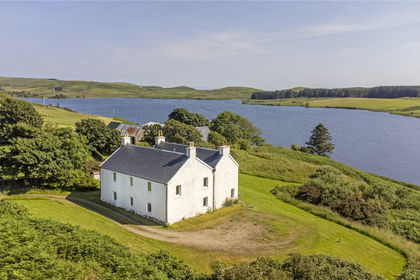
- Price
- Offers Over£440,000
- Size
- 3.24 acres
Bunessan, Isle of Mull, PA67, Isle of Mull, Argyll and Bute PA67 Scotland
Added on 05/08/2026Country Home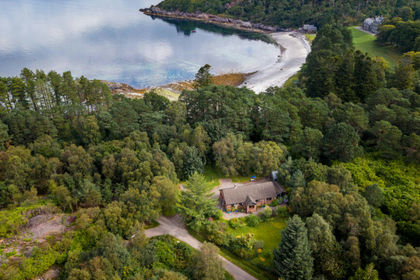
- Price
- Offers in Excess of£500,000
- Size
- 6.5 acres
Kemble, Roshven, Argyll, Bute and South Lochaber, Highland PH38 Scotland
Added on 09/09/2026House with Land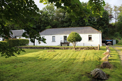
- Price
- Offers Over£500,000
The Old Byre, Knoydart, Inverness, Skye and West Ross-shire, Highland PH41 Scotland
Added on 14/08/2026Barn Conversion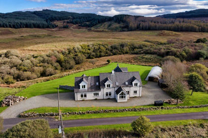
- Price
- Guide Price£625,000
- Size
- 4 acres
Added on 06/11/2026House with Land
- Price
- Offers Over£415,000
- Size
- 2 acres
Added on 22/06/2026Residential
- Price
- Offers Over£575,000
- Size
- 10 acres
Dalmally, Argyll and Bute, Argyll, Bute and South Lochaber, Argyll and Bute PA33 Scotland
Added on 18/06/2026Country Home