Kemble, Roshven
- Land size
- 6.5 acres
- Bedrooms
- 3
- Bathrooms
- 2
Description
Kemble is an attractive detached property situated in the peaceful village of Roshven surrounded by generous garden grounds and within easy reach of the beach. Built in 1967 the property extents approximately 116 sq m. The associated land is 6.5 acres ( 2.64 hectares) The accommodation includes a spacious lounge, a modern fitted kitchen installed in 2023, three bedrooms, a family bathroom and a separate modern shower room. Further improvements include a new fuse box installed in 2022 and a garage constructed in 2019. Outside the property benefits from a long private driveway, ample garden grounds and a cabin equipped with lighting and electrical sockets. The land associated with the property is otherwise wild established woodland and permits direct access to Roshven beach. Services: Water is from a shared private water supply. There is a septic tank. Cooking facilities, and heating is provided by an oil-fired Rayburn. Electricity is from the National Grid. Fibreoptic broadband cable has recently been laid adjoining the property The Rayburn and white goods are included in the sale price while other items of furniture may be available by separate negation
DIRECTIONS
From Fort William head briefly north and then west on the A830 towards Mallaig for 25 miles, passing through Corpach and Glenfinnan. Continue until Lochailort.
Immediately after the Lochailort Inn onto the A861. Continue for around four miles you reach Roshven, then follow the road for a further five miles until you se signs for West Field.
Turn right at the West Field sign and cross the small wooden bridge. Immediately after the bridge, take the left fork and follow the signs for Baldory. Continue uphill Kemble will be on your right at the end of a long driveway.
LOCATION/AMENITIES
Roshven is a small and picturesque coastal hamlet located in the Scottish Highlands, set along the shores of Loch Ailort in one of the most sought-after areas of Lochaber.
The location is renowned for its natural beauty, with panoramic views across the sea to the Small Isles and easy access to beaches, woodland, and hillside walks. Residents can enjoy a wide range of outdoor pursuits including hillwalking, kayaking, fishing, and wildlife watching, with frequent sightings of deer, seals, dolphins and even golden eagles.
Despite its peaceful and rural setting, Roshven remains well-connected. The village of Glenuig is nearby. The junction at Lochailort provides access to the popular “Road to the Isles,” linking you to Fort William in around 40 minutes, as well as ferry routes to the Isle of Skye and the Small Isles.
Local amenities are intentionally minimal, preserving the area's charm and sense of escape, while everyday conveniences, shops, cafés, and services can be found within a short drive. The wider region offers a wealth of attractions including beaches, golf courses, historic sites, and outdoor adventure activities, making it ideal for both full-time living and holiday retreats.
Map Location
Property details
- Tenure
- Freehold
- Council Tax Band
- Ask Agent
- Date Posted
- 2026-09-09
Market Value Analysis
Compared with 135 Homes with Land listings in Scotland (5+ acres).
Utilities & Restrictions
Utilities
- Electricity
- Ask Agent
- Water
- Ask Agent
- Heating
- Ask Agent
- Broadband
- Ask Agent
- Sewerage
- Ask Agent
Rights & Restrictions
- Public Rights of Way
- Ask Agent
- Private Rights of Way
- Ask Agent
- Listed Property
- Ask Agent
- Restrictions
- Ask Agent
Listed status, conservation areas and planning constraints for this location are in the full report.
Property Features
- Accessibility
- Ask Agent
- Parking
- Driveway
- Garden
- Front Garden
Beyond the particulars: planning activity, flood history, heritage and ground risks, checked for this exact spot.
Connectivity
Broadband
Fastest speed available at this postcode
2 Mbps
Under 10 Mbps here
Suitable for
- Basic browsing & email
Mobile signal
Outdoor predictions; indoor signal depends on building materials.
Ofcom Connected Nations postcode-level predictions. Speeds and signal are modelled, not measured, and vary between addresses and providers.
Signal is the easy part. Planning activity, flood history and protected designations here are in the full report.
Nearest Schools
Primary
- Arisaig Primary School6 miles
- Pupils
- 29
- Type
- Non-denominational
- Acharacle Primary School6.7 miles
- Pupils
- 48
- Type
- Non-denominational
- Lady Lovat Primary School9.3 miles
- Pupils
- 11
- Type
- Non-denominational
- Mallaig Primary School11 miles
- Pupils
- 70
- Type
- Non-denominational
- Strontian Primary School12 miles
- Pupils
- 23
- Type
- Non-denominational
Secondary
- Mallaig High School11 miles
- Pupils
- 101
- Type
- Non-denominational
- Ardnamurchan High School12 miles
- Pupils
- 126
- Type
- Non-denominational
- Tobermory High School19 miles
- Pupils
- 151
- Type
- Non-denominational
- Lochaber High School26 miles
- Pupils
- 839
- Type
- Non-denominational
- Kinlochleven High School32 miles
- Pupils
- 135
- Type
- Non-denominational
Distances are straight-line from the advertised location. Source: the national school registers (DfE, Welsh Government, Scottish Government) and Ofsted.
Schools are just the start: planning activity, heritage and any flood history here are in the full report.
Amenities
Supermarket
GP surgery
Pharmacy
Straight-line distances from the advertised location. Sources: NHS records, Geolytix supermarket locations, OS Open Greenspace and the national trails registers.
The area stacks up? Now check the location itself: planning nearby, protected designations and past flooding.
Getting Around
Nearest station
Nearest bus stop
Typical drive times
Straight-line distances from the advertised location; drive times are typical free-flow times over OpenStreetMap road data, so allow more at peak. Public transport locations from DfT NaPTAN.
Easy to reach matters. So do planning activity, flood history and ground risks: all in the full report.
Flood Risk
From SEPA flood map open data, checked around the advertised map pin and allowing for the listed acreage where known. This summary comes from LandSale, the advertising platform, not from the listing agent, and is not part of the agent's particulars. Risk can vary across a single holding, so verify anything critical through your own searches before committing.
Rivers and the sea
Surface water
Mapped within the area searched, not at the advertised map pin itself.
These bandings are the summary. Where this location sits on the flood maps, plus planning activity, heritage and ground risks, is in the full report.
Important notice: Information, maps and tags on this page are drawn from the advertising agent's marketing materials or generated automatically. LandSale has not verified them. Relying on these details is at your own risk, always carry out independent checks before committing to a purchase.
LandSale full disclaimer
Marketing information only - not formal particulars. The details on this website are provided for general guidance and do not constitute an offer or contract. Neither LandSale nor the advertising estate/land agent accepts responsibility for any inaccuracy.
1. Source of information
- Listing content: Core description, asking price, tenure, measurements, photographs and planning history originate from the marketing materials of the advertising estate or land agent. LandSale does not author this content and cannot guarantee its accuracy.
- Automated tags & categorisation: Property type, land-use class, acreage bands and similar labels may be applied by machine-learning models. They are intended as a helpful guide only and may not reflect the property's legal status or permitted use.
- Third-party & enriched data layers: Maps, boundary outlines, planning designations, soil reports, broadband coverage and other environmental or location-based insights are licensed from external suppliers. Such data are supplied “as is", may be incomplete or out of date and are subject to change without notice.
2. Verification required
Prospective purchasers must verify critical matters, including but not limited to planning permission, title boundaries, public rights of way, environmental constraints, acreage, services, access and VAT status, through their own inspections, specialist surveys, legal advisers and the selling agent before relying on the information or entering into any contract.
3. No warranty or liability
LandSale gives no warranty, express or implied, as to the accuracy, completeness or fitness for any particular purpose of the information displayed. LandSale shall not be liable for any loss, damage, cost or expense arising directly or indirectly from any use of or reliance on such information, save where liability may not be excluded by law.
4. Updates & feedback
If you believe any detail on this listing is inaccurate, please let us know. We will investigate and, where appropriate, update the listing or notify the agent.
© LandSale | Version 1.3 - August 2026
Listing agent
McIntyre & Co, Fort William
38 High Street, Fort William, PH33 6AT
Similar properties for sale
- Price
- Guide Price£320,000
- Size
- 2.3 acres
Added on 27/06/2026House with Land
- Price
- Offers Over£320,000
- Size
- 4.22 acres
Added on 29/01/2026Cottage
- Price
- Guide Price£335,000
- Size
- 7.4 acres
Added on 03/07/2026Smallholding
- Price
- Offers Over£445,000
- Size
- 1 acres
Added on 27/05/2026House with Land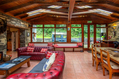
- Price
- Offers Over£500,000
The Old Byre, Knoydart, Inverness, Skye and West Ross-shire, Highland PH41 Scotland
Added on 14/08/2026Barn Conversion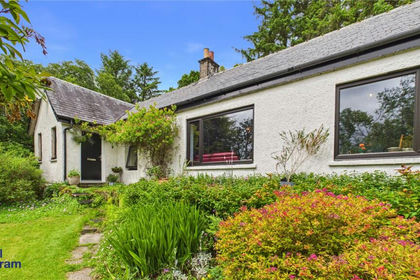
- Price
- Guide Price£365,000
- Size
- 1.34 acres
Added on 15/07/2026Cottage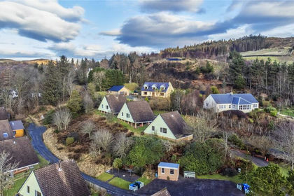
- Price
- Guide Price£365,000
- Size
- 1.5 acres
Added on 29/01/2026Holiday Let Property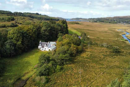
- Price
- Offers Over£695,000
- Size
- 5.98 acres
Added on 29/01/2026House with Land
- Price
- Offers Over£600,000
- Size
- 2 acres
Added on 24/06/2026House with Land
- Price
- Guide Price£420,000
- Size
- 1.3 acres
Lismore House, Invergarry, PH35, Inverness, Skye and West Ross-shire, Highland PH35 Scotland
Added on 29/01/2026House with Land