Hatham Green Lane, Stansted, Sevenoaks, Kent
- Land size
- 12.2 acres
- Bedrooms
- 6
- Bathrooms
- 6
Key Features
- Handsome detached farmhouse
- Six bedrooms, six bathrooms
- Over 3,000 sq ft of accommodation
- Additional apartment above a barn
- Equestrian facilities
- Gardens & off street parking for numerous vehicles
- Rural setting with views over adjoining farmland
- Good location with excellent road links
Description
Parsonage Farm is a substantial six bedroom farmhouse occupying 12 acres of land in the picturesque village of Stansted. Originating in the 17th Century the farm has been added to over the years and now features over 3,000 sq ft of living space.
PROPERTY
Steeped in history and set within 12 acres plus of equestrian facilities and beautiful Kent countryside, Parsonage Farm is an exceptional country estate offering an increasingly rare combination of period character, multi-generational living, and premier equestrian facilities.
At the heart of the property is a distinguished six-bedroom, six-bathroom detached residence. With origins dating back to the 1700s, the home has been thoughtfully extended over the centuries to seamlessly blend historic architectural integrity with the demands of modern family life. Spanning more than 3,000 square feet, the main dwelling features a collection of versatile, light-filled reception rooms. The intuitive layout provides the perfect balance for remote working, grand-scale entertaining, or harmonious multi-generational living.
As well as a good range of reception rooms each bedroom benefits from its own bathroom. As you rise up through the house the countryside views become more and more breath taking.
The accommodation includes: entrance hall, cloakroom, drawing room, sitting room, dining/family room, kitchen/breakfast room, utility room, cellar, master bedroom with en-suite bathroom, dressing room study, five further bedrooms with en-suites. The rooms are spacious and feature good sized windows letting the light flood in, there are a number of reception rooms which offer a nice combination of big open plan spaces and smaller cosy rooms depending on family needs.
The property also benefits from double glazed windows with the vast majority being replaced in 2024/2025, oil-fired central heating, the current owners have replaced the roof in Oct 2022.
GARDEN
The property is approached from driveway access on either side of the main house, with a gated driveway providing ample off street parking for several vehicles. The formal garden surrounding the house includes a large courtyard, duck pond and areas of lawn and leads directly onto the stabling, barns and land with fenced boundaries.
SECONDARY ACCOMMODATION
Beyond the main residence, the estate offers remarkable adaptability and significant income streams:
The Barn Apartment : A versatile one-to-two-bedroom first-floor flat situated above the primary barn. Ideal as a staff apartment, guest annex, or rental property.
The Coach House (Available by Separate Negotiation): A self-contained two-bedroom first-floor flat positioned over garaging and a carport with its own area of garden.
EQUESTRIAN FACILITIES AND GROUNDS
The estate extends across approximately 12.2 acres of beautifully maintained land, thoughtfully divided into five distinct paddocks. The boundaries are gated and fenced and every field benefits from large, self-feeding water troughs. For equestrian enthusiasts, the infrastructure is outstanding:
Stable Barn: A substantial agricultural building configured with eight stables, alongside extensive storage and ancillary space and dog shower, kitchenette, toilet/sink.
Secondary Barn: A highly versatile space featuring its own private office. Positioned adjacent to the existing manège, it offers the scale to be adapted into a private indoor school
utilized for machinery storage, or explored for potential residential conversion (subject to the necessary consents). There is plenty of hard standing for parking horse boxes and a second secure gate to access the property next to that barn.
Outriding: Direct access to the local bridleway network is located immediately opposite the estate gates.
SURROUNDING AREA
Nestled in the highly coveted and scenic village of Stansted, Kent the property enjoys sweeping, uninterrupted rural views to both the front and rear. While deeply peaceful, the village benefits from a vibrant community focused around the historic church, a renowned local school for special educational needs, and the popular Black Horse public house.
The location strikes a perfect balance between rural seclusion and exceptional connectivity to motorways. Families are well-served by the excellent surrounding education options, falling within the catchment area for both the Dartford and Maidstone Grammar Schools. Daily amenities are easily accessible in nearby Wrotham, Borough Green, and West Kingsdown.
For the commuter, transport links are world-class:
Ebbsfleet International: Offers high-speed rail links to London St Pancras in approximately 20 minutes.
Sevenoaks Station: Provides direct mainline services to Charing Cross and Cannon Street in 30-35 minutes.
Swanley Station: Located eight miles away, offering a 25-minute service into London Victoria.
Road & Air: Immediate access to the A20, M20, and M26 connects swiftly to the M25, placing Gatwick, Heathrow, City, and Stansted airports-as well as the Channel Tunnel-within easy driving distance.
Parsonage Farm is a rare opportunity to acquire a versatile country estate that adapts effortlessly to grand family living, equestrian pursuits, and long-term investment.
TENURE
Freehold.
SERVICES
Mains electricity, oil-fired central heating and private drainage.
LOCAL AUTHORITY
Tonbridge & Malling - Council Tax Band G.
ENERGY PERFORMANCE CERTIFICATE
Energy Rating D.
Map Location
Property details
- Tenure
- Freehold
- Council Tax Band
- G
- Date Posted
- 2026-11-06
Market Value Analysis
Compared with 165 Homes with Land listings in South East England (10+ acres).
Energy Performance Certificate
Energy Efficiency Rating
Based on UK Energy Performance Certificate standards (EU Directive 2002/91/EC)
Running costs are one side. Planning activity, flood history and ground risks for this location are in the full report.
Utilities & Restrictions
Utilities
- Electricity
- Mains
- Water
- Mains
- Heating
- Oil Heating
- Broadband
- Ask Agent
- Sewerage
- Septic Tank / Private
Rights & Restrictions
- Public Rights of Way
- Ask Agent
- Private Rights of Way
- Ask Agent
- Listed Property
- Ask Agent
- Restrictions
- Ask Agent
Listed status, conservation areas and planning constraints for this location are in the full report.
Property Features
- Accessibility
- No Wheelchair Access
- Parking
- Garage, Driveway, Off-Street Parking, Gated Parking
- Garden
- Garden
Beyond the particulars: planning activity, flood history, heritage and ground risks, checked for this exact spot.
Connectivity
Broadband
Fastest speed available at this postcode
15 Mbps
Standard (10-30 Mbps)
Suitable for
- Web & social
- Music streaming
- Standard video calls
Mobile signal
Predicted 4G and 5G signal; indoor signal depends on building materials.
Ofcom Connected Nations postcode-level predictions. Speeds and signal are modelled, not measured, and vary between addresses and providers.
Signal is the easy part. Planning activity, flood history and protected designations here are in the full report.
Nearest Schools
Primary
- St. Edmund's Church of England Primary School1.3 milesNo Ofsted rating
- Ages
- 4 to 11
- Pupils
- 197
- Type
- Voluntary controlled school
- Faith
- Church of England
- St George's Church of England Voluntary Controlled Primary School1.7 milesOfsted: Good
- Ages
- 4 to 11
- Pupils
- 195
- Type
- Voluntary controlled school
- Faith
- Church of England
- New Ash Green Primary School2.3 milesNo Ofsted rating
- Ages
- 4 to 11
- Pupils
- 400
- Type
- Community school
- Culverstone Green Primary School2.3 milesOfsted: Requires improvement *
- Ages
- 4 to 11
- Pupils
- 207
- Type
- Academy converter
- Vigo Village School2.8 milesOfsted: Good *
- Ages
- 4 to 11
- Pupils
- 134
- Type
- Community school
Secondary
- Wrotham School2.5 milesNo Ofsted rating
- Ages
- 11 to 18
- Pupils
- 1,054
- Type
- Academy converter
- Meopham School3.5 milesOfsted: Good
- Ages
- 11 to 18
- Pupils
- 905
- Type
- Academy sponsor led
- Leigh Academy Longfield4.2 milesOfsted: Good
- Ages
- 11 to 18
- Pupils
- 992
- Type
- Academy sponsor led
- Trinity School5 milesNo Ofsted rating
- Ages
- 11 to 19
- Pupils
- 1,153
- Type
- Free schools
- Faith
- Christian
- Knole Academy5.9 milesNo Ofsted rating
- Ages
- 11 to 19
- Pupils
- 1,410
- Type
- Academy sponsor led
* Latest graded judgement covers quality of education only; no overall grade was issued under the 2024-25 inspection framework.
Distances are straight-line from the advertised location. Source: the national school registers (DfE, Welsh Government, Scottish Government) and Ofsted.
Schools are just the start: sold prices nearby, planning activity and any flood history are in the full report.
Amenities
Supermarket
GP surgery
Pharmacy
Hospital
Green space
Straight-line distances from the advertised location. Sources: NHS records, Geolytix supermarket locations, OS Open Greenspace and the national trails registers.
The area stacks up? Now check the location itself: planning nearby, protected designations and past flooding.
Getting Around
Nearest station
Nearest bus stop
Typical drive times
Straight-line distances from the advertised location; drive times are typical free-flow times over OpenStreetMap road data, so allow more at peak. Public transport locations from DfT NaPTAN.
Easy to reach matters. So do planning activity, flood history and ground risks: all in the full report.
Flood Risk
Environment Agency open data, checked around the advertised map pin for the listed acreage. Long-term risk counts flood defences; the planning map's flood zones do not. Provided by LandSale, not the listing agent, and not part of the agent's particulars. Risk varies across a holding, so verify before committing.
Rivers and the sea
Planning map: Flood Zone 1.
Surface water
Not at the pin: mapped about 20 metres away.
These bandings are the summary. Where this location sits on the flood maps, plus planning activity, heritage and ground risks, is in the full report.
Important notice: Information, maps and tags on this page are drawn from the advertising agent's marketing materials or generated automatically. LandSale has not verified them. Relying on these details is at your own risk, always carry out independent checks before committing to a purchase.
LandSale full disclaimer
Marketing information only - not formal particulars. The details on this website are provided for general guidance and do not constitute an offer or contract. Neither LandSale nor the advertising estate/land agent accepts responsibility for any inaccuracy.
1. Source of information
- Listing content: Core description, asking price, tenure, measurements, photographs and planning history originate from the marketing materials of the advertising estate or land agent. LandSale does not author this content and cannot guarantee its accuracy.
- Automated tags & categorisation: Property type, land-use class, acreage bands and similar labels may be applied by machine-learning models. They are intended as a helpful guide only and may not reflect the property's legal status or permitted use.
- Third-party & enriched data layers: Maps, boundary outlines, planning designations, soil reports, broadband coverage and other environmental or location-based insights are licensed from external suppliers. Such data are supplied “as is", may be incomplete or out of date and are subject to change without notice.
2. Verification required
Prospective purchasers must verify critical matters, including but not limited to planning permission, title boundaries, public rights of way, environmental constraints, acreage, services, access and VAT status, through their own inspections, specialist surveys, legal advisers and the selling agent before relying on the information or entering into any contract.
3. No warranty or liability
LandSale gives no warranty, express or implied, as to the accuracy, completeness or fitness for any particular purpose of the information displayed. LandSale shall not be liable for any loss, damage, cost or expense arising directly or indirectly from any use of or reliance on such information, save where liability may not be excluded by law.
4. Updates & feedback
If you believe any detail on this listing is inaccurate, please let us know. We will investigate and, where appropriate, update the listing or notify the agent.
© LandSale | Version 1.3 - August 2026
Similar properties for sale
- Price
- Guide Price£1,950,000
- Size
- 6.76 acres
Barngate Farm, St. Clere Hill Road, TN15, West Kingsdown, Kent TN15 England
Added on 29/01/2026House with Land
- Price
- Guide Price£1,850,000
- Size
- 10.83 acres
Added on 20/05/2026House with Land
- Price
- Guide Price£2,000,000
- Size
- 19.69 acres
Horns Oak Road, Meopham, Gravesend, Kent, DA13, Meopham, Kent DA13 England
Added on 24/09/2026House with Land
- Price
- Offers in Region of£1,700,000
- Size
- 14.6 acres
Added on 07/10/2026Equestrian property
- Price
- Guide Price£1,800,000
- Size
- 7.5 acres
Added on 29/01/2026House with Land
- Price
- Guide Price£1,400,000
- Size
- 7.92 acres
Added on 10/07/2026House with Land
- Price
- Guide Price£1,500,000
- Size
- 7.3 acres
Added on 27/05/2026Fishery
- Price
- Guide Price£1,690,000
- Size
- 23.37 acres
Added on 18/09/2026House with Land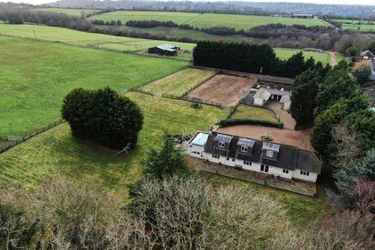
- Price
- £1,950,000
- Size
- 14 acres
Added on 16/09/2026Equestrian property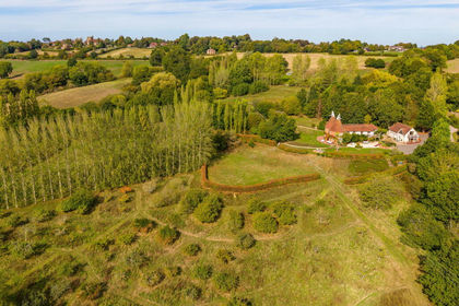
- Price
- £1,950,000
- Size
- 8 acres
Triggs Oast, Cranbrook Road, Goudhurst, Cranbrook, Kent. TN17, Goudhurst, Kent TN17 England
Added on 07/10/2026House with Land