Bickleigh, Tiverton, EX16
- Land size
- 5.76 acres
- Bedrooms
- 7
- Bathrooms
- 4
Key Features
- Four-Bedroom Grade II Listed Farmhouse with Separate Two-Bedroom Barn
- One-Bedroom Annexe Forming Part of the Farmhouse
- Approximately 5.76 Acres of Gardens, Pasture & Woodland
- Wonderful Private Position Above the Exe Valley
- Far-Reaching Views Across Rolling Mid Devon Countryside
- Separate Residential Accommodation, Sold Together on One Title
- Stream, Wildlife Pond & Natural Woodland
- Characterful Converted Barn in Good Internal Order
- Stables, Traditional Outbuildings & Double Carport
- An Exciting Opportunity to Modernise a Period Country Home
Description
It's the setting that makes Henbere so special. Hidden away at the end of a private driveway, surrounded by rolling farmland and enjoying wonderful views across the Exe Valley countryside, this is somewhere that feels a world away from everyday life. Yet the pretty village of Bickleigh is only around a mile and a half away, with Tiverton, Exeter and the M5 all within easy reach. The property extends to approximately 5.76 acres, with open pasture, gardens, natural woodland, a stream and pond, creating a lovely environment for wildlife and plenty of space to enjoy the outdoors. Whether it's watching the changing seasons, keeping a few animals, gardening or simply enjoying the peace and quiet, the land and surroundings are a huge part of what makes this such an appealing place to live.
The accommodation is particularly interesting because Henbere comprises two adjoining residential buildings, being sold together as one property. The main farmhouse is a substantial Grade II listed home dating back to the late 16th century, full of traditional features including exposed beams, fireplaces and an impressive inglenook in the dining room. There are three principal reception rooms, a kitchen/breakfast room, useful ancillary accommodation and four bedrooms, including two with their own bath or shower facilities. There's also an adjoining one-bedroom annexe with its own living room, shower room and galleried bedroom, providing flexibility for extended family or guests. The farmhouse hasn't been occupied for several years and now requires modernisation, so buyers should come expecting a project rather than a finished home. However, the generous proportions, character and beautiful surroundings provide plenty to work with.
Adjoining the farmhouse across the courtyard is Henbere Barn, a substantial converted thatched barn providing a separate two-bedroom home. Unlike the farmhouse, the barn is in very good order internally, with a particularly lovely sitting room featuring a large stone inglenook fireplace and wood-burning stove, a separate dining room, kitchen/breakfast room and bathroom. The thatched roof does require attention, which buyers should factor into their plans. Outside, the driveway opens into a spacious courtyard with plenty of parking, a double carport, garden store and a range of traditional outbuildings, including stables and a barn with hayloft. The gardens include lawns and paved terraces, one of which enjoys especially lovely views across the countryside, while the adjoining pasture slopes gently towards the woodland, stream and pond. Henbere is certainly a property that needs investment, but for someone looking for a private country home with land, character and genuinely flexible accommodation, it offers an unusual opportunity in a beautiful part of Devon.
Please see the floorplan for room sizes.
Current Council Tax: Band G and D - Mid Devon
Utilities: Mains electric, water, telephone & broadband
Broadband within this postcode: Ultrafast available
Drainage: Private drainage (septic tank)
Heating: Oil and wood-burners (Please note the boiler in the farmhouse is not working but the one in the Barn is)
Construction: Cob/stone/brick
Listed: Yes Grade II
Conservation Area: No
Tenure: Freehold
Buyers' Compliance Fee Notice: Please note that a compliance check fee of £25 (inc. VAT) per person is payable once your offer is accepted. This non-refundable fee covers essential ID verification and anti-money laundering checks, as required by law.
Agents’ Notes:
Boundaries, Access & Parking:
Boundary positions, access rights and parking arrangements have been provided by the seller, and any land plans shown are for identification purposes only. We have not seen the title deeds or other legal documents, and buyers should confirm exact details and ownership responsibilities with their conveyancer. Henbere House and Henbere Barn are being sold together under a single freehold title. They are understood to comprise two residential dwellings, with the one-bedroom annexe forming part of the farmhouse. The precise planning status and any restrictions on independent occupation remain subject to confirmation.
Broadband & Mobile Coverage:
Broadband speeds and mobile signal vary by provider and location, and service availability can change over time. Buyers can check current availability and predicted speeds at or via the Ofcom coverage checker.
Digital Photo Enhancement/Virtual Staging:
Some images in this brochure may have been digitally enhanced or virtually staged, for example by adding lighting effects, blue skies, twilight ambience, furniture or décor, to help illustrate how the property could look. These images are only illustrative and do not show the current fixtures, fittings or condition. Always rely on your viewing for an accurate understanding of the property.
Private Drainage:
We’re informed by the seller that the property has a private drainage system, which they advise is in working order. Buyers should satisfy themselves regarding its type, condition and regulatory compliance with their conveyancer.
Condition:
The farmhouse has been unoccupied for several years and requires modernisation. The converted barn is in good internal order, although its thatched roof requires attention. Buyers should make their own enquiries and obtain appropriate professional advice regarding the condition of the buildings, particularly the thatch, and any proposed alterations to the listed structures. There is likely to be asbestos content on the outbuilding roofs, typical of the age but buyers should be aware.
Heating Type (Non-Mains):
We’re informed by the seller that the property is heated via oil. Buyers should confirm servicing arrangements and running costs.
Rights of Way:
We’re informed by the seller that the property benefits from a right of way over the driveway and a change to the south-eastern boundary is in the process of being formalised with the solicitors however this will not affect the purchase or enjoyment. Buyers are advised to confirm details and legal status with their conveyancer.
Thatch / Cob Construction:
We’re informed by the seller that the property includes cob walls and/or a thatched roof. Such construction may have specific maintenance and insurance requirements, and buyers should make their own enquiries before purchase.
Chain Status / Vacant Property:
We’re informed by the seller that the property is intended to be sold with vacant possession. This information was correct at the time of listing but may change prior to sale.
Executor’s / Probate Sale:
The property is being sold on behalf of an estate following a bereavement. The seller has limited knowledge of the property’s history or condition, and buyers should satisfy themselves on all aspects prior to purchase with their conveyancer.
Bickleigh is a particularly picturesque Devon village, nestled in the beautiful Exe Valley and surrounded by rolling countryside, approximately four miles south of Tiverton and ten miles north of Exeter. Known for its charming thatched cottages, historic stone bridge over the River Exe and popular Fisherman's Cot pub, the village enjoys a wonderful rural setting whilst remaining conveniently placed for everyday life. There is a well-regarded village primary school, church and active local community, while the nearby market town of Tiverton offers an excellent range of shops, supermarkets, cafés, leisure facilities and schooling, including the prestigious independent Blundell's School and Preparatory School. The A396 provides a direct route to both Tiverton and Exeter, with Junction 27 of the M5 and Tiverton Parkway railway station also within easy reach, offering mainline services to London Paddington and beyond. It's a lovely location for those seeking a quieter village lifestyle without sacrificing accessibility or convenience.
DIRECTIONS
Use EX16 8RA or the what3words is ///drift.loose.flask
EPC Rating: E
Map Location
Property details
- Tenure
- Freehold
- Council Tax Band
- G
- Date Posted
- 2026-11-06
Market Value Analysis
Compared with 414 Homes with Land listings in South West England (5+ acres).
Energy Performance Certificate
Energy Efficiency Rating
Based on UK Energy Performance Certificate standards (EU Directive 2002/91/EC)
Running costs are one side. Planning activity, flood history and ground risks for this location are in the full report.
Utilities & Restrictions
Utilities
- Electricity
- Mains
- Water
- Mains
- Heating
- Oil Heating
- Broadband
- Ask Agent
- Sewerage
- Septic Tank / Private
Rights & Restrictions
- Public Rights of Way
- Ask Agent
- Private Rights of Way
- Ask Agent
- Listed Property
- Yes
- Restrictions
- Ask Agent
Listed status, conservation areas and planning constraints for this location are in the full report.
Property Features
- Accessibility
- Ask Agent
- Parking
- Parking Available
- Garden
- Private Garden
Beyond the particulars: planning activity, flood history, heritage and ground risks, checked for this exact spot.
Connectivity
Broadband
Fastest speed available at this postcode
1.8 Gbps
Gigabit full fibre · available to 54% of premises
Suitable for
- 4K streaming on every screen
- Full-time home working
- Online gaming & big downloads
Mobile signal
Predicted 4G and 5G signal; indoor signal depends on building materials.
Ofcom Connected Nations postcode-level predictions. Speeds and signal are modelled, not measured, and vary between addresses and providers.
Signal is the easy part. Planning activity, flood history and protected designations here are in the full report.
Nearest Schools
Primary
- Bickleigh on Exe Church of England Primary School1.3 milesOfsted report card · Jun 2026
- Ages
- 2 to 11
- Pupils
- 159
- Type
- Academy converter
- Faith
- Church of England
- Heathcoat Primary School2.5 milesOfsted: Requires improvement
- Ages
- 3 to 11
- Pupils
- 267
- Type
- Foundation school
- Wilcombe Primary School2.6 milesOfsted report card · Feb 2026
- Ages
- 3 to 11
- Pupils
- 157
- Type
- Academy converter
- Tidcombe Primary School2.7 milesNo Ofsted rating
- Ages
- 3 to 11
- Pupils
- 143
- Type
- Academy converter
- Castle Primary School2.8 milesOfsted: Good
- Ages
- 4 to 11
- Pupils
- 293
- Type
- Foundation school
Secondary
- Tiverton High School3.2 milesOfsted: Inadequate *
- Ages
- 11 to 16
- Type
- Academy sponsor led
- Cullompton Community College4.1 milesOfsted: Good
- Ages
- 11 to 16
- Pupils
- 746
- Type
- Academy converter
- Uffculme School7.2 milesOfsted: Good *
- Ages
- 11 to 16
- Pupils
- 1,093
- Type
- Academy converter
- Clyst Vale Community College7.6 milesOfsted: Good
- Ages
- 11 to 18
- Pupils
- 944
- Type
- Academy converter
- Cranbrook Education Campus8.5 milesOfsted: Good
- Ages
- 2 to 16
- Pupils
- 1,066
- Type
- Academy sponsor led
* Latest graded judgement covers quality of education only; no overall grade was issued under the 2024-25 inspection framework.
Distances are straight-line from the advertised location. Source: the national school registers (DfE, Welsh Government, Scottish Government) and Ofsted.
Schools are just the start: sold prices nearby, planning activity and any flood history are in the full report.
Amenities
Supermarket
GP surgery
Pharmacy
Hospital
Straight-line distances from the advertised location. Sources: NHS records, Geolytix supermarket locations, OS Open Greenspace and the national trails registers.
The area stacks up? Now check the location itself: planning nearby, protected designations and past flooding.
Getting Around
Nearest station
Nearest bus stop
Typical drive times
Straight-line distances from the advertised location; drive times are typical free-flow times over OpenStreetMap road data, so allow more at peak. Public transport locations from DfT NaPTAN.
Easy to reach matters. So do planning activity, flood history and ground risks: all in the full report.
Flood Risk
Environment Agency open data, checked around the advertised map pin for the listed acreage. Long-term risk counts flood defences; the planning map's flood zones do not. Provided by LandSale, not the listing agent, and not part of the agent's particulars. Risk varies across a holding, so verify before committing.
Rivers and the sea
Planning map: Flood Zone 1.
Surface water
Not at the pin: mapped about 20 metres away.
These bandings are the summary. Where this location sits on the flood maps, plus planning activity, heritage and ground risks, is in the full report.
Important notice: Information, maps and tags on this page are drawn from the advertising agent's marketing materials or generated automatically. LandSale has not verified them. Relying on these details is at your own risk, always carry out independent checks before committing to a purchase.
LandSale full disclaimer
Marketing information only - not formal particulars. The details on this website are provided for general guidance and do not constitute an offer or contract. Neither LandSale nor the advertising estate/land agent accepts responsibility for any inaccuracy.
1. Source of information
- Listing content: Core description, asking price, tenure, measurements, photographs and planning history originate from the marketing materials of the advertising estate or land agent. LandSale does not author this content and cannot guarantee its accuracy.
- Automated tags & categorisation: Property type, land-use class, acreage bands and similar labels may be applied by machine-learning models. They are intended as a helpful guide only and may not reflect the property's legal status or permitted use.
- Third-party & enriched data layers: Maps, boundary outlines, planning designations, soil reports, broadband coverage and other environmental or location-based insights are licensed from external suppliers. Such data are supplied “as is", may be incomplete or out of date and are subject to change without notice.
2. Verification required
Prospective purchasers must verify critical matters, including but not limited to planning permission, title boundaries, public rights of way, environmental constraints, acreage, services, access and VAT status, through their own inspections, specialist surveys, legal advisers and the selling agent before relying on the information or entering into any contract.
3. No warranty or liability
LandSale gives no warranty, express or implied, as to the accuracy, completeness or fitness for any particular purpose of the information displayed. LandSale shall not be liable for any loss, damage, cost or expense arising directly or indirectly from any use of or reliance on such information, save where liability may not be excluded by law.
4. Updates & feedback
If you believe any detail on this listing is inaccurate, please let us know. We will investigate and, where appropriate, update the listing or notify the agent.
© LandSale | Version 1.3 - August 2026
Similar properties for sale
- Price
- Guide Price£995,000
- Size
- 4.6 acres
4.6 Acres Knowle, Cullompton, EX15, Cullompton, Devon EX15 England
Added on 16/06/2026House with Land
- Price
- Guide Price£700,000
- Size
- 6 acres
6 Acres Approx - Calverleigh, Tiverton, EX16, Tiverton, Devon EX16 England
Added on 18/04/2026House with Land
- Price
- Guide Price£950,000
- Size
- 2.8 acres
Added on 02/06/2026House with Land
- Price
- Guide Price£980,000
- Size
- 7.08 acres
Added on 29/01/2026Smallholding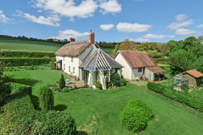
- Price
- Guide Price£750,000
- Size
- 2 acres
Added on 11/03/2026Farmhouse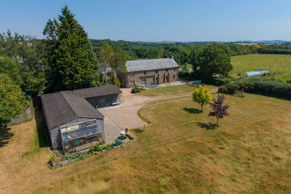
- Price
- Guide Price£895,000
- Size
- 8 acres
Black Dog, Crediton, EX17, Woolfardisworthy, Devon EX17 England
Added on 20/07/2026House with Land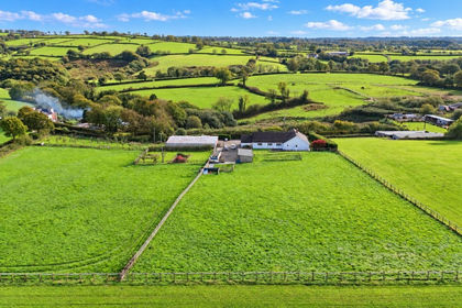
- Price
- Guide Price£675,000
- Size
- 3 acres
Added on 20/10/2026Smallholding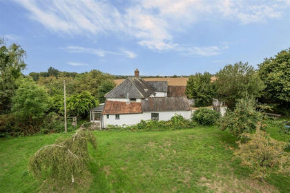
- Price
- Offers in Excess of£800,000
- Size
- 5 acres
Added on 19/10/2026House with Land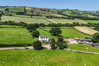
- Price
- Guide Price£950,000
- Size
- 41.35 acres
Ashbrittle, Wellington, TA21, Wellington, Somerset TA21 England
Added on 18/09/2026Small Farm
- Price
- Offers in Excess of£700,000
- Size
- 3.68 acres
Whiteball, Wellington, Somerset, TA21, Sampford Arundel, Somerset TA21 England
Added on 09/09/2026House with Land