Black Dog, Crediton, EX17
- Land size
- 8 acres
- Bedrooms
- 4
- Bathrooms
- 2
Key Features
- Spacious high quality barn conversion
- Land of just under 8 acres
- Rural and peaceful location
- 4 Double bedrooms ensuite to the master
- Open plan kitchen/diner with Aga
- Spacious lounge with woodburning stove
- Stable block/outbuilding
- Level pasture split into two paddocks
- No onward chain!
Description
Surrounded by open countryside and set within just under 8 acres of level pasture, this impressive home offers generous living space, excellent equestrian or smallholding potential and a range of versatile outbuildings. Thoughtfully designed and well maintained throughout, it combines the feel of a traditional country house with the practicality needed for modern family life.
The heart of the home is the spacious farmhouse kitchen and dining room, where a central island creates a natural gathering point. Wooden shaker-style units are paired with granite-effect worktops, while the oil-fired black Aga sits alongside a Neff eye-level oven and microwave, a four-ring ceramic hob, integrated dishwasher and fridge. There are patio doors out to the front patio and marble flooring runs through the kitchen, dining area and hallway, adding to the sense of quality and space.
The lounge is warm and welcoming, with engineered oak flooring, original heavy beams and a wood-burning stove set within a feature fireplace. It's a room made for relaxing, with plenty of space for family life or entertaining.
A practical utility room provides additional storage, shaker-style units, a sink, space for a washing machine, tumble dryer and large fridge-freezer, along with access to the side. A downstairs WC completes the ground floor. Underfloor heating runs throughout this level, while radiators serve the first floor.
Upstairs, a spacious landing includes an airing cupboard and useful storage. The large principal bedroom is particularly impressive, enjoying three windows that frame views across the surrounding countryside and ensure the room is filled with natural light, there is a spacious ensuite bathroom with large shower enclosure. Three further double bedrooms provide flexible accommodation, served by a stylish family bathroom with a roll-top bath, large shower enclosure and distinctive feature basin.
Outside, the property continues to impress. A substantial L-shaped timber outbuilding includes open garaging, an enclosed garage, greenhouse and a hobby room or garden office complete with its own WC and wash basin, making it an ideal workspace or studio. Originally built as a stable block, this building has scope to return for that use, or use as it’s been converted.
The land extends to just under 8 acres, divided into two level paddocks that are well suited to horses, livestock or simply enjoying the space and countryside setting. The fields enjoy excellent natural light throughout the day and offer plenty of opportunities for those looking to embrace a rural lifestyle.
The driveway is owned as part of the property title and serves two neighbouring homes, with shared maintenance arrangements in place. The property also benefits from timber double-glazed windows, mains water, a private septic tank and oil-fired central heating with underfloor heating to the ground floor.
This is a rare opportunity to enjoy a well-equipped country home with substantial land, versatile outbuildings and the space to adapt to a wide range of lifestyles, whether you're keeping horses, running a smallholding or simply looking for room to breathe.
Please see the floorplan for room sizes.
Current Council Tax: Band F - Mid Devon 2026/27 - £3729.88
Utilities: Mains electric, water, telephone & broadband
Broadband within this postcode: Standard 3Mbps (Airband or Starlink would provide much faster speeds. Current owner uses Airband running at 40 Mbps)
Drainage: Private
Heating: Oil fired central heating & woodburning stove
Construction: Stone
Listed: No
Conservation Area: No
Tenure: Freehold
Buyers' Compliance Fee Notice: Please note that a compliance check fee of £25 (inc. VAT) per person is payable once your offer is accepted. This non-refundable fee covers essential ID verification and anti-money laundering checks, as required by law.
Boundary positions, access rights and parking arrangements have been provided by the seller, and any land plans shown are for identification purposes only. We have not seen the title deeds or other legal documents, and buyers should confirm exact details and ownership responsibilities with their conveyancer.
Some images in this brochure may have been digitally enhanced or virtually staged, for example by adding lighting effects, twilight ambience, furniture or décor, to help illustrate how the property could look. These images are only illustrative and do not show the current fixtures, fittings or condition. Always rely on your viewing for an accurate understanding of the property.
We’re informed by the seller that the property has a private drainage system, which they advise is in working order. Buyers should satisfy themselves regarding its type, condition and regulatory compliance with their conveyancer.
BLACK DOG is a pretty little village sitting astride one of the highest ridges of land between Dartmoor and Exmoor with panoramic views across the countryside. The village is perfect for those seeking a quiet, rural idyll. Three miles away is Morchard Bishop where there’s a lovely village shop as well as a doctors and a primary school. Approximately nine miles away is the market town of Crediton or ten miles to Tiverton both with a good selection of independent shops, restaurants and larger supermarkets.
DIRECTIONS
From the A377 at Morchard Road, take the road to Morchard Bishop, after the London Inn take a right turn towards Black Dog. At the crossroads in Black Dog, go straight across towards Puddington. At Littleborough Cross, take a right turn and the lane is the next on the left marked with a Helmores board.
For Sat Nav: EX17 4QX
What3Words: ///scrap.allergy.clapper
Map Location
Property details
- Tenure
- Freehold
- Council Tax Band
- F
- Date Posted
- 2026-07-20
Market Value Analysis
Compared with 459 Homes with Land listings in South West England (5+ acres).
Utilities & Restrictions
Utilities
- Electricity
- Mains
- Water
- Mains
- Heating
- Oil Heating
- Broadband
- Ask Agent
- Sewerage
- Septic Tank / Private
Rights & Restrictions
- Public Rights of Way
- Ask Agent
- Private Rights of Way
- Ask Agent
- Listed Property
- Ask Agent
- Restrictions
- Ask Agent
Listed status, conservation areas and planning constraints for this location are in the full report.
Property Features
- Accessibility
- Ask Agent
- Parking
- Parking Available
- Garden
- Private Garden
Beyond the particulars: planning activity, flood history, heritage and ground risks, checked for this exact spot.
Connectivity
Broadband
Fastest speed available at this postcode
3 Mbps
Gigabit full fibre · available to 17% of premises
Suitable for
- Basic browsing & email
Fixed wireless access may also be an option here.
Mobile signal
Predicted 4G and 5G signal; indoor signal depends on building materials.
Ofcom Connected Nations postcode-level predictions. Speeds and signal are modelled, not measured, and vary between addresses and providers.
Signal is the easy part. Planning activity, flood history and protected designations here are in the full report.
Nearest Schools
Primary
- Witheridge Church of England Primary Academy2.7 milesOfsted report card · Jan 2026
- Ages
- 2 to 11
- Pupils
- 135
- Type
- Academy converter
- Faith
- Church of England
- Morchard Bishop Church of England Primary School3.6 milesNo Ofsted rating
- Ages
- 2 to 11
- Pupils
- 101
- Type
- Academy converter
- Faith
- Church of England
- East Worlington Primary School3.7 milesNo Ofsted rating
- Ages
- 0 to 11
- Pupils
- 75
- Type
- Academy converter
- Cheriton Fitzpaine Primary School3.9 milesNo Ofsted rating
- Ages
- 2 to 11
- Pupils
- 91
- Type
- Community school
- Sandford School4.8 milesOfsted: Good
- Ages
- 3 to 11
- Pupils
- 74
- Type
- Community school
Secondary
- Queen Elizabeth's6.1 milesOfsted report card · May 2026
- Ages
- 11 to 18
- Pupils
- 1,096
- Type
- Academy converter
- Tiverton High School8.2 milesOfsted: Inadequate *
- Ages
- 11 to 16
- Type
- Academy sponsor led
- Chulmleigh Community College9 milesNo Ofsted rating
- Ages
- 11 to 16
- Pupils
- 735
- Type
- Academy converter
- Thomas Hall School11 milesOfsted: Requires improvement
- Ages
- 4 to 16
- Pupils
- 438
- Type
- Free schools
- South Molton Community College12 milesOfsted: Good *
- Ages
- 11 to 16
- Pupils
- 656
- Type
- Foundation school
* Latest graded judgement covers quality of education only; no overall grade was issued under the 2024-25 inspection framework.
Distances are straight-line from the advertised location. Source: the national school registers (DfE, Welsh Government, Scottish Government) and Ofsted.
Schools are just the start: sold prices nearby, planning activity and any flood history are in the full report.
Amenities
Supermarket
GP surgery
Pharmacy
Hospital
Green space
Straight-line distances from the advertised location. Sources: NHS records, Geolytix supermarket locations, OS Open Greenspace and the national trails registers.
The area stacks up? Now check the location itself: planning nearby, protected designations and past flooding.
Getting Around
Nearest station
Nearest bus stop
Typical drive times
Straight-line distances from the advertised location; drive times are typical free-flow times over OpenStreetMap road data, so allow more at peak. Public transport locations from DfT NaPTAN.
Easy to reach matters. So do planning activity, flood history and ground risks: all in the full report.
Flood Risk
Environment Agency open data, checked around the advertised map pin for the listed acreage. Long-term risk counts flood defences; the planning map's flood zones do not. Provided by LandSale, not the listing agent, and not part of the agent's particulars. Risk varies across a holding, so verify before committing.
Rivers and the sea
Planning map: Flood Zone 1.
Surface water
Not at the pin: mapped about 100 metres away.
These bandings are the summary. Where this location sits on the flood maps, plus planning activity, heritage and ground risks, is in the full report.
Important notice: Information, maps and tags on this page are drawn from the advertising agent's marketing materials or generated automatically. LandSale has not verified them. Relying on these details is at your own risk, always carry out independent checks before committing to a purchase.
LandSale full disclaimer
Marketing information only - not formal particulars. The details on this website are provided for general guidance and do not constitute an offer or contract. Neither LandSale nor the advertising estate/land agent accepts responsibility for any inaccuracy.
1. Source of information
- Listing content: Core description, asking price, tenure, measurements, photographs and planning history originate from the marketing materials of the advertising estate or land agent. LandSale does not author this content and cannot guarantee its accuracy.
- Automated tags & categorisation: Property type, land-use class, acreage bands and similar labels may be applied by machine-learning models. They are intended as a helpful guide only and may not reflect the property's legal status or permitted use.
- Third-party & enriched data layers: Maps, boundary outlines, planning designations, soil reports, broadband coverage and other environmental or location-based insights are licensed from external suppliers. Such data are supplied “as is", may be incomplete or out of date and are subject to change without notice.
2. Verification required
Prospective purchasers must verify critical matters, including but not limited to planning permission, title boundaries, public rights of way, environmental constraints, acreage, services, access and VAT status, through their own inspections, specialist surveys, legal advisers and the selling agent before relying on the information or entering into any contract.
3. No warranty or liability
LandSale gives no warranty, express or implied, as to the accuracy, completeness or fitness for any particular purpose of the information displayed. LandSale shall not be liable for any loss, damage, cost or expense arising directly or indirectly from any use of or reliance on such information, save where liability may not be excluded by law.
4. Updates & feedback
If you believe any detail on this listing is inaccurate, please let us know. We will investigate and, where appropriate, update the listing or notify the agent.
© LandSale | Version 1.3 - August 2026
Listing agent
Helmores, Crediton
111-112 High Street, Crediton, Devon, EX17 3LF
Similar properties for sale
- Price
- Guide Price£895,000
- Size
- 4.96 acres
Added on 03/07/2026Farmhouse
- Price
- Guide Price£950,000
- Size
- 90.38 acres
South Grendon - Lot 1, Grendon Lane, Witheridge, Tiverton, EX16, Tiverton, Devon EX16 England
Added on 10/09/2026Smallholding
- Price
- Guide Price£1,100,000
- Size
- 4 acres
Added on 01/04/2026Barn Conversion
- Price
- Offers in Excess of£900,000
- Size
- 5.5 acres
Added on 29/01/2026House with Land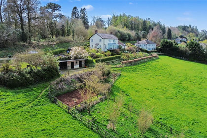
- Price
- Guide Price£700,000
- Size
- 6 acres
6 Acres Approx - Calverleigh, Tiverton, EX16, Tiverton, Devon EX16 England
Added on 18/04/2026House with Land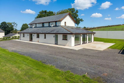
- Price
- Guide Price£730,000
- Size
- 8 acres
Added on 22/09/2026House with Land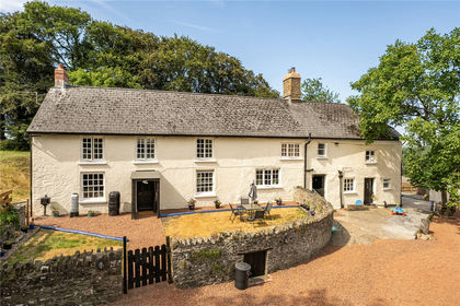
- Price
- Guide Price£1,100,000
- Size
- 63 acres
Knowstone, South Molton, EX36, South Molton, Devon EX36 England
Added on 28/07/2026Smallholding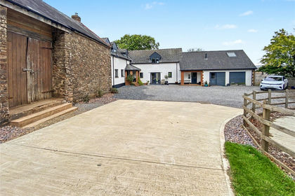
- Price
- Guide Price£950,000
- Size
- 8.25 acres
8.25 Acres Washfield, Tiverton, EX16, Tiverton, Devon EX16 England
Added on 25/09/2026Smallholding
- Price
- Guide Price£800,000
- Size
- 13 acres
Added on 28/01/2026Golf Course
- Price
- Guide Price£825,000
- Size
- 6.35 acres
West Anstey, South Molton, EX36, South Molton, Devon EX36 England
Added on 25/06/2026Smallholding